Quoi and I said our goodbyes today — well, more like “until next we meet” — since I’m hiking on, and she needs to stay put to help her foot heal. She’ll have to catch up with me at some point: the date she needs to leave the country remains unchanged, which means her finish date is unchanged. She’ll just have fewer days to complete the trail, which means more miles each day, a prospect she is not much relishing.
After getting up and having breakfast (the same waffle, eggs, sausage, and hash browns as from yesterday), I repacked my pack, and took care of a few other chores before leaving the Burney Mountain Guest Ranch: I reserved a motel room in Mount Shasta for when I get there next week, and then ordered a new pair of boots from Amazon, since none of the outfitters in Mount Shasta carried Merrell Moabs. (I also ordered a bunch of Propel electrolyte mix, since I ran out and the only place I’ve seen that even has them is the store at Burney Mountain Guest Ranch, whose entire supply I bought yesterday.)
It was hot out today, but it was also cloudy, which helped make it feel much less hot than it otherwise would have been with sun exposure. The sun managed to peek out of the clouds a couple of times during the day, but for the most part, it was safely hidden behind the clouds.
I left the ranch a little after nine. Early on, the trail passed by a tree that was nearly completely covered in small holes; likely drilled by woodpeckers. It’s a wonder the tree hadn’t fallen apart.
Very briefly, Mount Shasta came into view, and then disappeared behind the hills for the rest of the day.
Not long after that, I ran into two southbound hikers, Stats and Rocksteady. I had previously met them on day 2, in Lake Morena. Since then, they had both suffered injuries that delayed them; as a result, they had recently flipped from Tehachapi to Ashland, and are now working their way back south to where they left off.
The trail this morning was mostly a light pine forest (so, some shade when the sun is low, and none when the sun is high). It wasn’t very steep, and was a pretty nice dirt trail bed. The trail also passed a large number of incredibly well-maintained dirt roads.
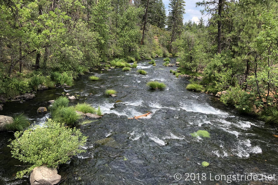
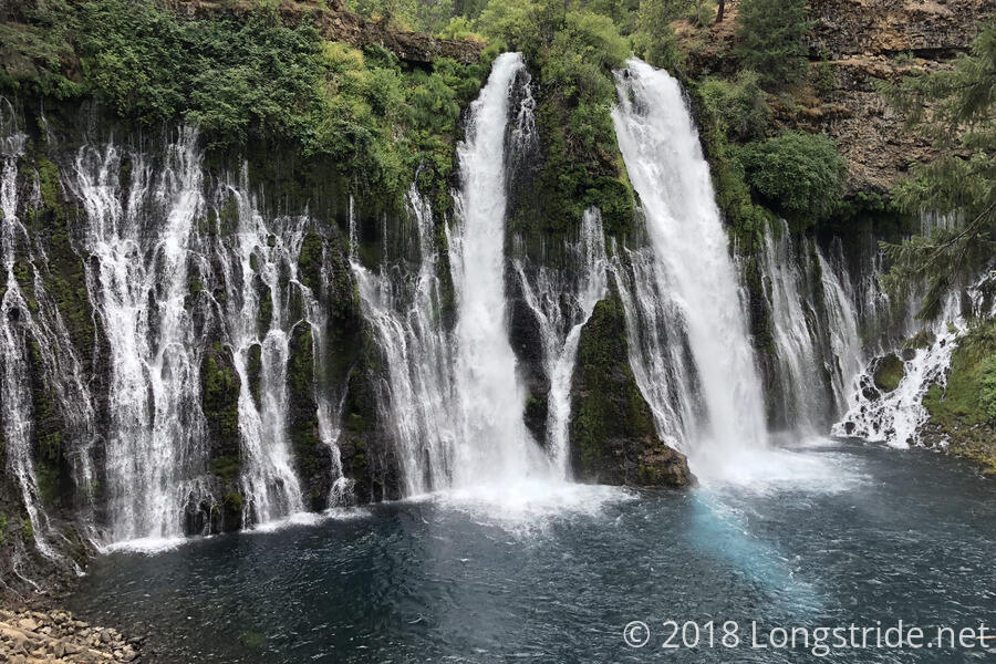
The PCT briefly runs through Burney Falls State Park, which has a very nice campground directly on the PCT, as well as an educational visitors center and overpriced general store (where I got an ice cream cone and cold soda). The park’s main attraction, though, is Burney Falls, which (as one might guess) is fed by Burney Creek, which is fed by rain runoff and snowmelt from Burney Mountain. The falls is also fed by an underground aquifer, which drains into the creek near the falls and is the sole source of water to the falls in the summer, when the creek otherwise runs dry. (The trail passed over Burney Creek shortly after entering the park, and there wasn’t a drop of water to be seen.)
A side trail from the PCT joins the Falls Loop, which crosses over Burney Creek (now flowing, after being recharged by the aquifer), and passes the visitor center and near the general store before going to an overlook of the falls. It then descends down to the level of the base of the falls, 124 feet down, where it was noticeably cooler, then follows the (now quite full) creek a short distance, crossing it via a bridge and looping back to the bridge near the top of the falls.
The falls was a great detour, and easily the most scenic thing near (or on) the trail today. The hour and a half I spent off the PCT was well worth it.
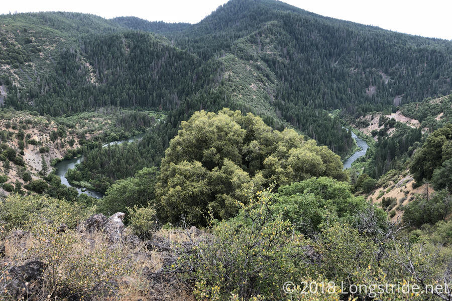
Later, the PCT passed over a dam at Lake Britton, on the Pit River (which I could later see from further downstream and much higher up). (Burney Creek also flows into the Pit River.) A work crew at the dam, just leaving as I was passing by, offered me a cold bottle of water (which I immediately drank). One of the crew, who said he had been working in the vicinity of the PCT for years, said he saw 20 hikers pass by today, and that he’d never seen that many go by in a single day.
I stopped just short of 15 miles at a campsite just past Rock Creek at 4:30, one of my earlier stopping times. It was a good place to stop, though, near the base of a long climb, which I didn’t really want to do in the heat, or at the end of the day.
Tomorrow: leave early to start on a 12-mile climb before it gets too hot. Hopefully get to a spring with tentsites 23 miles up the trail.