A wet, rainy day fittingly brought us to Rainy Pass and took us into Mazama, the last trail town in Washington. With only about sixty miles to go to the border, the end of the trail is almost upon us.
Not long after CareFree and I got out of my tent and started to pack up, a National Park Service ranger came over to check that we had an overnight permit. We had the appropriate permit to camp at Bridge Creek, of course, and the ranger was happy that we camped in the designated PCT campground, rather than in one of the campgrounds closer to the trail that was not specifically set aside for PCT hikers. I also let the ranger know about the bear that we saw last night, and he was especially happy that we got video of it, and gave us the address to send the video to so that the park’s bear biologist could further study the actual actions of a bear in the park, rather than just the second-hand information from hikers as relayed to park rangers.
There was no rain overnight; the morning was cool and overcast. Delayed a bit by our chat with the ranger, we left the campground around 7:40, returning to the PCT. Just north of the campground, a sign indicating distances to the next several large campgrounds in the North Cascades National Forest was slightly vandalized, with a piece of paper partially taped over “Fireweed”, re-labeling it as “Free Weed”. The trail roughly paralleled Bridge Creek, heading upstream, to the northeast. It didn’t take too long for rain to start, and we quickly put our rain jackets on.
While the first day of fall is still a week away, as we’ve been heading further north, and later into the season, fall color has been increasingly prevalent, with reds, oranges, and yellows starting to become prominent along the trail. The vast majority of leaves are still green, but it won’t be too long before the only green is from evergreens.
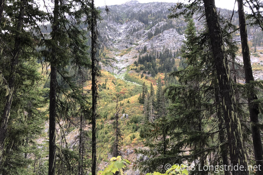
After crossing Bridge Creek via a (somewhat) recently rebuilt bridge deck, just beyond the confluence of Bridge Creek and its North Fork, the trail turned east to snake its way through the valley and around Frisco Mountain. Apart from the rain, the next few hours were largely uneventful, and we tried to keep our spirits up with (hopefully) a warm bed and town food only a few hours ahead of us. Two hours (and about 4.5 miles) in, we stopped for an early break, ducking underneath a large tree next to the trail in an attempt to get just a little bit less wet.
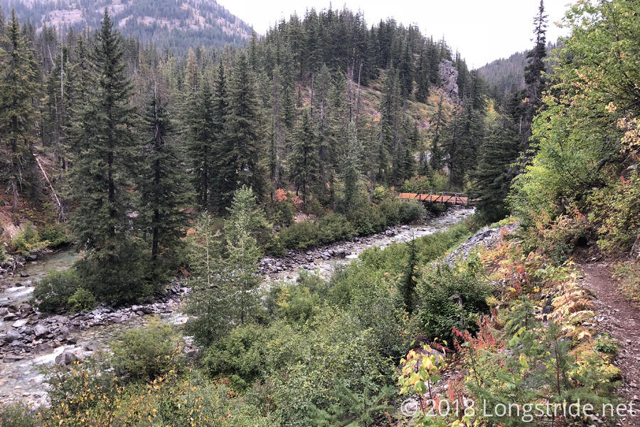
A few minutes after the break, we reached the crossing of Maple Creek, which offered us two means of crossing: a ford, and a footbridge. We opted the footbridge, because it was raining, though I’m not certain that was the best choice. To get to the footbridge required hiking over large rocks, all of which were wet; there was a distinct risk of slipping. The ford, by contrast, might have still been passable without getting too wet, though that would have required walking near the edge of a (short) waterfall. Another hiker actually passed us taking the ford while we were crossing the footbridge, highlighting how much slower the footbridge route was. Either way, though, we made it across safely, without getting more wet than we already were.
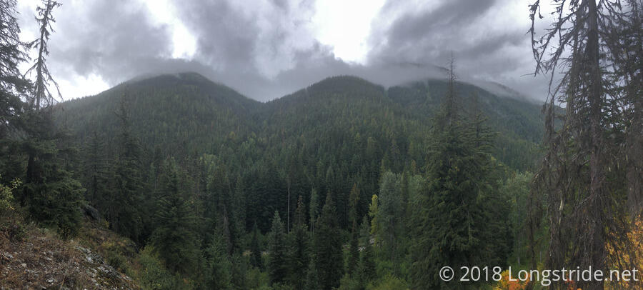
Though the next several miles were under tree cover, the rain intensified, making the day ever-more dreary. At one point, we reached a fallen tree blocking the trail, and in a moment of frustration, CareFree started to saw through it with her knife. (Her knife cut through the wet wood surprisingly well, though it still would have taken a long time to cut through the tree, likely dulling her knife several times over in the process.)
Still, we made reasonably good time, and stopped for a break at a trail junction as the rain was starting to let up a little. While we were there, Phoenix hiked past, and CareFree and I were so engaged in whatever it was we were talking about that we didn’t make the realization that she hiked down the wrong trail! By the time we did, it had already been several minutes, by which point it wasn’t really feasible to chase her down; we had to hope that she’d realize the wrong turn sooner, rather than later.
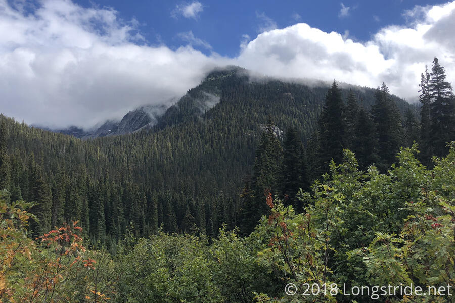
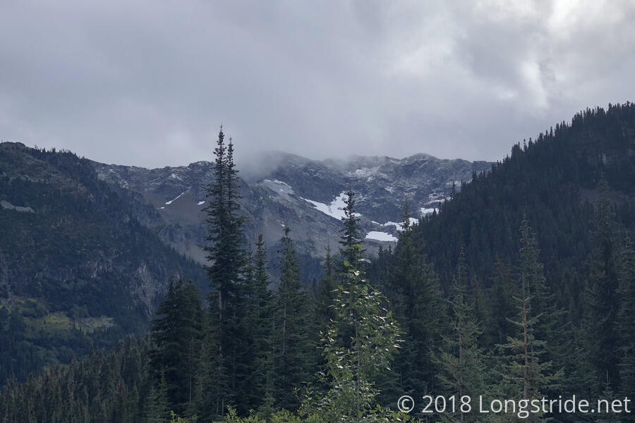
The trail continued north, curving around Frisco Mountain. The rain gradually stopped, and the clouds started to part, revealing blue skies. Along the way, as we approached the highway, we crossed Bridge Creek a few times, including once over a very wet and slippery log.
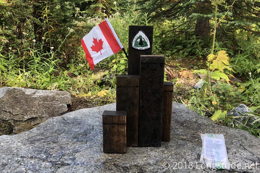
After approaching and following alongside Highway 20 for about two miles, we approached the trailhead and road crossing at Rainy Pass. Just before the road, there was a small makeshift monument (about a foot tall) in the style of the northern terminus monument, originally placed there when the Holman Fire closure completely blocked access to the northern terminus and Rainy Pass was the last open road crossing on the trail.
We weren’t out on the road with our thumbs out too long before we got a ride. An older guy in a pickup truck stopped at the intersection to the north trailhead parking lot, said he needed to use the toilet there, and if we were still here when he was done, he’d be happy to give us a ride into Mazama. As we waited for him to return, Phoenix arrived, having caught up from her wrong turn earlier. Once the guy with the pickup truck returned, the three of us threw our packs into the bed of his truck and piled into the cab.
The driver, formerly in the navy, and a trucker, was also a hiker with the name Talks-a-Lot, and quite lived up to his name, and we shared hiking stories on the way into Mazama. As it turned out, Talks-a-Lot (whose named reminded me of Inquisitor, back in Ashland) was also going to Ravensong’s Roost, before heading to Hart’s Pass tomorrow for a short section hike back to Rainy Pass. (Hart’s Pass, 30 miles north of Rainy Pass, is the last road crossing on the PCT before reaching Canada, though it is a lot more remote than Rainy Pass.) On our drive, we could see the mountains had fresh snow, likely from the same clouds that rained on us yesterday and today.
Along the way, Phoenix mentioned that her husband is meeting her in a few days at the terminus (camping a couple of miles inside Canada since it’s not permissible to enter the US from Canada there). She offered that it might be possible to give us a ride back to the US from Manning Park, and we decided we’d work out the plan for that after dinner.
Ravensong’s Roost hiker’s hut is a small two-floor structure with a common area, kitchen, dining area, and bathroom and shower, with an upstairs loft sleeping area. Besides the hiker’s hut, there’s also space for tenting on the property, as well as a teepee. Not wanting to stay outside when we could be inside, CareFree and I quickly made a beeline for the loft, and claimed the queen-sized mattress on the floor next to the stairs. In all, there are about a dozen hikers here, including Caveman, Fireman, Good Karma, and Lucky Duck. As we arrived, workers were fixing the roof, filling the hut with the sounds of hammering.
Talks-a-Lot gave us a ride to the Mazama general store, a short distance down the road, where CareFree and I picked up some food for a late lunch today and breakfast tomorrow, and some beer to take with us to drink at the northern terminus. While we were leaving, we met a park ranger who was changing the fire closure maps on display outside the store. From her, we got a weather forecast: after tonight, we should get three days of good weather, followed by rain. Depending on the timing, that should give us just enough time to make it to the border, if not Manning Park, before it rains.
Back at the Roost, CareFree and I got showers, which took some effort, because the knob had fallen off, requiring the use of a carabiner used as a wrench to control the water. Afterwards, Good Karma, CareFree, and I walked over to the Mazama Country Inn, just past the general store, for dinner. The inn’s restaurant was operating reservations-only, apparently because it was a Sunday and they were running low on food. They managed to squeeze us in, though, with the caveat that some menu items might be restricted since we didn’t have reservations. I got a burger, and it was one of the most disappointing burgers I’ve had on the trail.
Half of the reason we went to the restaurant was because there was free WiFi, though, so we hung out in the restaurant until closing time, and in a lounge overlooking the restaurant for a short while after. My main (and accomplished) goal was to purchase airplane tickets to get back home. Unless something unexpected happens, I’ll be flying home next Tuesday.
Unfortunately, we still haven’t heard back from Canada regarding CareFree’s entry permit (not that we expected to, since there hasn’t been a business day since we last checked), so barring some miracle of internet access over the next few days, she’s going to have to turn back at the border and hike back to Harts Pass, adding 30 miles to her trek.
Back at Ravensong’s Roost, we talked with some of the hikers that arrived while we were out at dinner, including Surge. In another case of it being a small world, it turned out I met him on my Long Trail thru-hike last year while he was working at the Mount Mansfield visitor center.
CareFree and I also planned the next few days hike with Phoenix. Her husband is hiking in from Manning Park to meet her at the terminus monument on the evening of the 19th, and then hike back to Manning Park Resort on the 20th, leaving to drive to Seattle in the afternoon. This worked out pretty close to my plan: get to the border on the morning of the 20th, and reach the resort in the afternoon. Seattle will get me reasonably close to my cousin’s house in Auburn (at least compared to where I am now), and it shouldn’t be too bad to figure out how to get to her house once I’m back in the US.