The penultimate day on the trail may have started off slow, but the afternoon was full of beautiful scenery and an epic lake as my six-month-long journey nears its conclusion.
Instead of the 5:30 alarm we had been setting in recent days, given that we hadn’t even been attempting to get out of our sleeping bags when we were “supposed” to, we decided on a 5:45 alarm, to give us an extra 15 minutes of sleep. It was pretty cold outside, and our 15 extra minutes of sleep turned into another hour; we didn’t actually get up until 6:30, which was still a good 15 minutes before sunrise. Even then, we were very sluggish in the cold, not starting today until almost 9. For the next-to-last day on the trail, we certainly weren’t off to a good start.
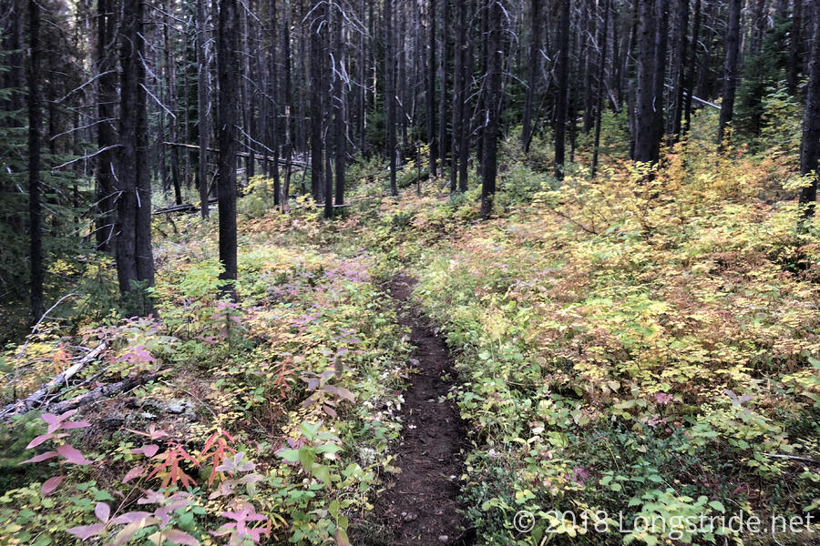
Much like yesterday ended, today started with a trek through a mostly incredibly boring forest riddled with horse poop and small stream crossings. Fairly early on, we ran into Caveman, on his way back from the border. One of the hikers in Mazama who was considering taking the PCT back to Harts Pass through the closure, he said he opted not to because no one else was, and also because there were lots of rangers and hunters out and he didn’t want to get fined for being in a closure area. He also mentioned that one of the bridges ahead was sketchy, and that another hiker (the one in Stehekin who didn’t have a passport, and who was going to turn around at the border) had fallen off, into the river, and required assistance to get out; the event spooked them enough that they said they were going to go into Manning Park anyway, even if getting back into the US becomes problematic.
Caveman wasn’t the only hiker we saw today on their “victory lap”; we probably saw a dozen more hikers returning from the terminus throughout the day, including at our campsite this evening.
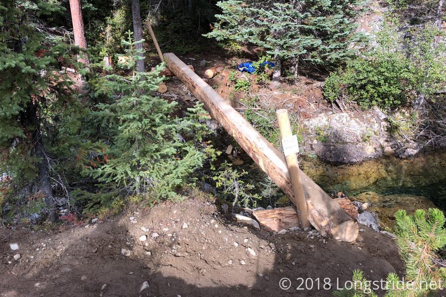
The main bit of excitement this morning came from a new bridge under construction, crossing the Middle Fork Pasayten River. About three and a half miles in, the fire detour itself took a detour. According to the detour signs, further north, a bridge was out and the trail largely impassable due to a landslide and fallen trees. The trail instead detoured over a new spur trail connecting the Robinson Creek Trail (which we were on) with the Buckskin Ridge trail on the other side of the river.
This spur trail seemed somewhat new; the clearest evidence to that being the new bridge that is under construction over the river. A trail crew had built enough of the new bridge that it was functional, but definitely not safe: there was a support platform on both sides and a log had been laid across, with one of the bridge’s railing supports installed on each end, but nothing else — it was a minimum viable bridge. A sign warned, “Bridge Under Construction. Not Open For Use.”
Naturally, we ignored the sign, and crossed. It was easily five or ten feet over the river, making it quite dangerous if we fell off, but it was flat (and scored, for better grip), and mostly level, and way better than some of the more sketchy crossings we had, especially in the Sierra. CareFree made it across quickly; I crossed somewhat more slowly, inching my way across to ensure I wouldn’t lose my balance.
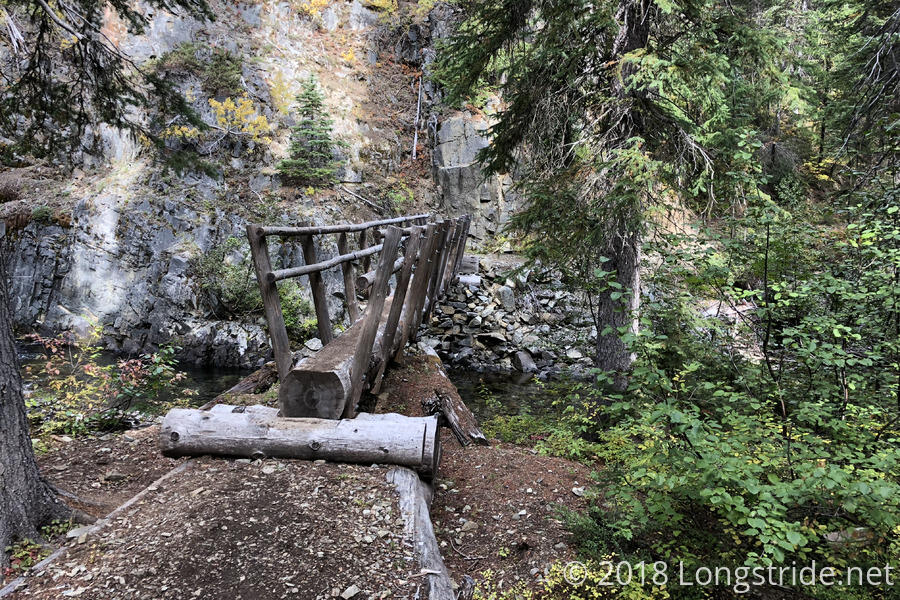
After another mile and a half or so, we crossed the West Fork Pasayten River on a (fully-constructed) bridge, and took a break shortly after at the Rock Creek Trail junction. While there, a pair of hunters passed us on horses, leading a donkey behind them. (These were the only hunters — and horses — that we saw today.)
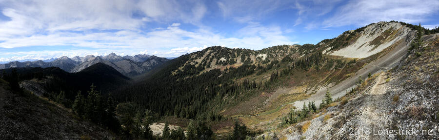
We continued on, following the Rock Creek Trail west, gradually climbing 2000 feet up from the valley back to the PCT. Most of this was in forest, with the trail somewhat less-well maintained and slightly overgrown, though as we climbed, we passed through occasional gaps in the forest, and got a few decent views in the process. It was a great sense of relief when we could see, ahead of us, the PCT switchbacking along the head of the valley, connecting between Rock Pass to the south, and Woody Pass to the north.
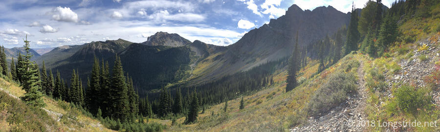
Around quarter after two, we rejoined the PCT at the north end of the Holman fire closure, and stopped for a break just south of Woody Pass, taking in the first mostly-open views since almost a day ago, when we started the detour. Returning to the PCT here also brought us about halfway into the PCT overlap with another National Scenic Trail, the Pacific Northwest Trail. The PNT starts in Glacier National Park in Montana, heading west for 1200 miles to the Pacific Ocean in Washington, sharing trail not only with the PCT, but the Continental Divide Trail as well.
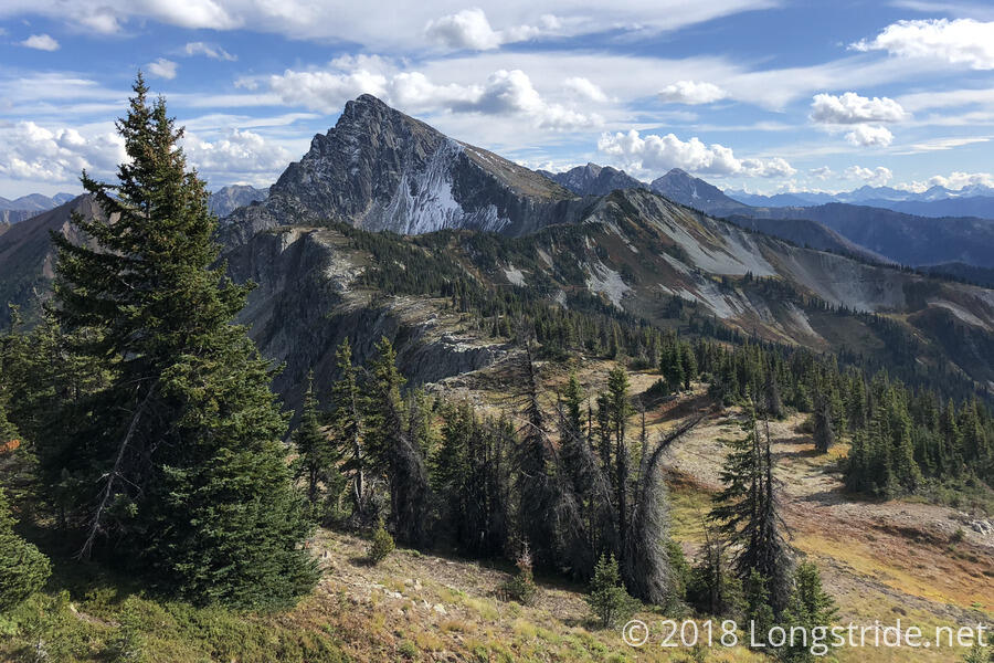
Leaving where we stopped for our break, we began the final climb of the PCT, turning north and heading over Woody Pass to follow alongside Three Fools Peak. With the trail above the treeline, we had an expansive view to the west, which included Mount Baker, the northernmost of the Cascade volcanoes in the US.
Around 4:30, we reached our final campsite of the trail, at Hopkins Lake. Located in a bowl about 800 feet down from the top of the ridge, it was a beautiful sight on our way down. By the time we got to the lake itself, it started to become quite cool, and the sun had nearly dipped below the ridge, disappearing from view well over an hour before sunset.
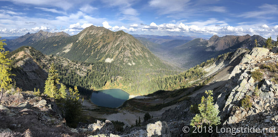
When we arrived at the lake, there was already one tent in the clearing near the lake, and over the next several hours, more and more hikers arrived. It was quite a wonderful campsite, with space for a large number of tents fairly spread out around the lake so that people weren’t right on top of each other. We quickly gathered water from the lake (only momentarily distracted by the ducks floating near the center of the lake) and set up my tent, moving inside as quickly as we could.
This is the third day since we left Mazama, and we’ve had three great days of weather, well spent to get us to a great campsite just 6.4 miles from Canada. With clouds starting to move in and our weather grace period set to end tomorrow, hopefully we’ll at least make it to the terminus before bad weather truly moves in. Once the sun was below the ridge, it became outright cold, and the wind quickly picked up, making it unpleasant to be outside. We hunkered down inside my tent, and set an alarm for tomorrow morning — one I didn’t want to incredibly overshoot.