Today’s hike was a fairly easy eight miles east along the C&O Canal towpath, in preparation for a much longer day tomorrow.
I got up around 7:30, a bit earlier than I really intended, and packed everything up and got a shower. Then I sat down and relaxed for a few hours, taking advantage of late checkout to listen to some of my podcast backlog, but mostly, killing time so I wouldn’t get to camp too early in the afternoon.
I finally left the motel about quarter to noon, and after a quick stop at a gas station to pick up a sandwich for lunch, finished the short walk through town and turned onto the Chesapeake & Ohio Canal’s towpath. The canal, originally built in the 1800s, was constructed to provide a water route following the Potomac River, which itself is not navigable. The canal went out of business in the 1920s due to competition with railroads and floods that damaged the canal. Today, it is a (very long) National Park, and it is possible to hike (or bike) the 184 miles between Cumberland, MD and Washington, DC along the canal’s towpath, originally used by mules to pull boats through the canal.
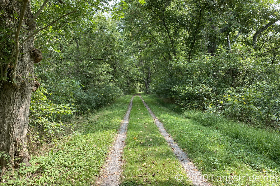
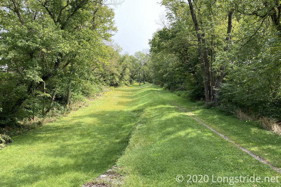
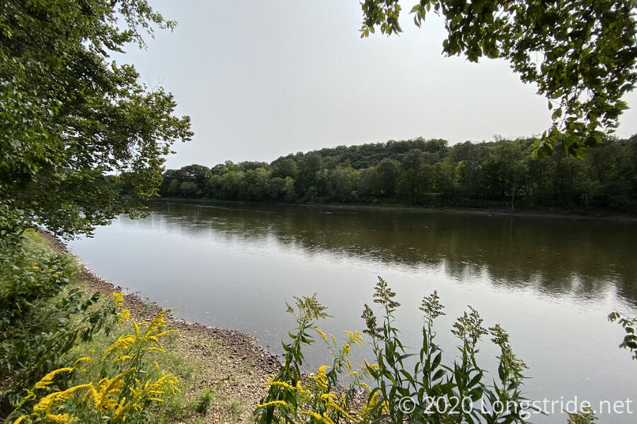
From a hiking perspective, the towpath is pretty boring. It’s essentially flat, with grass or gravel to walk on, and treed-in for most of its length. Historically, though, there are the ruins and remains of the locks and other structures that once formed the canal, along with the occasional view of the Potomac River.
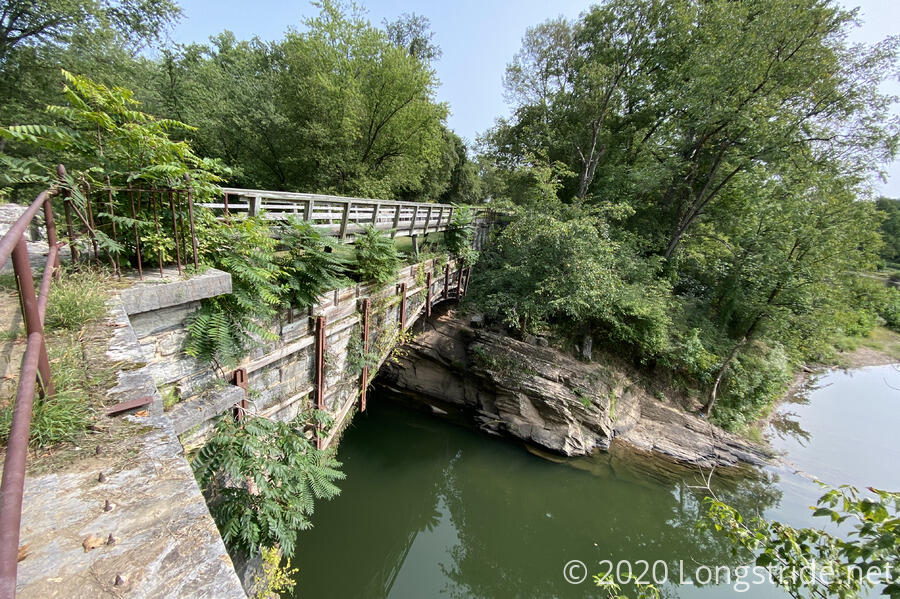
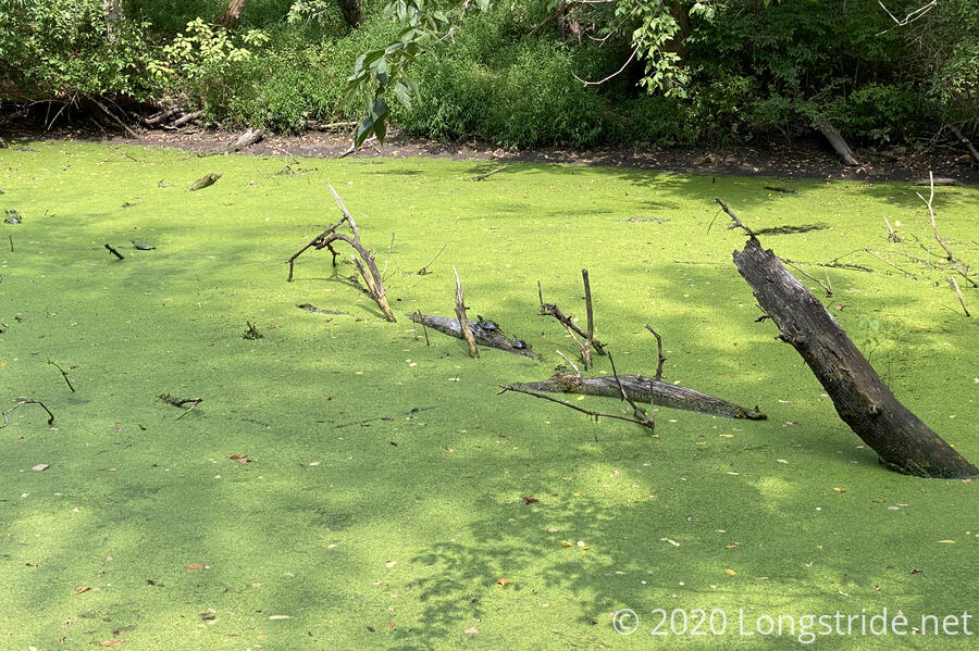
The canal itself existed under a variety of states. Near Hancock, it was properly filled with water and could, in theory, be used for boats. Elsewhere, it was dry, with a dirt bottom and trees and brush growing in the dry waterway. In other places, it was grass, or filled with water and duckweed, a place for animals to thrive.
I took a short break after a little more than four miles, at the Little Pool campsite, taking a picnic table just vacated by a trio of bikers. Leaving the campsite, I noted that the handle for the water pump was missing, and hoped that water at my destination wouldn’t be a problem.
Another four miles later, I stopped at the Licking Creek Campground, a much smaller space than Little Pool. The water pump here did have a handle, though I was a little surprised at how many pumps it took to get it to produce water. (I was beginning to worry it would be dry and I’d have to get water from the creek, but then it started to provide water.)
In the campsite area, I found a flattened patch of grass — someone else had clearly rented here recently, and I put my tent in the same place to minimize disruption.
Dinner was quick; I didn’t cook ramen because I’d eaten so much food in town and today was only a short hike. Later, as I was getting ready for sleep, I thought maybe I should have cooked the ramen to give me more energy for a long day tomorrow.
Shortly before sunset, two bikers arrived. They had biked 70 miles today, from Cumberland, and were planning on making it to Harpers Ferry tomorrow. (It’ll take me just a bit longer to make my way there.) They’d started in Pittsburgh, taking the Great Alleghany Passage to Cumberland; and the towpath from there.
They tried to start a fire in the campsite’s fire pit, but all the wood they’d collected appeared to be too wet to catch. They even tried lighting the fire with their stove, without success.
I’m off to sleep relatively early today, since I have 22 miles (!!) to hike tomorrow, to the next possible campsite (shelter). The first part is roadwalk, which will help considerably. Still, I have to set a 5:30 am alarm to make sure I don’t run out of daylight while hiking. Eww.