My feet hurt, and I'm exhausted, but still, today met a number of milestones.
I got up and left camp early — before 7:15 am, the earliest yet. (I might have been able to leave a few minutes earlier, but I was trying not to make too much noise as I packed my pack.) Immediately before I left, the fog that surrounded the shelter briefly let loose with tiny hail, as if to announce my departure. The early hike through the cloud was through rough, rocky terrain, and anywhere there was dirt, it was sticky or slippery mud.
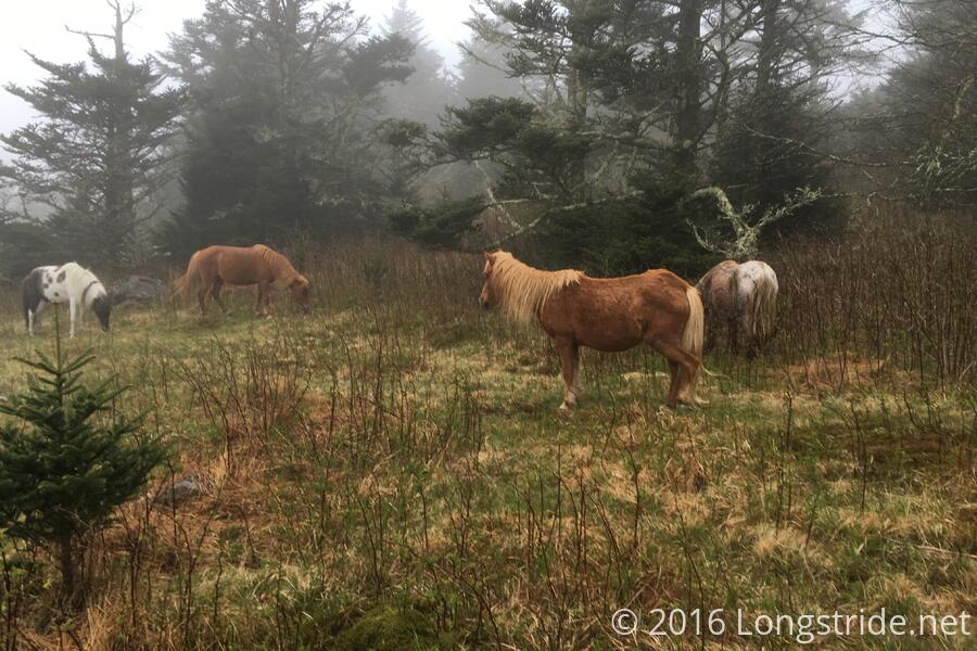
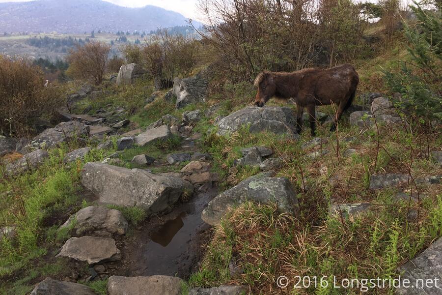
This time, I actually got to see the ponies. There was a small herd that gathered around the trail, grazing on grass. I stopped to take a few pictures, until one of them walked across the trail behind me and continued to graze, it's rear end within kicking distance of me. (I took that as a cue to move on.)
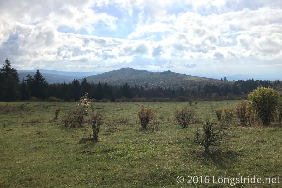
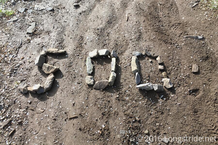
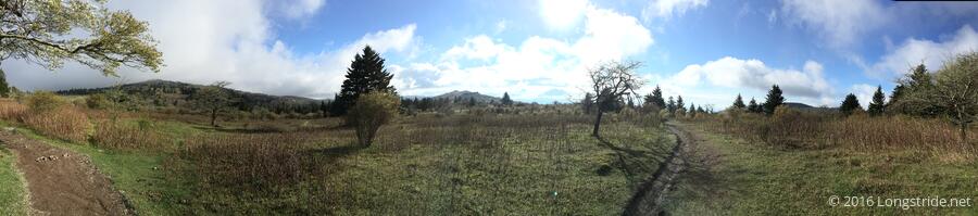
The sun finally deigned to make an appearance as I entered the Grayson Highlands, and a short distance into the park met the second milestone of the day: the 500 mile marker (written on the ground with stones). Shortly after that was a 500.2 mile marker, also written with stones.
Rain clouds in the distance made for a worrisome hike, but they proved to not actually be a problem.
About five miles in, just short of the Wise Shelter, I stopped by a creek to collect water for the day. I knew I was going for a long day, so part of my strategy was to not refill my (not empty) water bladder until partway into today's hike, to keep the starting weight down. With the rocky sections shortly after I started, this proved to be an even better idea than I initially expected.
Leaving the Grayson Highlands brought me to another cow pasture. Most of the cows were laying on the ground, rather than up grazing, but this time, there were also bulls in the field as well. I tried to give them a wide berth (at least, as wide as the trail and surrounding terrain permitted), but with my bright orange pack cover on, I couldn't help but be reminded of all those cartoons where bulls charge colorful flapping objects.
The next several miles of the trail, to the Old Orchard Shelter, continued to be rocky, wet, muddy, and slow-going. In many places, the trail itself was a stream (thank goodness for waterproof boots!). After passing the shelter (after stopping for a quick snack break), the terrain immediately became much more friendly.
I do want to clarify: the difficulty with the trail today is only with the surface features: wet, muddy, rocky, rooty in some places, and slanty. The hills, while they were still there, and still long, were not as steep as they've been in days past, and were it not for the roughness of the terrain, today could have been a very easy hike.
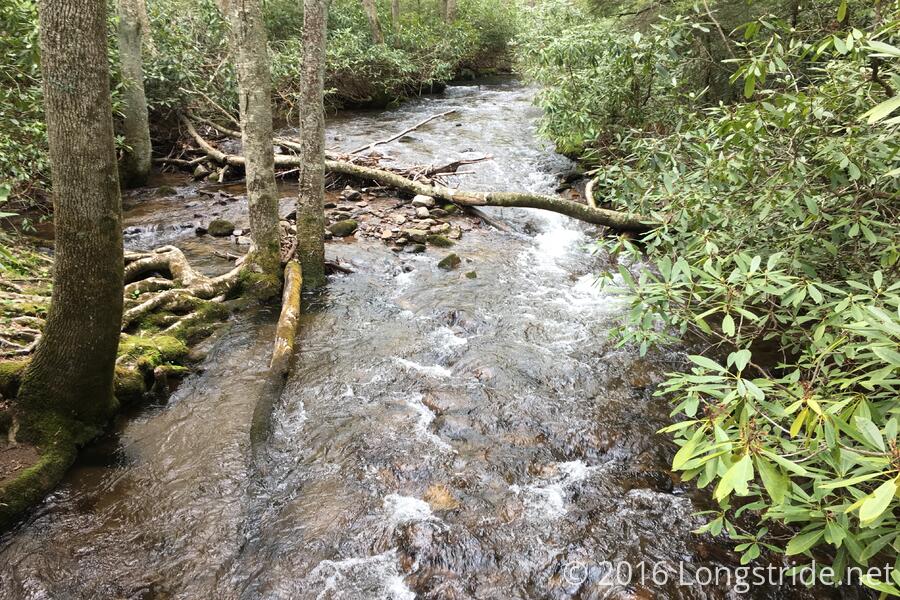
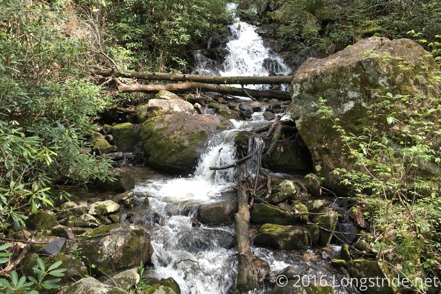
I reached the Hurricane Mountain Shelter around 2:45, and had a choice to make: stop here, after a respectable 16.1 miles, or push on. Our original plan has us stopping at a shelter about 5 miles further from where I stopped last night, and then pushing about 20 to Trimpi Shelter. Wary of the difficult (really: more annoying than difficult) terrain, long distance, and late arrival time to the shelter, I opted to continue on, but planned to split the difference and stop at a campsite 2.5 miles short of the shelter. A stream crossing and waterfall provided some nice scenery for the later part of today's hike.
Unfortunately, I never found the side trail to the campsite, and the group of people I saw camping in the approximate place of the turnoff said there was no water. This left me with no choice: if I wanted a dinner tonight consisting of something other than peanut butter and candy bars, I had to go to the shelter. Already fairly tired from the ascent up the mountain to the campsite, I forced myself onward, to Trimpi.
I finally made it to Trimpi Shelter around 6:15, eleven hours after I started, and moving 25.3 miles down the trail, my longest day yet. Fortunately, I was able to get a spot in the shelter (and on the ground level; the two bunk spaces look pretty treacherous, and one person even strung paracord around the posts to provide a barrier against him falling off).
After such a long walk, it was a difficult decision as what to do next: massage my feet, or cook dinner. My feet won.
I drank an awful lot of water during dinner. I think the relative ease of the hills today lulled me into not drinking as much water as I probably should have.
Tomorrow: ten miles to the Partnership shelter, from which you can order pizza! And from there … Marion? That's the original plan Beast and I worked out, anyway, but since I haven't had cell reception in a day and a half, I'm lacking important details, like the name of the motel Beast and I were planning on staying at, or even, where Beast is at all. Hopefully, as I get closer to Marion (or more specifically, I-81), I'll pick up reception and things can be clarified.