Having declared a pause on our BMT thru-hike due to my back injury, CareFree and I began a several-day drive back to Maryland, with sightseeing (and hiking) along the way.
My back is feeling better than it had been the last few days, and part of me wishes I was back on the trail, rather than heading home, but I’m fairly certain that my back would be very unhappy with me were I to force it back out onto the trail.
The day started off with yet another excellent breakfast at the Tellico Plains Lodge. Afterwards, as we had discussed yesterday, the lodge’s owner, Walt, gave CareFree and I a ride to the town of Alcoa, about an hour away. He dropped us off at a car rental place near the airport, conveniently located on his way to pick up his repaired tractor.
We got a car, which wound up being larger than what we’d asked for, but nicer, and they didn’t charge us extra for it — which was good, because the only alternatives available for the one-way drive home were pick-up trucks!
We stopped at a nearby McDonald’s for lunch, and formulated a plan for the next few days, that would get us home in time to drop the car off in three days — Saturday. We settled on a plan we had discussed over pizza last night: rather than driving straight back (boring!), we’d return to Tellico Plains and take the Cherohala Skyway, a 45 mile scenic road through the Cherokee and Nantahala National Forests. Then, starting tomorrow, we would drive up the entirety of the Blue Ridge Parkway, a 465-mile road along the crest of the Blue Ridge Mountains. At its northernmost extent, the Blue Ridge Parkway ends and Skyline Drive begins, a 105-mile road through Shenandoah National Park. Along the way, my back permitting, we’d stop for sightseeing and short hikes.
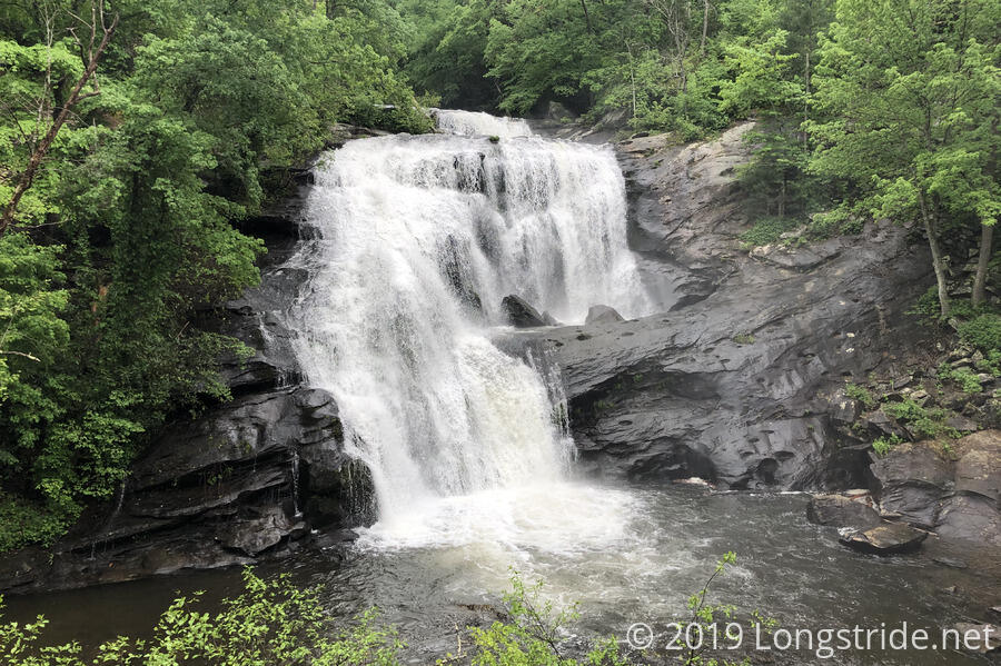
The drive back to Tellico Plains was uneventful, and we turned east on the Cherohala Skyway. Our first stop was a short detour off the skyway, to Bald River Falls, a nice waterfall we passed yesterday when Steve took us from Green Cove to Tellico Plains.
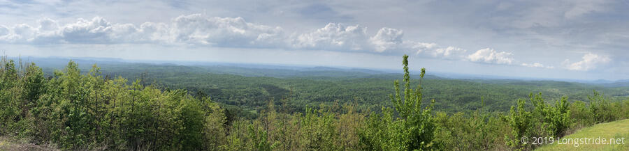
After returning to the skyway, we stopped at several overlooks along the way, taking in the scenery from much more open vistas than had been typical on the Benton MacKaye Trail.
We decided to take a short out-and-back hike at Hooper Bald, where a hunting preserve once made use of one of the mysterious Appalachian Balds. There are many mountains in the southern Appalachians that lack trees near their summits for unknown historical reasons. Many theories have been posited, but no one knows for certain why the balds were bald. (Today, the balds are kept bald by mowing, grazing, or proscribed fires.) Our start was delayed a few minutes due to some light rain, but once that passed, it was an an enjoyable hike.
From the top of Hooper Bald, we could see Huckleberry Bald, the high point of the Cheoah Ranger District in the Nantahala National Forest. On our way back to the car, we decided to be a little adventurous, taking a disused trail back through the woods rather than following the beaten path.
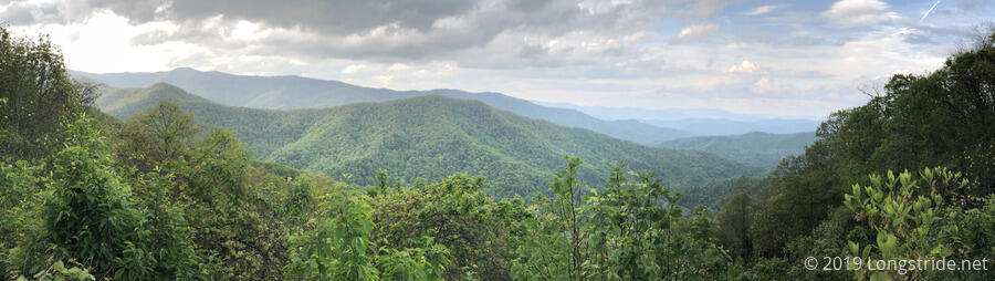
A short distance down the road was a trailhead to hike up to Huckleberry Knob. Although it was still getting later on in the afternoon, we decided to go for it. The roughly mile-and-a-quarter hike to the top went by quickly (though we did stop to puzzle over some animal tracks in some mud), and at the top, we were rewarded with a 360-degree panorama of the surrounding mountains. We could also see approaching storm clouds, so we quite quickly made our way back to the car, making the 2.5-mile round-trip in under 45 minutes. The clouds looked more threatening than they actually were; they blew through relatively quickly, giving us a few short gusts of wind at the top of Huckleberry Bald, and little else.
We made two more stops as we continued along the Cherohala Skyway, a short out-and-back to a view, and a short “nature hike” loop.
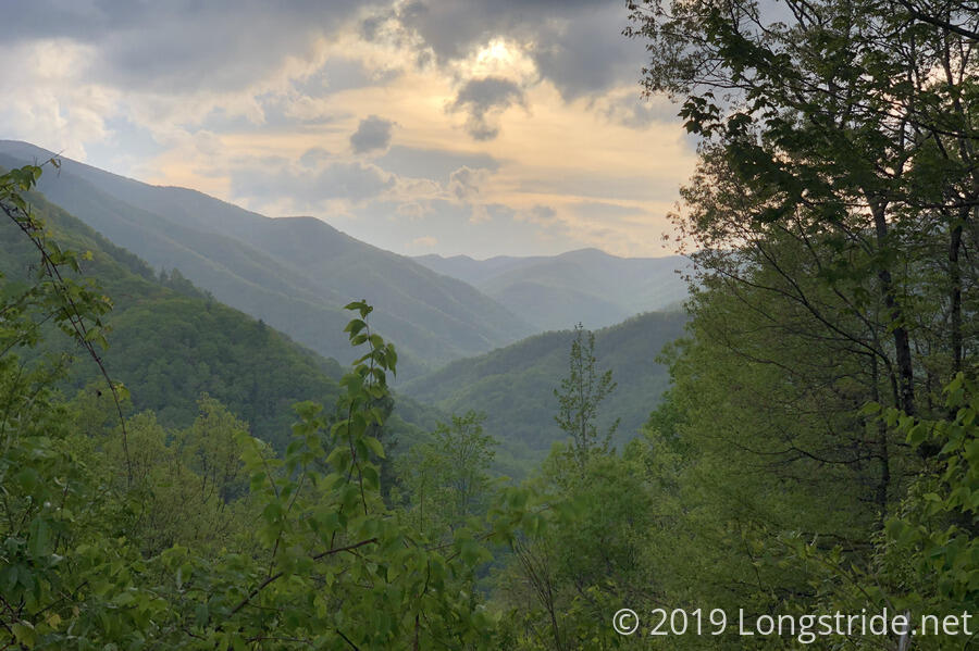
Late in the day we finished our drive along the Cherohala Skyway, and sought out dinner, somewhere between where we were, and Cherokee, near where the Blue Ridge Parkway starts. As we drove through the mountains, we were almost hit by a truck pulling a long 4x4 vehicle carrier, and later, a cop car, both of which were making very wide turns along the narrow, windy mountain back-roads.
The road took us through Robinsonville, and we stopped for dinner at the Rogers Smoky Mountain Restaurant. We got in just before closing, and had a great meal. We booked a room in Bryson City, a short distance away from Cherokee.
On our way there, the road brought us to Stecoah Gap, where the Appalachian Trail crosses NC-143. I stopped there briefly to have a quick look around. I was surprised to see a picnic table there; I didn’t remember that at all from when I was there three years ago, though, that was the day I hiked to Fontana Dam Shelter, for my then-longest day on the trail, so it’s not surprising I wouldn’t remember that detail. It was nice to see trail magic was still going — a trail angel left trail magic on the picnic table: several bags of chips and dehydrated food. Hopefully, no animals will get to them before tomorrow’s hikers do!
We finally finished our day after 9 pm, arriving at Ridge Top Motel in Bryson City. The motel was fairly inexpensive, and the room made clear why: it looked like it was last remodeled 50 years ago (so, never), with doorknobs and fixtures out of the 1960s and meat-colored paint on the walls.
Tomorrow will begin our journey up the Blue Ridge Parkway. We have no idea where we’ll wind up stopping, but it’ll be an adventure!