Day three of our road trip home saw a big change in scenery, a lot of driving, and an evening rainstorm that followed us through half of Virginia.
After another simple breakfast of trail leftovers, we took our leave of Pineola and returned to the Blue Ridge Parkway around 9:30 am, continuing our circuitous route north. the road continued to wind along and through the Blue Ridges of the Appalachian Mountains, snaking its way through North Carolina and towards Virginia.
Our first stop was the Beacon Heights trail, also along the Mountains-to-Sea Trail, which took us to an exposed rock face that had some nice views.
Our second stop was along a nature trail (also partially along the MST) that took us to a waterfall. The trail to the waterfall was intended to be a loop, but a portion of the trail was closed for maintenance.

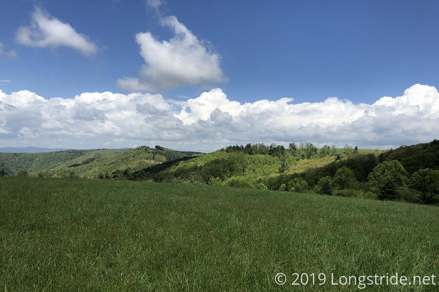
Our last stop before lunch was at “The Lump”, a small rounded bald that provided a panoramic view of much of the nearby landscape.
As we continued our drive along the BRP, we frequently saw signs for the Mountains-to-Sea Trail as it crisscrossed the parkway, far more frequently (at least to my recollection) than the Appalachian Trail crossed the BRP and Skyline Drive. As we approached Virginia, we saw two hikers walking along the road. We stopped to ask them if they were hiking the MST, but they said they were hiking the length of the Blue Ridge Parkway!
Our last hike of the day was just inside Virginia. The Fisher Peak Loop trail took us around Fisher Peak, but did not actually summit it. As we neared the end of the loop, we saw a man up ahead trimming the trail with a lawnmower. Aubrey, a member of the Friends of the Blue Ridge Parkway, paused his maintenance to chat with us a short while. His work boots almost completely falling apart, CareFree gave him some gorilla tape to keep the soles attached.
As we continued north on the parkway, the difference in the mountains became more pronounced. Whereas North Carolina was more rugged with the parkway frequently running along the mountainside, in Virginia, the mountains were more like rolling hills, with more flatter areas and farmland, and the road running through the mountains, rather than on their sides.
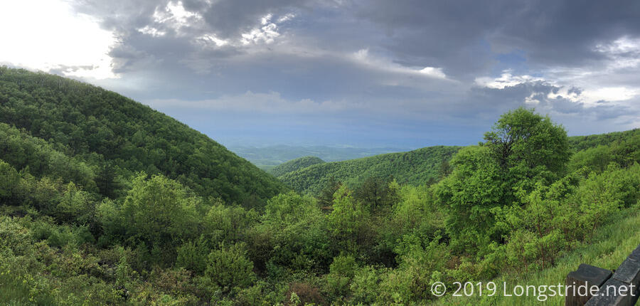
As evening approached, we could see a storm brewing to the west. We stopped in Roanoke for gas and dinner, and while we were there, the storm hit, with some rain, thunder, and lightning.
The storm subsided while we ate, and we returned to the parkway, stopping at the Taylor Mountain Overlook, the Appalachian Trail’s southernmost crossing of the BMT.
We continued on, but as it was getting dark, we were still not done with the Blue Ridge Parkway, and we needed to be home by morning to return the rental car we were driving, a new plan emerged. One of the main reasons for taking the Cherohala Skyway, Blue Ridge Parkway, and Skyline Drive BRP (If we had gotten there) was for the scenery. With sunset, there wouldn’t be any, and instead, we’d be driving on a dark windy mountain road. Instead, we exited the Blue Ridge Parkway at Buena Vista, taking the interstate north and to home. Later, when we return to complete the Benton MacKaye Trail, we’ll return to the Blue Ridge Parkway and complete the drive.
As it turned out, getting off the BRP when we did was a fortuitous choice: shortly after we left the parkway, it began raining, which intensified for the next couple of hours, bringing lightning and poor visibility as we drove up the interstate. The rain eventually subsided as we made our way home.
We made it home not long before midnight, but, after three long days of driving, sightseeing, and hiking, we could finally relax.
This half of our BMT saga is over, but we’ll be back sometime in June to finish our hike.