Our penultimate day on the trail brought us up and over three ridges as we neared the end of our northeast trek through the Smoky Mountains.
With a combined 9,000 feet of elevation change today, and expecting rain this afternoon, CareFree and I again left camp shortly before eight am. As with yesterday, this afforded us cooler temperatures for our first climb of the day. All the thunder and lightning last night before we went to sleep amounted to only a light rain for a little while shortly after midnight. Fortunately, even though the ground was still wet, it couldn’t be more humid than it was yesterday; air can only hold so much moisture.
Leaving our campsite, and still following the Chasteen Creek Trail, we continued the climb we started yesterday afternoon. The trail was quite wide, though rough with rocks, and it was tiring to climb since it was hard to maintain pace.
The first of our three steep climbs today went relatively quickly, and was replaced by a steep downhill along the Enloe Creek Trail. Along the way, the trail began following Enloe Creek itself, and eventually crossed it with a ford. We considered using our camp shoes so as not to get our shoes and socks wet, but the rocks looked to be slick (and indeed, were quite slippery). Going through in our boots was the much safer choice, but now meant I had two sets of very wet socks — the pair I wore yesterday barely dried overnight.
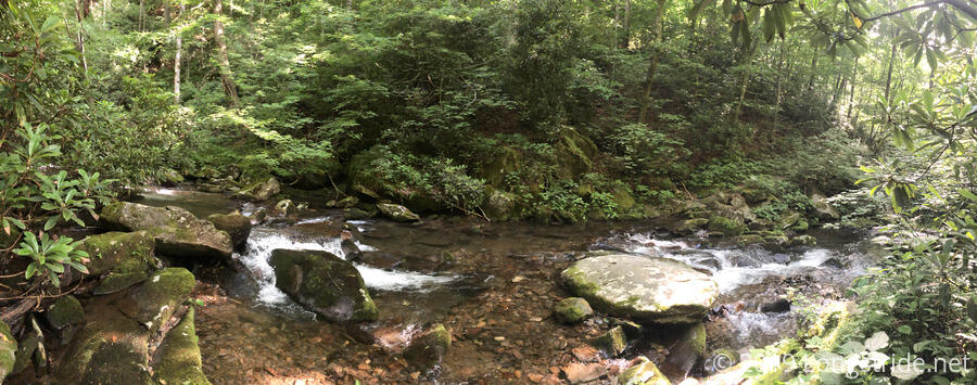
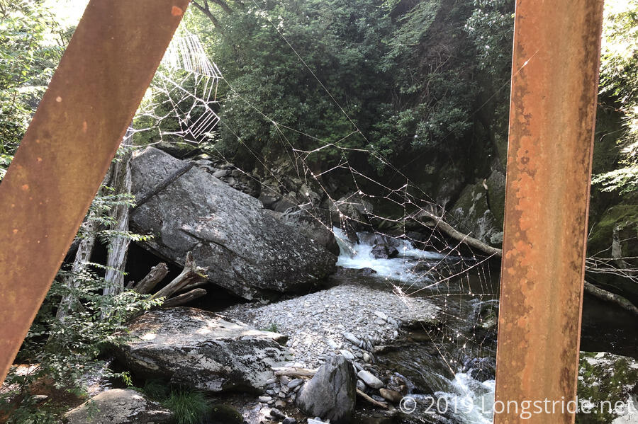
Our first downhill ended by crossing the loud Raven Fork on a metal bridge near some of the river’s cascades. There, we saw our first other people of the day, a couple at a campsite next to the bridge that were packing up from their overnight camping and fishing trip.
Our second climb commenced on the other side of the bridge, and rose even more steeply than our first. Tired, and soaked with sweat, we took a break at a trail junction, where we were immediately set upon by vicious biting gnats. They were bad enough as they were, before we realized they were also blood-suckers. After taking my camp shoes off to scratch at them, I found that several of my toes were bloody from where they had been biting, and crushing one resulted in a small explosion of blood.
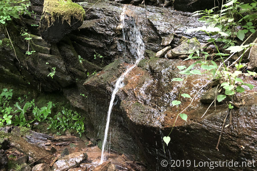
Our second uphill and downhill today teased us with some views of distant ridges through the trees, but it was quite difficult to really see anything, let alone take pictures of it. The trail passed by a tiny waterfall, flowing quite well due to yesterday’s rain.
We took our second break at the base of our third uphill, at the Beech Gap trailhead, sitting down on a large rock placed to block the trail from the nearby road. While there, several cars passed by, butterflies nibbled at the salt on our shoes, and a nice breeze blew to help cool us down. I said that it’d be nice if that breeze blew all the way to the top. CareFree suggested it might bring clouds and rain with it.
Our third climb of the day started off uneventful, but a large blow-down forced us off-trail to get around it. We bushwhacked through the forest for a bit, and then hiked up a dry creek bed to get back up to the trail further up the mountain. A bit later, we ran into another couple doing a section hike of the BMT, doing the north half of the Smokies. Last night, they stayed at the Laurel Gap Shelter we were heading for, and filled a bag with trash that previous occupants left behind.
We continued to climb up the mountain, and the sky suddenly darkened. Unfortunately, CareFree was right about the breeze blowing in the rain. When we were a little less than two miles from our destination, the Laurel Gap Shelter, in a nice high-elevation pine forest, it began to rain. We put on our pack covers, and instinctively (and knowing there was a shelter up ahead), I charged up the hill, much to CareFree’s consternation. The rain, however, turned out to not be a little lighter than yesterday’s rain, and without sufficient cooling, I started to slow down, allowing CareFree to catch back up. Near the top of our climb, the rain fizzled out, and I slowed down on an easy flat section to hike with my partner, only to have the rain come back in force as we began a half-mile descent to the shelter.
Soaked, we arrived at the Laurel Gap Shelter. A sturdy three-walled stone structure with a wooden roof, built-in fireplace, bench-and-table seating along its front, and cooking table along its side, the shelter was a welcome step up from setting up a tent. It was built in the same design as many of the shelters along the Appalachian Trail in the Smokies, though had been updated somewhat recently with a new roof that had some translucent sections to provide more light to the interior, and a pair of gutters to direct water runoff to the side of the shelter. It also had an area a short distance away from the shelter to tie up horses, but was lacking a privy, instead having a “toilet area” that was sure to be a mess in the high-altitude pine environment.
Naturally, the rain stopped shortly after we arrived at the shelter, but if the rain hadn’t, the shelter gave us a nice place to stay dry (or rather, not get more wet).
Also at the shelter was another couple, who decided they were going to set up a tent because, because the sleeping platforms in the shelter were hard wood, and they didn’t bring a sleeping pad. (They shouldn’t have done this, since tenting isn’t allowed at the shelter, but it’s not like I had any way to stop them.)
Our first order of business at the shelter was to string up clothes lines to hang up all of our wet clothes, hoping they might dry overnight. Then, I walked down to the nearby creek to get water for cooking dinner. As was the other day at Bearpen Branch, with the tables built under the shelter’s roof, it was much easier to prepare, cook, and eat.
While we were eating, another hiker arrived, bringing the shelter’s population to five for the evening. He was out on a five day loop including part of the Appalachian Trail.
Hoping to dry our clothes, we tried to light a fire in the shelter’s fireplace. Alas, the available wood was far too wet to get any substantial heat. We did cover the area in a nice campfire scent, though. (Much better than the smell of wet hiker.)
The great thing about today’s hike is that the constant and repeated elevation changes as the trail oscillated between about 3,000 and 5,000 feet showed off quite dramatically the change in forest between lower-elevation deciduous forest and higher-elevation pine forests. If you weren’t paying attention, you could easily miss the slow and gradual change in the forest structure. Likewise, the trail tread changed just as dramatically, as the soil and forest floor changed along with tree type.
Expecting more rain tomorrow afternoon, we turned in early today, hoping to get an early start tomorrow for our last day on the BMT.