Today brought me into the foothills of the Wind River Range, the next major section of the CDT.
With breakfast at 7 am sharp, I got up with just enough time to make it across the street for breakfast. It was a fantastic meal of eggs, sausage, and pancakes. My only real constraint this morning was a 10 am checkout time. Naturally, I didn’t feel much pressure to get going, even though I knew that the longer I took to leave, the higher in the sky the sun was going to be, and the hotter it’d get.
Leaving town just after ten, rather than immediately going back to the CDT, I followed a dirt road that lead directly to South Pass City. Just outside of town, I got chased by two small dogs, barking and snarling. Their owner was very apologetic and quickly got in between me and her dogs, distracting them long enough for me to get away.
From town, the road gradually climbed between two higher hills, emerging into a wide open space, not really flat enough to be a plateau. In a few places, the road was lined with trees, a nice departure from the last week. It was occasionally a little windy, but otherwise, it was very nice out.
As the road approached South Pass City, it passed by the Carissa Mine, dating to 1867, where substantial gold deposits were once found. Through a cycle of boom and bust (and new and improved mining technology), the mine was open and closed through a variety of owners, closing for the last time in 1949, and designated a historic site in 2003.
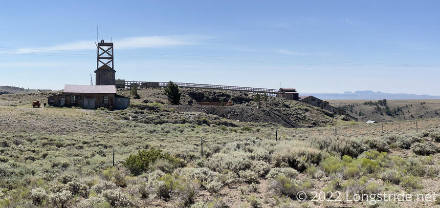
A sign indicated that South Pass City is Wyoming’s smallest continuously-inhabited town; another sign just before the visitor center claimed that South Pass City had a population of “about 4 people; roughly 3 cats; approximately 3 dogs”.
South Pass City is more tourist attraction than actual town. After a brief stop at the restroom, I went to the visitor center and picked up the box I sent from Grand Lake. The visitor center had a small selection of snacks, mostly hard candy, and a fridge with independent sodas. An ice cream cooler was sadly empty. I got a soda, and had a snack break, repacking my food bags, which are now excessively heavy with a week’s worth of food to get me to DuBois.
Now after noon, I set a goal of 15 miles for today, but with 164 miles to go to get to DuBois, I’ll have to average roughly 20 miles per day for the next week to get there before I run out of food. Not impossible, but it’ll be a challenge.
I followed a road out of town, missing where the trail turned off, and taking a slightly longer road walk to reconnect with the trail. From the town, the trail climbed up to a large, flat plateau, and followed along dirt roads and faint trail with few markers. At a cattle guard, an umbrella leaned against a fence, left by a hiker. With all the sun exposure, it was tempting to take it, but I wasn’t looking to carry yet more weight.
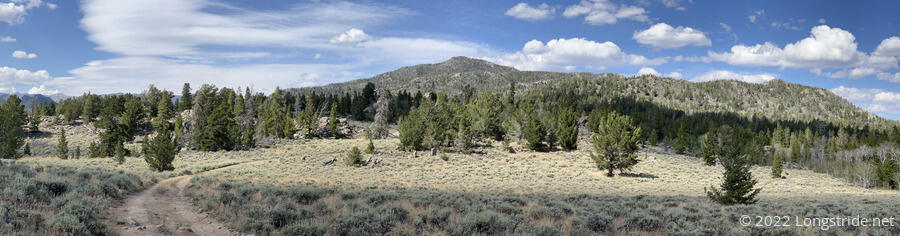
Crossing Wyoming Highway 28, the trail continued its gradual ascent, switchbacking its way into the Wind River Range with a series of dirt roads. The roads up to the highway were a variation on the blandness of the Great Divide Basin. After crossing the highway, though, trees increased in number as I progressed, and the trail finally felt like it was actually going someplace new. And the roads, being mostly doubletrack rather than packed dirt, were softer and easier on my feet. For the first time in a while, I took a break in the shade.
Not long after leaving my break, I met my first southbounder, Duke. He says he knows there’s at least one hiker ahead of him — it would have been easy for me to miss them since I just spent most of a day in Atlantic City. Now that I’ve seen one sobo, I expect to start seeing a lot more over the next few weeks.
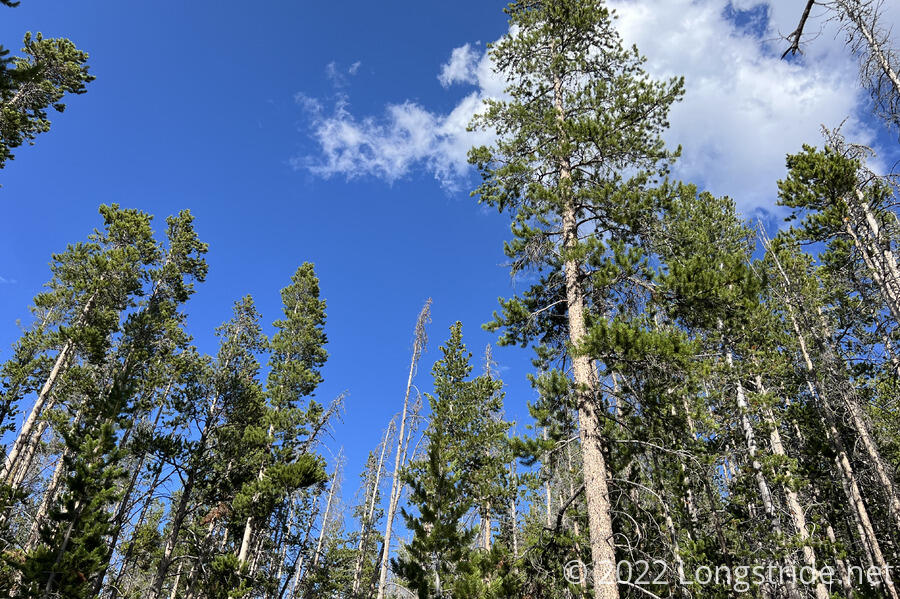
I continued climbing into the Winds, first entering the Shoshone National Forest, and then Bridger-Teton National Forest. It will be great to leave the sagebrush and cow pastures behind. (At least, I hope I’m leaving them behind…)
Shortly before five, I stopped at a creek with a campsite to make dinner. It was a couple of miles before I planned to stop again, but it felt like a good place to cook. While I was there, Pecorino arrived and also cooked dinner. Wild Man passed by, and the rest of the group is still behind somewhere, falling behind me when they went into Landers to resupply (rather than sending a box to South Pass City).
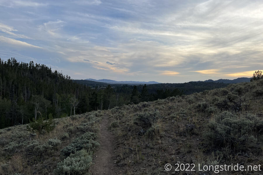
Leaving the campsite, I wanted to make it at least another couple of miles in order to make my distance goal, but every little bit beyond that would make the next week to DuBois easier. Now after six, the sun was quickly setting, and disappeared behind clouds. The occasional raindrop fell.
Shortly after leaving the campsite, the uphill ended and I began following a valley downhill, towards the East Sweetwater River, which initially looked like it did not have a dry crossing. This was the first tricky water crossing I’ve had in a while, however after looking around for a little bit, I found a series of fallen logs in the river that, with some care, I was able to use to cross the river. (It’s a little confusing to me that this is the East Sweetwater River, given that I’m now two days west of the Sweetwater River.)
About five minutes after crossing the river, I reached a trail junction. Following the other trail a very short distance took me too a relatively flat open area. Now just before sunset, I stopped to set up my tent, having made it 18.5 miles, a little better than my goal.
There are two primary alternates to the CDT through the Winds, Cirque of the Towers, and Knapsack Col, both of which are supposed to be amazingly beautiful. Tomorrow afternoon, I’ll reach the beginning of the Cirque of the Towers alternate, which ought to take a day to go through.