The long roadwalk through the Great Divide Basin is nearly at an end, as I cross historic pioneer trails and come within sight of the Winds.
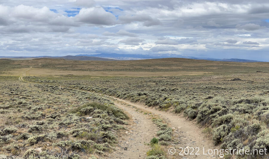
Improving on my early start yesterday, I woke up at 4:30 and was hiking by quarter of six, getting a mile and a quarter in before sunrise. As has been the norm the last several days, the trail continued following a dirt road across a wilderness of sagebrush and cow pies.
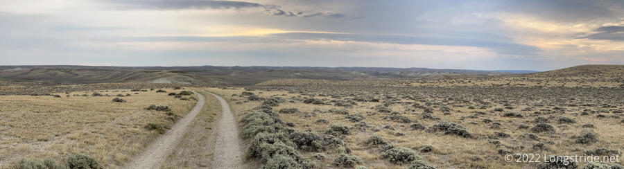
Matching the weather forecast yesterday, the day started off overcast, accompanied with some fairly strong wind blowing towards me, making it slow to hike at times.
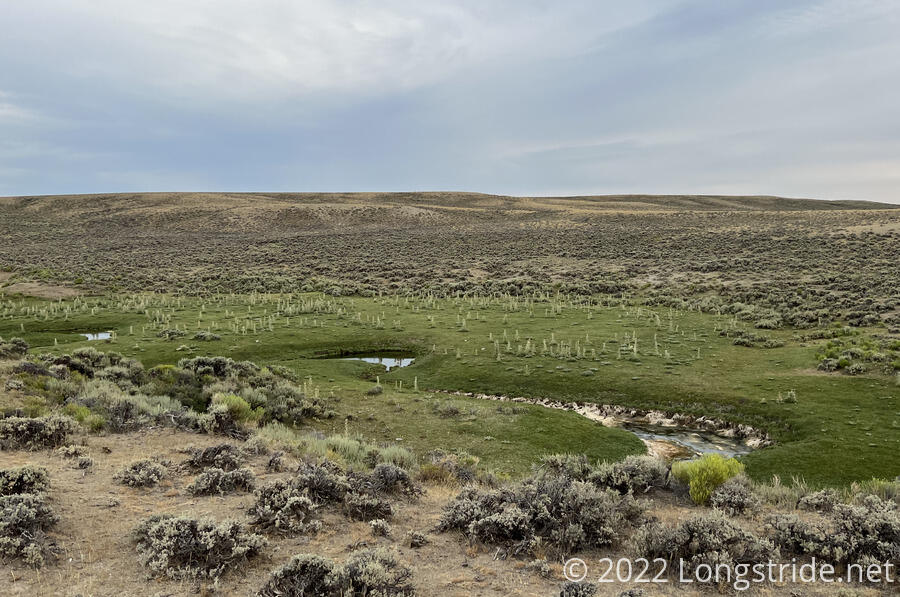
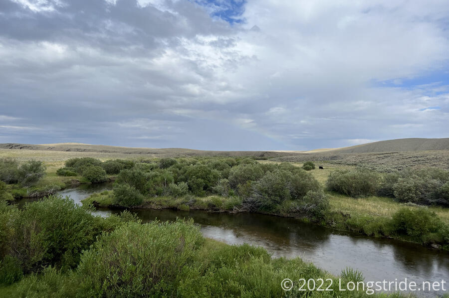
The trail made its way into a creek valley. Lush green grass surrounded a very meandering creek, with the road mostly staying far enough back to not really have a good view. There were a couple of nice flat grassy areas along the way that would make for good campsites.
I saw several horned lizards this morning, reminding me that over the last few days, there’s been quite a few of them along the trail in the Basin. I don’t think I saw any while I was in Colorado, which is not surprising, since they prefer dry areas.
I stopped for a short snack break around 8, having made good progress. The wind continued to be a bit of a nuisance, and while it was still mostly cloudy, the sun occasionally poked through a thin layer of clouds.
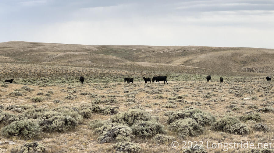
Several herds of cows roamed the sagebrush meadows this morning, though they stayed far enough away that I didn’t have any problems with them.
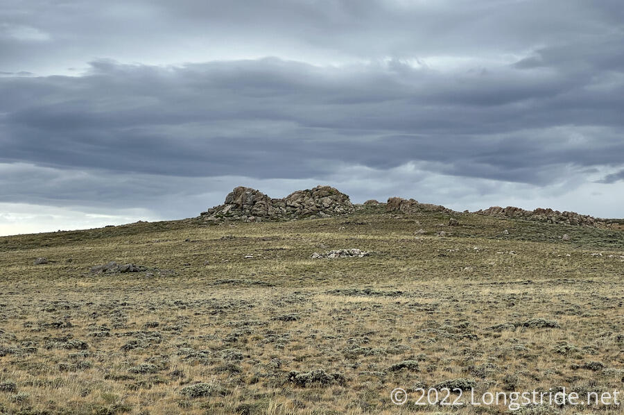
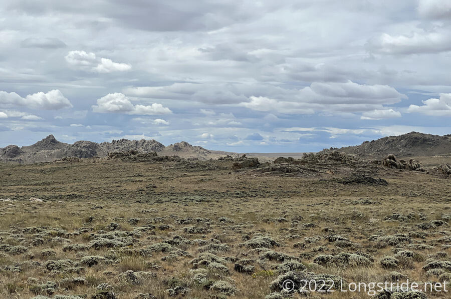
Over the course of the day, the surrounding landscape gradually became more interesting. In the morning, I passed by a long rock wall embedded in the hill above a creek valley. The surrounding land got more hilly, with exposed rock mounds and craggy hills.
Continuing to make fast progress this morning, I hiked 11.5 miles by 10 am, though my feet were very unhappy about it. The wind continued to increase, and a few scattered raindrops turned into a light rain. Naturally, when I stopped to put my pack cover and rain jacket on, the rain diminished a bit. After it stopped, I took the opportunity to take a break and rest my feet. I took my boots, which is something I haven’t been doing recently, to air my feet out and massage them a bit, though the cool weather neither dried them off well nor was comfortable to begin with.
Further on, two square concrete pillars off to the side of the trail stood out as unusual — I was used to seeing such pillars marking trail junctions in Shenandoah, but their appearance on the CDT was a surprise. These pillars marked the California Trail (Seminole Cutoff) and the Oregon Trail, important emigrant routes in the westward expansion of the US. My initial surprise was quickly tempered with, “well, of course”. Had I given any thought to it at all, it was obvious that the CDT had to cross the Oregon Trail at some point, I just didn’t know where. Of course, I had flashbacks to playing the computer game of the same name in school, and was quite glad that water filtration technology (among others) has advanced considerably since the days of pioneers.
The trail continued its roughly northwesterly track, as the sun finally pushed its way through the clouds. By 2 pm, having gotten up unusually early, and with three long days behind me, I was thoroughly exhausted, to the point where I could barely walk straight. I located a flat spot next to the trail, laid out my sleeping pad, and took a 45 minute nap. I felt much better when I was done.
The roadwalk itself continued to be thoroughly boring, but the scenery steadily improved, most notably with the appearance of the southern extent of the Wind River Range coming into view amidst the clouds. I’ll be entering the Winds in a few days, and I’m looking forward to it: it’s said to be one of the most beautiful sections of the CDT.
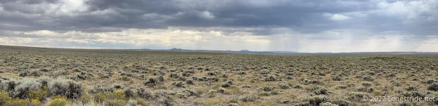
The sun dipped behind the clouds again, and off to the west, it began to rain, which was a little troublesome since that was the direction I was heading in. Fourtunately, though, the clouds were far enough out that, while I did get a smattering of raindrops, it wasn’t anything significant.
Finally, for the first time today, the trail turned off the dirt road and onto a proper trail, following a fence along a couple of hills and along the side of a meadow, reaching the Sweetwater River. Tired, I began looking for a campsite, but all the good areas were infested with cows, a few of which insisted on standing on the trail, barely a path of beaten-down grass.
Rejoining a road, a sign warned of private property and to stay on-trail. My next opportunity for camping was a “stealth” camping spot underneath a bridge over the Sweetwater, which unfortunately appeared to be in the private property, making it not an ideal choice. When I got there, I found two cyclists under the bridge cooking dinner. From the Netherlands, they were cycling from Pinedale to Rawlins today, roughly a 200 mile stretch. A bit over halfway, they hoped to reach Rawlins before sunset.
I collected water from the river and cooked dinner on a concrete support platform under the bridge. It was a little cramped, but I could actually sit down comfortably.
There wasn’t really anywhere under the bridge to set up a tent. It’d be entirely possible to lay out a sleeping pad on the concrete platform, which was fairly well-shielded from the sun and wind. Given it was still private land, though, I wasn’t going to stay beyond the time it took to cook and eat. As I was leaving, mosquitoes suddenly showed up, further confirming that the bridge was a bad spot to “camp”. The mosquitoes continued to be a nuisance the rest of the evening.
While cooking dinner, I decided to stay at Wild Bill’s Bed & Breakfast in Atlantic City tomorrow, about ten miles ahead and a mile off-trail. This would make for about a half-day, giving my feet a little break. Also, tomorrow’s my birthday, so it seemed entirely reasonable to treat myself. I called to make a reservation.
That done, I hiked on another fifteen minutes, and dropped down a hill to camp near in a nice grassy meadow near Rock Creek. Nice, that is, except for the copious amount of cow pies in nearly every tent-size flat spot. The mosquitoes quickly went after me, and I set my tent up as fast as I could to avoid them.
I finished today about three-quarters of a mile short of a marathon. However, the last four days have set a new personal record: 104 miles, averaging 26 miles/day. As tiring and monotonous as this stretch of trail has been, at least it’s almost over: it’ll only be about another full day of hiking before I completely exit the Basin and enter the Winds.
My feet hurt more than they have in a long time. I suspect that I over-tightened my shoes in reaction to my feet slipping in my boots on the downhills the day I left Grand Lake.
With only about ten miles to go tomorrow to get to Atlantic City, I’m not bothering to set an alarm. Tomorrow will be a nice and relaxed day.