Exiting the Wind River Range, I continued north through meadows, forests, and cow pastures.
Yesterday’s rain continued long into the evening. By morning, the rain had stopped, but it was still cold and wet out, and fog hung in the trees on the other side of the river. Naturally, I started hiking much later than I wanted; a few southbounders passed while I was getting ready.
The trail continued to follow the Green River out of the mountains, gradually going downhill. The river picked up a significant meander along its valley, and split into two channels in several places.
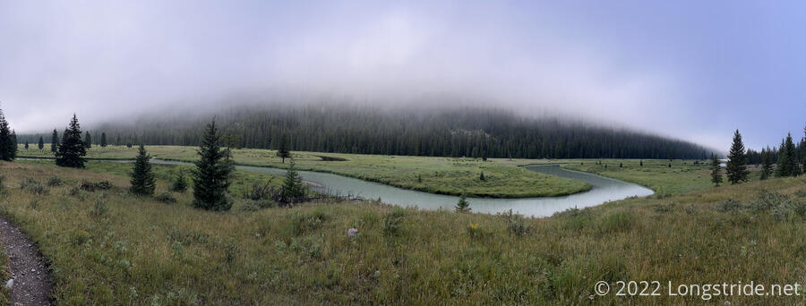
The river widened, forming a lake nearly the width of the entire valley, thanks to a natural dam formed on the valley floor. After flowing through the channel, it became river-sized again, only to expand into another valley-width lake once more on its way out of the valley.
As I continued downhill, the fog gradually lifted. A mountain peak (actually, the side of a knife edge) suddenly appeared above the trees straight ahead. A few southbounders and day hikers passed by.
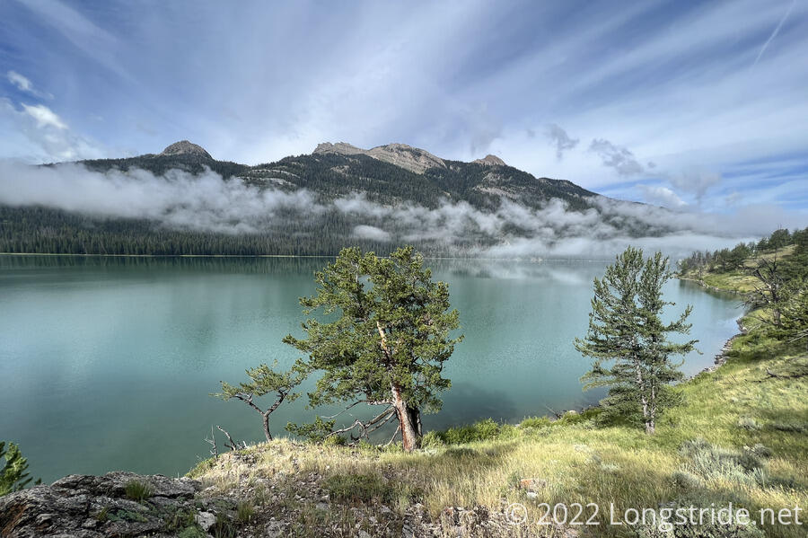
Across the lake and river, I could see a campground — the one Fuck-It and Pecorino used to hitch a ride to Pinedale. It seemed nice enough, at least from a distance, but it was definitely way further away from Pinedale than I think is reasonable to hitchhike.
Passing the campground, the valley widened and became a meadow, and the trail turned, heading uphill towards a pass to the north. A couple of historic wooden cabins stood in the meadow, on the other side of a fence. A group of people climbed up a side trail to a hill to see a large boulder that (presumably) a glacier deposited at the top of the hill.
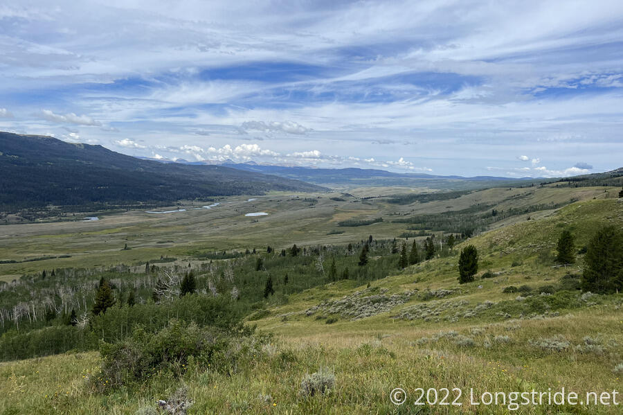
Heading up along the side of a mountain, the trail gradually climbed up out of a wide valley, filled with grasses and small trees and bushes. Looking back, the green Green River flowed around the bottom of a mountain, eventually curving around it and turning south.
As the trail climbed, the sagebrush and grasses near the trail became overgrown. It wasn’t the most pleasant hike, but fortunately, they were dry, so I wasn’t getting wet. Yet.
Entering forest, the trail climbed over a small ridge and dropped down into an adjacent valley. This led me through an area of blowdowns worse than the area south of the entrance to the Cirque of the Towers. I had to take my pack off twice to climb over and crawl under a mess of fallen trees, and it was relatively slow progress.
After crossing the valley and its creek, the Roaring Fork, the trail began climbing up the side of another mountain, beginning a steep climb up to Gunsight Pass. It started raining. I put my pack cover on, but left off my rain jacket to keep from overheating. Later, as the rain increased, it got considerably colder, forcing me to put my jacket on.
There were several more fallen trees I had to navigate on the way up, but fortunately, none anywhere near as bad as when I was entering the valley.
The final approach to Gunsight Pass was up a small creek valley, which left a divot in the side of the hill. A fence at the top of the pass suggested I was probably entering more cow pastures.
At some point today, I left the Wind River Range. If it wasn’t when I started climbing up away from the Green River, then it was somewhere between there and going over Gunsight Pass. Either way, the Winds are over, and it’s time for something new.
After dropping down slightly from the pass, the trail meandered cross-country, alternating between meadows and forests.
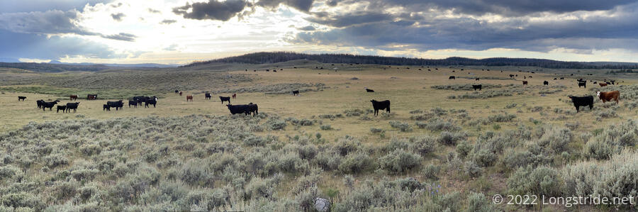
As I expected, there were plenty of cows. A herd stood directly on the trail, and on both sides, staring at me, and at the other northbounder that happened to catch up with me just then.
We got them to move by just walking down the trail at them, but it was a little unnerving to be walking in the middle of so many cows.
The trail crossed a creek that didn’t quite have a dry crossing. Investigating up- and down- stream a bit, there looked to be a few places where a dry crossing would be possible if the water were a little lower. At the trail crossing, it would have been easy enough to jump across if I didn’t have a pack, but the extra weight (and lack of safe area to get a running start) meant I had to stop for a bit to swap my boots for crocs.
The trail continued alternating between forests and meadows for a little while, ultimately settling on meadow for the rest of the day. While in the forest, I passed several cows that were roaming through the woods. It was surprising — I never really thought of cows as being forest animals before! Even more cows straddled the trail in the meadow, but these moved out of the way more quickly than their kin earlier in the day.
The trail joined a dirt road. Crossing the meadows on a dirt road, with the mountains in the distance, reminded me lot of a day in New Mexico featuring similar (though considerably drier) terrain.
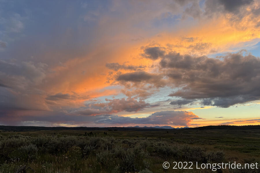
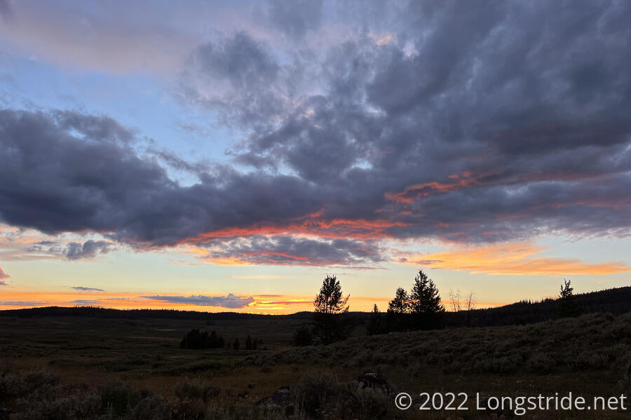
The sky to the west filled with what appeared to be storm clouds, which gave the evening sky a quite colorful appearance as the sun set.
I crossed a creek, with a somewhat involved rock hop, and with sunset approaching, I began searching for campsites, hoping I’d find one reasonably close to the creek, with at least a bit of shelter. (Seeing a forest ahead, I gambled that I could find a campsite close enough that it’d be easy to come back and get water.) About a tenth of a mile uphill from the creek, I did find a decent little campsite surrounded by small trees just off the trail. Cow pies all over the area forced my tent into a slightly less than ideal space, but I was able to make it work.
I started cooking dinner just as the sun started dipping behind the mountains. Dinner took much longer than it should have, thanks to accidentally spilling water on my stove, necessitating drying it out with my lighter (which I pretty much have just for this reason) before it would ignite. Then my headlamp ran out of power because I forgot to charge it in Pinedale, so I had to use the flashlight on my phone (which worked, but was annoying to use).
The uphills today were still somewhat problematic in terms of pace, but since most of them weren’t terribly steep, I had a reasonably good day today, almost 21.5 miles. Tomorrow, I’m still undecided about where I’m going to stop, but it might be a shorter day in order to camp well outside of the grizzly bear area.