The wind blew all night, but because of our semi-protected campsite, it never got to be terribly windy, and certainly nothing like the forecast was calling for. I only had one stake pull out, right before I went to sleep. Because it was going to be so windy, I had pitched my tent lower to the ground than usual to lower the wind profile, which meant getting up was a bit more of a nuisance, since any time I moved around, I rubbed my head on my tent’s roof.
Quoi, Dylan, and I left camp just after 8 to cool weather and a light wind. This section of trail turned out to be pretty nice: the trail was surrounded by trees, grass, and wildflowers. Our immediate destination was the Cleghorn Picnic Area, 12.8 miles from our campsite. At the picnic area, pizza can be ordered for delivery. After skipping dinner last night on account of the late hour and persistent winds, I was quite looking forward to a pizza.
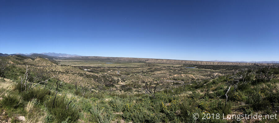
As the trail continued winding its way west, we got views of the nearby valley, which was quite green, and which had a couple of small lakes. Later on, it became clear this greenery was because there was an aqueduct running through the valley.
After about 8.5 miles of the trail weaving around the mountainside, we took a break at a road in front of the embankment for a dam, though at the time, I didn’t realize what it was a dam for. (I assumed there was water on the other side, but given the largest bodies of water I remember seeing so far were the Whitewater River and Deep Creek, I wasn’t really expecting much.)
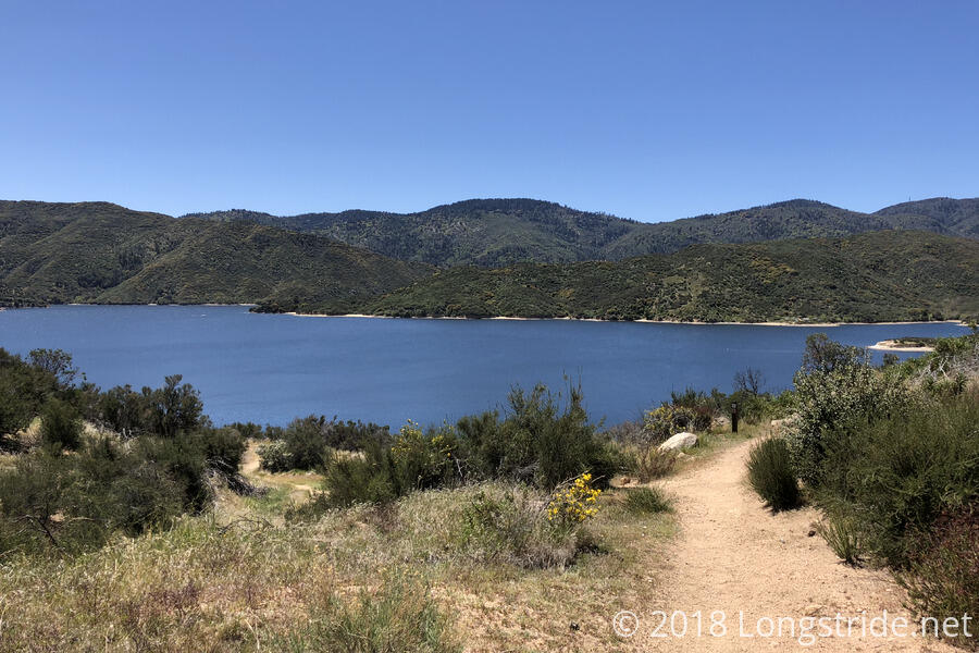
After a mile and a half of climbing, the trail went over a crest and Silverwood Lake came into view, a giant, blue oasis in the middle of the not-quite-desert. Definitely a very welcome sight to see; if anything so far could be rightfully called the “shock to the senses” that the Whitewater River was billed as, it was this lake. The next three or so miles of trail climbed along the side of the lake’s basin, with occasional access points to beaches on the lakeside. A few small flocks of ducks floated in the lake, and off in the distance, someone in a power boat was driving around in circles.
We finally made it to the Cleghorn Picnic Area at 1 pm, starving and ready for food. After calling the pizza place and starting to make our order, a hitch arose: the delivery driver didn’t start until 3! I didn’t really want to wait around for two hours before I could get food, but, pizza!, and also there was a covered picnic area to wait out the sun. So, we opted to wait, expecting other groups of hikers would arrive behind us and we could all make one giant order to save on the delivery charge.
Eventually, ten of us at Cleghorn ordered pizza (I got a 12” pineapple/sausage/green pepper pizza). While we were waiting, hiker/trail celebrity Rebo showed up and did short video interviews with several of us; Sparky and I were reminiscing at the time about our AT hikes, so Rebo asked us a few questions about the AT and how the PCT compared.
Eventually, our pizza arrived (and Quoi and I split a two-liter bottle of 7-Up). I was able to eat almost my entire pizza, but just ran out of space in my stomach for the last half of the last slice. Any more, and I would have felt like a bloated pizza hog.
Shortly before leaving, we saw a pair of bald eagles, one adult and one juvenile, flying (or fighting) around a tree across the lake. There also seemed to be another, smaller bird involved, but we were too far away to really get a good look at what was going on.
Around 5, Quoi, Dylan, and I finally made our exit from the picnic area, with a plan to make it past the top of the next mountain, a nearly four mile climb, and then on to a campsite not listed in the guide Quoi remembered existing from her hike last year. (She attempted a PCT thru-hike, but had to abort after someone stole her passport, medication, and other essential items while she was in town.)
It was a bit of a long climb up the mountain, along occasionally narrow sections of trail, and slowed a bit by the large quantities of soda and pizza we consumed. I mused out loud that it was a little surprising we don’t see more stories along the lines of, “hiker is injured or dies after accidentally stepping off the edge of the trail”. One thing the PCT does quite frequently is long sustained uphills or downhills, and while that’s not necessarily difficult in and of itself, it does get a bit tiring when all you do for two hours is go up (or down).
Slowly, we watched Silverwood Lake get smaller in the distance, until we finally turned to the other side of a mountain and lost sight of it entirely. We made it to the top of the climb a little after 7, leaving us with little precious daylight left to get to a campsite. We pressed on, and found that the first campsite we came to, listed in the guide, was occupied by Rebo. We kept on hiking, and I eventually had to get out my headlamp, making today unexpectedly my first stint of night-hiking on the PCT.
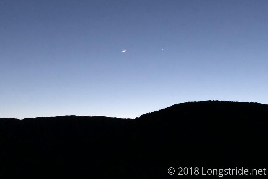
After the sun had been set for half an hour, the landscape turned into a black silhouette in front of a deep blue sky, with the Moon and Venus shining side-by-side. Fortunately, we only had to hike for about half an hour with headlamps on before we found a campsite on the side of the trail just barely big enough for us to cram all three of our tents in. Our tents are practically on top of each other, with stake lines from my tent and Dylan’s tent running underneath the other tent’s vestibule.
As I was setting up my tent, a train horn blew in the background, and I had a brief thought back to my night at the Boiling Springs Backpackers Campground on the Appalachian Trail, when nine trains rumbled through in the night. Fortunately, though, we are far enough away from the tracks that that won’t be an issue.
Today was also another 20-miler, which was kind of amazing given the four hour break in the middle of the day. Tomorrow will be far shorter, as we nero into Cajon Pass for McDonald’s and a hotel room.


