Today brought both good and bad trail, as well as great views and surprises.
Overnight, there was a nice breeze going; which died down a couple of hours before sunrise. It was too bad, because I would have really appreciated a nice breeze throughout the day.
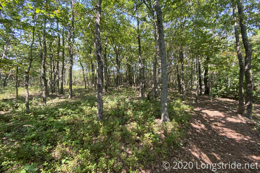
I left the shelter about quarter to eight, continuing north along the ridge. Every now and then, the trail passed by what looked like might be a halfway decent view in winter.
Near a power line clearing; the trail became overgrown. Each time I hit some of the plants, giant puffs of pollen went flying into the air. By the time I made it through that section, my pants and my legs had a noticeable yellow tint to them. If I’d gone through any more, I may as well have been a character on The Simpsons.
But at that power line clearing, once I stepped out of the forest, into the full brightness of the morning sun, I knew it was going to be a hot day. Also my shoes were now wet (from the overgrowth), so that was going to be wonderful too.
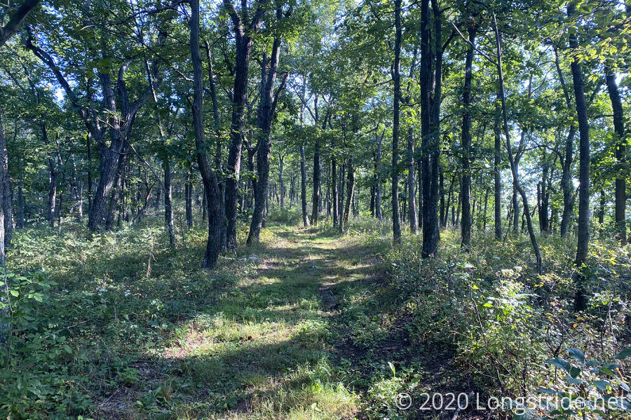
Once the overgrowth died down, though, the trail became a grassy road bed, and that was a joy to hike.
The road bed brought me to WV 55/US 48, where, as promised, there was 2 gallons of water stashed for me behind a bench. I stopped for a break, and refilled my water bottle and pack from one of the gallon jugs, and washed the pollen off my legs with what little remained. I gambled that Pinnacle Shelter would have water, and didn’t open the other gallon; it was already going to be a long day, and carrying the close to four liters of water I now had would be hard enough. Some other lucky hiker would be the recipient of a surprise gallon of water on the trail, presuming it didn’t get picked back up before then.
Crossing the highway (with not a whole lot of traffic), the trail resumed following the ridge. A private road paralleled the trail just downhill, and there were a couple of campsites along the ridge with winter views that were probably used by whomever owned the road, because the campsites themselves were pretty bumpy and didn’t seem suitable for overnight use.
About an hour after leaving the water cache, no trespassing signs appeared to the east, as the trail entered private property. The trail would remain in private property for the remainder of the day.
When the trail reached the (aptly named) Dry Gap, I found a second water cache of two gallons! Still pretty full from the last cache just a couple of miles earlier, this second cache was both unnecessary and still highly appreciated. Hopefully, another hiker comes by either of the caches and is able to make use of them.
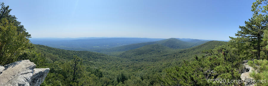
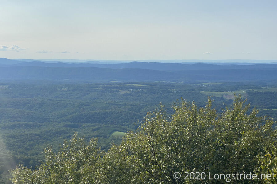
From Dry Gap, this next section of trail was relatively recently opened, in 2015, a relocation of the trail to follow the ridge on private land. About a mile up from Dry Gap was the Eagle Rock view. The hike there followed a familiar pattern of initial easy road-shaped switchbacks followed by something much steeper. There were several rock outcrops (including one with a concrete bench) that provided an expansive view to the east.
It was a little early for a second break, but with the view, I would have stopped there had it not been for the large family also there, with their pet chicken. (Yes, pet chicken. Apparently, according to one of the children, it doesn’t let them catch it, but it always follows them around wherever they go. I suggested it was a smart chicken, it clearly knew who had the food!)
After Eagle Rock, the trail became a lot more rocky, and continued that way for a couple of hours.
I did stop for a break about half an hour after Eagle Rock, along a rock wall just below the ridge. The ridge itself didn’t have much of a view, just to a clearing on the other side of the ridge with some rusting heavy machinery parked.
As I predicted, the afternoon grew hotter, though there occasionally was a nice breeze; and it wasn’t oppressively humid. The heat did get to me eventually, though; and during an ascent, stopped for fifteen minutes on a large rock next to the trail to use it as a heat sink to cool down. I needed the break anyway, but doing it on a cool rock helped.
Besides the rocks, the next obstacle was a somewhat overgrown ferny trail, so it was often difficult to tell where the trail actually was. Fortunately, the area was well-blazed, which provided enough clues to figure out where the trail was given where it needed to get to.
The private property signs continued for most of the day, and the trail was beginning to feel a little claustrophobic, between the signs and lack of views. There was nowhere to go, but forward, or even campsites (or areas that looked like maybe they could be campsites) to stop and stretch out.
The next obstacle was a tiny rock scramble; so short I might not have noted it as such except for the guidebook’s description. At the same time, the view to the west opened up, so there was at least some gain for the effort.
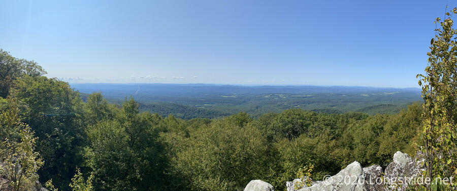
If it hadn’t been so hot (and the sun shining practically in my face), the views would have made an excellent place for a break. Instead, I took my next snack break on a rock in the forest just past the views.
Finally, the trail reached something else: the side trail to the Lucas Woods camp, over a mile downhill. (The campsite used to be on the Tuscarora, until the Tuscarora was relocated to the ridge.) This might have served as an alternative for water, but yesterday, John Stacy mentioned being there recently and not being able to get water from the pump, so it was a pretty long distance for there to only maybe be water. I pushed on to Pinnacle Shelter.
Shortly before the shelter is a view (the Pinnacle). Wanting to see the view, I followed the white-blazed trail up, dropping my pack at the base of a short rock scramble up. As I was. Limbo game, I noticed the Tuscarora’s blue blaze off to the side. Once I got to the top, I took in the view, and then grumbled as I took the Tuscarora back down to get my pack. If I’d known the white trail was a loop with the Tuscarora, I’d have skipped the rock climb, fun though as it was. It was now after 5 pm, and I was tired and hungry.
I quickly made it to the shelter from there, and dropped off my pack. First order of business was water for dinner, so I grabbed my water bag and continued down the Tuscarora until I got to the “spring”. Not really flowing, it was more like a stagnant pool of water with leaves and water insects slitting about the surface.
Fortunately, the water was deep enough that a few trawls with my bag got me plenty of water (and leaves).
Back at the shelter, I started filtering, and exploded the contents of my pack on the shelter floor, getting stuff set out for (eventual) bed and getting ready to cook dinner. As I was wandering around the shelter’s porch, a wasp fell into my beard.
I brushed it off in alarm, and it wandered around on the deck for a bit before eventually flying off. I looked up, and found where it came from: a wasp nest just under the roof’s peak. They were far enough up that I suspected we would all get along fine, as long as they didn’t dive-bomb me further.
As I was getting ready to lug stuff down to the shelter’s covered picnic table for dinner, I was surprised by the arrival of someone else to the shelter. He introduced himself as Pat, and had an old external-frame pack. From his otherwise well-groomed appearance and not-all-there demeanor, I thought maybe he was a military vet that didn’t well transition back to civilian life. He seemed as surprised to find me here as I was to see him, so I told him there was plenty of space in the shelter (and helped him get his pack’s sternum strap disconnected so he could get his pack off, since he seemed to be having a problem with that.)
It turned out he was not a military vet; he was actually from a group home, out now for a short section of the Tuscarora with Nukon (Nick), himself a section maintainer of the Tuscarora in Pennsylvania. Imagine that, in two days, I’ve met two PATC trail maintainers! Nukon also section-hiked the Appalachian Trail, completing his last section (Maine) in 2016. Pat’s pack was the one he’d used on the AT. They’re both section-hiking the Tuscarora together, Nukon’s way of giving Pat a significant tangible accomplishment.
We sat down for dinner, and had a good discussion of what was ahead on the trail for both of us. For Nukon and Pat, for now it’s just the section I’d hiked today, through Dry Gap. For me, Nukon suggested that part of my plan for Pennsylvania was overly ambitious, especially considering the declining daylight hours. He gave me his contact info and offered a water drop at a shelter on a dry section of the trail in PA, so that will help greatly.
Tomorrow: resupply in Gore, then the first half of a roadwalk.