Today didn’t quite go as planned either, but it also worked out better in the end.
Knowing I’d have a long day today, including a stop in the town of Toms Brook for resupply, I’d set an alarm for 6. It’s funny; I’d woken up in the middle of the night and had a hard time getting back to sleep, but once the alarm came, it’s the easiest thing in the world to hit snooze (four times) and go back to sleep.
I think it was mostly not wanting to deal with a wet tent that really delayed me getting up, but I finally got up, got my food bags down from the tree I hung them in, had breakfast, and then set to work packing everything up.
If left camp a little after 8, later than I wanted, but not too bad. The trail back up the mountain to the Tuscarora was steeper going up than I’d remembered it being while coming down, but even that only took about another half hour.
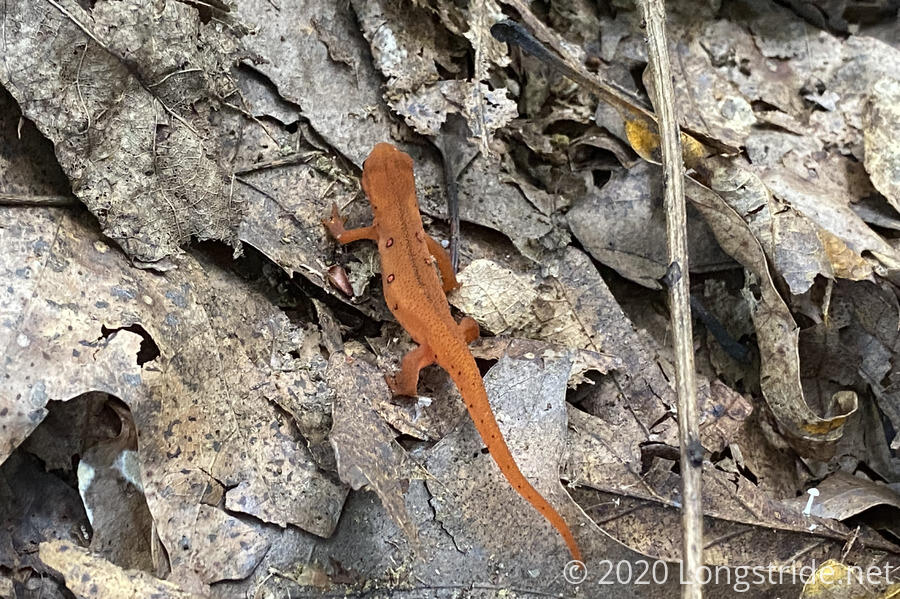
The Tuscarora continued to climb up and over the ridge. On the way, I spotted an orange salamander, relatively common on the AT, especially further south.
On its way down, the trail left the George Washington National Forest, entering private property. I’d be on private property or public roads for most of the rest of the day, until reentering the forest on the west side of the Shenandoah Valley.
While initially a little steep on its way down, the trail through private lands was generally less steep. The trail wandered it’s way down a pretty easy footpath. I suspected it might be an old road bed, especially after passing a small creek that went through a culvert underneath the trail. I also suspected this part of the trail got a lot of use from hunters. On my way out of the forest, I saw two hunting blinds just off-trail.
As I exited the forest, the trail took me through a road through a farm. Unfortunately, it was a bit overgrown, and the sun had not had a chance to dry out the plants. My shoes got soaked in just a few minutes.
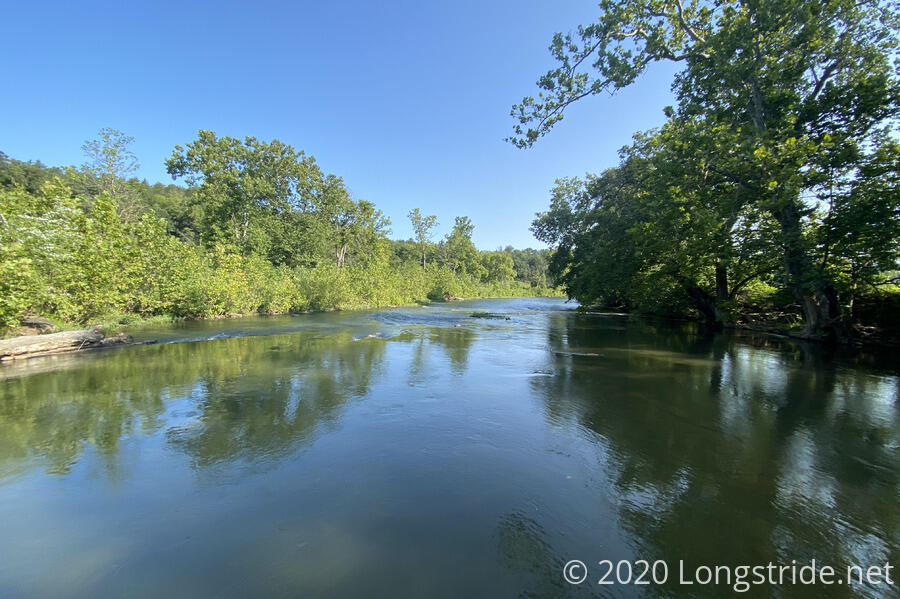
Exiting the farm property took me over a low-water bridge over the North Fork Shenandoah River. It seems the River itself is normally not very deep; I wonder how often the bridge floods over.
This began the first road walk of the day. Fortunately, there was very little traffic along the roads that would take me to the town of Toms Brook. Even better, this first portion was mostly downhill, and I made good time. Along the way, I noticed that the bridge over the Shenandoah was not the only “low water” bridge; half the roads I passed had low-water bridges and signs warning to not cross when flooded. I wondered how often they flooded.
As I approached a bicycle sitting on one side of the road, I heard a dog barking from up the (very) steep hill/rock face to my right. I looked, and saw a dog, as well as a father and son climbing the hill. As the dog ran partially down the hill towards me, still barking, I took a slightly defensive posture, and the kid yelled something like “don’t worry!” I continued down the road, but kept an eye on the fog, who ran off the hill; into the road, and continued barking. I sighed, but it seemed to be keeping its distance, and I kept going.
But the barking never got quieter. I’d occasionally look back, and the dog was still following me, a reasonable distance back, for probably about half a mile, all the while barking it’s head off.
I had a thought back to a time on the AT where I passed a sign on a tree asking hikers to run back the dog, because it likes to follow and they had already lost four dogs that year. “This is how you get your dog run over by a car,” I thought.
Five minutes later, I approached a guy out running on the road with his dog (not very fast, apparently, since I managed to keep pace with them for five minutes), and a van passed us, heading back up the hill.
Turning off the road after 40 minutes, the trail entered a Shenandoah Valley Battlefields Foundation property, a relatively recent relocation. I half expected there to be informational kiosks, or something, but there wasn’t. It makes it a little hard to appreciate the historical area one is traveling through.
The last bit of trail through the “park” was adjacent to homes with more barky dogs. Fortunately, this time there was a fence between us.
That brought me to US-11. A short jaunt north on the road brought me to a Dollar General. It was time for this hike’s first on-trail resupply.
I stuffed my pack into a tiny shopping cart and began slowly roaming the aisles, looking for food. As a treat, I got two bottles of soda and a bottle of Gatorade, and a package of beef jerky. I made use of the restroom, and took a brief “hiker shower” using the sink and a couple of paper towels. It wasn’t very thorough, but I did feel a lot better afterwards.
After paying, I sat down on a chair out front of the store, ate a snack, drank one of my sodas, and repacked my resupply. I now have four days of food to get me to the Gore, VA post office, which has a box that will get me to Hancock, MD.
Even though I wasn’t being especially quick about it, the whole town stop took just slightly under an hour, my best resupply time ever. (Second best was, I think, three hours in Waynesboro, VA while on the AT.)
I set out on the second half of today’s roadwalk, now heading west out of Toms Brook. I made excellent time, even though the more afternoon sun left me with little shade. Just up the road from the Dollar General, the trail went over a disused railroad track. (At least, I hope it’s disused, given there are trees growing from the tracks!) A little past that, the road went past a creek; there were three cows standing in the creek, underneath the shade of a tree. It seemed like a good place to be.
As the trail headed west away from Toms Brook, the roads and surroundings took on an increasingly rural feel, especially once the trail crossed over I-81.
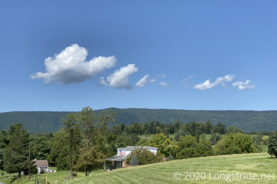
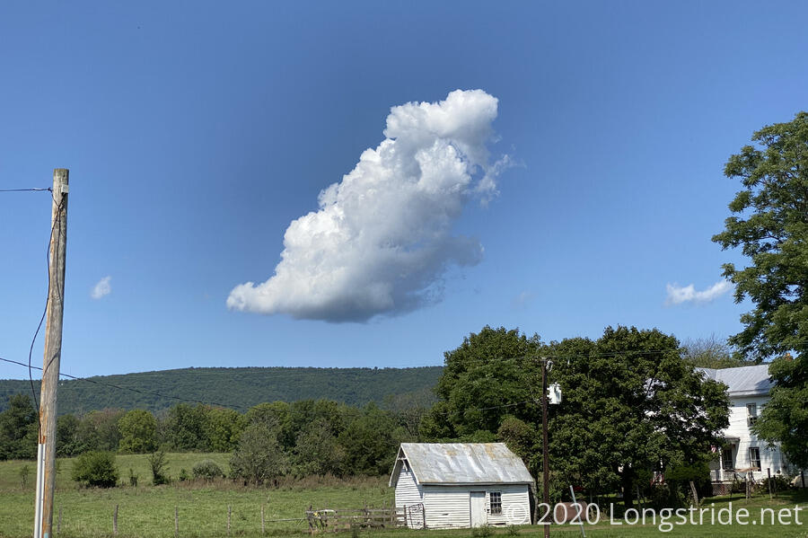
Some clouds appeared over the mountain ahead, and it was nice to be able to watch them evolve over time.
Later, I passed a doe and two fawn at a creek a few dozen feet away from the road.
The roadwalk went for four miles from town, until it started to climb into forest. By this point, it had long become a gravel road. I wondered why anyone would want to live so far down gravel roads, but I guess it’s just one of the things you have to deal with in rural areas, like low water bridges.
After about 4.5 miles (in just under an hour and a half!), the trail turned off from the gravel road it had been following, and I stopped for a break. The heat was getting to me and I needed to rest and cool down.
I took the opportunity to unpack and dry out my tent. I also drank the entire bottle of Gatorade I bought. I decided I should probably have gotten a second. I rested on the side of the trail for over an hour. While I was doing so, a pair of kids drove down the gravel road on an ATV, and then a few minutes later, drove back up the road. They did this a second time later; the third time, they were followed by two women and a girl on a second ATV.
From where I stopped, the trail began a much steeper climb up the mountain. In the heat, it was slow going. A large fallen tree blocked the trail at one point, and it was a nuisance to get around. Mostly, I was tired from the heat and it was more frustrating than actually difficult.
After what seemed like forever (but was actually only 35 minutes), the trail brought me to Zapp Rd, behind a house on the ridge that had a stunning view of the valley below. Through the mostly-glass walls of the house’s common area, inside, I could see a telescope. I wondered if they used it to look at the stars, or the valley.
Another 20 minutes uphill from the house, I reentered the George Washington National Forest, and almost immediately took a short break, sitting on a rock for a few minutes. At least this time, I was nearly fully shaded from the sun.
My goal for the day was the campsite I assumed would be at Cedar Creek (since where there’s water, there’s often a campsite), making this a 17.7 mile day. As I slowly made my way up the mountain, I was realizing that this was unlikely to happen. I was too tired, and it was starting to become too late in the day.
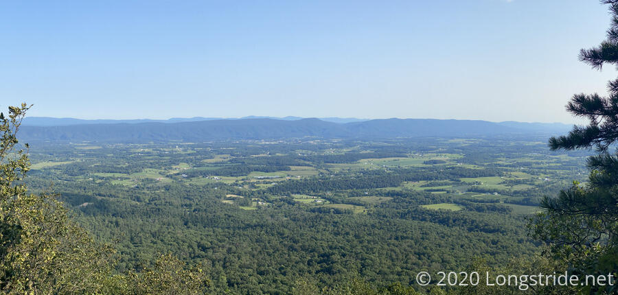
As I continued to climb and follow the ridge, and was coming to terms with having to dry-camp, I passed a number of okay campsites, some with obstructed views, and was considering a largeish one, when I noticed it had a trail heading back towards the ridge. I checked it out, and found a smaller campsite that was adjacent to an outstanding overlook of the valley. A nice, constant breeze blew. It was one of the few places on the ridge where the view wasn’t obscured by trees.
That was it, I was done for the day.
It was not the campsite I was looking for, but definitely was the campsite I needed.
The breeze, besides keeping bugs away, would also help quickly dry my clothes and keep everything dry overnight. It didn’t take me long to get my tent set up and a bear line thrown.
I found a small waterproof box with a geocache and logbook, so I made an entry. It was relatively new, there were only a small handful of entries.
Siting near the rock outcrop, I cooked dinner and watched the shadows change over the valley and the lights turn on as the sun began to set. The breeze continued, and it remained cool, but not cold. It was quite pleasant.
Tomorrow’s plan is somewhat questionable. Today’s slightly shorter than planned day (15 vs. 17+) makes for a 17 mile day to Gerhard Shelter, which might not have water, and an equally long day the day after to another shelter, with no water in-between.
I set my alarm for 6 am tomorrow. I almost never camp somewhere I can see the sunrise, so I’m making sure I see it tomorrow.