Generally miserable weather shortened today’s hike, but fantastic scenery on the way to the Cirque of the Towers made it entirely worth it.
Overnight, the rain stopped and started a few times. When I got up shortly after 5 am, everything outside was wet — and most everything inside, as well. I was highly unmotivated to get moving, even though I had plans for a long day today. By 6:45, I’d finally had breakfast and put on my (still wet, cold) hiking clothes, and got out of the tent, only for it to start raining again. If I’d been a few minutes faster, or the rain a few minutes later, I’d have been in the process of taking my tent down and committed to going. But the timing was “perfect”, and I just got back into my tent, put my dry town clothes back on, got my sleeping bag back out, and went back to sleep.
Some time after ten, the rain had finally stopped, and a light fog blew through. With the sky getting lighter, and the sun occasionally breaking through the clouds, I decided that it was finally time to get going.
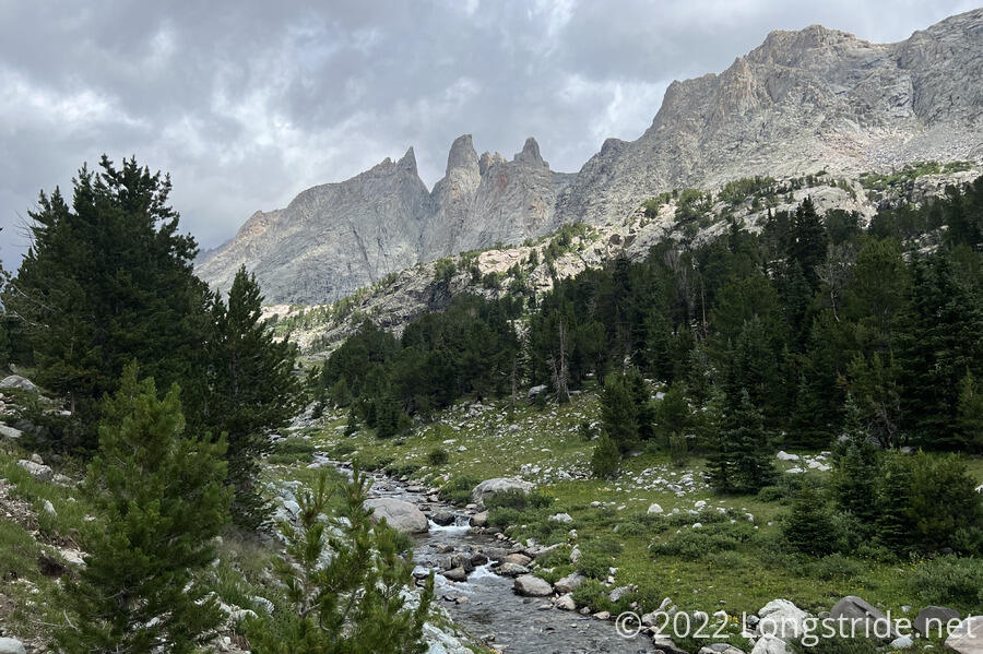
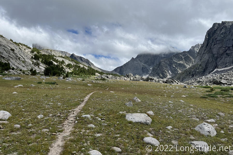
From my campsite, the trail continued through the forest, roughly heading northwest, above a creek valley. As the trail descended towards the valley, the trail split. One trail dropped down to the valley, which contained a wet meadow adjacent to a lake that took up most of the valley floor. The other trail climbed back up the side of the valley. With no real indication of which way I should go, and really not wanting to get my feet more wet than they already were (and my map not being helpful), I opted for the high route. After a little while, I decided that this was probably not the intended trail. From higher up, I could see a clear trail in the valley below, and the upper trail showed signs that it hadn’t been maintained in a while. Figuring I was on an old trail, that had to have an outlet, I kept going forward through annoying blowdowns, and reached a steep descent through loose dirt and rocks that brought me down to the trail on the valley floor.
The trail followed Little Sandy Creek for some time, gradually going uphill with increasing steepness.
Shortly after noon, nestled in some trees, I saw a veritable tent city, with a significant portion of the group, including Stumblebee, Bass, Sprouts, Wild Man, Cool Whip, Trainwreck, and Dragon Sky (whom I hadn’t seen since Chama). Also there was Velveeta, who had camped about a mile back.
Now noon, I didn’t want to stick around too long since I’d only hiked two miles hiked so far, and was soon on my way, with Velveeta following. I hoped the weather would stay reasonable; it was still cloudy, with a few patches of blue sky, and the sun came out occasionally. The clouds moved quickly thanks to a strong wind, giving me hope that the weather would soon improve.
Velveeta passed me when I stopped for a break, not so much because I was tired, but because I was hungry. Nearly 1 pm, I’d only had breakfast so far today. Even though it was a little cool out, the wind and what little sun managed to shine did a fantastic job of drying me out, and by the time I started from my break, I felt almost dry.
But since I was now clearly not going to make my distance goal today, I was resigned to going into Pinedale, rather than pushing all the way to DuBois. This was a bit disappointing, since it’d cost me at least a day of hiking for the detour, but there was little I could now do about it.
I’d had my pack cover on since I left camp; even though it seemed like the weather was improving (that is, there seemed to be fewer clouds in the sky, wind notwithstanding), I wasn’t entirely confident it wouldn’t rain again. But I left my rain jacket off, because I knew I’d likely overheat wearing it, especially since it was still quite damp.
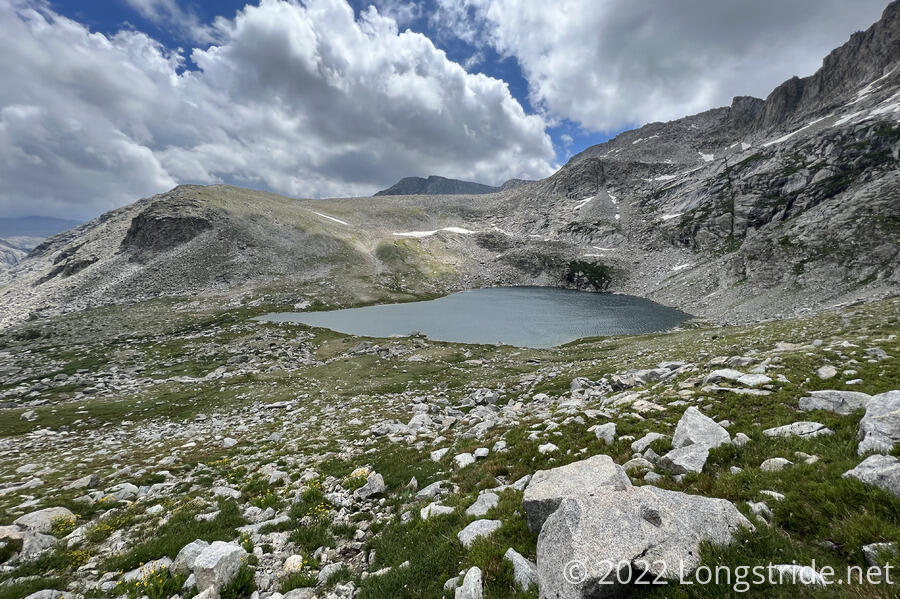
The trail continued following Little Sandy Creek upstream towards the valley’s headwall, diverging from the creek to go up a side valley, vaguely following another creek. I went off-trail a bit to try and find a dry crossing around the creek, an outflow from a lake. I succeeded, but the dry crossing was only possible because the gusts of wind were strong enough to briefly slow the creek’s flow so that some stepping stones were exposed.
I passed nearby two tents in the process; I didn’t recognize them, so I didn’t call out, assuming they probably belonged to weekend hikers. Holing up in tents, in this wind, seemed like an entirely sensible thing to do, though it would have been hard to pick a more exposed location.
After crossing the creek, the trail began a steep ascent up the valley’s headwall, taking me towards Temple Pass, and I caught up with Velveeta. The wind continued to pick up, slowing our progress up the mountain. Looking back down at the lake, I could see two figures circling one of the tents, seemingly in the process of taking it down.
Temple Pass formed a saddle between Temple and East Temple Peaks, a short distance of relative flatness between the steep climb up and a steep climb down. Just as I reached the top of the climb, a strong gust of wind hit me from behind, bringing with it a flurry of pea-sized hail. I was glad I still had my pack cover on, and thankful that this was coming from behind; the last thing I wanted was to be hit in the face with hail.
Immediately after I had that thought, a wave of rain washed over me, as if someone behind me threw a wading pool at me, and I went from dry to completely soaked, in just a few seconds.
Now in a downpour of cold rain, Velveeta and I began a rapid descent from the pass. This was tricky; the rain made it occasionally difficult to see, even before factoring in steepness and rocky terrain. Ahead, bands of rain washed over Temple Lake, their presence clear from their effect on its surface.
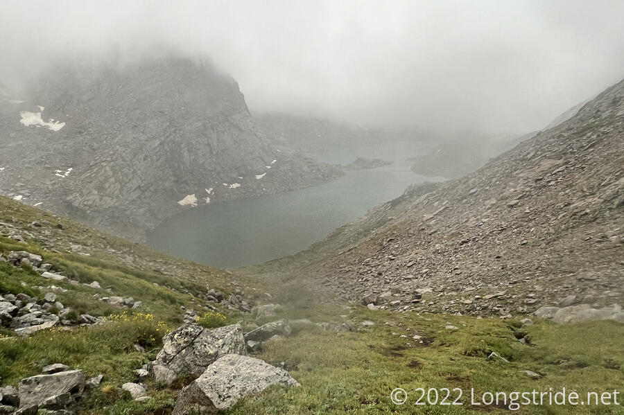
Rushing down from the pass, we were fixated on huge boulders that had fallen from Temple Peak and came to a stop just before the lake. There was no shelter to be had on the way down, but, perhaps there would be amongst those boulders.
We met two other hikers there, who were sheltering underneath a large slab of rock. There was room for us, but I was quite cold and wet, and I needed to keep moving. We learned that the trail as described on our maps disappeared into the lake, and that we’d need to climb back up a bit in order to keep from having to hike through the lake. In our haste to get out of the rain, we’d likely missed a trail that would have cut off a few hundred feet of the descent to lake level.
Climbing back up involved a bit of rock scambling that was a bit slow for me. (Velveeta was practically flying.) Once I made it up, though, I had my choice of several trails, only one of which was actually on my map, and I eventually made it past Temple Lake without having to get my feet wet. (Or rather, wetter than they already were.) By this point, the rain had stopped and the clouds started to lift.
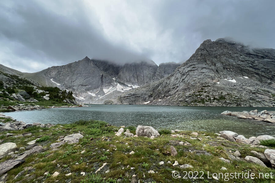
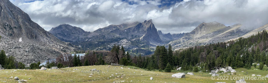
From the lake, the trail climbed up a little onto a relatively flat, rocky plateau, that would have made for great camping if it hadn’t been so exposed.
The plateau was nearly a mile long. As I continued, an incredible landscape of rugged mountains slowly unveiled as the clouds continued to lift and blow away.
The trail descended from the plateau, and I stopped for a break on a a small rock outcrop with Velveeta, who was drying out his tent. About half an hour later, Fuck-It and Pecorino caught up. They had been in the tents I saw before Temple Pass; when they saw Velveeta and I heading up to the pass, they had thought the whole group had gone on ahead, and quickly rushed to tear down their tents and catch up. We guessed that the rest of the group was most likely not going anywhere today; between rain and wind, the weather had been fairly miserable until nearly 4 pm.
While we were sitting to let things dry out, I mentioned I felt awfully far behind where I needed to be in order to finish the trail in a reasonable time, without jumping up to Glacier and working my way back south. With it now being the beginning of August, I figure there’s only about a month and a half left to complete the trail before winter weather sets in in Montana. With about 1250 miles to go to Canada, that averages to a 23-mile-per-day pace, with no rest days. Which is not really realistic. (With the fire closure in New Mexico I need to go back and complete, I’m not yet halfway done, even though there’s fewer miles to Canada than I’ve hiked already.)
Fuck-It mentioned the Big Sky Cutoff (also known as the Super Butte Cutoff) as a possibility. By cutting out the giant zig-zag that is the CDT along the Idaho-Montana border, and taking a more direct route, over 200 miles could be saved. This works out to a 19-mile-per-day pace, which is still high, but at least closer to the realm of possibility.
I knew of this alternate before the trail, but hadn’t seriously considered it, mostly because it’s considered an unofficial alternate and isn’t included in my trail guide. But now, with the unexpected slowness of the last few days weighing on me, I’m actually seriously considering it for the first time.
The four of us continued on, finishing the descent to Big Sandy Lake. Thanks to the rain today, a network of small creeks along the trail were overflowing their banks, making for soggy, muddy ground. We passed a father and young daughter who were out fishing.
Without warning, the right load lifter on my pack broke, failing the same way as the left one did four days ago. I was hoping to not have to deal with this, but now, it was clear: I need to get a new pack as soon as possible; hiking without both load lifters for an extended period is untenable.
We made our way to the north shore of Big Sandy Lake, passing by no small number of campsites already set up. This was by far the most people I’ve seen on the CDT, though it was clear these were all weekend hikers. We had to go nearly a quarter-mile off-trail before we could find a good spot for the four of us, with enough extra space in case the rest of the group showed up.
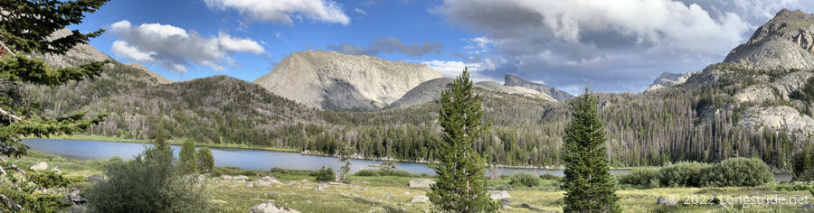
We quickly got our tents set up, and gathered around a fire pit; Pecorino started a fire for us using his camp stove to get the fire going very quickly. (This is something I’d been looking for an excuse to try since early on the Appalachian Trail.) We had a great view of Big Sandy Lake from our site, and even caught a glimpse of a bald eagle flying overhead.
Having decided to go into Pinedale, I tried to coordinate that with Fuck-It, Velveeta, and Pecorino. The usual way into Pinedale is to hike ten miles off-trail to a trailhead, and then hitch into town. That’s about 52 miles total from here. Fuck-It advocated for a campground about 70 miles ahead, directly on-trail, that one can hitch from. He planned to get there in three days, which I didn’t think would work for me. (Tomorrow includes two long, steep passes, Jackass Pass and Texas Pass. 25 miles through that seemed unlikely, even before considering my pack being broken.)
It started raining, and we quickly retreated to our tents. I found that my phone wouldn’t charge again, due to water in its charging port. This wasn’t the first time it happened, though, so I wasn’t as worried about it as I was the last time.
As I was going to sleep, I realized that today is the first day since the Pie Town Alternate almost three months ago that I’ve been on-trail, but off the CDT for an entire day. Tomorrow, after passing through the Cirque of the Towers, I should be back on the CDT proper, and on my way to Pinedale for rest.