Now more than halfway through the Wind River Range, the trail took me on a “short” but tough day through a land of lakes and creeks.
Around 2:30 am, I woke up really cold. Looking out of my tent, some of the plants on the ground had a fine layer of frost on them. So did my tent’s roof. I’d left my water filter hanging on a tree last night (as I normally do, when I don’t expect it to be cold) in case I needed to filter more water in the morning. Frost, though, meant it was below freezing, and I couldn’t leave my filter out for that. So in the middle of the night, I had to go out in the cold, get the filter, and bring it back inside the tent so that it wouldn’t freeze. At least the moon was still out, very bright.
After being unable yesterday to find on the map the campground Fuck-It mentioned a couple of days ago (that would allow me to avoid the ten-mile-each-way hike to Pinedale), I managed to locate it, as well as comments that suggested it really was very difficult to get a ride from there to Pinedale. Not wanting to waste time on an unreliable hitch, I’m definitely taking the side trail to Pinedale. Which means, when I get there tomorrow depends entirely on how far I hike today.
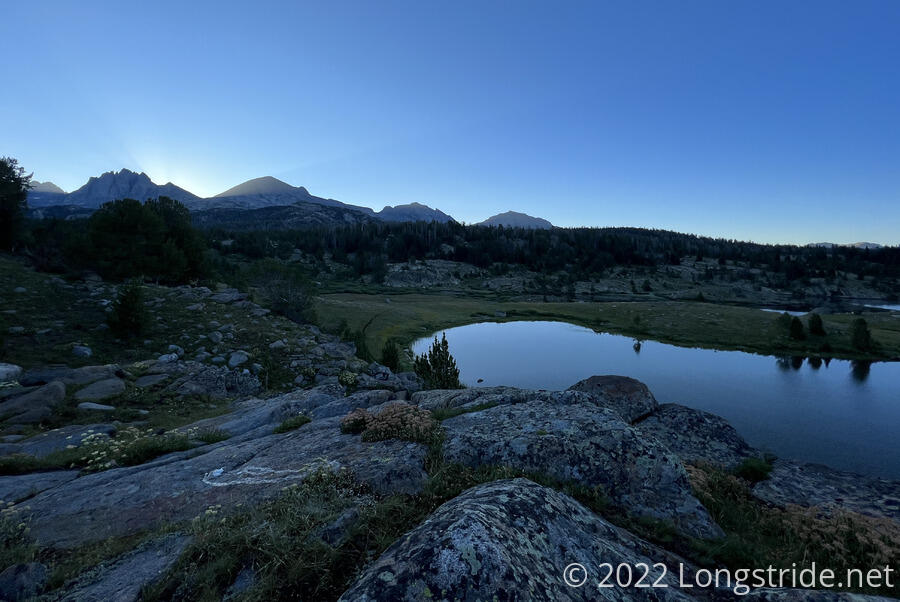
Plans for an early start didn’t succeed. I made it out of my tent by quarter of seven, in time to see the sun rise over the mountains to the east. I took my time packing up, letting my sleeping bag and tent partially dry once the sun came up. I finally left camp around 8:30. By then, the frost that was on the ground was entirely gone, and it was almost hot out, with not a single a cloud in the sky.
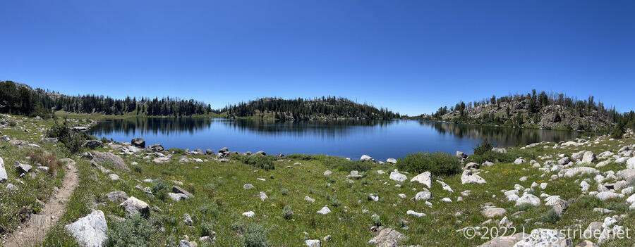
Similar to yesterday evening, the trail this morning continued through a relatively flat landscape marked with rocks, small lakes, and several creeks. Heading northwest, the trail gradually climbed towards mountains in the distance.
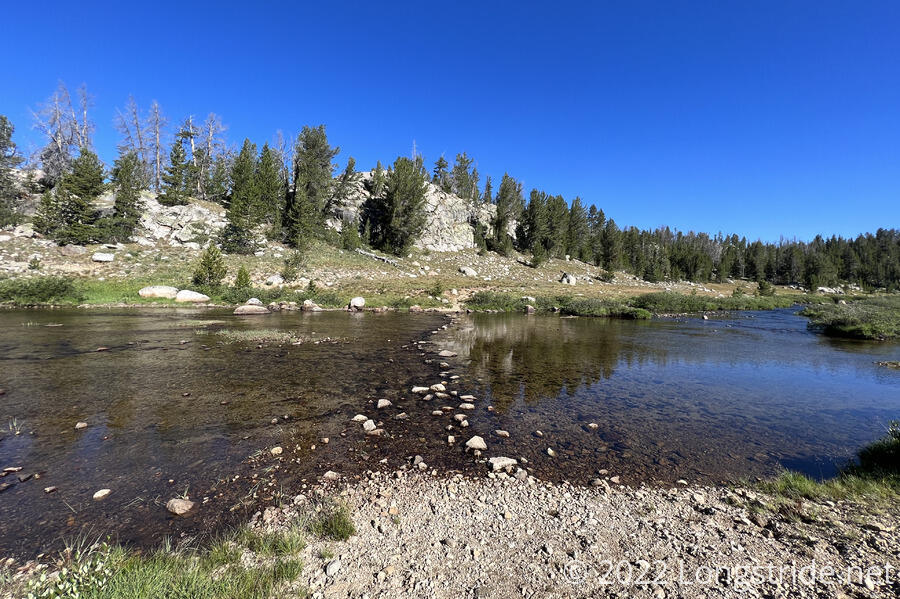
In less than an hour, I crossed three somewhat wide creeks with stepping stones across their width. The two widest had just a little too much water for the stepping stones to provide a dry crossing, and I wound up dipping a foot in towards the far shore for both of them.
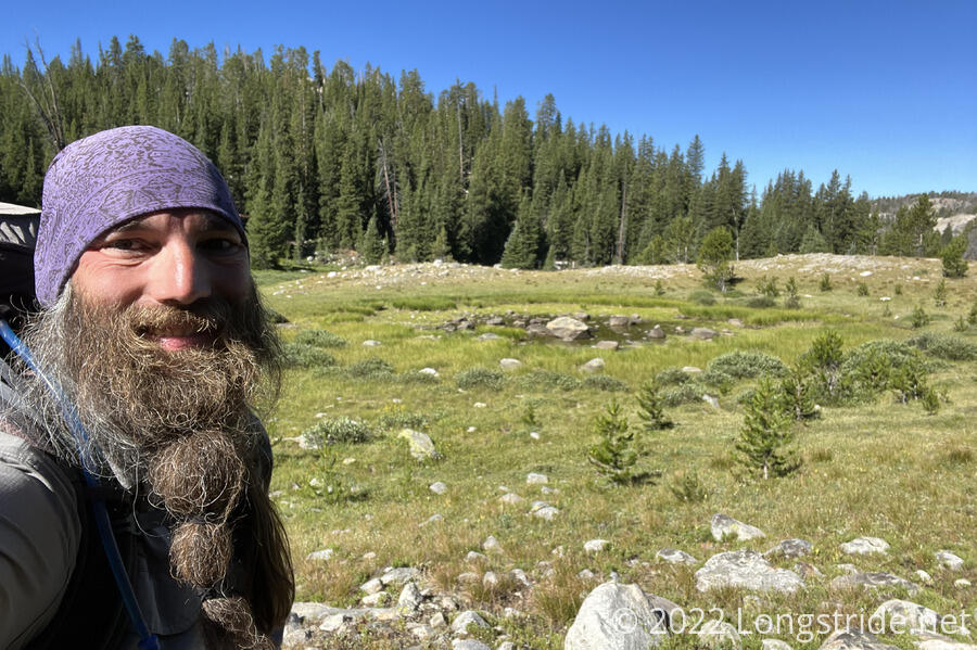
After spending most of the morning in open meadows, the trail ducked into forest as it continued its gradual climb. With the forest came a few blowdowns. I sprained my ankle going over one of them; the ground on the other side was very soft, and my foot didn’t do what I expected. I hobbled forward a bit, and stopped for a break at a very conveniently located campsite.
Only about five and a half miles into the day, I was thoroughly exhausted. The brief steep uphill once I entered the forest shouldn’t have been as tiring as it was. It’s probably a result of my broken pack, coupled with basically having two (now unnecessary) extra days of food since leaving Rawlins. The mental strain of still being more than 1200 miles from Canada and not sufficient time to make it there before winter weather certainly didn’t help matters.
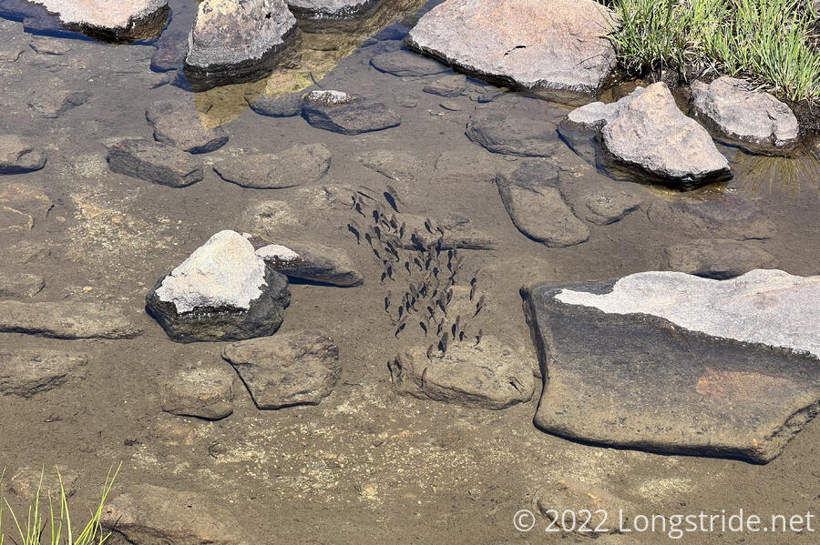
But, moping about how hard everything has become wasn’t getting me anywhere. I pushed on, passing more lakes and creeks, including one with some fish swimming on the trail.
My jerry-rigged load lifters failed again; I re-tied them, more securely, and against a different place on my pack, hoping that that might help improve how the shoulder straps are pressing against my shoulders. It did help, a little at least, but it’s still not sufficient.
I passed more blowdowns. A wildflower grew out of the dirt still clumped on the roots of an upended tree trunk. Lakes and creeks continued to proliferate; the land here had once been covered by glaciers that certainly left their mark.
I passed a southbounder, who said going to Pinedale was well worth it — definitely good news to hear about a town I was originally looking to skip — as well as Knapsack Col, an alternate that starts shortly after the side-trail that leads towards Pinedale. He’d gone into town from the campground Fuck-It is planning on exiting from, but it took him three hitches to get back to trail, which is quite a bit too unpredictable for me.
I continued passing lakes and creeks, though they started diminishing in frequency as the trail climbed. Excluding the Cirque of the Towers alternate, the CDT itself has stayed alongside the Winds; this would be the first time the CDT actually went into these mountains.
Tired, I stopped for another break under a nice shade tree next to the trail. A slow day so far, by 3 pm, I'd only gone 11 miles. Afterwards, I continued an increasingly steep climb, crossing over Hat Pass, strewn with large boulders.
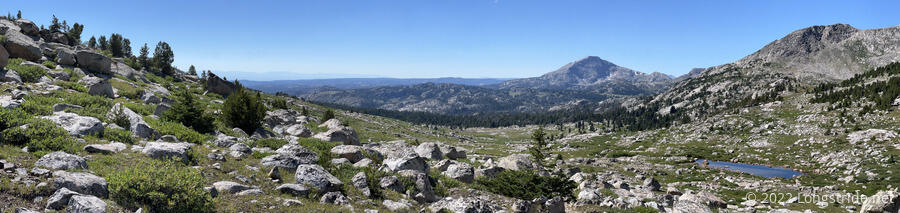
From the pass, I had a nice downhill for a couple of miles, stopping for another break under a tree next to a meadow and small lake. After I finished my break, I only made it a minute or two down the trail before deciding to go back and cook dinner; it was nice (and shaded) scenery, and getting rid of the weight of another meal would help the rest of the day. I knew this would hinder going a long distance today, and make finding a campsite harder, but I was just too tired to keep going.
Going through more forest, the trail zig-zagged around quite a few fallen trees, then returned to the more meadow-like landscape that had been more common today. I passed a group of five or six people that had set up a fence around their campsite — maybe they had a dog I didn’t see? — and crossed another creek, that had just enough rocks for me to make it across without getting my feet wet.
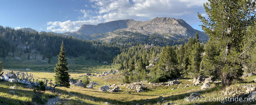
Now getting close to sunset, I began looking for campsites. This was a bit nervewracking; after crossing the creek, the trail got a bit steep, and rocky, and there wasn’t much in the way of obviously good campsites. On my map, I found one in a bit of a bowl, and aimed to get there before sunset. I made it to a roughly flat, rocky saddle about a half-mile before, and decided to stop there instead. I was close enough to see that the bowl looked a bit damp, and staying there would likely be cold and wet. (In contrast to cold and dry where I stopped.)
While the scenery was great today, I was rather disappointed that I only hiked 16 miles; 20 should have been easy. But the uphills were maddeningly fustrating, likely due to my pack, but I’m also not sure if I’ve been eating enough. I think I am on-trail, but I feel like I haven’t been filling up as much in town as on prior trails, and it almost feels like I’m starting to “fade”, like I was the last week or so on the PCT. I don’t think it’s elevation — the trail’s only around 10,000 feet now. And with distance to Canada weighing on me, today has been a tough mental low-point. The Big Sky/Super Butte alternate is looking more and more attractive.
But, at least I’ll be in town tomorrow, and definitely taking a zero, my first in a week and a half since Rawlins.