I had anticipated waking up around 7, in order to get to Inn at Long Trail's breakfast, starting at 7:30, but I wound up sleeping in a bit longer; the overcast skies and wet ground seemed to confirm the weather forecast of rain for the day.
I finally made it down to the dining room around 8, and wound up having breakfast with Ron and Cynthia. The two of them continued to be full of great stories, either from Ron's AT hike attempt in 2008, or from his years of motorcycling across the country. Breakfast seemed to take longer today than it did yesterday, and we weren't finished until after 9.
Returning to my room after breakfast, I realized I really wanted a nap, and for another lazy day. I almost considered staying another day just so I could go back into Rutland and watch a movie, but, better sense prevailed, and I finished packing my bags and headed back out to the trail close to 10:30, a much later start than I had anticipated.
The hike started off overcast, dark, foggy, and gloomy, and it continued to be that way all day. Starting off at Inn at Long Trail, I continued north on the Sherburne Pass Trail to its intersection with the Appalachian Trail, and took the AT south to Maine Junction, where the AT and Long Trail diverge (or converge, depending on your direction of travel). I had considered taking a side trail up to Deer Leap Rock, a rock outcrop visible from the Inn, and which apparently provides a great view of Pico Peak, but given my late start, I decided this was not feasible, given I wanted to go further than just the next shelter.
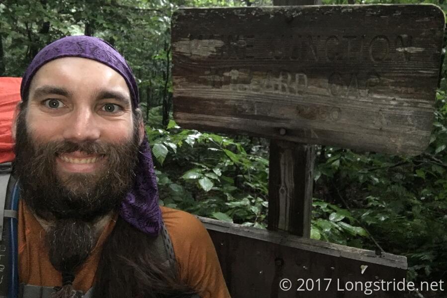
Maine Junction quickly arrived, and I turned north, departing the Appalachian Trail. From here on, it'll just be the Long Trail, winding its way to Canada.
At the next road crossing, I met Zippy, a young woman from Connecticut who has been section hiking the AT, having already completed the trail in Connecticut, Massachusetts, and Maryland. For her current section, she started off at the Massachusetts/Vermont border and had planned to hike to Katahdin, but after she reached Rutland, decided that she'd like to actually finish something, and so diverged from her plan, and continued hiking north on the Long Trail. (She plans to return to Rutland after reaching Canada, and resume her AT hike at that point.)
Zippy and I made it to the Rolston Rest Shelter around 1 pm, making good time through the damp woods, and stopped there for a quick snack break. Since it was still early in the day, we decided to push on to the David Logan Shelter, about 7.5 miles further. (I had originally considered going to the shelter after that, Sunrise, but given my late start, that seemed impractical. A pity, because I'm assuming Sunrise Shelter has that name because, clearly, it must have an excellent view of the sunrise.)
Shortly after leaving Rolston Rest, the rain forecast for the afternoon finally started. Happily, most of it was caught by the tree canopy, and very little of it actually made it to the ground. While the ground was still wet, humid, and occasionally foggy, I mostly stayed relatively dry, as the trail wound its way through the green tunnel the AT is famous for.
My luck with the rain didn't hold out, though. Coincidentally, the rain picked up considerably during a brief section where the trail was more exposed, and I finally wound up getting wet. After that point, the trees stopped absorbing as much rain, as the canopy leaves gradually got more and more waterlogged. The trail also was a bit more overgrown than had been typical further south, and I picked up a lot of water from brushing against plants growing into the trail from the sides.
I made a straight push from Rolston Rest to the David Logan Shelter, about 7.7 miles, so it seemed like it took forever to get there. Not helping were a couple of sections that had infrequent blazing, and a few areas where it seemed ambiguous which way to go. Still, though, I made it to the shelter around 5, making fairly good time, all things considered. Most of the trail wasn't too difficult; in a few places, there was really only a problem because the rain made it slippery, and because a larger number of downed trees than usual on the trail that required work to get around.
At the shelter, I met Joe, who had already been there about two hours. He was a southbound AT thru-hiker, who reached the Long Trail and decided to head north on the LT to avoid the AT northbound bubble, who were apparently all asking the same annoying questions every time he came across them.
The David Logan Shelter is unique in that it has a half-height fourth wall made of large wire mesh with a matching gate to allow entry. Our guess is that it is to protect the shelter from porcupines, since it's not likely to deter much else.
Finally taking advantage of the set of town clothes I brought, I switched out of my wet hiking clothes and into my dry town clothes, using my rain pants as leg warmers to avoid having to get out my other set of trail pants and attach the legs.
Joe, Zippy, and I had a rousing conversation about the trail and our experiences as we cooked dinner, and eventually, as we finished, things calmed down. Another hiker, Earbud, arrived, but by then, Zippy and Joe were in their sleeping bags, and I was sitting at the shelter's picnic table (conveniently nestled between two sets of bunks, so the lower bunk is used as the seats) typing up this post.
The rain started again, and, just now, seems to be winding down. The weather forecast is still calling for some more rain overnight, but the forecast for the next several days has improved, and should be rain free!
Tomorrow: 12.6 miles to Sucker Brook Shelter, unless I decide to go further.