A dreary day took us through three towns and two sections of the East Coast Trail.
It rained overnight, and more rain is forecast through the day, though it was only just foggy this morning as CareFree and I left our lodging, starting a road walk along the north side of Bay Bulls Harbour, through the town, and along the south side of the harbor. We planned about 24 km, and last night arranged with Don, the owner of our lodging, that he’d pick us up when we were done.
A sign along the road claimed that Bay Bulls (then, Bay of Bulls), which appeared on a map in 1592, is the first English place name in Newfoundland. (Other names were of French or Portuguese origin.) However, the meaning of the name is unclear, since there weren’t cattle in Newfoundland at the time. (Guesses on the sign include the “bulls” being some kind of marine or bird life, or an English pronunciation of a French word.)
Our road walk around the harbor took about 45 minutes, with a light rain starting just before we reached the forested Mickeleens Path. Although the tree overgrowth along this path was much improved from Motion and Spout Paths yesterday, suffice to say, we quickly got very wet. Fortunately, the rain only lasted about an hour.
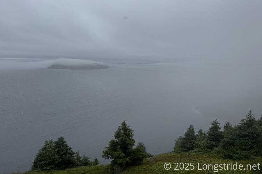
Thanks to the very damp conditions, we saw lots of slugs on the trail, as well as a fair number of snails. This path was quite an improvement from before, though with water accumulating, it still wasn’t as fast a hike as we’d hoped. We weren’t exactly trying to stay dry, because that was impossible, but we were trying to avoid getting our feet soaked, which worked well enough until it was no longer possible, and then we had soaking wet feet for the rest of the day. Most of our views were obscured or bland, thanks to the clouds.
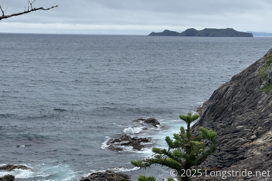
For the first time, we saw puffins out on the water, mingled in with ducks and sea gulls. Unfortunately, they were always pretty far away, so we never really got a good look at them; the binoculars we got in St. John’s worked wonders, but even then, they were still tiny.
While on a break, a day hiker doing Mickeleens Path as an out-and-back stopped to chat with us briefly, then continued on. We had a more extended conversation with him when we ran into him on his way back an hour later.
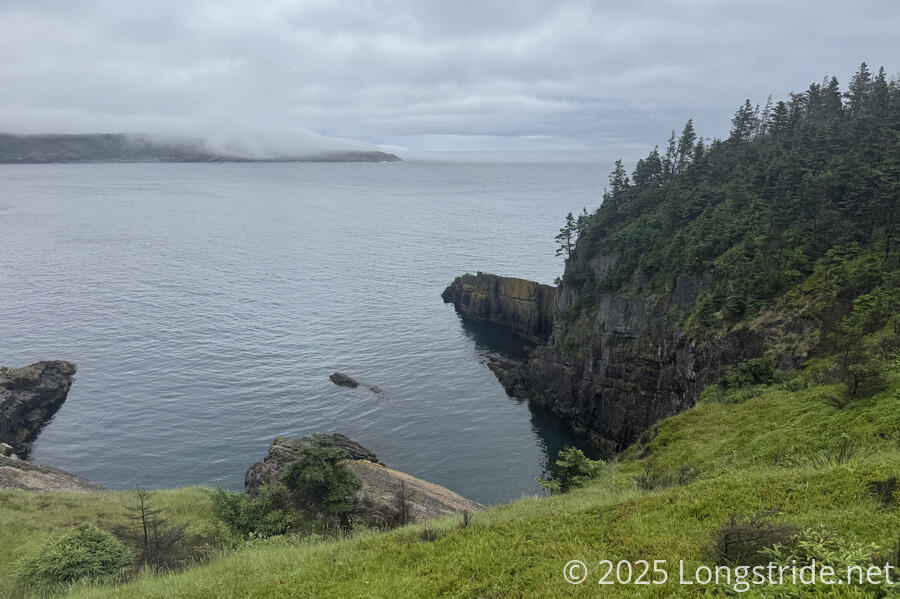
Rounding a head, we transitioned from Bay Bulls Harbour to Witless Bay. The surf was strong there, and on a few rocky beaches below the trail, we could hear rocks being rolled by retreating waves. At least one of those beaches looked like it had capelin washed up.
Eventually, we exited the Mickeleens Path, and began the Witless Bay community walk. Passing by a local information center next to a picnic area by a beach, we were beckoned in by the two staffers. We chatted for a bit, and they gave us Witless Bay lapel pins. I mused that it’d be neat (though hugely wasteful) if all the communities on the trail had little pins. (On a longer hike, I probably wouldn’t have taken one, but we’ll be done in a week, and these pins are small and lightweight, so why not; it’s a neat souvenir from the hike.) At CareFree’s request, they directed us to coffee: a Tim Hortons that was entirely too far off-trail, and the Irish Loop Coffee House that was closer.
Witless Bay is also the center of the Witless Bay Ecological Reserve, which covers an area of water near the coast including four small islands teeming with seabirds. (It’s currently nesting season.) Witless Bay claims to be the puffin capital of North America, with 60% of North American Atlantic puffins traveling here to breed.
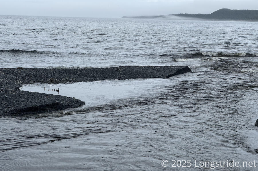
Just past the information center, we crossed a bridge over Perrys Brook, a relatively raging torrent compared to the other creeks and rivers we’ve seen. Next to the channel funneling the creek into Witless Bay, a family of ducks paddled around in a calm pool of water.
A few minutes later, a guy passing by offered to give us a ride. (We declined.)
We passed a convenience store. About ready for a break, we decided to stop there. Unfortunately, they didn’t sell coffee, but we were able to get ice cream as a snack. They were also conveniently located next to a small beach with some chairs to sit down on, and we had a short break, cognizant that time was ticking and we needed to finish at a reasonable time for Don to pick us up from our finishing trailhead today.
That seemed to go out the window when we passed the Irish Loop Coffee House another ten minutes down the road, and we stopped there for coffee and desserts. Their latte machine was broken (which CareFree initially understood as they had no coffee whatsoever!), but CareFree was able to get her coffee.
We were there for about half an hour. After we left, it was only another half-hour road walk to Ragged Beach and the start of Beaches Path. About five minutes before we got there, we passed a house that had a sheep grazing in its lawn. On our ride back to town this evening, Don mentioned that a large portion of the nearby forest used to be cleared for sheep grazing, and that it’s relatively recently regrown.
Beaches Path largely mimicked Mickeleens Path: it closely followed the shore on the cliffs above the ocean, heading out of Witless Bay, around a head, and back in to the next bay, Mobile Bay. Rated “easy”, it largely delivered on that. The clouds over the ocean lifted a bit as the afternoon progressed, so we got better views of several islands in the area.
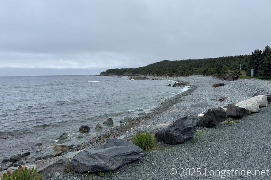
Beaches Path also delivered on its namesake. Several times, while along Witless Bay, the trail passed rocky cobblestone beaches that one could walk on (or go into the ocean). Not long after rounding the head, though, the beaches stopped and the trail again followed on cliffs high above the water.
Beaches Path ended at a gravel road, where we called Don and told him we were about 45 minutes away from where we wanted him to pick us up. The path then abruptly started again, taking us on a somewhat rugged path in a forest between a community and the ocean, and then onto one last very rocky beach at the head of Mobile Bay. (I was briefly concerned this would take longer than we’d told Don, but the bonus trail wasn’t all that long.) After that was a mostly gravel walk up the south side of the bay, to the trailhead for Tinkers Point Path. Short and rated “easy”, we probably could have also tackled this path today if we’d started an hour earlier and been more judicious on our breaks, but at 24 km, we were already at one of our longer days, and we were wet and still had chores to do anyway.
We finished a bit earlier than we’d expected, and had a short wait for Don to arrive. The drive back to Bay Bulls took only 10 km (less than half the distance we walked) and less than 15 minutes.
Don dropped us off at the Foodland, and we picked up food for dinner and breakfast tomorrow, and did our resupply, which will cover three days and about 70 km to Ferryland. We walked back to our unit, got showers, did laundry, and ate dinner.
Although today was relatively easy, we’re both quite sore (and our feet looked like shriveled prunes, having been in wet shoes all day). At least the weather tomorrow is looking better, though we might have some rain in the late afternoon to contend with.