One last day on the East Coast Trail brought us to its terminus in Cappahayden.
Clouds remained in the distance over the ocean, but the fog lifted. It was a bright, sunny day. A perfect day for hiking.
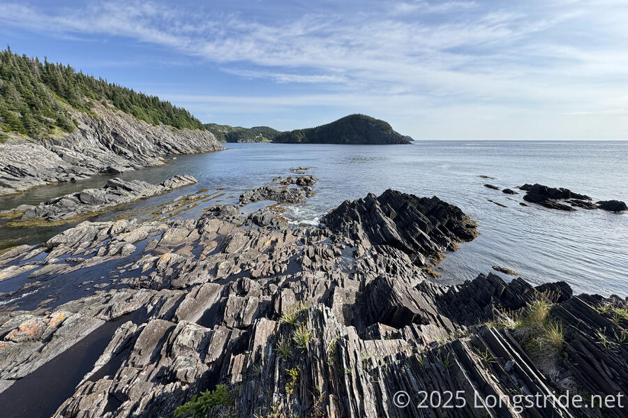
Leaving our campsite shortly after 8, CareFree and I continued south towards Bear Cove. Unlike the start of the path yesterday, this trail was a proper trail, somewhat more rough and rugged, and just a little muddy. From a slightly different vantage point just down the trail from our campsite, Water Cove looked significantly more rocky than it did last night.
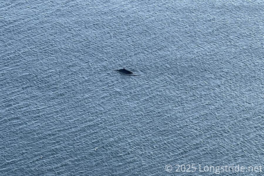
It didn’t take long to see a whale out off the coast, which I think turned out to be the best picture I managed to take of a whale (which is not to suggest that it was a good picture of a whale). After this, though, we saw fewer whales than usual as we went further south today.
We also saw a grouse, wandering down the trail ahead of us. At least it didn’t flap at us angrily like last time.
The lighthouse was a bit of a disappointment. Rather than being a “proper” lighthouse, it was just a light on a truss to elevate it, and an electrical box which probably also housed the foghorn we were hearing yesterday evening. A small campsite a short distance further near a creek would have made a good place to camp yesterday, but likely would have been uncomfortably loud from the foghorn.
At a break on a nice grassy area next to the trail, a solo thru-hiker passed us heading north.
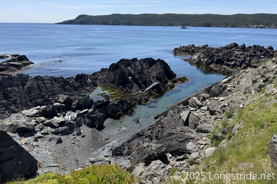
The rest of the walk to the end of the Bear Cove Point Path was relatively uneventful. After a little more rugged and damp trail, it left the forest, going through open hilltops above Renews Harbour. The coast was dotted with coves and rocky outcrops that would be a hazard to navigation. As we turned into the harbor, we passed several small coves with very clear water, attached to rocky beaches, that looked like they would be great for swimming. CareFree wanted to go down to one of the earlier ones we saw, and I was somewhat dubious about that since it looked like a pretty steep walk/climb down. The next couple were essentially completely unreachable from the trail, down a very steep cliff. Another one we passed had a rope someone had installed to make access easier.
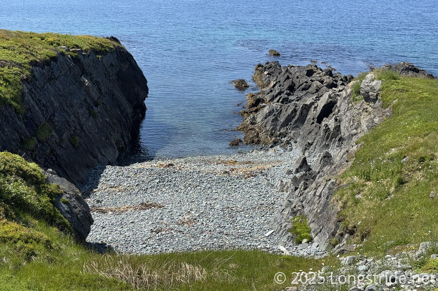
Just before we reached the end of the path, we found a cove that was easy to access — there was a set of stairs down; obviously, people who lived here frequented this cove. We took a fifteen minutes break so CareFree could take a dip in the water — very cold — and then followed the path another 30 seconds to its end, passing weirdly close to someone’s house, as the ECT seems fond of doing. I wasn’t really keen on stopping, being a combination of ready to be done with the trail and also not really ready for it to end, but my legs were pretty tired — I was a bit cold last night, and also I think they know today’s the last day on trail.
We had a brief chat with a woman and her mother, both of whom had just moved from Ontario to Renews two years ago. (We wondered why, but it seemed an impolite question to ask people we’d just met.)
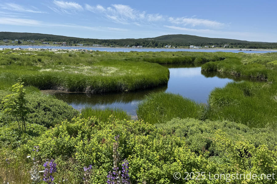
The walk through Renews was scenic, though there was basically nothing of note in town, and definitely no gas station or cafe where we could get a snack. Some wetlands made for nice scenery distinct from the many coves we passed.
We passed the amusing junction of Front Road and Back Road, and also stopped for a brief chat with three locals, who were out walking along the road. They said they saw us walking down the road the other day, and also that it’s been dry recently so the trail to Cappahayden shouldn’t be too bad. Which was good to know, because basically everyone we’ve talked to who knows about the trail has said how poor the final path is.
We stopped at perhaps the only identifiable business we saw, an arts and souvenir store that we saw a sign for 18 km up the road as we were leaving Ferryland. The owner had beckoned us over. A former member of the ECTA board of directors, he let us fill up with water from a large water jug, and we spent a little while chatting with him inside — where it was nice and cool. He confirmed everything that we’d heard, that the last path on the trail is one of the worst because it’s so far away from St. John’s for maintenance crews. But still, it’s the last section of trail, just a few more hours, and we’d be done.
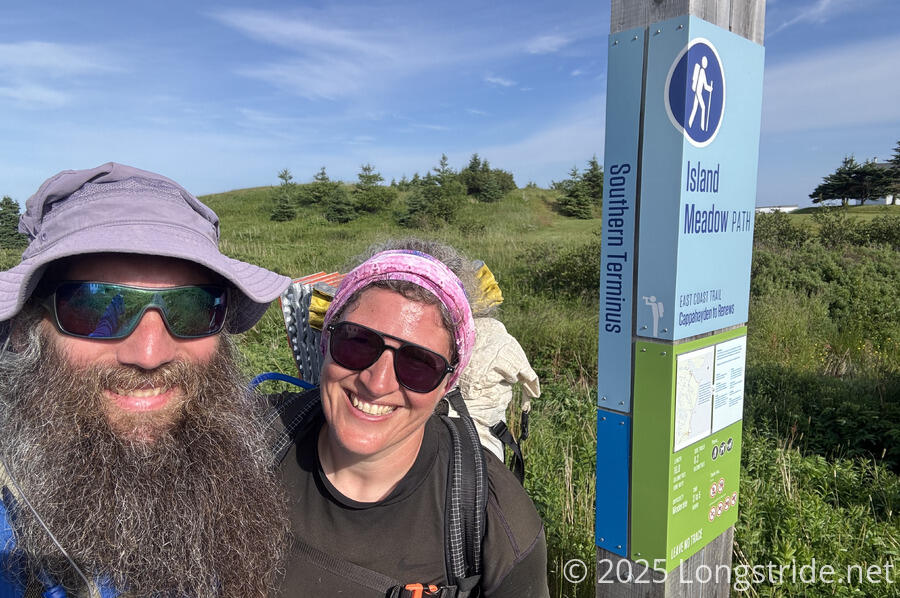
We stopped for a short break at the trailhead, and then set off on the Island Meadow Path. It was okay for a short while, then as expected, got somewhat rough and muddy. We kept our feet dry for a while, but there was only so much that could be done, and they eventually did get wet. (On a rainy day, it wouldn’t surprise me if much of this path would resemble a creek.) There were plenty of places where, once upon a time, there had been wooden planks or boardwalk to walk across, but they’d since sunk into the ground or become damaged and not functional for their intended purpose of keeping feet dry. We chatted briefly with one more nortnorthbounder.
As we proceeded down the coast, we could occasionally hear a ringing from offshore. A couple of marker buoys with bells out by rocks a fair distance into the ocean clanged as they rocked with the waves.
After passing the path’s its eponymous Island Meadow, the mud on the trail improved. A note in our maps suggested that “if seas are calm, hikers can choose to hike the beach, instead of the path, south of Island Meadow”. I was hoping this might be a viable alternative to hiking on muddy trail. We’d asked about this at the arts store, and were met with confusion, and told that while we could do that, we almost certainly wouldn’t want to. And getting there showed why: there really wasn’t a beach along the coast, just rocks. It might make for a fun challenge if someone were day-hiking, but it makes no sense with a heavy pack. (Not to mention, the suggestion is one-sided: it doesn’t say when someone should stop following the rocks and rejoin the trail.)
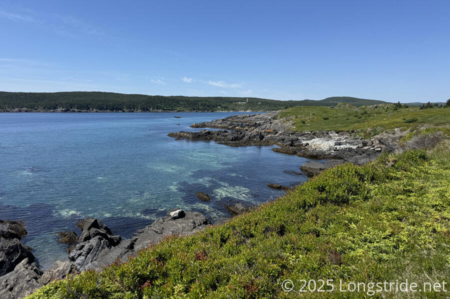
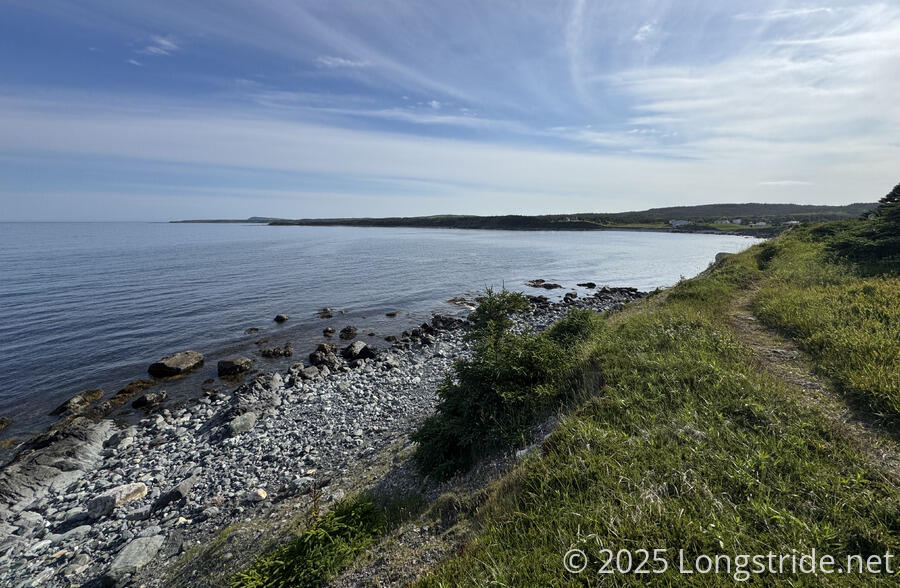
What really helped with the mud was passing to another part of this path. After reaching Bear Cove, we briefly followed Highway 10 to cross a river, then re-entered forest on the other side. The trail quicky transitioned to meadow, and we followed an exposed path with great views. We passed a pair of hikers heading north who commented that the trail was “muddy” a little further ahead for us. We got the impression (judging from their clothes and unusual packs) that they were inexperienced, and after we were out of earshot I mused (correctly, as it turned out) that probably there’s just one muddy section left, and it’ll be a nothingburger.
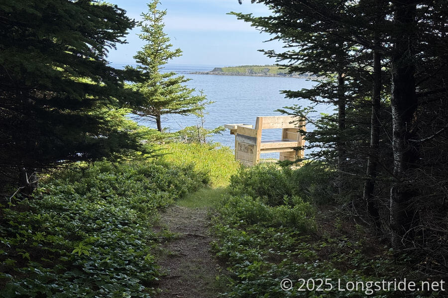
We passed a couple of benches at viewpoints along the trail, and then followed the edge of Burnt Head, with a network of paths criss-crossing the meadow. It seemed a very popular place for locals; there were quite a few chairs of various sorts set up at viewpoints; evidently, people claimed “their” view with a chair.
Coming into Cappahayden Cove, the trail followed a very narrow path very closely to the edge of a steep cliff. It felt the most unsafe the ECT had ever been, and I wondered why they didn’t put the path even just a little further away from the edge.
Nearly done, we mistook as the terminus the monument to the SS Florizel, which was visible from a distance and had a pair of flags flying. (The SS Florizel was a passenger ship that sank in 1918 after striking a reef near Cappahayden, with the loss of most of its passengers and crew.) The actual terminus was just a short distance away.
Now having completed the East Coast Trail, we returned to Highway 10, and proceeded to try and hitch a ride north. We didn’t really expect to get all the way to St. John’s, so we were hoping to be able to get to Ferryland: we expected we’d be able to get a room at Dunn’s B&B again, and we wanted to explore the Colony of Avalon museum on the head almost just across the street from the B&B. Complicating this, though, was that there was no cell reception at all in Cappahayden. If there was nothing in Renews, Cappahayden looked to have even less.
After about 15 minutes, during which time, three cars and a truck passed, we struck gold: we got picked up by Tiyoshi, who used to live in the area, and now on his way to St. John’s to visit family. He was quite familiar with the ECT, having hiked the whole trail previously (though only in sections), and had been a volunteer on trail work crews. And, where he was going was just down the street to the hotel we eventually booked once we got cell reception again. Thanks again for the ride, Tiyoshi!
The ride back to St. John’s took just under an hour and a half. It was a little weird traveling so quickly along what took us ten days to hike, especially with portions of the trail’s community walks being on Highway 10, so we were driving (almost) on our footsteps from the last week and a half. (This felt a little reminiscent of our last day on the Canary Islands GR131, where we did much the same thing.)
We’ll have a few days to do some sightseeing before it’s time to head back home. But for now, it’s time to relax.