Earlier this summer, my partner and I hiked the East Coast Trail, a coastal hiking trail covering much of the easternmost coast of the Avalon Peninsula of Newfoundland, Canada.
Although the trail occasionally tested my patience, I very much enjoyed the ECT, and would happily recommend it for anyone interested in a three-week hike.
The Trail
The East Coast Trail is organized as a series of 25 hiking trails, with a “community walk” between all but two of them.
This makes the ECT extremely well suited to a wide variety of hiking styles. There’s only two section ends (Motion and Spout Paths, and La Manche Village and Flamber Head Paths) that are in the wilderness, though they have dirt road access to a trailhead parking lot, so it is entirely possible (with appropriate support) to hike the trail as a series of day hikes and exclusively stay in inns or B&Bs along the way.
The trail tread itself, with a few exceptions, was generally good, though as a whole, the ECT is very rugged, with rocks, roots, and lots of short ups and downs, and was easily the slowest trail I’ve hiked. Trail maintenance was a mixed bag, but annoyances aside, there weren’t any places on the trail that were dangerous because of (lack of) maintenance.
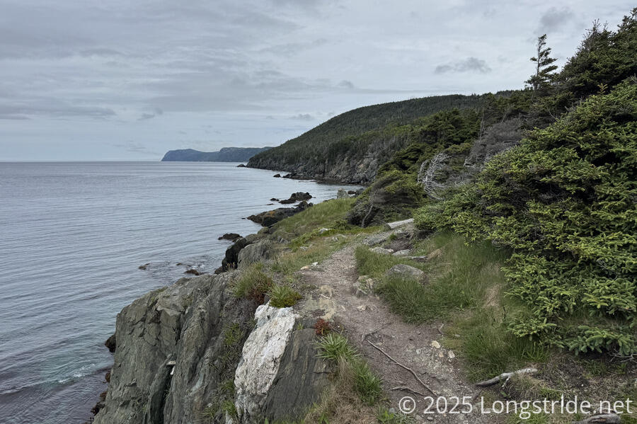
The ECT is a coastal trail, largely following along the clifftops along the Conception and Atlantic coasts. Especially south of St. John’s, the trail closely follows the coastline, adding many, many miles by traveling in and out of the many bays and harbors along the eastern coast. Despite all the hills, there aren’t many mountains here; the trail summits just a handful, all north of St. John’s.
The Community Walks
The community walks, taking us through two dozen towns and the capital of Newfoundland and Labrador, St. John’s, were unique, as least as far as hikes I’ve been on so far. This makes the ECT the first long trail I’ve hiked where I went through a town every day. (The Canary Islands is a close second — on the few days that trail didn’t go through a town, a town was an easy bus ride away. Similarly, the North Island section of Te Ararora was rarely more than two or three days between towns.)
Along the route, most towns had information displays about the local history. Not not all of it was flattering, but it did paint a good picture of the region’s history.
It was nice to be able to go into town (for some definition of town) every day. While we attempted to camp as much as was practical, we did take advantage of the numerous opportunities to stay indoors, and split the hike evenly between camping and staying in town.
And if roadwalks through communities aren’t you thing, hitchhiking to the next trailhead is always an option.
Overall, I really like the idea of the community walks, but sometimes it felt that the concept exceeded its execution. There were a few towns where there was absolutely nothing nearby that would cater to hikers (whether long-distance or day hikers): no cafes or shops; no restrooms or water; sometimes not even a place one might stay overnight. I kind of can’t blame the small towns for not having open shops, especially when the hiking season is so short, but that doesn’t make it any less disappointing.
Scenery
Being a coastal trail, the ECT was in sight of the ocean, or a bay, harbor, or cove off the ocean, for a substantial fraction of its length. The ruggedness of the coast was somewhat similar to the Great South West Walk and Great Ocean Walk in Australia, with rough waves and rocky coastlines, though the ECT had significantly more bays and inlets than either of those two trails.
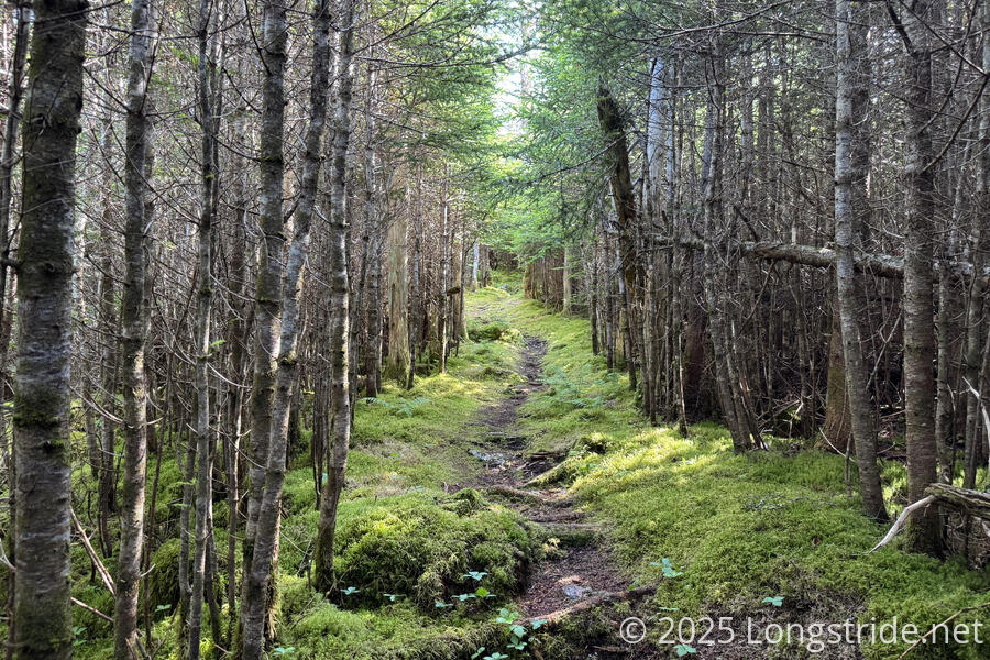
The ECT is my furthest north long-distance hike (so far). Accordingly, this made most of the forests pines, with the trail extending into alpine areas on occasion. The forests often had a beauty to them — when they weren’t overgrown — but between the forests and lack of significant elevation change, most of the scenery came in the form of Newfoundland’s rocky coastline.
Our late-June and early-July hike was a bit late to see icebergs, but it’s possible to see them earlier in the season as the Labrador Current transports them down from Greenland.
Most days on trail, we saw whales, which was always exciting, even as it often slowed us down. I only wish we could have seen them from a little closer.
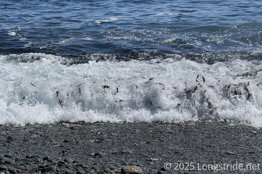
We also got lucky to see the capelin roll in Middle Cove, where thousands of the small fishes wash ashore while spawning.
The Spout, a wave-powered water spout was an interesting on-trail sight, though we were there at the wrong time of year for a truly spectacular waterspout. More interesting for us in that area was the rugged coastline, with sea stacks that held nests for bald eagles.
About a week further south, we were treated with an impressive sea arch that we could climb on top of.
In marshy areas along the trail, flowering pitcher plants were not uncommon, and more than once we passed by ponds with lots of croaking frogs.


People
The ECT was not a crowded trail. While we were hiking, we saw only a handful of other hikers walking the whole trail, and all of them were heading north. (We hiked south.) There was only one night where someone else was at the same campsite as we were, and they were only out for one night.
In towns, residents were generally friendly. When we needed water in Bauline, a resident out for a walk happily walked us back to her house to get water for us. Once we made it a couple of days south past St. John’s, on community walks, we frequently had people asking us, unprompted, if we needed a ride. Some of those people clearly knew where the trailheads were, offering directly to take us there.
The Maps
The East Coast Trail Association provides a very nice map set. From a thru-hiker perspective, there’s some room for improvement, since the maps are paper-only, and it’s somewhat unwieldy to carry the full mapset, especially if you don’t want to fold them up. But the back of the maps include a fantastically large amount of information about the trail environment, sights, and flora and fauna that go well beyond what I’ve seen in guidebooks for many other trails. Someone put a lot of time into preparing that information, and my only regret was that, even with having photos of the maps on my phone, that information just wasn’t very accessible while hiking.
Trail Maintenance
Maintenance on the East Coast Trail is a bit of a mixed bag.
From Topsail Beach, the Long Shore Path is incredibly well maintained, which is partially due to it being the newest section added to the trail. The next section, the Piccos Ridge Path, was also well maintained, except for a couple of short and extremely steep sections suffering from erosion. (Ropes along those sections provide additional support, so it’s not overly dangerous.)
After that, though, the age of the ECT’s infrastructure and a general lack of maintenance was evident in most sections of the trail.
The trail clearly at one time had a very significant amount of work put into it. There were lots of short boardwalks across potentially wet areas. (Though it was generally dry out, and we didn’t have much of a problem with the ground being wet.) However, many of the boards were aged, broken, and some had even come loose from their fasteners. In a few places, this meant that boards would swing up in front of or behind you if you stepped near their end, like you’d see in cartoons.
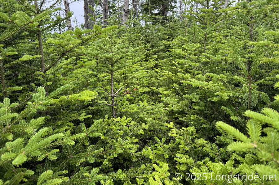
A few trail sections were notoriously overgrown, in some places comically so. More than once, pine trees overgrew the trail so much that the trail was completely covered. On the days it rained, we got far wetter from brushing against the trees than we did from the rain that fell.
As we got further south from St. John’s, the level of recent maintenance dropped off. While the overgrowth was mostly south of St John’s, there were overgrown sections north as well.
Excepting the overgrowth, though, the trail tread as a whole was fine, though it was fairly rugged. It rained a few days while we were on the trail, but the trail as a whole seemed to have pretty good drainage. The only area that was clearly problematic was the southernmost section of trail, which suffered from being the furthest away from St. John’s, and also that part of the trail went through a forest that had been logged, which damaged the ground and disrupted drainage. There were plenty of boardwalks that had were long-sunken into the ground, not providing any tangible benefit. Although annoying, it was mostly fine for us, since it was our last day, but I had to feel sympathy for the half-dozen hikers we saw that day just starting out.
Also suffering maintenance issues were the trail’s official campsites. Of the six sites, three of them had broken, unusable tent platforms and very little clear flat space to pitch tents. The rugged and occasionally dense forest provided few opportunities to camp aside from those sites, and while they were occasionally mentioned in the maps, we mostly had to rely on an unofficial several-year-old spreadsheet posted on the trail’s Facebook page that described possible camping areas, and not always with enough detail to accurately locate them.
Trail maintenance was the most disappointing part of the trail for me, but nuisances aside, we tried not to let it affect our enjoyment of the trail. Not every trail has the maintenance budget and volunteer resources of, say, the Appalachian Trail or Pacific Crest Trail, and when put into that perspective (and given the amount of winter weather Newfoundland gets), the East Coast Trail is surprisingly well hikeable.
In Summary
Rough edges aside, the East Coast Trail is fantastic, and you should hike it! It was for me an enjoyable two-and-a-half-weeks of coastal trail, and my first long trail in Canada.
The East Coast Trail Association apparently has plans to extend the trail further south. If they’re successful in doing this, I’ll happily make my way back to Newfoundland to hike the new portions of the trail.