A long day brought us a great surprise: an unexpected roof over our head for the evening.
This morning started off better than yesterday: sunshine and clear blue skies. That didn’t really help our campsite, though, which was still an unmaintained mess. Beyond the broken tent platforms, the path to the privy had quite a few trees fallen across the path, requiring some morning gymnastics.
Next to the privy was a mouse hole. It poked its head halfway out its hole, saw me, and ducked back in.
The two hikers that camped with us last night said they only hiked 10 km, so they didn’t know anything about the next campsite, but the trail they did hike was pretty overgrown, so we (didn’t) have that to look forward to.
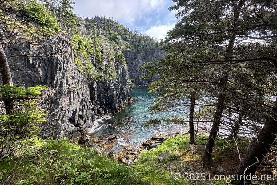
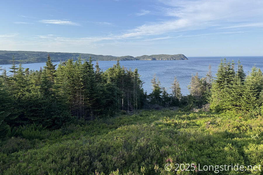
Wet, overgrown trail aside, we had nice scenery to start off the day. At least it was less overgrown than yesterday. Continuing south along the coast, we passed scenic coves as we worked our way towards the next town on the trail, Brigus South.
As we reached the end of the Flamber Head Path, the trail descended towards town on steep rock. Wooden slabs nailed into the rock to act as minimal stair steps had worn out and were missing in some places, making it a little frustrating, though not overly challenging.
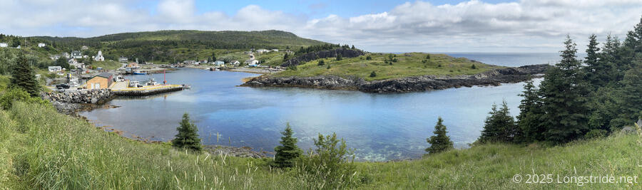
Brigus South seemed to be a town in renewal: nearly every building we passed as we quickly walked through town was a construction site: some being repaired, others expanded, and some being built.
Leaving Brigus South, we joined the Brigus Head Path, a relatively short trail with a “moderate” difficulty rating. In general, this trail lived up to that designation, though it did have a somewhat different approach to maintenance. The initial part of the trail wasn’t so much overgrown, as, someone recently went through and haphazardly flattened the grasses, as though it was a chore they didn’t really want to do. So while at least we weren’t walking through knee-high grasses, our feet would have gotten soaked if it had been the slightest bit wet.
Once uphill a bit, we passed by another bog with flowering pitcher plants. I’d always gotten the impression that pitcher plants were relatively rare, but, they seem to grow well in Newfoundland. Well enough, even, that they’re Newfoundland’s provincial flower!
Near the pitcher plants was Coughlan Cove, which had exceptionally clear water on the coast.
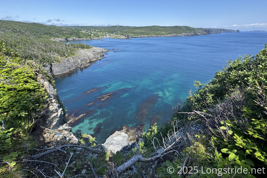
A bit later, when we stopped at a view to put on sunblock, we saw several whales out in the ocean. They unfortunately remain too far out to make for reasonable pictures. It’s surprising to us, though, just how many we’ve seen. Just like with koalas on our hikes of the Great South West Walk and the Great Ocean Walk in Australia, we thought we’d be lucky to see just one or two, and it turned out they were everywhere!
One of the disappointing parts of the East Coast Trail is the (lack of) maintenance. The trail has clearly had an immense amount of work put into it to build the trail, including an incredible amount of boardwalk in areas prone to water. But it seems like it hasn’t been maintained in so long that many boards are rotted, broken, missing entirely, or worse, loose (with the worst offenders swinging up as if you stepped on the head of a rake). The culmination of that is staircases like the one pictured below, where nearly every rung is splintered, tilted, missing its surface or ballast, and several rungs are swamped with overgrown trees.
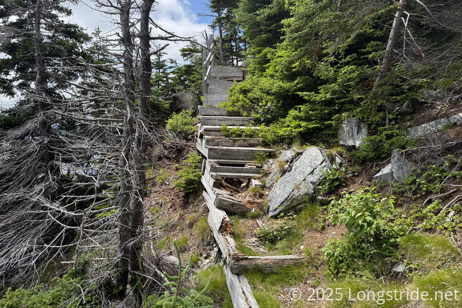
Somehow, though, the trail remains hikeable, and that’s quite a testament to the trail crews that built the trail in the first place.
A short while after that rickety staircase, we reached road, and began to walk through Admirals Cove and Cape Broyle. This was another long road walk, and with the sun out in force, it was hot and not fun (save that we were still walking twice as fast as we did while on even the ECT’s moderate difficulty trails).
We stopped for a break at a very nice picnic area, with a table and some chairs. I think it was meant for a different local hiking trail, but we were in too much of a hurry to want to figure out where that trail was and where it went.
Continuing on the road, we ran into a pair of hikers from Utah, who were hiking the whole trail heading northbound. They told us of an unlocked hunters cabin open for hikers to use a short distance before the ECTA campsite we were heading for today, and advised that we should definitely stay there. (Our maps mentioned the existence of the cabin, but not that it was available for use, so we didn’t factor it into our plan.) Knowing about it now, though, and given our experience with the campsite last night, and that the weather forecast was calling for rain overnight, we were quite happy to consider it as an alternative.
On our way out of Cape Broyle, we stopped at a gas station and convenience store, for coffee and ice cream.
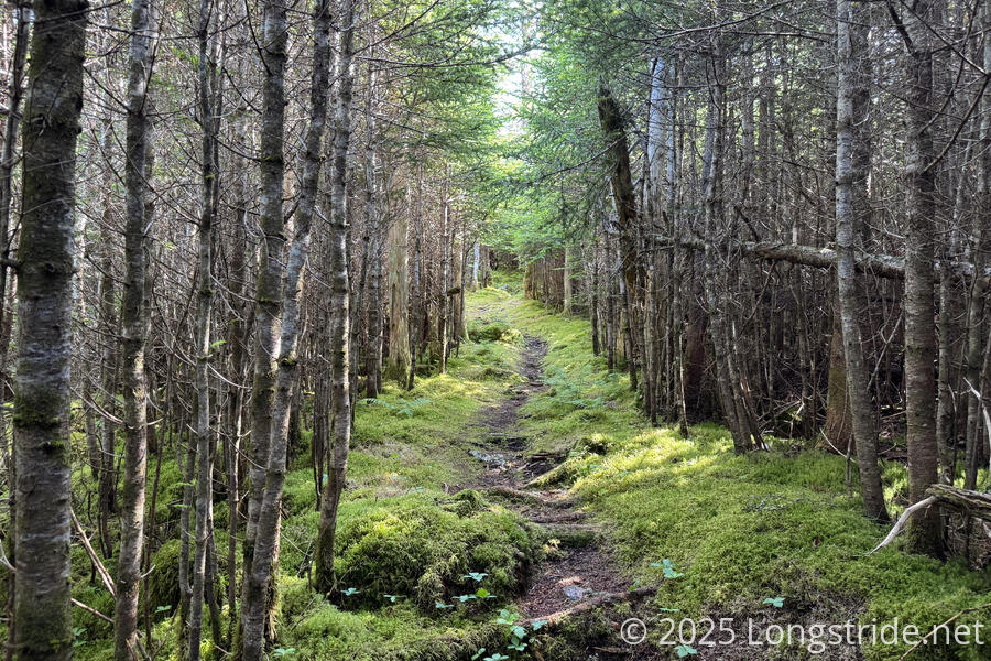
On the outskirts of town we reached the Cape Broyle Path. Rated strenuous, at 19.4 km, it is also the longest section of the ECT. The path started off going through what seemed like someone’s personal junkyard. After that, likely to skirt property lines, it dove out to the “beach”, a very rocky endeavor. After clearing the beach, the trail made a steep climb, and then mellowed out, gently bouncing up and down for most of the rest of the day. After that first climb, the trail was almost uncharacteristically nice: a soft pine needle trail through a pine forest, lined with moss. For a little while, at least, it seemed like something out of a fairy tale.
After a kilometer or two, though, the nice trail disappeared, and we had to cross some (mostly dry) stretches of boggy trail.
After a while, the overgrown pine trees returned, slowing our progress the rest of the day.
For a while, I thought we might be able to make it to the caving without needing a break, but an extended uphill made us both quite hot and sweaty, forcing us to stop for a short break.
Shortly before 7, we reached the hunters cabin, with a very faded sign on the front, “Thank you for leaving it as you found it”.
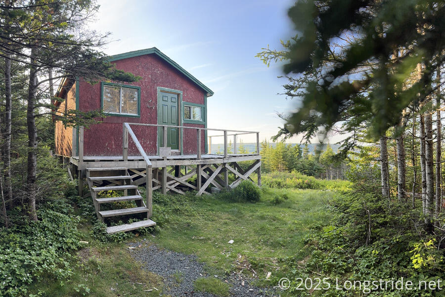
A bit stifling inside from baking in the sun all day, the cabin was otherwise quite nice. Four bunks large enough for two people, with plenty of cold-weather bedding, and another single bunk provided ample sleeping space. It also had a table and plenty of chairs, some supplies, and a pair of log books going back to 2019.
A spacious porch, an almost overflowing privy, and a nice view over the ocean rounded out the amenities.
We got water from the creek a couple minutes ahead on the trail; we probably didn’t drink enough during the day, since we made use of nearly all of the 10 liters of water we fetched in three trips.
On the path to the privy, I found a clutch of seven eggs lying on the ground. Not immediately thinking of any other forest ground birds, I guessed that they were probably grouse eggs. The nest seemed unguarded, and the eggs looked whole, but with some cracks. Probably hikers using the cabin spooked the mother bird, and it abandoned the nest.
We’re expecting rain overnight, so it’ll be good to not have to deal with a wet tent tomorrow morning. Tomorrow, we’ll reach Ferryland near the end of the day, and we’ll have a resupply to do, but we’re not entirely clear where we’re camping. We’ll just have to see what the day brings.