Today, CareFree and I entered the Great Smokies Mountains, beginning the last leg of the trail.
When we went to get breakfast from the lodge’s restaurant, it was overcast and gloomy outside. By the time we got started, around 9:30 (about an hour later than we had intended), the sun started to peek from behind the clouds. On our way out, I stopped to sign the hiker log in the restaurant, and ran into two BMT southbounders. According to them, the trail condition was much better than what we’d encountered the past few days, though there was still some overgrowth and a lot of downed trees.
We continued along the trail, appreciating that it was only slightly overgrown. Along the way, near the lodge, we passed two disc golf tees that were on the trail. Later, we passed a disused (and falling apart) wooden water tower.
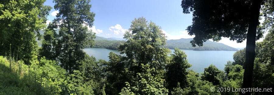
After about an hour, we reached the BMT’s next junction with the Appalachian Trail, which it follows for a few miles until the two trails split again just inside the Great Smoky Mountains National Park. We passed some views of Fontana Lake, but because it’s summer and the trees all have leaves, there’s a lot fewer places you can actually see the lake than when I was here (in spring) while hiking the Appalachian Trail.
After another hour, we reached a notable AT landmark, the Fontana “Hilton” Shelter, so nicknamed because it’s one of the nicer shelters on the trail, complete with potable water, hot showers, and (I think) is the only one that has a solar charging station. We took a short break there to check out the view and sign the log book. While there, a couple of older women walked by; apparently from what I could piece together, they and their husbands were hiking the BMT by doing weekly section hikes on the weekends. Their next section was south, from Fontana to Big Fat Gap. I tried to warn them about the extremely overgrown trail there, but they seemed distracted and disinterested in holding a conversation.
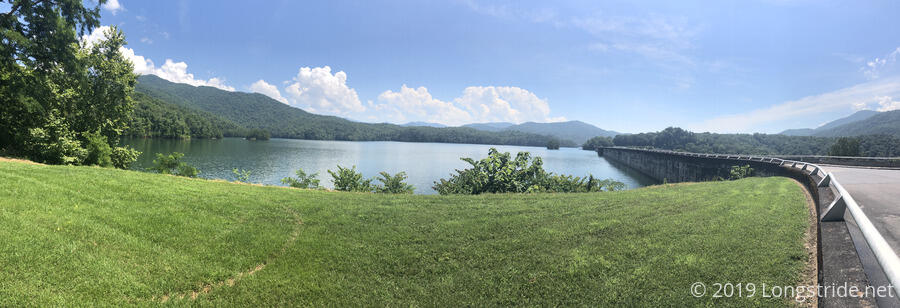
Our next milestone was crossing Fontana Dam, the highest dam in the US east of the Mississippi. Built in three years in the 1940s for power production to assist with the WWII effort, the dam is still in operation now. When I was here in 2016, they were working on repairing the road that travels directly over the dam. That’s since been completed.
At noon, we reached the entrance to the Smokies, following a road uphill. About a mile later, the BMT and the AT again diverged, the AT turning north and heading uphill to the main ridge of the park, while the BMT turned east to run along the northern rim of Fontana Lake, along the Lakeshore Trail. This is the last time the BMT and AT will meet.
We stopped for a break at a creek. While there, we met the only other person we saw in the Smokies today, a woman heading toward the trailhead. She was surprised to see us, and us her. She was also a bit spooked: she’d had an encounter with a bear not too far away, and it didn’t immediately run off when she tried to scare it. (She said it seemed more curious, but then eventually turned and left.) We stayed on the lookout when we left the creek, but we did not see the bear she warned us about.
The Lakeshore Trail the BMT follows in the south of the Smokies seems to be an old road bed. This was especially evident by a string of the rusted metal husks of long-abandoned cars on the side of the trail.
The trail being an old road bed, and with the resources of a national park behind its maintenance, the trail was much nicer today than it was in recent days.
Our second break was at the spacious Lost Cove campsite, located directly on the trail, just a short walk to the lake. There, we found two ticks on my legs, and one on CareFree. Unfortunately, even the better maintenance in the Smokies did not eliminate those pesky arachnids. We also saw two people pass by on a motorboat.
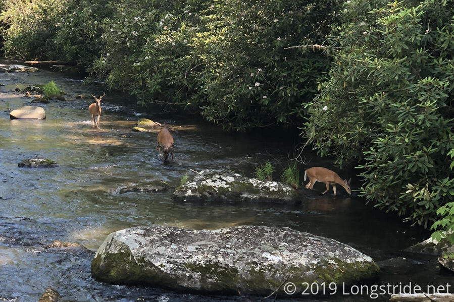
Just past the campsite, the trail crossed Eagle Creek on a bridge. From the bridge, we could see three deer, including two bucks with antlers, wading through and drinking from the creek.
As we continued, so did the wildlife. Numerous small frogs hopped out of our way, we collected more ticks, and we (barely) saw a bear below the trail, moving away from us.
By 5:30, we reached our destination, Possum Hollow (Campsite 88).
After picking off more ticks, we relaxed for a while, then set up our tent, got water, and cooked dinner. Even that was interrupted by ticks: I had to remove one crawling up my water bottle! We also heard coyotes yipping in the distance.
Now that we’re in bear country — the Smokies is said to have the largest concentration of black bears in the US — proper food storage is essential. Fortunately, the Park has provided the campsites with bear lines: reinforced metal wire suspended from a line between two trees, with a pulley and hooks to allow raising food bags out of the reach of bears (and many other forest critters, too).
Tomorrow, we’ll continue along the Lakeshore Trail, following it deeper into the Smokies.


