Water is a vital part of life. This makes water logistics a very important factor in long distance hikes. Lack of (as well as the occasional great abundance of) water on the Continental Divide Trail provided ample challenge along much of its distance.
Water Nowhere...
The “Crazy Cook” terminus of the CDT starts near the Mexican border, in New Mexico’s bootheel. Located well into the Chihuahuan Desert, this was the most significant actual desert I’ve hiked. (The Pacific Crest Trail only goes through a short section of the Sonoran Desert. In the Canary Islands, Fuerteventura is nearly entirely a desert, but dotted with towns that make the trail not terribly onerous.)
This part of the CDT is so dry that the Continental Divide Trail Coalition maintains five water caches placed for hikers in the 84-mile stretch from Crazy Cook to Lordsburg, the first trail town, placed in roughly 15-mile intervals.
Between Lordsburg and Silver City, the trail more closely resembled the PCT’s desert regions in southern California (though with a bit less of the PCT’s strikingly colorful scenery). The trail was still dry, but frequent-enough oases provided water, so the water carries weren’t too awful.
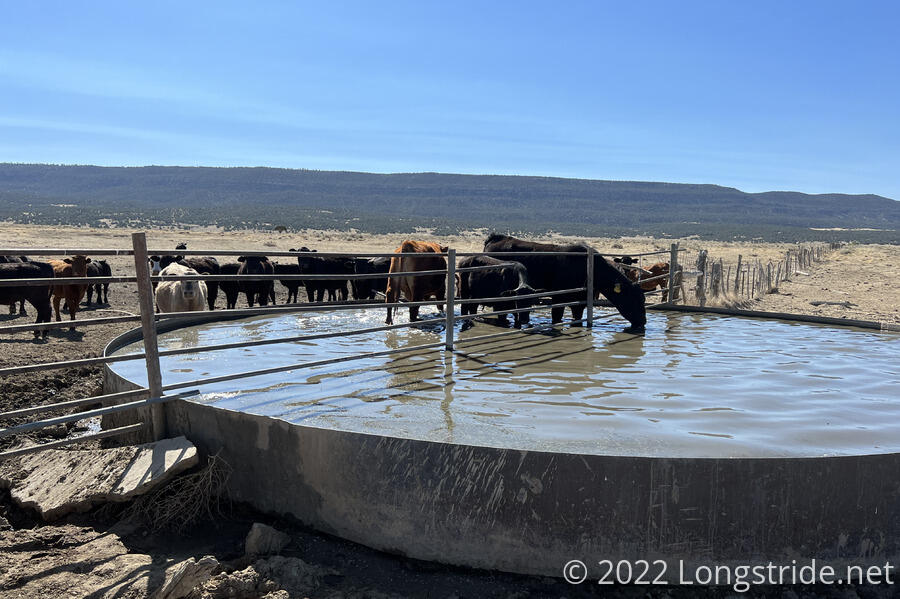
One of the worst parts of the trail in New Mexico was when the water source was cattle troughs. Often, there was a pump running so that actually clean water was available, but there was a good chance the water in the trough was thoroughly gross, due to cows actually standing in the troughs. Fortunately, water filters make that sort of water drinkable (if not especially great tasting).
... and Everywhere ...
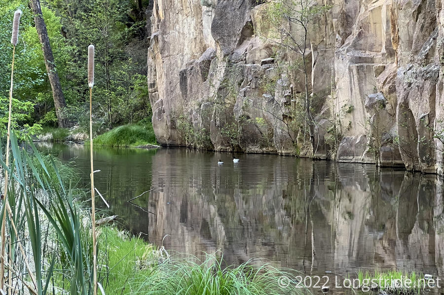
North of Silver City, a planned (and wonderful) detour along the Gila River up its canyon was the section least like any other trail I’ve ever hiked, and a welcome respite to two weeks of very dry trail to the south. Over the course of a little more than three days, I crossed through Gila River the river 244 times. Three days of continuously wet feet wasn’t especially fun, but the contrast between the Chihuahuan Desert and the Gila River valley was like night and day.
In anticipation of the Gila River, I bought a pair of waterproof socks shortly before I left for the trail. They weren’t nearly as helpful as I hoped — most of my crossings of the Gila River were deeper than the socks were tall, so water soaked in from the top. Still, my feet got less wet than they otherwise would have, and I did use them once or twice in the Southern San Juan Mountains in Colorado as both extra insulation and to keep my feet drier from snow.
... but Mostly in Moderation
Aside from the section south of Lordsburg, water wasn’t that much of a problem on the CDT, though there were still more (and longer) water carries than on the PCT. Even the famously dry Great Divide Basin in Wyoming had sufficient water available, thanks to a couple of solar wells and and a fantastic water cache.
In the Sierra on the PCT, nearly every day the trail forded through fast-flowing creeks gushing with snowmelt. The CDT, by contrast, didn’t have that problem. Aside from the Gila River, there weren’t that many wet water crossings, and they were generally more annoying than actually dangerous. At least part of that was getting lucky on snow in Colorado: an unseasonable early season heat wave caused the otherwise normal level of snow to melt much faster and earlier than usual. But generally, the CDT’s routing has the trail high enough up on mountains that creeks are crossed before they get big. Mighty rivers like the Rio Grande were but mere trickles where I crossed them.
Snow
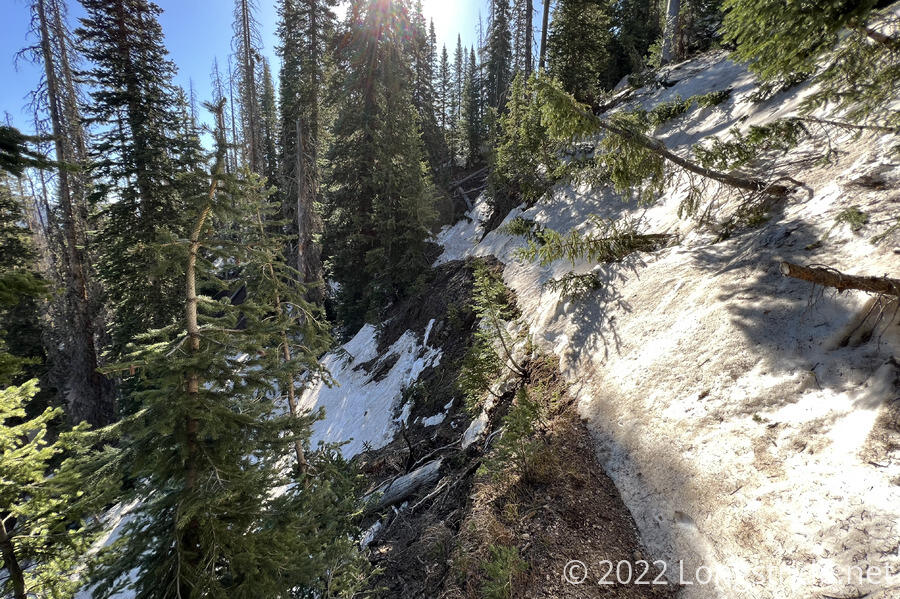
On the PCT, snow was but a nuisance, (though a snowstorm did hinder two attempts to summit Mount Whitney). The same can’t be said for the CDT, though. Even though quite a lot had melted off before I got to Colorado, there was still enough snow on the trail that most days through southern Colorado, in particular in the San Juan Mountains, involved snow crossings, some of which were very sketchy or quite long, and required a great deal of effort to traverse safely. Most of the long or difficult snow traverses were in the San Juans, but the worst (and the only one where I actually used my ice axe) was descending the north side of Lake Ann Pass, which still retained a significant snow field near the pass on a very steep north-facing slope. With that major exception, most of the snow traverses north of the San Juans were just minor nuisances.
I wish I’d taken more pictures of the particularly hard snow traverses, but that’s a gap in my photo collection. I was more focused on crossing safely and moving forward, rather than recording the trail being annoying and difficult.
Weather
The unusually high early season temperature in northern New Mexico and southern Colorado left the more desert-like New Mexico extremely dry, to the point that the Forest Service closed all of the national forests in New Mexico preemptively to reduce the risk of a fire. I was told by a ranger that the trees in northern New Mexico were so dry, in comparison, a matchstick had a higher average water content!
Further north, I was unprepared for how humid the CDT was. I expected the trail to be similar to the PCT (that is, very dry everywhere but Washington), but outside of the desert areas, it was noticeably more humid. I wasn’t expecting this, given the trail’s high elevation, and I woke up to a damp tent and sleeping bag from condensation much more frequently than I expected. Of course, the CDT was still far drier than the Appalachian Trail; rarely did I get as sweaty and sticky as I have on my east coast hikes.
| Trail | Days | Rain | Hail | Snow |
|---|---|---|---|---|
| AT | 177 | 20 | 2 | 1 |
| PCT | 187 | 15 | 3 | 2 |
| CDT | 163 | 38 | 13 | 4 |
| State | Days | Rain | Night | Hail | Snow |
|---|---|---|---|---|---|
| NM | 26 | 0 | 0 | 0 | 0 |
| CO | 55 | 15 | 6 | 9 | 1 |
| WY | 29 | 11 | 10 | 2 | 0 |
| ID/MT | 39 | 9 | 6 | 2 | 1 |
| NM 2 | 14 | 3 | 2 | 0 | 2 |
| Total | 163 | 38 | 24 | 13 | 4 |
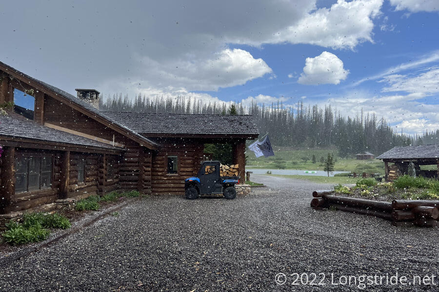
Despite being the shortest (in days on trail) of my triple crown hikes, I got by far the most precipitation on the CDT. The trail in Colorado is famous for afternoon thunderstorms, though I still got fairly lucky in that regard, only getting caught in storms a few times. The first was a hailstorm on the day into Silverton. I was chased by a thunderstorm on my way to Grays Peak, though nothing came of it for me. The day before, I dropped off a ridge and took an alternate route to avoid a thunderstorm on a long, exposed ridge.
Perhaps the most memorable storm was when I got hit from behind by a wall of water just as I crested a pass in the Wind River Range in Wyoming, going from dry to completely soaked in a matter of seconds.
Unsurprisingly, New Mexico was the driest; I only got precipitation there during my late-season section from Chama to Grants. Colorado was the wettest by far, with Wyoming and Montana roughly the same.
All things considered, water on the CDT was not as big a problem as I thought it might be. The worst part of the CDT’s water situation was an abundance of truly gross water in New Mexico. And that’s nothing a good filter can’t solve. After that, the snow situation was unnerving at times, but easily survivable with patience. Between that, and reading the clouds well enough to stay out of the way of thunderstorms while on high ridges, I didn’t have much of a problem with water in any of its forms on the CDT.