I knew going in that the Continental Divide Trail has a lot of road walks. And after fairly lengthy road walks on the Tuscarora Trail and the Canary Islands, I thought I was prepared. I wasn’t.
A Plethora of Roads
| State | Days | Dirt | Paved | Any | Any % |
|---|---|---|---|---|---|
| NM | 37 | 30 | 13 | 36 | 97% |
| CO | 49 | 25 | 10 | 28 | 57% |
| WY | 27 | 17 | 8 | 18 | 67% |
| MT | 36 | 27 | 3 | 27 | 75% |
| Total | 149 | 99 | 34 | 109 | 72% |
| Total % | 66% | 23% | 73% |
What I did not expect was the sheer quantity of dirt roads along the CDT. Nearly three-quarters of my hiking days (not including zeroes) involved either a dirt or paved road. In New Mexico, this meant a road every day, except for one day in the middle of the Gila River Alternate. Not all of these roads were long, but they were still not trail, and they still wear you down.
As a brief respite from rugged trail, roads are great. They tend to be flat and level, or reasonably close to it. This makes it easy to go faster than usual. On roads, I could easily hike 3 miles/hour, and often over 3.5 mph. This is great for passing the miles quickly, but it’s hard on your body.
But, because roads are so flat and level, with few of the bumps and turns and minor obstacles that trail has, road walking very quickly becomes monotonous. Your legs and feet make the exact same movement, in the exact same way, repeatedly, sometimes for hours. This is tiring. It’s worse if the road is packed dirt or concrete with no give: that’s especially hard on your knees. Asphalt’s not great to walk on when it’s sunny out (it gets hot quickly), but at least it has a tiny bit of spring. And, roads tend to not have a lot of shade, so the sun tires you out faster as well.
New Mexico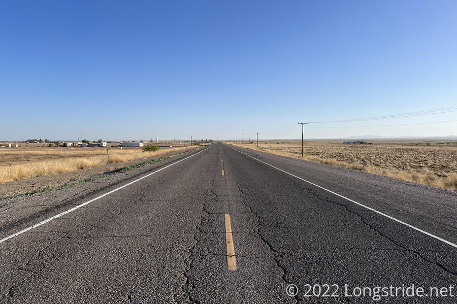 The Road Out of Lordsburg × The Road Out of Lordsburg
New Mexico was the worst offender in terms of quantity and length of paved road walks. With the exception of Chama, the CDT goes directly through every trail town in New Mexico, which meant a long walk along a paved road into and out of each of them.
The longest continuous paved road walk on the CDT was Grants, which was 30.6 miles from the La Ventana Natural Arch Trailhead through town, to the trailhead leading to Mount Taylor. If not for the detour I took from the Narrows picnic area to go up on the ridge and see the arch, the paved road walk would have started 8.6 miles earlier (for 39.2 miles in total of continuous paved road walk).
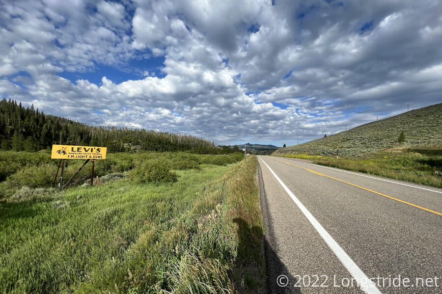
Colorado
Colorado had a few road walks, but they were short compared to the length of the trail in that state. And, in comparison to New Mexico being largely very flat to begin with, Colorado’s road walks were a relief compared to dealing with the rugged mountains that made up the bulk of the trail there. Most of them were dirt; the only long stretch of paved road in Colorado was 11 miles along a highway outside of Steamboat Springs, which rewarded me with my fastest hitch into (and out of) town ever.
Wyoming
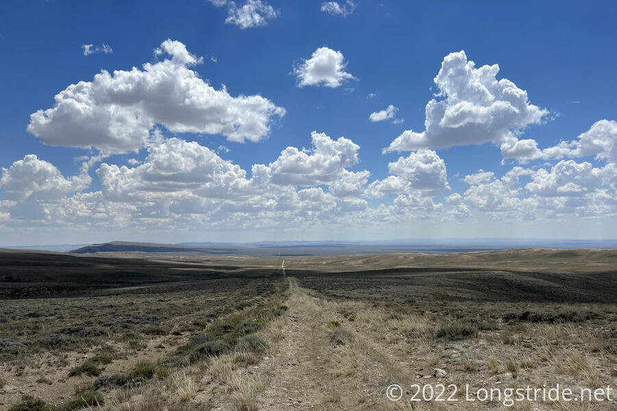
In Wyoming, nearly the entire trail I followed from Encampment to South Pass City (roughly 190 miles) was on (mostly dirt) road. To be fair, probably fifteen of that was detour from the official trail to nearby roads to speed up getting to Rawlins, Atlantic City, and South Pass City, but setting that aside, it still was not fun. At least it made for relatively fast hiking; I did two pairs of back-to-back marathons in that stretch.
Between Rawlins and Atlantic City, the CDT crosses the Great Divide Basin. Besides being nearly entirely (dirt) road walk, it includes quite possibly the single worst length of trail I’ve ever hiked, a roughly 35 mile stretch that, a few zig-zags aside, was largely straight as an arrow.
It didn’t help that during that stretch, one of the load lifters on my pack broke, unbalancing it, and increasing the effort it took to hike until I was able to get my pack replaced two weeks later.
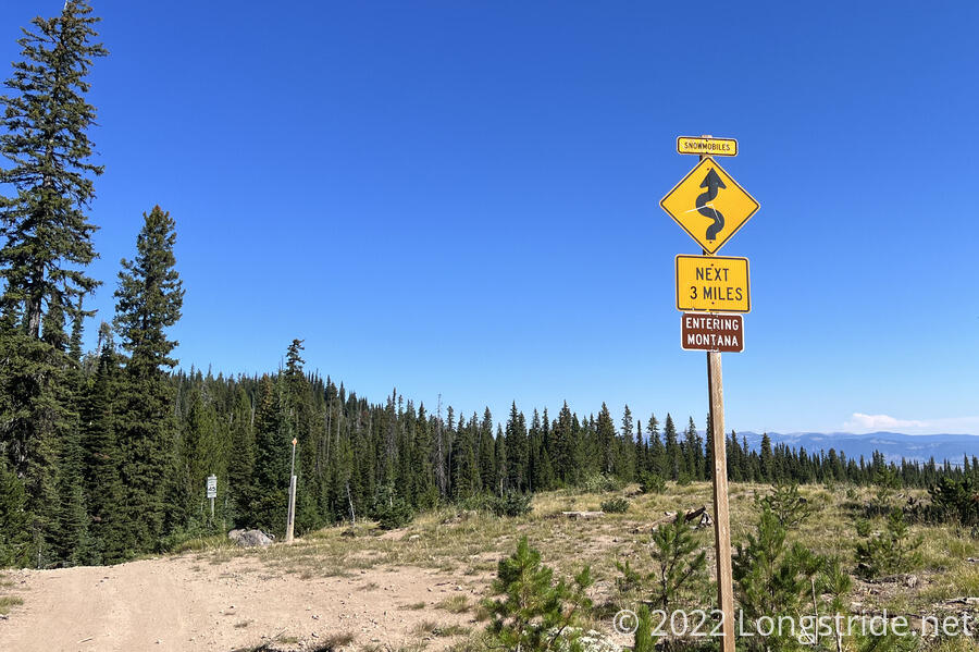
Montana
Entering Montana (on a dirt road) provided a number of novel (to me) signs for snowmobiles, including one with a speed limit of 45 mph (!) for snowmobiles. (The road would probably not be safe to drive with a wheeled vehicle at that speed, certainly not without creating a giant dust cloud.)
Most of the road walk in Montana was self-inflicted. I was far enough “behind schedule” that in order to make it to Canada before winter weather set in, I needed to take a 320-mile shortcut from West Yellowstone, MT to Butte, MT. That easily saved two weeks of hiking, but at the cost of replacing trail with a lot of dirt roadwalk. (It wouldn’t surprise me if more than half of the 185-mile shortcut was road.) Fortunately, most of that was dirt road, and it was broken up by some very scenic landscapes.
The road walks were least fun part of the CDT, especially since most of them were not tree-lined, leading to long, monotonous hikes baking in the sun.
The Continental Divide Trail Coalition is working to get more of the CDT off road and onto trail, but that is a years-long effort involving many landowners, and a project that only proceeds slowly.
I imagine finding myself back on the CDT again at some point, but the current road walks don’t really inspire that to happen anytime soon. Though, when I do make it back to the CDT, I look forward to at least a little less road and a little more trail.
Next: A Trail of Extremes