Today, I started the Seoul Trail, completing its first three sections.
After breakfast at my guest house, I made my way to Seoul Station, the nearest subway station, just a couple minutes walk downhill. Servicing four subway lines and several other rail services, the station is a sprawling underground behemoth with fifteen different exits, easily the largest subway station I’ve ever been in.
Immediately, I was impressed; each exit from a subway station is numbered, with signage indicating how to get to each exit. Conveniently, the Seoul Trail guidebook indicates which exit number to use to get to the trail from the station, and also, it’ll be easier to remember an exit number than, say, the cross streets (as in the DC metro system, which can also be ambiguous, when there’s exits on both sides of a road).
The relatively inexpensive fares on the Seoul Metro are paid with a “T-Money” card, one of which I got at the airport when I got a SIM. Recharging kiosks before the fare gates make topping up the card easy, but alas, they’re cash-only. (Not a problem; I also had a card with some leftover money from when my partner did the trail in November, and some cash from paying for and splitting last night’s dinner with Jay and Tina.) Subway trips have a base ₩1550 fare (about USD $1), plus a small distance-based rider for longer trips, bringing my fare out to Dobongsan Station to a total of ₩1850. Not bad for a roughly 45-minute trip.
A short walk from Dobongsan Station took me to the Seoul Iris Garden, and the start of the trail.
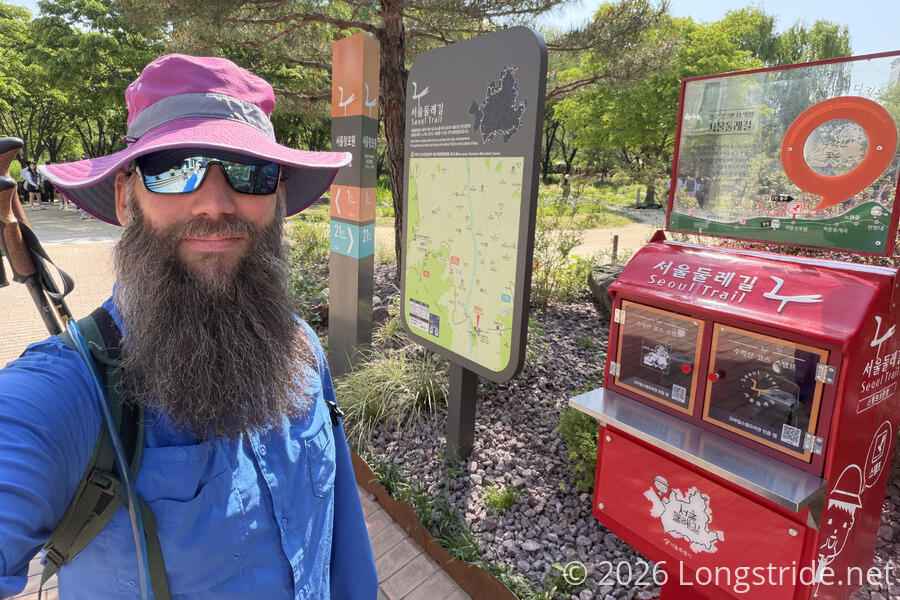
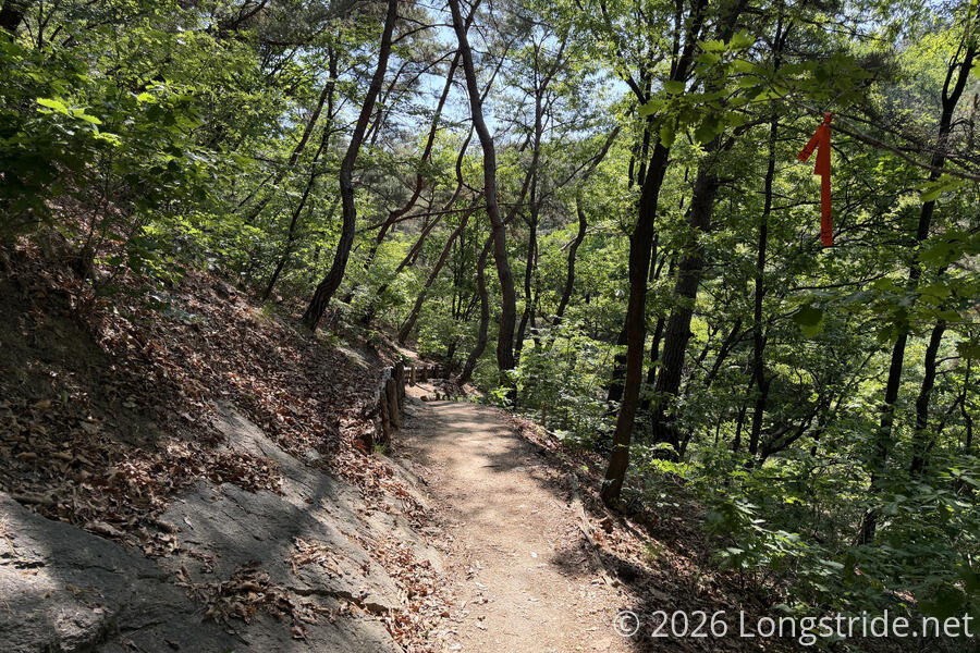
From the trail’s information center across from the start of the first section, I picked up a copy of the guidebook (there are Korean, English, Japanese, and Chinese versions), as well as a stamp book, to collect ink stamps from the 28 stamp boxes along the at the very start. The guidebook provides a brief overview of each stage, including a length, estimate, and easy/medium/hard difficulty rating. It’s a handy reference, but it’s not detailed enough to be used for navigation. (Though, this wasn’t a problem at all today: the Seoul Trail is one of the most well-marked trails I’ve ever hiked.)
Stage 1: Suraksan Mountain
I collected my first stamp, ostensibly a design reflecting the exposed rocks atop Suraksan Mountain, which the trail doesn’t actually summit.
The trail quickly wound its way out of the Seoul Iris Garden (and past a few large groups of students standing around, so I opted not to explore the Iris Garden — I’ll check it out further next week when I’m back here again), crossed a road, and joined a walking and cycle path alongside the Jungnangcheon River.
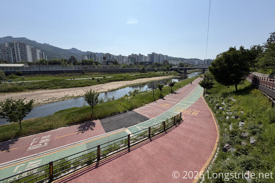
I crossed the river on a bridge — there are no river fords on this trail, thankfully! From the bridge, I could see a number of large fish in the river. Perhaps catfish, but it was hard to tell.
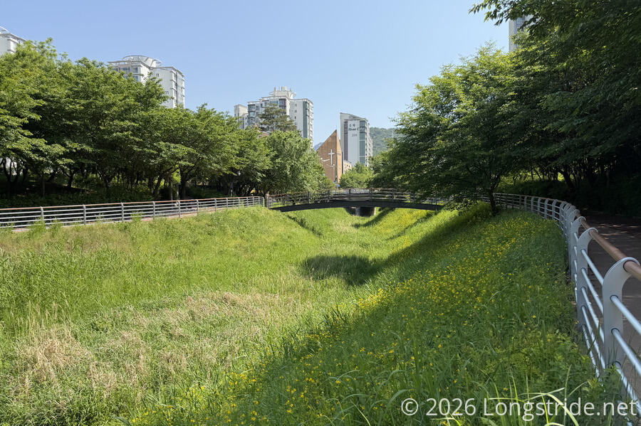
On the other side of the river, the trail quickly darted into a shaded walking path alongside a seemingly dry grassy stream bed.
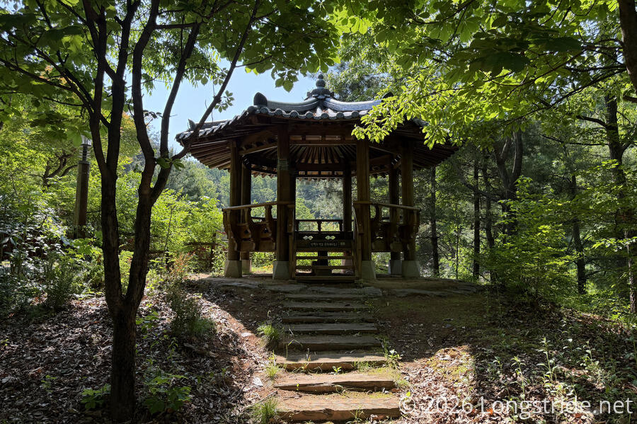
Heading into the forest, I passed some covered seating areas, some exercise equipment, and a very nice traditional Korean pavilion.
Just past that, I reached the northernmost point on the trail, as the Seoul Trail turned southeast at a junction to a trail going to the top of Suraksan Mountain. (A little on the clock for the day, I decided I didn’t have time for the detour — and elevation gain — going to the top. Maybe another day…)
Instead, the Seoul Trail followed the base of the mountain, on a very nice trail. Although the guide rated the trail as “hard”, the only thing that was hard was the elevation change. The trail itself was nice and wide, and largely free of rocks, roots, or other impediments. A surprisingly large network of other trails intersected with the trail; clearly, there’s a lot of hiking options here.
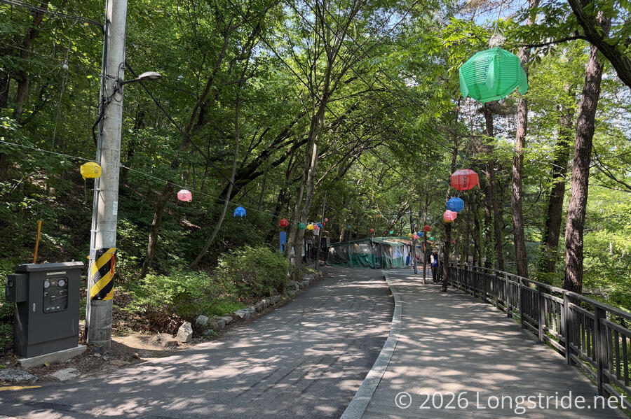
Briefly popping out of the forest, I saw a string of lanterns hanging from ropes on both sides of a small road. It was a nice colorful decoration, and I wondered if it was a permanent installation, or something temporary ahead of the Seoul Lotus Lantern Festival this weekend.
Seoul is quite close to the border with North Korea. A reminder of this was a sign (in Korean and English) warning of a nearby military station: unauthorized access and photography is prohibited, and damaging the fence can result in severe penalties. (North Korea is only 37 km away from that sign.) Besides the military station, the trail has a fair number of CCTV cameras actually on the trail, so there is quite a lot of surveillance going on.
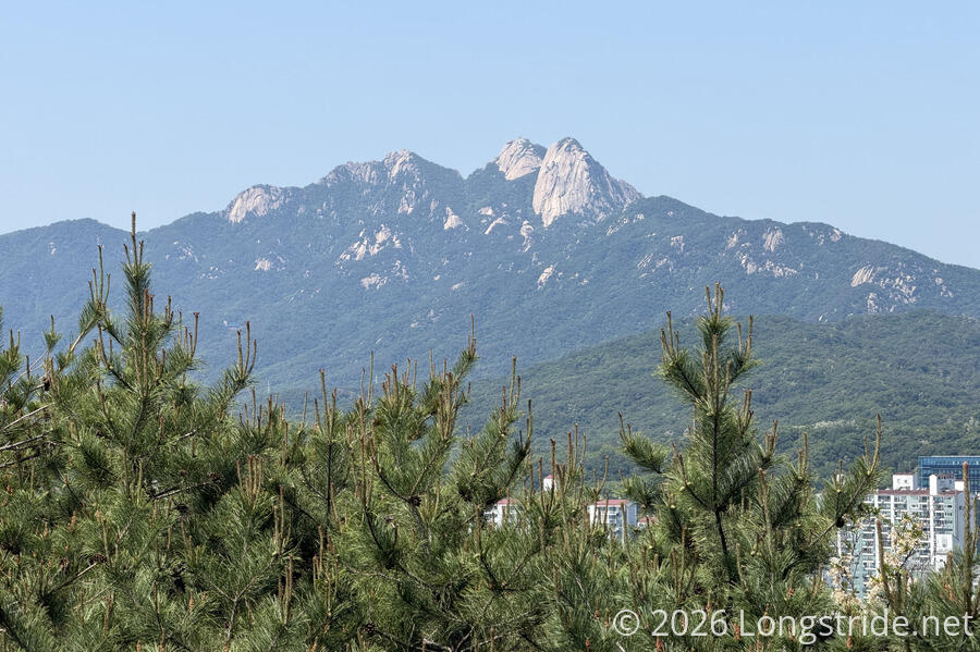
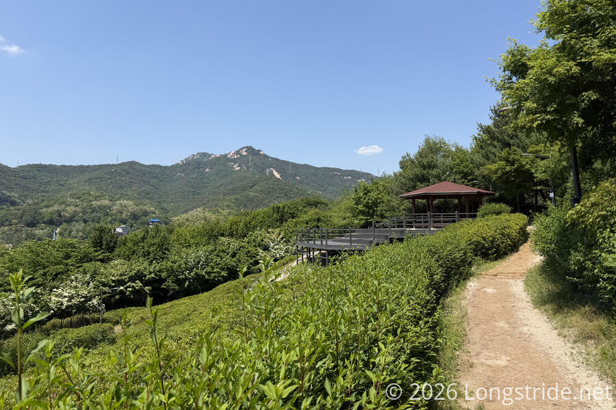
A little further on, an observation platform gave a somewhat hazy view towards Bukhansan Mountain. The Seoul Trail doesn’t summit Bukhansan, but the final few sections traverse the base of the mountain.
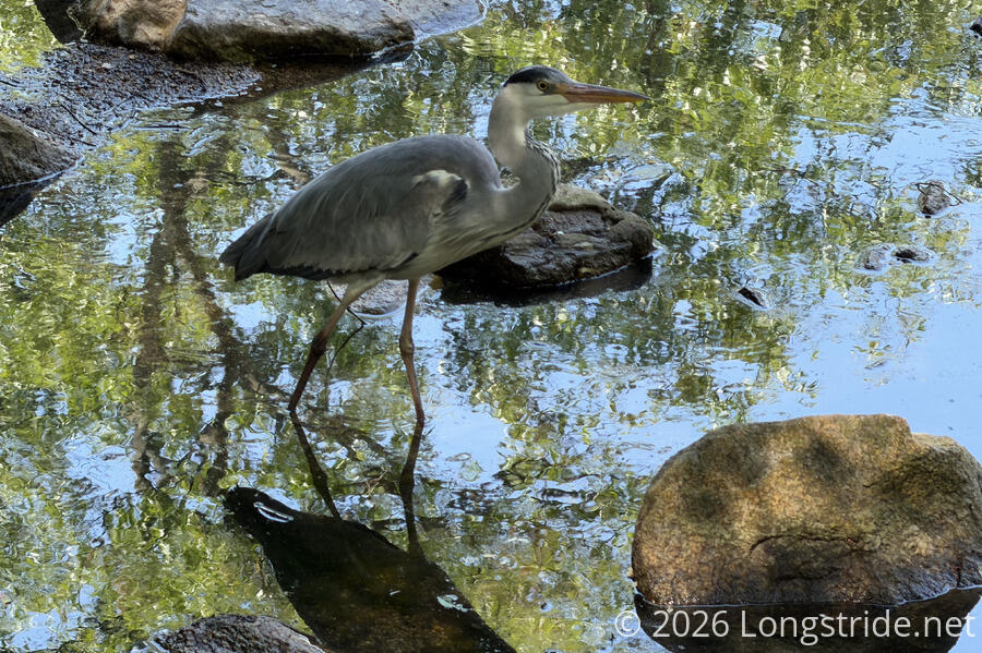
Crossing another road, and a small creek on large stepping stones, I passed a heron wading in the water. It didn’t seem to much mind the crowd of people looking from the bridge.
For a short distance, a huge number of trees lining the trail had forms stapled to their bark; thanks to the miracle of translation software, I was able to learn that these were markers indicating the trees had been inoculated to prevent pine nematode disease. This seemed a highly wasteful way to mark the inoculated trees, but this way, there’s certainly no confusion over whether a tree was injected or not.
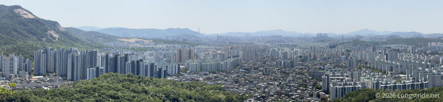
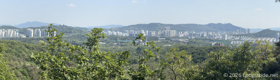
A nice observation deck provided the first, of what I’m sure will be many, panoramic views of Seoul. From the view, it was clear that many high-rises in Seoul were built several at a time with the same design right next to each other, like cookie-cutter McMansions in US suburbs on a gigantic scale.
Stage 2: Deongneunggogae — Deongneung Pass
Shortly after the observation deck, I reached the end of the first stage, marked with another map and stamp box, and began the second stage, heading towards Deongneung Pass. The stamp seemed to be of an exposed rock slab on the side of a mountain, which I definitely passed towards the end of the first stage.
There continued to be many benches, picnic tables, and exercise stations of varying sorts; certainly, if someone walking the trail wants to take a break, they needn’t go very far before reaching a nice, often shaded, place to sit down. I also saw what looked like a few tent platforms, but more likely, they’re just large flat sitting areas. As far as I know, camping isn’t permitted anywhere along the trail. There was even a restroom, with running water!
The trail continued to bounce along the many valleys along Suraksan Mountain. At one of the valleys, the trail briefly followed a stream valley partially downhill towards town. The path, now paved with stones rather than dirt, had streetlights and CCTV cameras, including one that startled me by speaking a recorded message as I passed by!
Another valley and a half later, the trail crossed Deongneung Pass on a bridge flanked with thick trees. Although you could hear the highway below the bridge, the road was hidden away by the foliage, a nice attempt at keeping the trail in a more nature setting.
I didn’t see much in the way of wildlife today. There were some birds — mostly magpies. But what I saw the most of were grasshoppers.
Stage 3: Buramsan Mountain
A pavilion and viewing platform rounded out Stage 2, and another stamp station kicked off the third stage, along the base of Buramsan Mountain, at the entrance to the Sanggye-dong Royal Azalea Park. This stamp featured a pavilion and what I’m guessing are azalea flowers.
The first two stages were rated “hard”, but the only thing hard about them was elevation gain. And even that wan’t terribly difficult, the occasional steep inclines moderated by stairs.
The third stage was “moderate”. Although still quite hilly, this section of trail was noticeably more relaxed. Though it didn’t stay in the azalea park very long, it retained more of a “neighborhood park” feel than the other two sections today.
I was surprised at the number of people I saw out walking on the trail today. There are lots of access points to the neighborhoods on the edge of Seoul, and the trail is legitimately very nice to walk, but Seoul’s trails are actually used by its residents in a way I haven’t commonly seen elsewhere.
This third section of trail was the most busy today, with frequent neighborhood connections. I passed through the top of someone’s garden, with heavy construction equipment downhill a bit clearing the land. There were lots of magpies, and also a few signs warning of anti-rabies (!) bait pellets sprayed in the area.
I skipped taking a 0.3 km side-trail up a steep set of stairs to the Hakdoam Temple, concerned about having enough time to get back to my room and get a shower before meeting Jay and Tina again for dinner. Though if I’d actually have read the guidebook more thoroughly before hiking through the section, I probably would have made the trip: the temple has a 23-meter tall rock-carved buddhist statue (which presumably is the inspiration for the stamp at the end of the section).
The trail eventually exited the forest, going through an arch to arrive on a city street. The trail continued along the sidewalk for another kilometer, ending its third section (with another stamp box) very conveniently across from an entrance to the Hwarangdae subway station.
Another roughly hour-long commute later, and I was back at my guest house for a nice shower, with a little time to spare for a short subway ride — this time right in the middle of the busy rush hour — to meet Jay and Tina at a chicken place for dinner. It was somewhat similar to the Korean BBQ we had yesterday, with food cooked on a stove in our table. Like yesterday’s meal, it also was fantastic.
All in all, this was a great first day on the trail.