A longer day today went through two very different mountain sections, and a long stretch along a river, in what turned out to be one of the most impressive linear parks I've hiked through.
Stage 11: Gwanaksan Mountain
From Sadang Station, the Seoul Trail follows a sidewalk through a neighborhood, then continues along the road leading to Gwaneumsa Temple, passing through an iljumun, the first entry gate of Korean Buddhist temples.
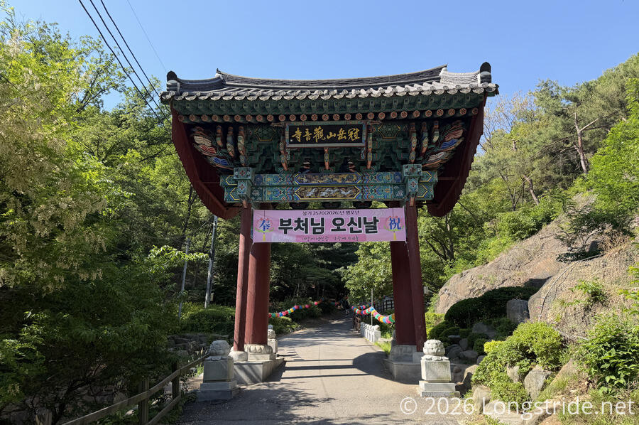
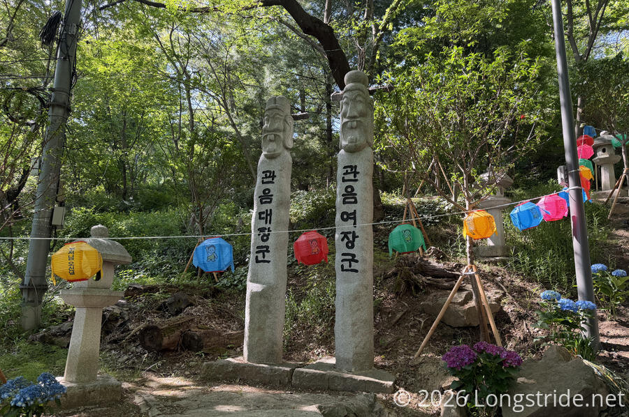
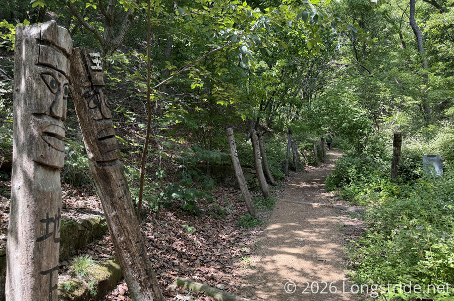
The road leading to the temple was decorated with lanterns. Near the temple were a pair of stone jangseung (장승) totem poles. These poles (often made of wood) traditionally marked village boundaries and are supposed to frighten away demons, but in this context, are adapted to mark the temple’s boundary and represent the temple's patron figure, Avalokiteśvara (Gwaneum Bodhisattva).
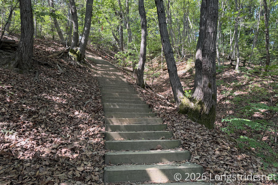
Passing the temple, the trail zig-zagged along the side of the mountain, generally following its contour. A little more rocky and rugged than usual, with all of the turns and short ups and downs, the trail briefly gave me strong vibes of the Appalachian Trail. Well, except for the staircases; one would rarely find stairs as nice as the Seoul Trail's on the AT.
Near an entrance to a neighborhood, the trail passed below a rock outcrop with a small hollow underneath. In the hollow, rocks were stacked to make dozens of small cairns.
As the morning progressed, it gradually got warmer. The forest shade helped keep the sun off, but the weather was shaping up to make for a hot day. And, I’d forgotten to bring my hat, so I needed the shade to perform double duty today.
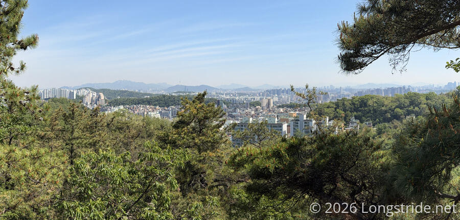
A view to the north provided one of the day’s few overviews of Seoul, before the trail joined a ridge and followed that down to the city.
Leaving the ridge, the trail passed through Nakseongdae Park. According to a sign in the park, it is the birthplace of Gang Gam-chan, a renowned general in the early Goryeo Dynasty (918-1392). The area got its name from a legend that a star (seong) fell (nak) from the sky at that site (dae) on the day of his birth.
After crossing a street, the trail quickly climbed to the top of a ridge, followed it a short distance, and dropped down to a road on the other side of the ridge, where it followed a sidewalk past the Seoul National University, and then on to the entrance to Gwanaksan Park, which marked the end of the section.
Stage 12: Hoamsan Mountain
Passing under a large iljumun gate, the Seoul Trail continued into Gwanaksan Park. Despite the name, the trail actually continues towards and below Hoamsan Mountain, initially following an access road primarily taken over by foot traffic and a few cyclists, the trail eventually turned off onto a dirt trail as it head uphill in a valley. Along the path, many wooden jangseungs guarded the trail from evil spirits.
Climbing up the side of the mountain quite quickly, the trail tread became a bit more sandy. Flanked with pine trees and large rounded rocks, and occasionally with a bed of pine needles on the trail, this section of trail reminded me of the Pacific Crest Trail in California. Then the trail crossed over a saddle, and that feeling quickly went away.
Now along the northern side of Hoamsan, the trail went through a long stretch of park that had multiple day-use shelters with picnic tables and benches and large expanses of flat land. In one small clearing, I passed a woman practicing her golf swing with a trekking pole. (Koreans seem to enjoy golf; I’ve seen quite a few netted driving ranges.)
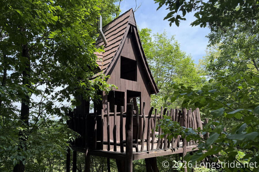
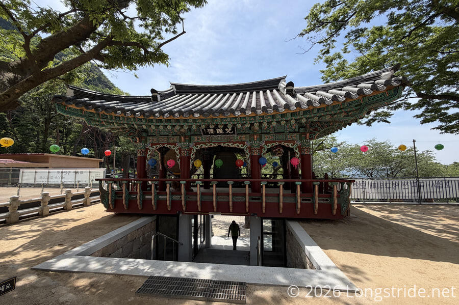
Just after a bridge over a dry river bed stood an observation platform facing towards the city, shaped like a tiny house out of a fairy tale. This seemed appropriate, given that just after, the trail passed a children’s nature learning ground.
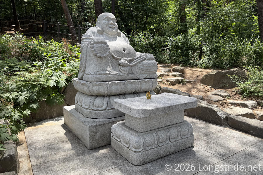
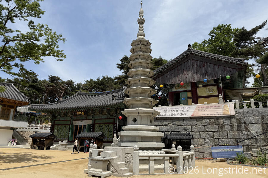
Further on, the trail approached the Hoapsa Temple, which greets visitors first with a granite plaque wishing visitors health and happiness, and then a statue of Budai, the Laughing Buddha.
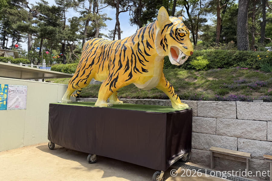
One story behind Hoapsa Temple is that when the palace of the Joseon Dynsasty was being built (c. 1393), a half-tiger beast would appear in the dark and destroy the construction. South of the city was a mountain resembling a tiger (Hoamsan). This led to the suggestion to build a temple on the tiger’s tail, so that the tiger could not move. This became Hoapsa Temple, the tiger-suppressing temple.
This explains why one of the tiger parade floats from the Lotus Lantern Festival stood watch at the entrance to the temple.
The temple grounds had a wide variety of buildings, in various traditional styles. I wish I’d taken more time to explore the temple, but there were a fair number of people there, and since I’m not buddhist, I didn’t really want to get in the way. The temple also had a small gift shop and cafe, though I opted not to get anything there.
After leaving the temple, the trail continued following the side of Hoamsan Mountain. Briefly, it became extremely dusty; I think the trees decided to have a go at pollination.
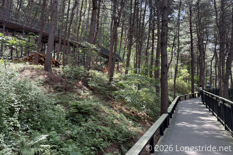
For a long stretch after the temple, the trail was on one of several sets of boardwalks, making for a very easy hike. Above the boardwalk, a two very large birds nests sat high in trees, though I couldn’t see if they were occupied. The trail also passed the Hoamsan Waterfall, an artificial waterfall that operates in July through October for 90 minutes a day! (Since it’s mid-May, I’m a little early.) Also at the waterfall was a large pedestrian bridge to an elevator to go down to the nearby road (and presumably access the neighborhood there).
After a long stretch hiking on the boardwalk faster than usual, during a somewhat steep downhill on more rugged trail than usual, my knee started bothering me. I stopped for a break to give it a rest on one of the many, many benches that have been along the trail today.
A little further brought me out of the forest, down a small street, and to a major road across from Seoksu Station. With the quite busy street and sidewalks, the trail markers were rather hard to see. Eventually, I spotted one across the road, and after getting turned around a little, figured out that I needed to go through the subway station to get over the tracks and to the start of the next section on the other side.
Stage 13: Upstream Anyangcheon Stream
A short distance past Seoksu Station, the trail turned north, along a road paralleling Anyangcheon Stream. After a little while, the road kind of just became a walking path that darted under several road bridges.
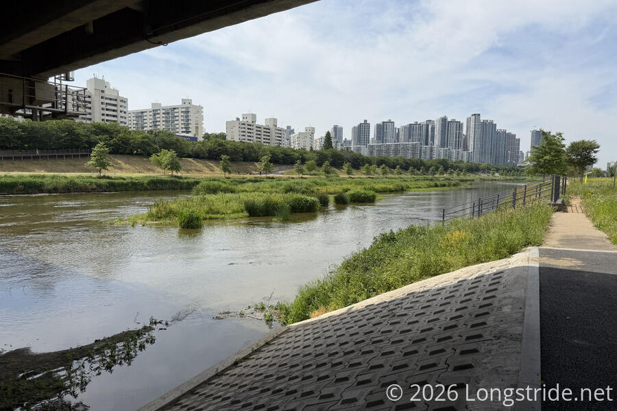
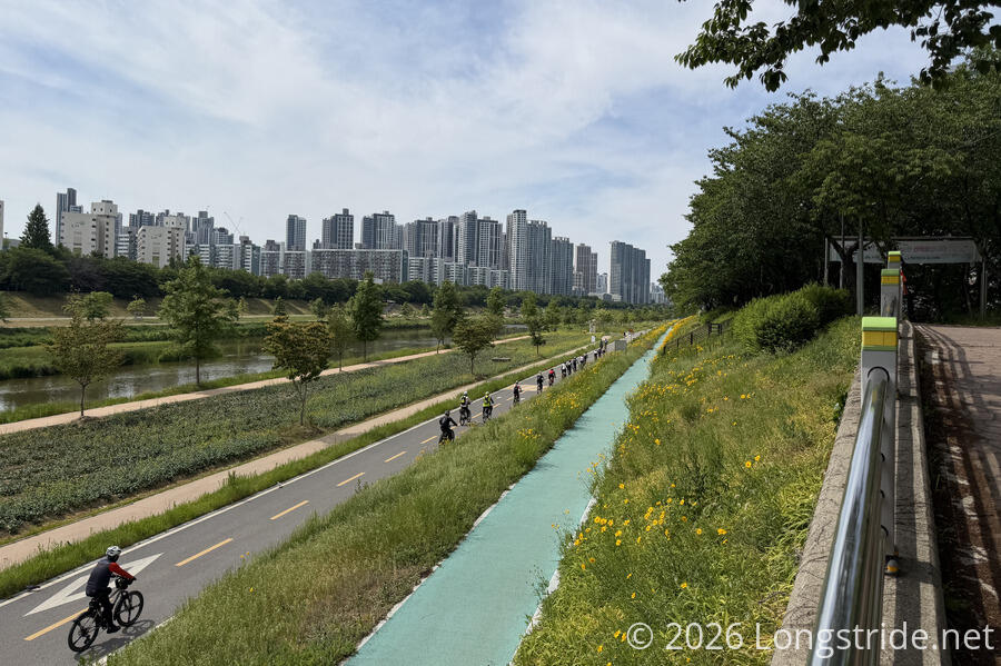
This began what is probably the most impressive linear park I’ve ever walked through.
On both sides of the stream (really, a small river), there were multiple walking and cycle paths, at different elevations and distances from the water. And for about 2 km, the trail was directly in the shade of an elevated highway. Naturally, there were more benches, picnic tables, and exercise stations than was reasonable to count, and restrooms every so often as well.
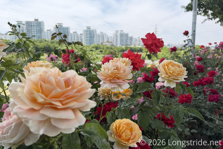
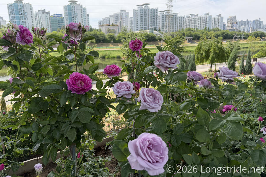
But that was only just the beginning. For a good distance, rows of roses lined the trail, somewhat like near the rose garden in section 6, but more roses, and for a longer distance. (A fair number of workers were doing maintenance on the flower beds, as well.)
This whole area was filled with people walking, resting at the benches, using the exercise equipment, even playing janggi (Korean chess). Below the trail, closer to the stream, there was a wide array of other venues, including a dog park, basketball courts, and a couple other plazas of some sort.
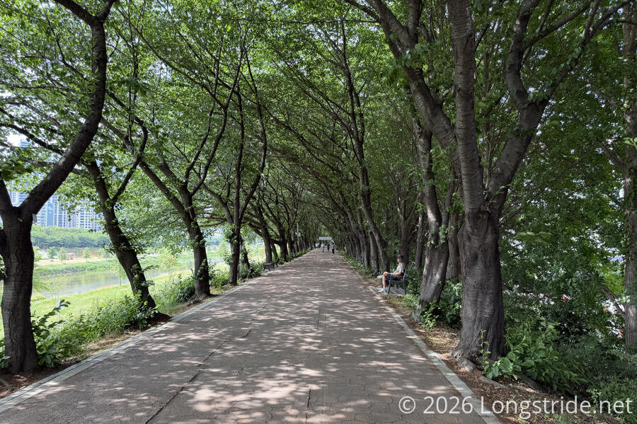
Once the trail left the shade of the bridge, it drew close to the river, and I wished for some trees. I didn’t have long to wait; just under a kilometer later, the trail moved back up towards the road, now under trees, and with a nice breeze as well. With the plethora of possible paths to choose from, the trail designers definitely knew what they were doing: keeping the trail in the shade as much as possible.
The amenities closer to the river resumed: a swimming pool and water park (closed, but seemingly being readied for the season); several soccer fields; an ecological park; a skate park; and a bike park. And, some of the restrooms even had showers! And that’s just what I could see on this side of the river; the other side looked mostly to just be walking and cycling paths, but also had some sports fields as well. There really were a lot of amenities along the riverfront, with almost no wasted space. I wish more cities had this kind of public infrastructure.
With as nice and flat as this section of trail was, I briefly considered continuing further down the stream on the next section of trail. But with this section’s trail being generally on harder surface than the dirt trails earlier in the day, my feet were beginning to become quite unhappy with me. I decided to call it quits at the end of the section, at Guil Station. Shortly before I got there, I saw an excavator in the stream, dredging dirt out of the river and depositing it on the small island the excavator was working from.
A short distance later, I reached the Guil Station, the end of the section, and took the subway back to my guest house.
Tomorrow, I'll continue on from here, heading further downstream along Anyangcheon Stream, to the Han River.