A long day took me the rest of the way down Anyangcheon Stream, across the Han River, and across two mountain ridges as I draw closer to the end (and the start!) of the Seoul Trail.
After a few hot days, the weather today was cooler, cloudier, and gloomier, with rain forecast for tomorrow. This made today much less photogenic, but at least the sun wasn’t as harsh.
Stage 14: Downstream Anyangcheon Stream
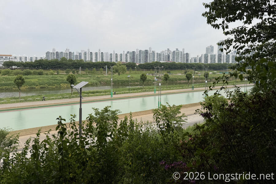
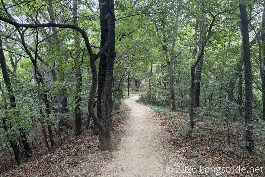
From Guil Station, the trail continued heading north, downstream along Anyangcheon Stream. Like yesterday, the trail along the stream had a highway on one side, separated by trees and barriers, and the space between the stream and the trail had a plethora of outdoor facilities. The trail itself had plenty of benches, picnic tables, and restrooms.
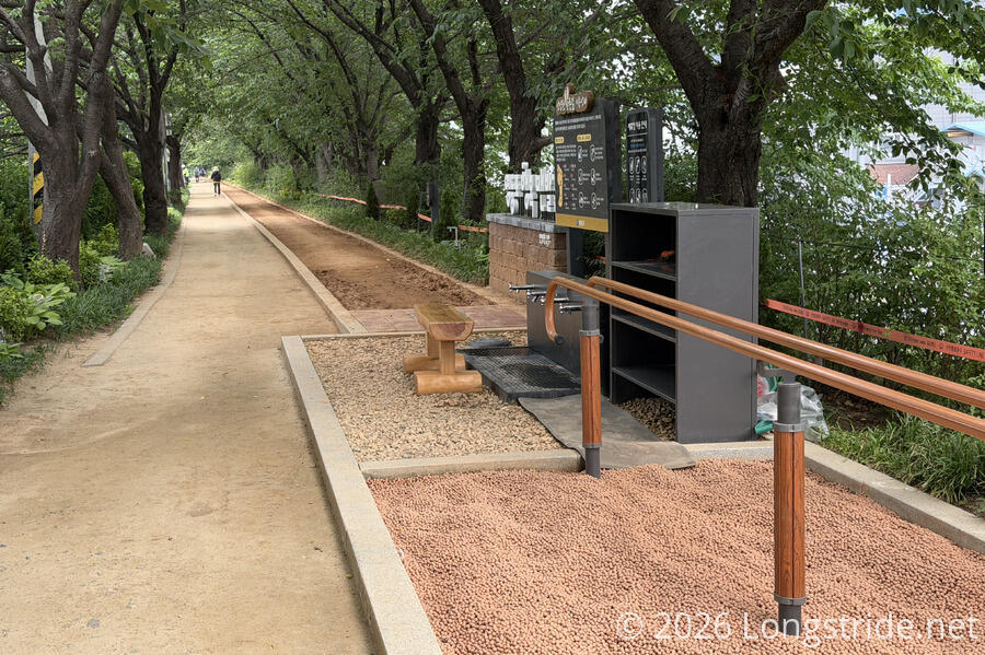
New along this section of the stream were several barefoot walking paths, with foot wash stations near one end. The intent is to promote health, presumably through the pressure of the clay ground applied directly to the feet, as in reflexology. Several of the paths were quite muddy near the foot washing stations, and one of them was under maintenance, with a work crew tilling and redistributing the clay.
I also passed someone who was tying new Seoul Trail marker ribbons to a tree; I got him to give me one as a souvenir!
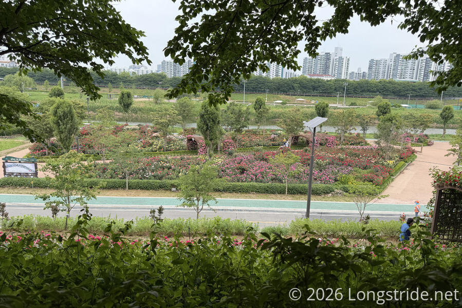
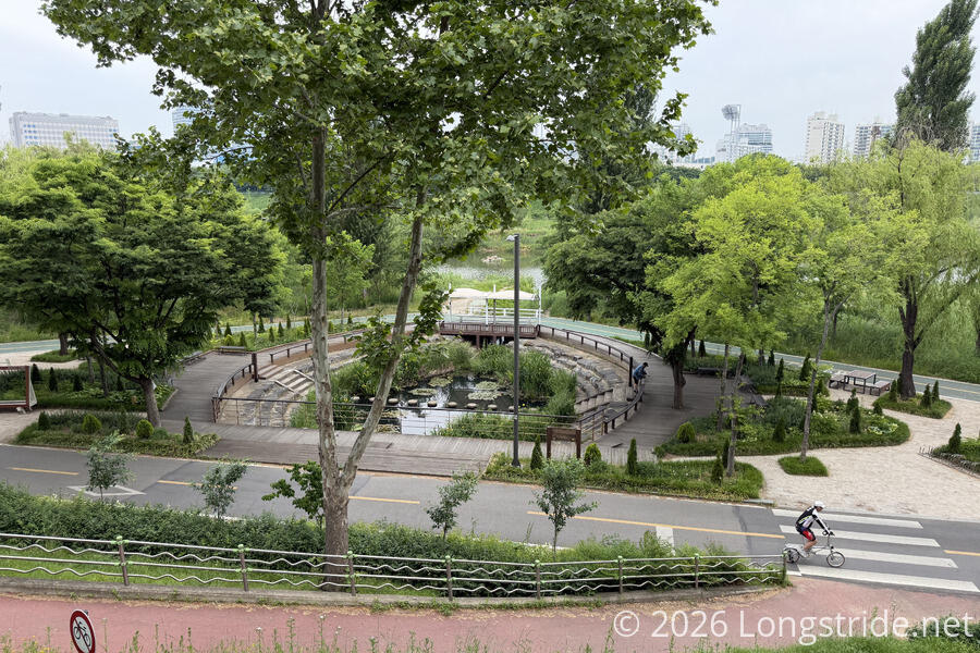
There were several more parks below the trail’s path, next to the river, with quite some amount of landscaping done. An ecological park also provided even more green space for walkers, runners, and cyclists.
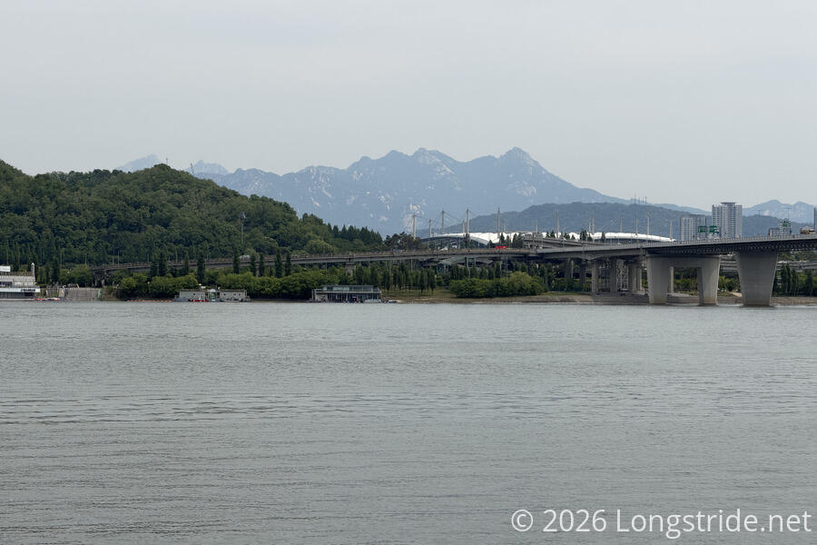
Eventually, the path following the Anyangcheon came to an end. Diverting away from the highway, it followed the side of two soccer fields, then a couple of baseball diamonds, eventually making its way to the Han River. With overcast skies, the river looked grey and drab. Across the river, I could see the top of Seoul’s World Cup Stadium, which I’d walk past two hours later. Beyond that was the mountains that make up Bukhansan National Park, which I’ll be walking along the next two days.
Nearby, the World Cup Bridge led to the stadium. If I’d been pressed for time, the bridge has a pedestrian path that would have taken me across the river, but instead, the trail forms a roughly 6.5 km U to cross the river downstream.
Turning west, the trail crossed the Anyangcheon’s confluence with the Han on a pedestrian and cyclists bridge, and followed the south bank of the Han. (It should come as no surprise that this path followed the river east as well. A continuous walking and cycling infrastructure follows the bank all of the way to where I crossed the river in Stage 6 four days ago!)
I stopped for a break just before the trail turned away from the river. An old guy who sat down at another bench after I arrived was very enamored with my beard, and in broken english, suggested that I must be a talented movie star. (If only!)
A short jaunt along another park (with more sports fields) brought me to the Gayang Bridge over the Han, and the end of the stage. This is also the westernmost point of the Seoul Trail.
Stage 15: Noeul and Haneul Parks
The trail followed the Gayang Bridge’s western pedestrian ramp from surface level up to the bridge, and across the river, just shy of a kilometer wide at this point. On the north side of the river, the trail followed a staircase (or elevator, at your option) back down to the surface, just outside of an archery range visible from the bridge.
Turning east and starting the return leg of the U-shaped path along the river, the trail followed a path adjacent to the Nanji Wetland, then jogged inland to follow a path below Noeul and Haneul Parks. Side trails went further into the wetlands.
The two parks, and the wetlands, are part of World Cup Park, established ahead of the 2002 Korean-Japan World Cup. The park, mostly comprised of the former island Nanjido, was used as a landfill and joined to the mainland in the 1970s. Giant staircases climb from the base of two of the former landfill mounds to the top (of Noeul and Haneul Parks). The trail largely followed a dirt access road along the base of the landfill mounds.
As the trail reached the east edge of the base of Haneul Park, it diverted from the road, then turned along the park’s eastern edge, following a forested trail north, shaded with a soft dirt and pine needle trail bed. This didn’t last especially long, but it was the nicest stretch of trail so far today; much of the trail to this point had been exposed to the sun. (Or would have been, were it not for the clouds.)
Stopping briefly to cross World Cup-ro (World Cup Road), I couldn’t help but be annoyed at Seoul’s road pedestrian infrastructure. Along most roads, the signals are very pedestrian unfriendly. Yes, there’s sidewalks, crosswalks, the occasional umbrella, and (usually) digital signs showing how long you have to cross, but the timing is very much geared to prioritize cars. There’s no pedestrian call buttons, and the signals are usually silent. The only affordance is a button to turn on audible signals intended for hard-of-seeing pedestrians. (This in contrast to recently being in Auckland, where pedestrian crossings have a call button that does affect signal timing, and which also activates an audible alert meant for all pedestrians.)
Directly across from the World Cup Stadium, the trail diverted to walk through the Oil Tank Culture Park, which is exactly what it sounds like. Following the 1973 oil crisis, the Seoul government built an oil storage depot to prepare for potential future oil crises. When World Cup Stadium was being constructed, it was determined that an oil depot only 500 meters from the stadium was unacceptably dangerous, and the oil stored there moved elsewhere. Afterwards, the site was redeveloped, turning the oil tanks into a variety of cultural spaces, including performance and exhibition halls. Sadly, feeling a little pressed for time, I didn’t take the opportunity to investigate the park further, but it’s a fantastic way to repurpose unused infrastructure for the public benefit.
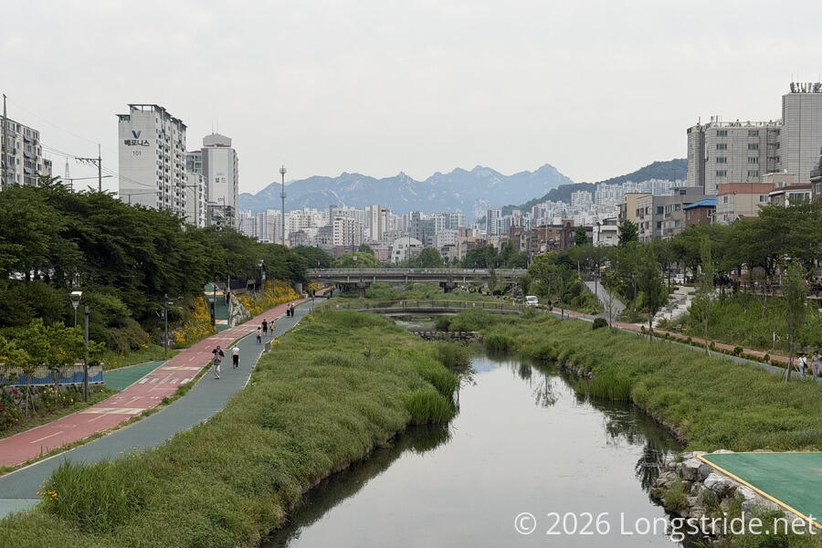
Passing the stadium, I again found myself on a walking and cycling track along a stream, Bulgwangcheon Stream.
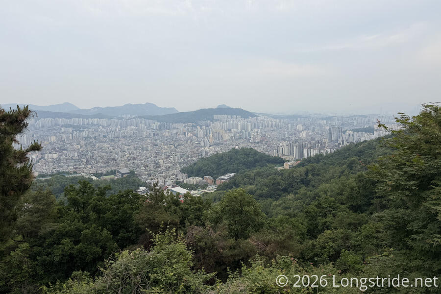
The trail followed the stream only briefly, but despite the dreary skies, it was quite scenic, especially with Bukhansan rising above the city in the distance.
Tired, and my knee a little unhappy, I decided to go only a little further past Jeungsan Station, to the end of the section, grab the stamp there, and then return to my guest house. But, the last bit of the section was a rather steep climb up the back road of a neighborhood, to the Jeungsan Sports Park, halfway up the top of the hill, and by the time I got there, I’d decided I wasn’t going to walk back down to to the subway station, only to have to walk back up again tomorrow. (Or rather, in two days: It’s supposed to rain tomorrow, so I’m taking a day off.)
Stage 16: Bongsan and Aengbongsan Mountains
From the Jeungsan Sports Park, the trail continued uphill, reaching, and then following the ridge to Bongsan.
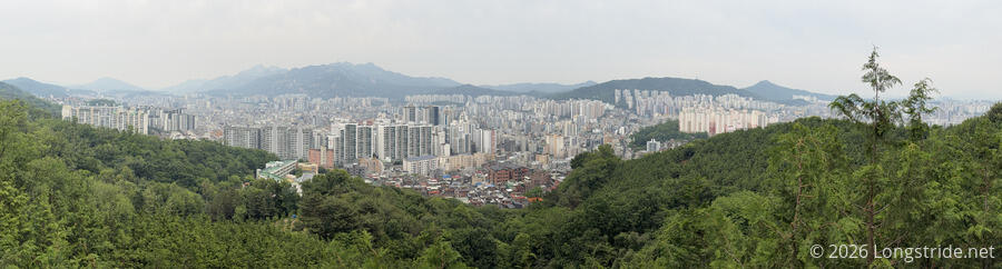
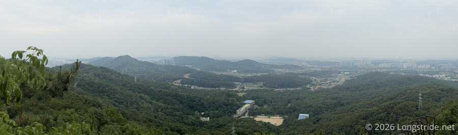
Once the trail got up to the top of the ridge, it was fairly smooth hiking, with the trail gradually bouncing up and down. Several viewpoints provided good views of the surrounding area, though the views were getting more and more hazy as the day went on.
Besides just a nice dirt trail, a very nice wheelchair-accessible boardwalk also provided access along the ridge. And, of course, there were plenty of trails that dropped down the sides of the mountain to neighborhoods on either side.
Some of the boardwalk was actually under construction: a small crew of workers was out, welding metal supports together on a boardwalk just downhill of the trail. A very large stack of planks sat next to the trail, waiting for installation.
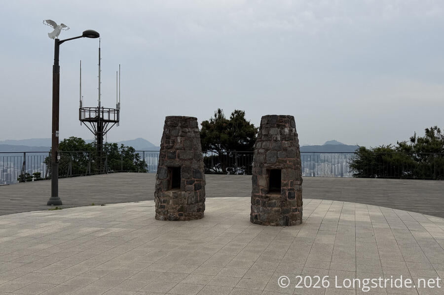
Following the ridge almost due north, the trail reached the Bongsan summit, literally, “Beacon Fire Mountain”, so named for the beacon that’s been in place on the mountain since the Joseon Dynasty (founded in 1392). The mountain is also known by the name Bongnyeongsan, “Phoneix Ridge Mountain”, since the ridge is said to resemble a phoenix sitting down while spreading its wings in peace.
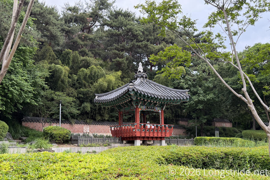
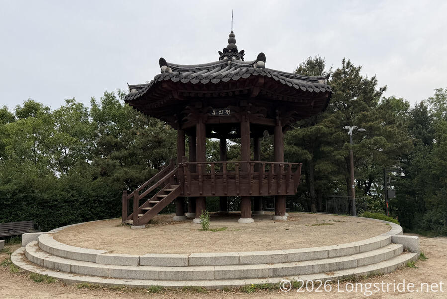
Besides the beacon and observation platform, a pavilion shared the summit area.
Leaving the Bongsan summit, the trail continued along the ridge, with boardwalk downhill, probably leading to the neighborhoods at the base of the mountain. At one point, the trail almost came within spitting distance of a row of apartment buildings. (Of course, a connector trail ran down to them.)
The next mountain along the ridge was Aengbongsan, “the mountain of many nightingales”. I didn’t hear that many songbirds, but it was still a nice trail. At the summit, an observatory faced west, one of the relatively rare views out of the city.
After a quite long day — 27 km, the longest day I’ll have on the trail — the trail exited the mountains, with yet another stamp box at the end of the section. A short distance later, following the next section along the city streets, I reaching Gupabal Station.
I briefly considered hiking the next section, which was rather short — it’d probably only take an hour and a half — but my knee was well past quitting time, and I let that thought go, taking the train back to my guest house.
The train car I was in had a sign claiming (in both Korean and English) that it was a “car with weak air conditioning”, offering the further explanation that it was “for passengers who prefer weak air conditioning”. Despite the sign, the air conditioning actually felt stronger to me than in other train cars I’d been in.
With rain forecast for the whole day tomorrow, I’ll take the day off, and let my knee rest. After that, it’ll just be two more days to ago, as the trail circles around Bukhansan National Park.