A dreary and occasionally rainy day dampened the mood as the Seoul Trail began its route through Bukhansan National Park.
Stage 17: Bukhansan Mountain: Eunpyeong Course
After a quite rainy day yesterday, I returned to Gupabal Station and continued east, almost immediately following Jinpannae Stream, winding in its valley sandwiched between high-rises and separated from the nearby road. The occasional bridge or set of stepping stones allowed access to neighborhoods on both sides of the stream.
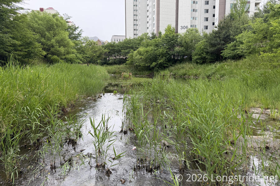
Originally forecast to be sunny today, it was instead overcast, cool, dreary and a little windy. The sky didn’t look all that great, but the forecast now said that it wouldn’t rain, so it should be fine, I figured. And, the weather wasn’t stopping anyone else from walking along the stream.
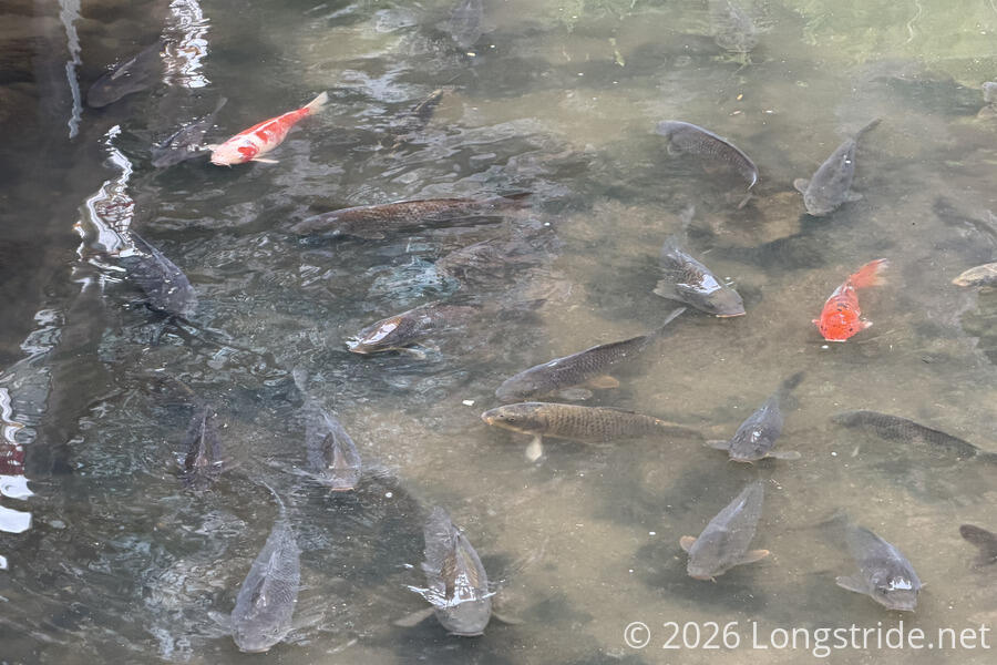
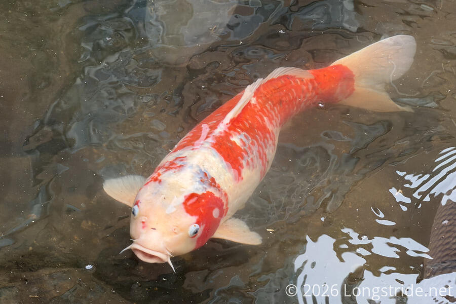
A small school of large koi flocked near a bridge. A nearby sign warned not to feed the fish. I doubted many people followed its instruction.
After not too long, the trail returned to the sidewalk along the road. The street had lotus lanterns strung up, likely for the Lotus Lantern Festival. I wondered how long they’d continue to be up.
In spite of the weather forecast, a light rain briefly fell. The rain quickly stopped, but even with the breeze, it was quite humid.
Entering a park, the trail looped around the backside of some apartment buildings. A trio of signs in quick succession stood out as unusual: a vinyl sign zip-tied to the fence around the high-rises warned against “acts that cause disgust to others, such as body exposure” (is that why so many people are completely covered from head-to-toe?); a sign warning a fence gate was used to keep wild boars out (the gate was open); and a sign warning of stray dogs, asking not to feed, approach, or provoke them.
The Seoul Trail also began to overlap with the Bukhansan Dulle-gil, a 70 km trail through Bukhansan National Park. As a result, for the rest of the day, there were fewer Seoul Trail markers, and quite a few “Dulle-gil” trail markers.
Exiting the park, the trail briefly followed a city street to enter another park. For most of the rest of the day from here, the trail was at the very edge of the city, where the streets and buildings stopped and the mountains of Bukhansan National Park really start.
At the top of a hill in that park, was a restroom. It was closed, literally boarded up. I think this is the first closed restroom I’ve seen so far on the trail, which was quite inconvenient, since I would have liked to use it.
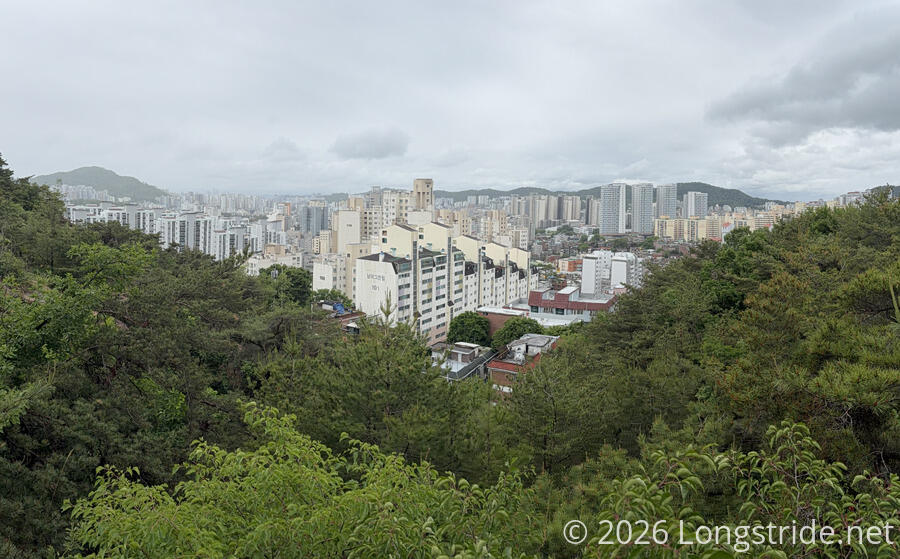
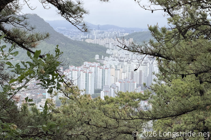
A sign, map, and staircase announced the entrance to Bukhansan National Park, and shortly after, I got my first decent view of the city today.
Winding around the mountain a little more, the trail dropped back onto a city street, reaching the end of the section.
Stage 18: Bukhansan Mountain: Jongno Course
Starting from the end of a road in a crease on the side of a mountain, the trail quickly jogged downhill and along a trail through a small park. Crossing a major road, the trail quickly started up a steep hill via another staircase.
Climbing straight up to the top of a ridge, the trail came to another nice viewpoint overlooking the city, with high-rises flowing like a river through a gap between two ridges.
Following the ridge, the trail crossed part of the wall that made up the Tangchun Daesung fortress, originally built in 1718-19. If I understood correctly the translation of a sign describing the wall, the wall originally connected to Inwangsan, a mountain to the south that is on the Seoul City Wall Trail, a loop following Seoul’s old city wall, and which connects the summits of Inwangsan, Bugaksan, and Namsan.
Despite the soggy weather, I was surprised at the number of people that were out walking in the forest.
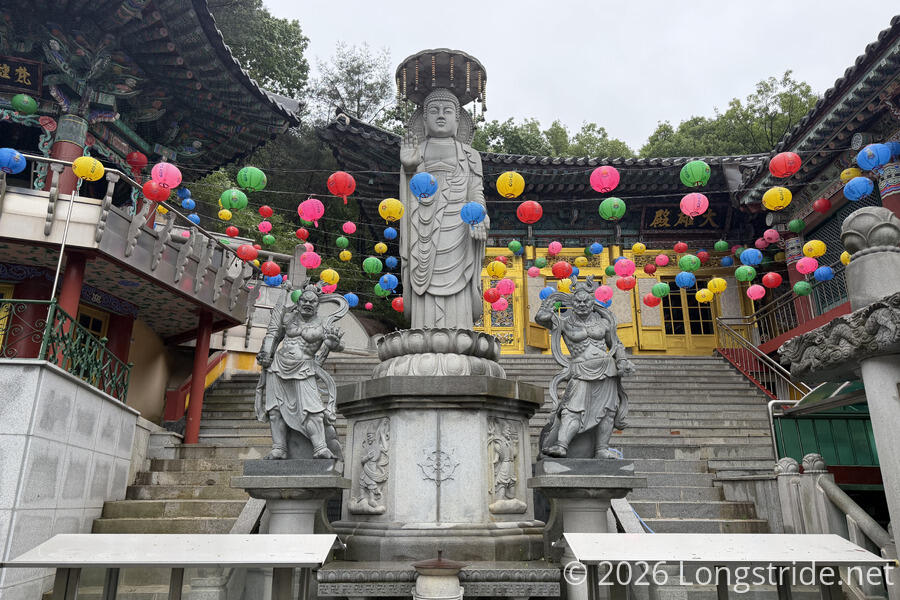
After crossing the wall, the trail began heading back downhill, leaving the forest via what seemed like someone’s extremely steep driveway. I passed a temple with a large swastika painted on it. I expected this would happen sooner or later, given the swastika is a prominent symbol in Buddhism.
Now winding through streets, rather than driveways, the trail rejoined the road I’d crossed on the other side of the ridge, after it came out of a tunnel through the mountain.
The rest of the section was on sidewalk or narrow street, passing through what seemed like a ritzy neighborhood (which included at least one ambassador’s residence), and a few more temples.
This section has been my least favorite so far. Certainly, the weather (which included some drizzle and a little light rain) didn’t help, but more than half the section was on somewhat steep roads, often at the very edge of the city’s extent up the mountain.
The section ended at another entrance into Bukhansan National Park. Rather than a subway station, the transportation for this section was a bus stop about five minute walk away from the trailhead. Still early in the afternoon, I’d briefly considered doing the next section in order to make tomorrow shorter, but since the weather showed no signs of getting any better, that seemed like a bad idea. Especially with tomorrow’s weather forecast calling for sunny skies. So, I walked down to bus stop and took the bus back to my guest house, getting dropped off only a couple minute walk from the Seoul Station subway exit I’ve been using for the past week.
The sun came out around 7 pm, after two days of rain and grey skies. It was really nice to have the bright sun light out after two dreary days of rain. Hopefully, it will continue to be nice and bright and sunny tomorrow for the last day of the Seoul Trail.