One last day on the Seoul Trail continued to circle around Bukhansan National Park, bringing me back to the Seoul Iris Garden, where I started the trail just over a week ago.
Stage 19: Bukhansan Mountain: Seongbuk Course
As expected, the bus ride back to the trail was uneventful, and after a few minutes of walking back to the trailhead, I reentered Bukhansan National Park.
After two days of rain, the forest was more lush and green, and the sky, which had been a little hazy over the past week was a little less so. With barely a cloud in the sky, it was bright and sunny today. And, despite the rain, the trail was remarkably dry.
Not even five minutes into the section, I saw a tree fallen on the trail, the first and only time I’ve seen that on the Seoul Trail. Most likely this was a result of the wind and rain the last two days. Given how much of the trail is connecting different neighborhoods via the woods, it’s really not surprising that fallen trees would normally be quickly swept away, and I bet the tree will be gone pretty quickly. (I think is close to a record for trails I’ve hiked; only the Australian trails I’ve hiked have come as close or better in terms of fallen trees on the trail.)
Shortly after, as the trail crossed a creek, I accidentally made a turn that took me up the mountain towards a temple. Further up the hill on the temple grounds, a cat stopped its patrol to watch what I was doing, until I retreated back down the hill and returned to the trail.
Just past the fork to the temple, the trail crested a ridge and started downhill. A short steep section was almost on the verge of rock scrambling, a rarity on this trail.
Near the bottom of a valley, a dirt crossroad went to a ranger station, with at least two park rangers milling about. This was, I think, the first time I’ve seen park rangers on the Seoul Trail.
Just past the ranger station, a little further down the valley near a small creek crossing, several benches sat near displays describing the local bird life — this was apparently a good spot for bird watching.
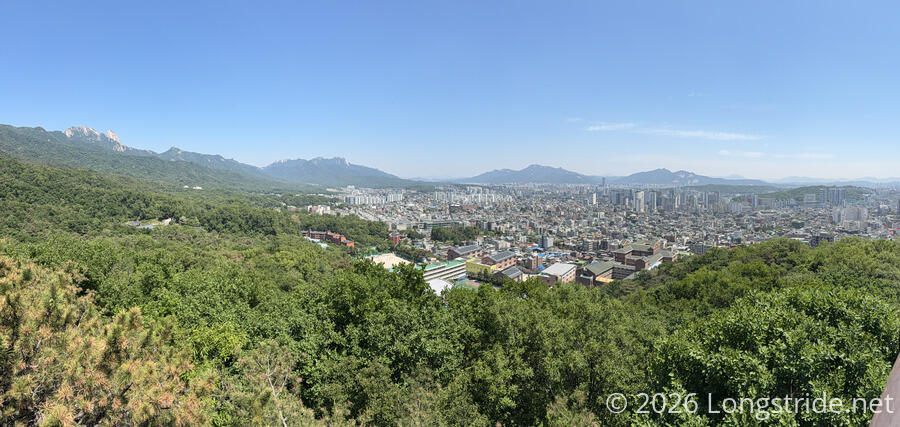
The start of the section was nice, but especially once I got to the first view, I was glad I didn’t attempt to walk this section yesterday. It would have been rainy and miserable, without much of a view. Now with the sun out, and with some of the haze cleared because of the rain, the views of the city were nicer than they had been so far.
Shortly after, the trail exited the forest, going through an active construction site, some kind of road work. Turning down the road, I passed the first other people (excluding the park rangers) who were on the trail. Given how nice the weather was, it took a surprisingly long time to see anyone else; I think this was probably because this particular section felt a bit more remote.
After passing through a small community park with a small lily pond, the trail crossed another active construction site, then passed behind what seemed to be an old apartment building converted into a temple.
The first observation tower today was the Huingurem Observatory. Rising above the trees, the platform gave a great view of the northern portions of Seoul, and several of the mountains on the outskirts of the city, including Baegundae Peak (the highest mountain in Seoul), and Suraksan and Buramsan, which I walked along on the first day on trail.
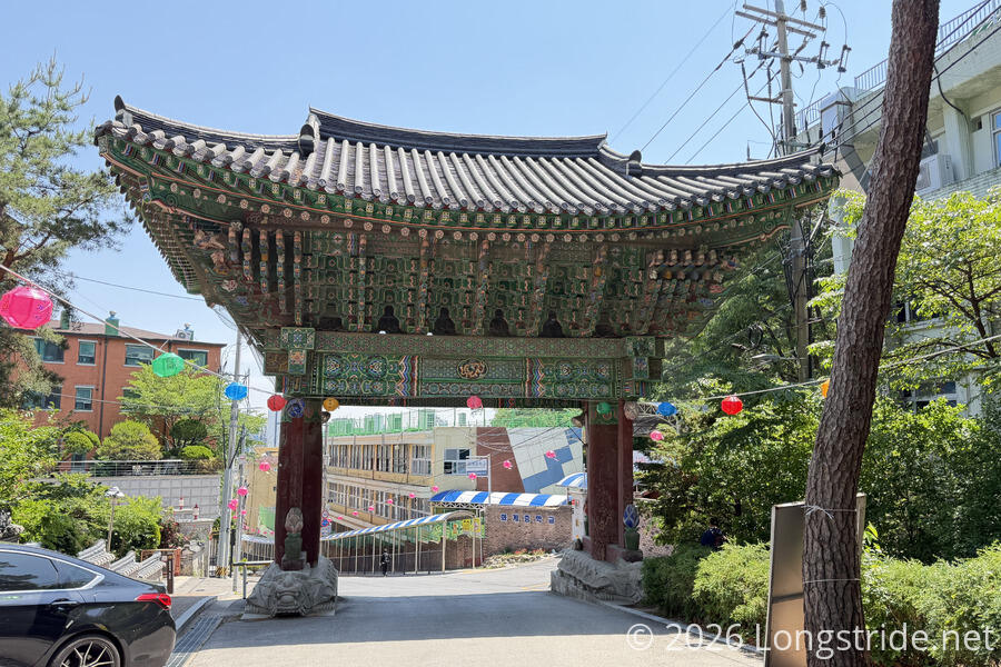
Down the hill from the observatory, the trail crossed the road leading to Hwagyesa Temple, where the section ended.
Stage 20: Bukhansan Mountain: Gangbuk Course
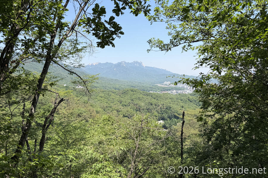
From the temple gate, the trail immediately re-entered the forest, climbing up along a ridge, making a long, lazy zig-zag. A brief gap in the trees revealed a view towards Dobongsan.
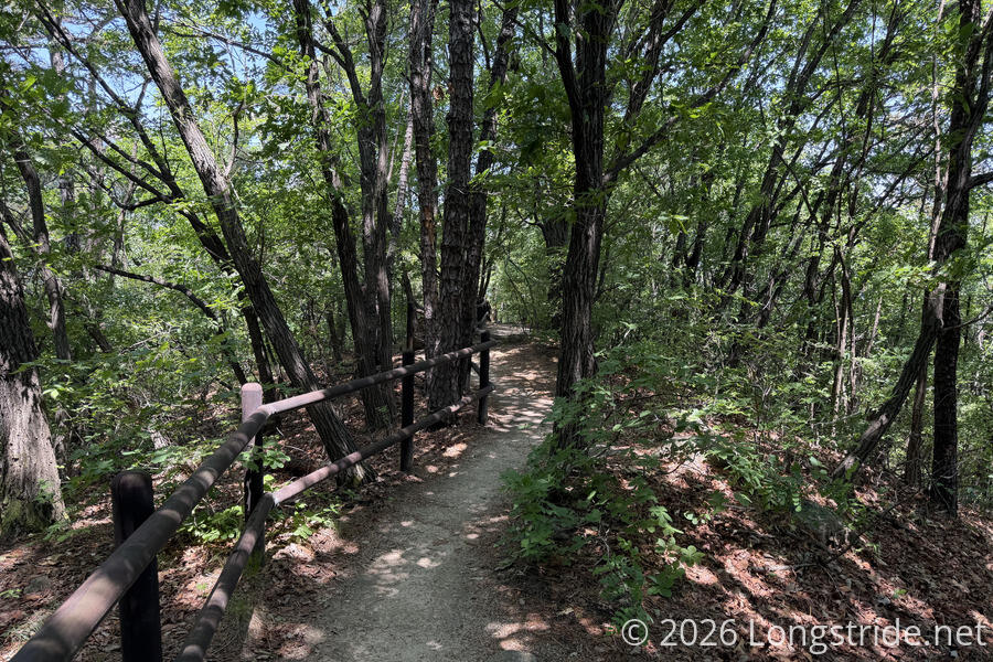
There was an absolutely incredible amount of elevation gain (and loss) today as the trail constantly climbed up and over the mountains’ ridges and valleys. Over the course of the whole day, I measured nearly 1,400 meters of gain and loss over about 21 km! I think this was the most out of any day on the trail.
For a while, the trail continued bouncing up and down, occasionally and briefly following roads on the outskirts of Seoul, and passing by several tombs and memorials for prominent historical figures.
A major landmark in this section is the April 19th National Cemetery, commemorating those who died in protests on that day in 1960 when police fired into a crowd of students protesting anti-democratic actions taken by South Korea’s president and government.
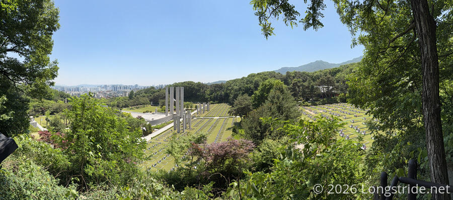
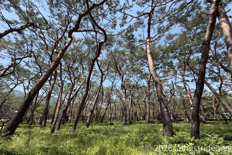
Later, the trail returned to the city streets, passing through the Solbat Neighborhood park, which had a thin forest that felt very out of place.
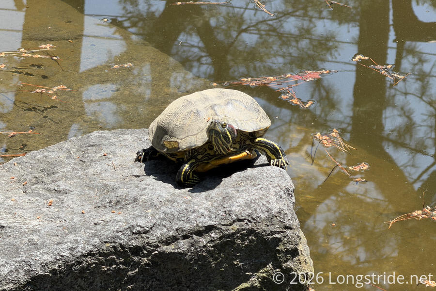
The section ended with a moderately long stretch along a road, passing a lively shopping area and a subway station.
Stage 21: Bukhansan Mountain: Dobong Course
The final section of the Seoul Trail followed along the base of Dobongsan, passing more temples, tombs, graves, and memorials.
This seemed to be a relatively more wild section of the forest, with several fences and gates crossing the trail to control the movement of wild boars.
It also had a somewhat unique observation platform. A spiral staircase led up to an octagonal platform, connected via a small bridge to a second platform and a spiral staircase back down.
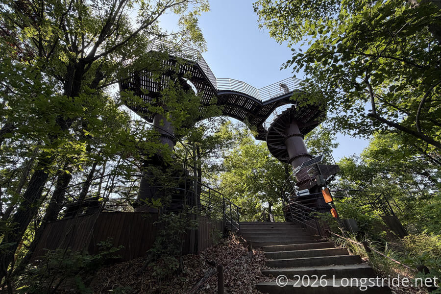
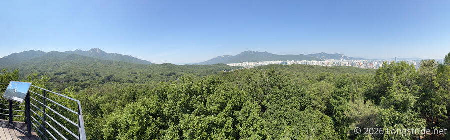
The forest ended near the Neung-Wonsa Temple, with a massive gate and view of Dobongsan peeking over the forest behind the temple.
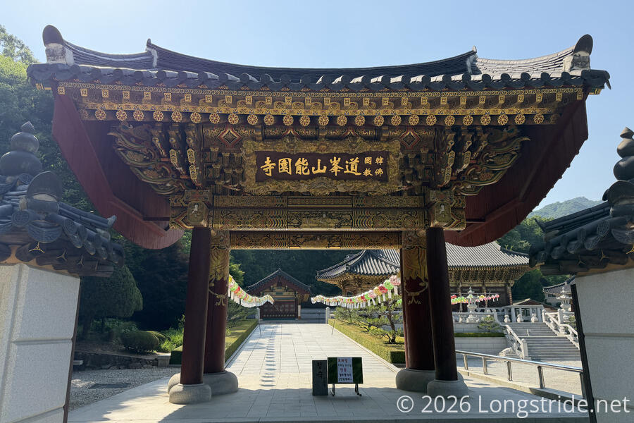
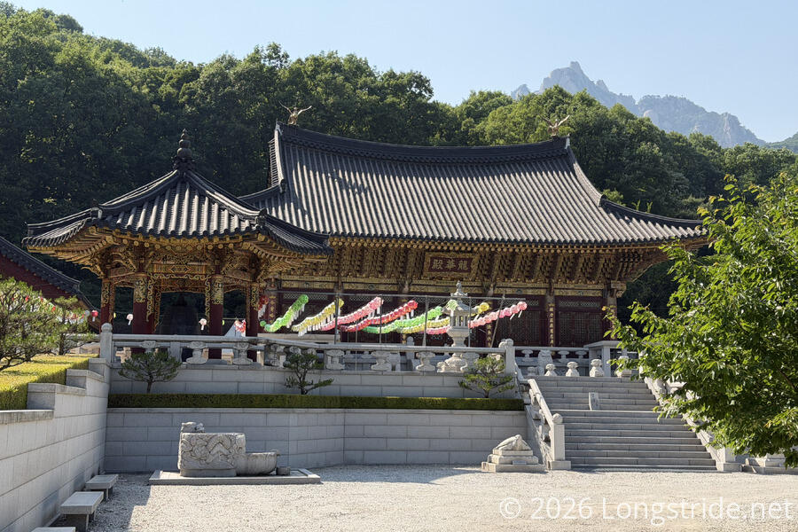
Somewhat unsurprisingly, there were a lot of people around the temple. A dirt road led back towards town, passing a large street market with quite a few outdoor gear stores.
Thanks to the distraction from all the people, I missed the final stamp station, and had to double back to find it. Fortunately, that only cost me about 10 minutes. A short walk past more street markets and restaurants brought me back to Dobongsan Station, where I’d arrived eight days ago to start the trail. Just a little further took me back into the Seoul Iris Garden to finish the trail, right where I started.
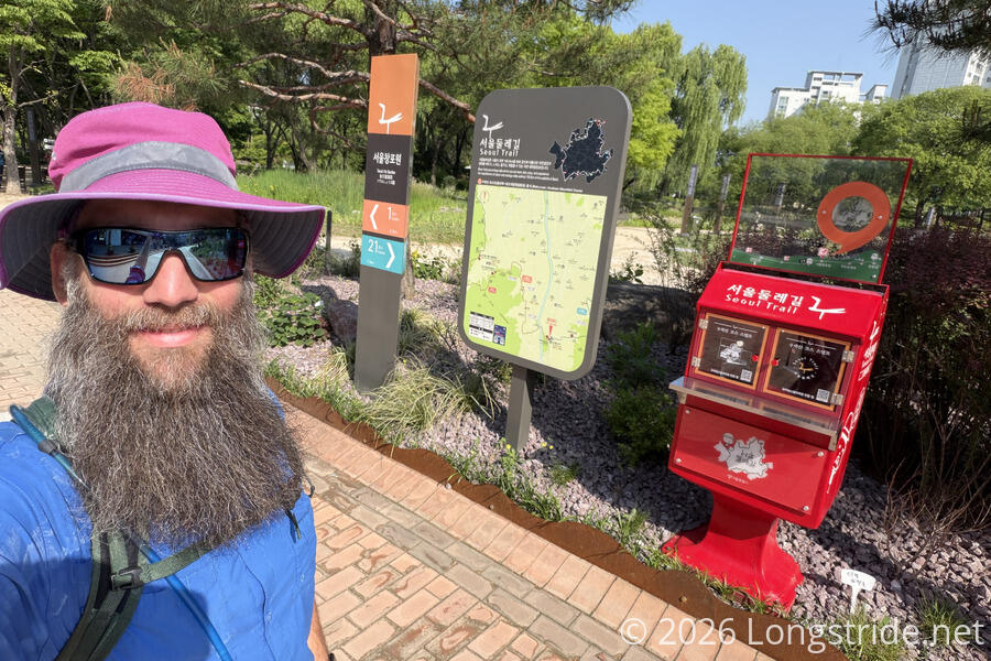
Opposite the start of the trail, is an information office, which I’d skipped when I got here first time since it looked busy. It seemed less busy as I finished the trail, I think because I got there right at the end of the day as they were trying to leave.
Part of the reason I’d bothered to collect all of the stamps along the trail — 28 in total — is because a completed stamp book is taken as proof that you’ve hiked the trail in its entirety. By turning in a completed stamp book at the office (and filling out a short survey and application), you are awarded with a certificate of completion signed by Seoul’s mayor, a trail pin, and a blue Seoul Trail completion ribbon. The certificates are numbered; mine is #99,561.
I should have taken the time to wander the iris gardens, but after the rather frenetic pace in the office, coupled with my knee deciding it was rather done with walking for the day, I immediately returned to Dobongsan Station and hopped on the train back to Seoul Station.
The Seoul Trail was a fantastic peek at South Korean culture, and in particular, their attitude towards outdoor recreation. Though it has parallels with Newfoundland’s East Coast Trail, the Seoul Trail is in a league of its own for participation by those who live near the trail.
With the Seoul Trail complete, I have some bonus miles to look forward to. Tomorrow, I’ll make a (much!) smaller loop around Seoul’s city center, along the Seoul City Wall Trail!