Continuing west along the southern outskirts of Seoul, the trail took me over a few mountain summits.
Stage 9: Daemosan and Guryongsan Mountains
Practically right from Suseo Station, a staircase led (steeply) up the side of a hill, following a zig-zaggy ridge that would eventually lead to Daemosan Mountain.
The first thing I noticed about the trail this morning was the large number of runners out. Nearly all of them were heading towards the forest entrance, though it was impossible to guess where they might have started from. Fortunately for them (and me), it wasn’t as hot out today as it was yesterday.
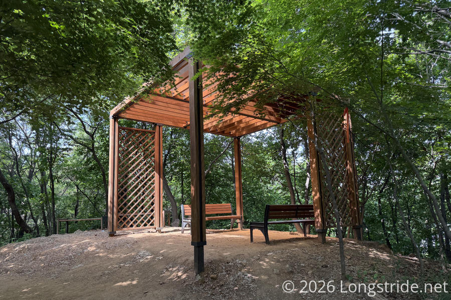
The trail was replete with picnic tables and benches — quite a few of them covered. Many were in use.
Only about twenty minutes in, I turned off the Seoul Trail. The Seoul Trail proper goes around the north face of Daemosan and Guryongsan Mountains. But a trail (one of many on the mountain) climbs to the top of the ridge, and follows the ridge to the summit of both mountains. That seemed like a more interesting hike to me, so I followed that, though it meant skipping Bulguksa Temple, which is nestled in a hollow below the Daemosan summit.
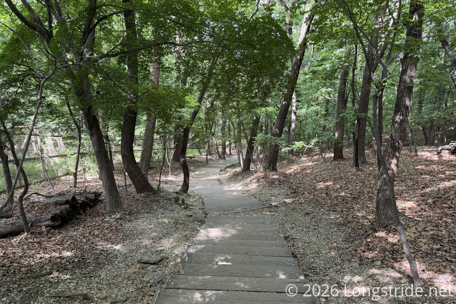
Leaving the intersection with the Seoul Trail, the trail leading to the top of the ridge got somewhat more steep. It was still easily walkable, of course, and plenty of residents were doing just that. Once up on the ridge, the trail was not particularly challenging. It was perhaps a little steeper than usual, with quite a few more benches than typical reflecting that.
It did seem that every couple hundred meters, there was a junction from some trail that climbed up the side of the mountain from a school or apartment building. (At least, that’s what the signage indicated.) This is a very well connected ridge top.
The Daemosan summit had a marker, but trees obstructed any view there might have been. Still, it was a quiet, forested mountain top, and several benches and seating areas at and near the summit all made for nice places to take a break. A short distance later, though, a clearing at a helipad gave a view to the north, towards the city.
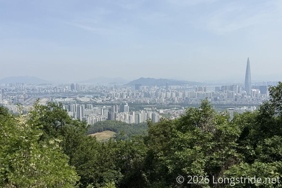
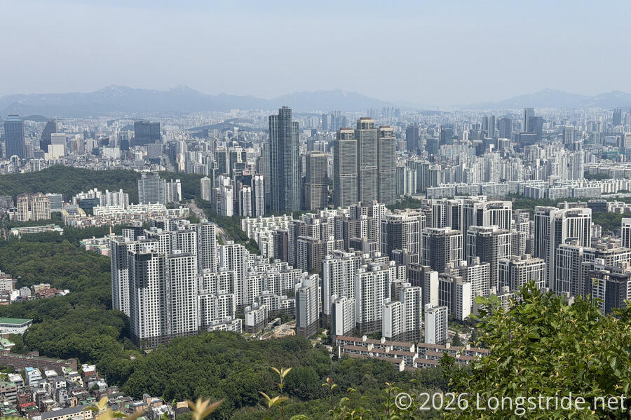
Lotte World Tower continues to stick out like an overgrown sore thumb. I was pretty sure it was taller than Daemosan (291 m); after I finished for the day, I looked the building up and found it was 555 meters tall, easily taller than many of the mountains in and around Seoul.
Even though I still wasn’t on the Seoul Trail, trail maintenance atop the ridge was still excellent, with easy dirt trail and wooden staircases as necessary on steeper sections.
The ridgetop, with its long sightline over Seoul, was the perfect place to put a cell tower, guarded by a fence with a warning of prison time, and (of course) a CCTV camera. Not only was the tower painted brown to look vaguely like a tree, but it had fake bark the whole distance up to the comms equipment. The only thing it was missing was something green at the top of the mast to really sell the illusion.
Also evident on prior days, but especially so from this ridge, is that many high-rises in Seoul are built in groups of near-identical buildings, giving a sense of repetitive uniformity.
What seemed like a summit marker for a minor peak divided the trail. From there until the junction with the Seoul Traill, there were significantly fewer people on that part of the ridge, and the trail got a little rougher and less developed. A lone woodpecker briefly made a bit of a racket pecking into a tree, and I remembered that I hadn’t seen the grasshoppers that had been so prevalent the first two days on the trail since then.
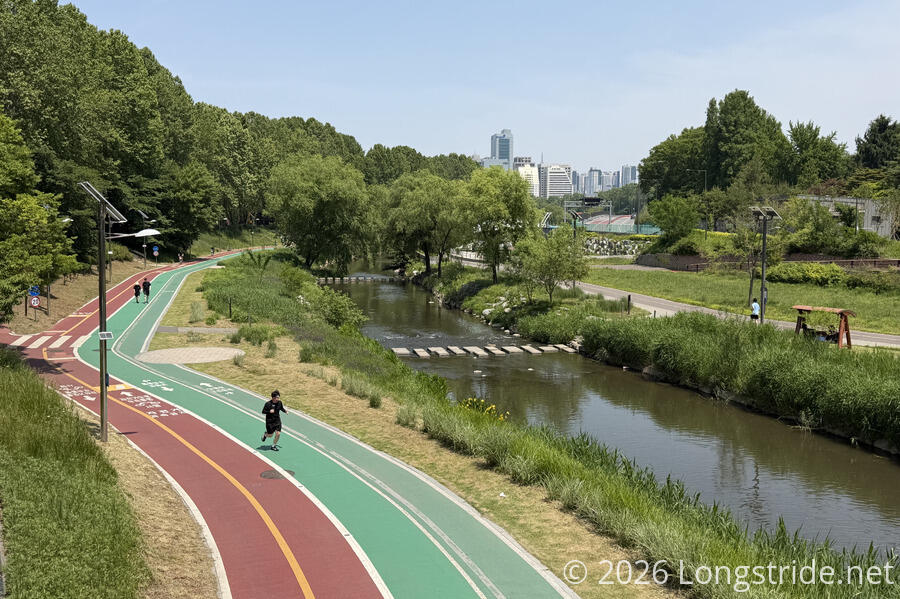
Eventually dropping off the ridge, the trail made its way back out onto city streets. Ribbons marking the trail were hard to see at a major road intersection, and through an area of road construction. It wasn’t immediately clear where I needed to go, but knowing the general direction I needed to go, I was able to muddle my way through, though I wound up on the wrong side of a small river (the Yeouicheon River). This wasn’t really a problem, though, the trail eventually crossed the river on a bridge to the side I was on.
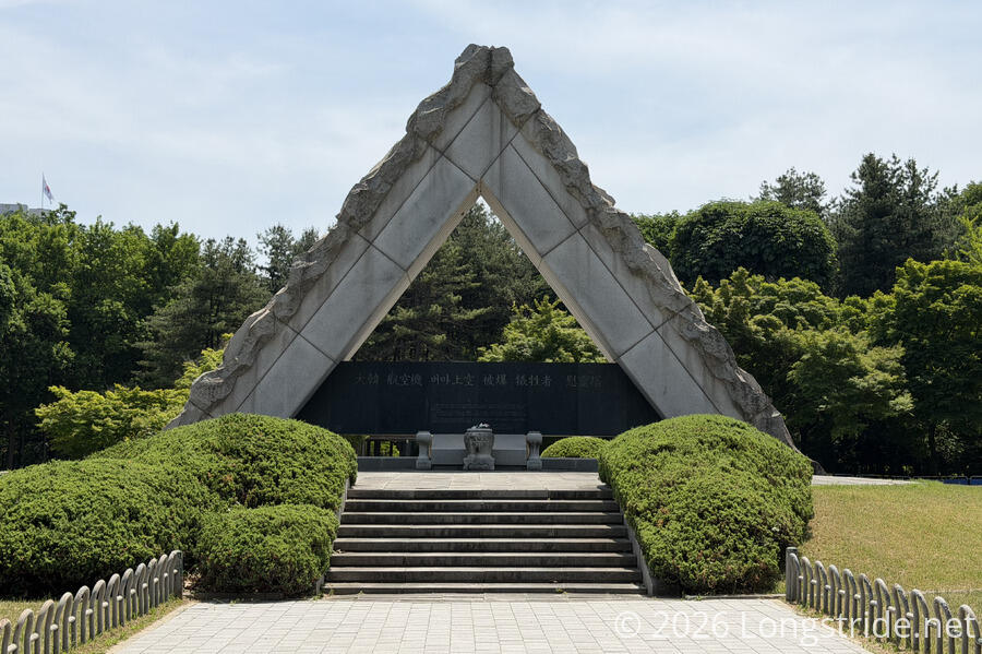
The trail departed the river to enter the Yangjae Citizen’s Forest, a small, triangle-shaped park wedged between the Yeouicheon River, a highway, and a smaller road. the forest has several monuments, including one for the bombing of Korean Air Flight 858, and one for the Baekma (White Horse) Guerrilla Corps, a 2600-strong group of students and youth who self-organized to assist (with no proper weapons or equipment) in the Korean War.
Stage 10: Umyeonsan Mountain
Crossing the road that formed the Yangjae Citizen’s Forest’s northwest border, the trail entered the Maehon Citizen’s Forest, an extension of the Yangjae’s wedge shape, and a stamp box and trail map marked the beginning of a new section.
Where the Yangjae forest had a bit of a quiet, solemn air to it, Maehon was much more lively, with a large picnic area and playground in very heavy use.
Maehon Citizen’s Forest was not much larger than its predecessor, and I quickly left the park, crossing Yangjaecheon Stream on a pedestrian bridge, and following some smaller streets.
After briefly cutting through a neighborhood park, the trail headed up a ridge, climbing maybe halfway towards the top of Umyeonsan Mountain, before veering off to follow the mountain’s north face.
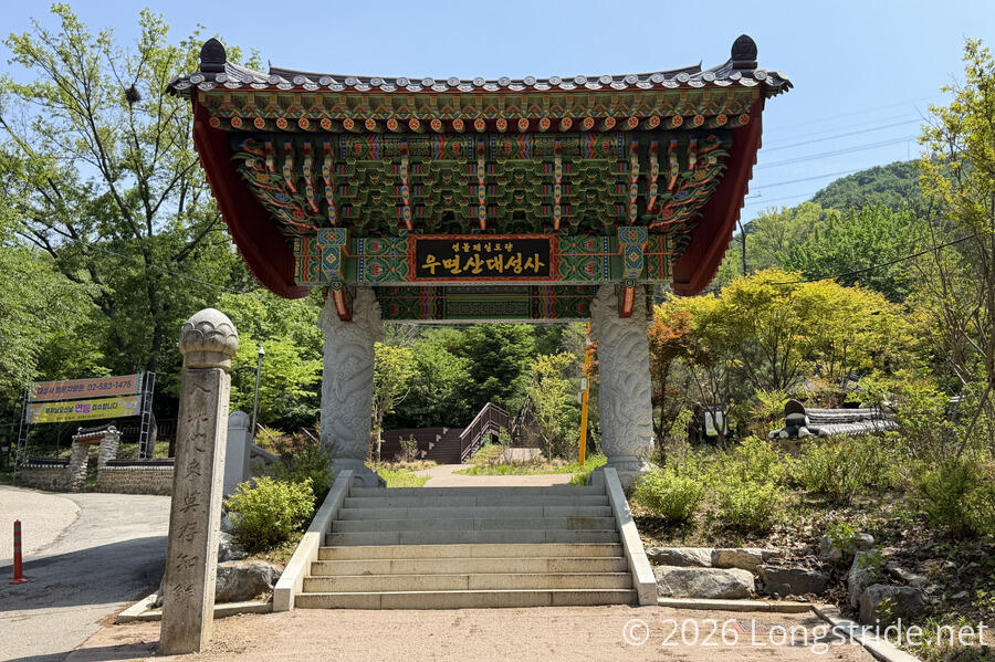
The trail passed near the entrance to Daeseongsa Temple. Clearly a popular place for walking, there was an extensive set of parallel wheelchair-accessible boardwalks.
Past the temple, the trail waved in and out along the lower portion of Umyeonsan Mountain, crossing several dry drainage valleys, a few of which were paved or bricked (with large stone blocks) to control erosion.
After exiting the forest and returning to city streets, the trail quickly made its way to the end of the section, near Sadang Station.
Now nearly 3 pm, I decided it was a little later than I’d like to begin another section, so I hopped on the subway and returned to my guest house in the city center. Tomorrow should be a bit longer, since I won’t be tired from standing at a parade for three hours!