Three more sections on the Seoul Trail take me through several parks, over two mountains, and across the Han River, as I continue my trek around Seoul.
Stage 4: Mangusan and Yongmasan Mountains
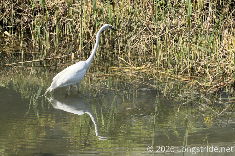
Continuing where I left off at Hwarangdae Station, the trail followed Mukdongcheon Stream, a small stream nestled between walking and cycling paths on either side. Numerous waterbirds, including a heron and some ducks called the stream home.
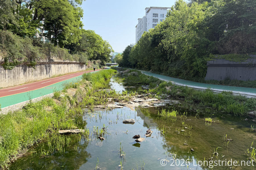
The trail followed the stream for about half an hour, with plenty of benches along the stream’s course. A stamp box marked the entrance to Sinnae Eoul Park, which had more benches, an exercise station, a basketball court, and a pair of tennis courts.
Exiting the park, I followed city streets for about twenty minutes, then began a brief ascent in a park.
Long ago, on the Appalachian Trail, I would occasionally joke about how trail maintainers needed to sweep the leaves off the trail to make it easier to see the ground. Today, I actually saw someone doing that: sweeping dried tree blossoms off the trail. I guess it made the trail seem more tidy, but to me, the trail looked more interesting and natural with the blossoms on the trail. (The sweeping also kicked up dust into the air, as some of the dirt on the trail was being swept off also.)
On the other side of the park, the trail reached a parking lot, and it took a little while to figure out where exactly I needed to go, before a local pointed me in the right direction. (There were hard-to-see marker ribbons on the other side of the full parking lot.)
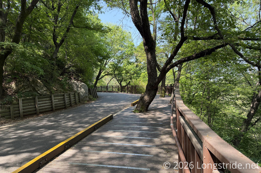
After crossing over a highway, the trail began its main climb of the day, in the Mang-u History and Culture Park. Following a road, narrowed to one lane with a (usually) wooden walking path on the side, this was a nice, shaded path up the side of the mountain. Naturally, there were plenty of benches along the way, and plenty of other people walking into the park.
The park is also a large cemetery (now closed for new burials), with numerous graves on both sides of the road. Some of these are for prominent historical figures, with trails going up and down the mountain to their burial sites.
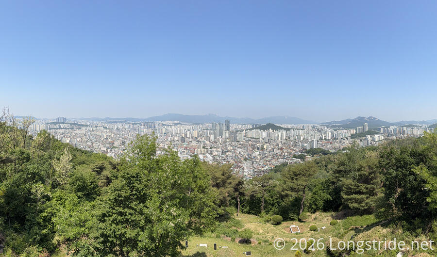
At an observation platform overlooking the city, a large group of school kids were standing on the platform taking a group photo, with several more large groups of kids — clearly, a large class trip — waiting on the road for their chance to take pictures. This dwarfed yesterday’s group at the Iris Gardens.
Stage 5: Achasan Mountain
At a saddle, with the trail reaching the mountain ridge, a stamp station and large shaded area with benches marked the beginning of a new section. After a break, I continued up the ridge, starting at a sign that “warned” there were 570 stair steps ahead.
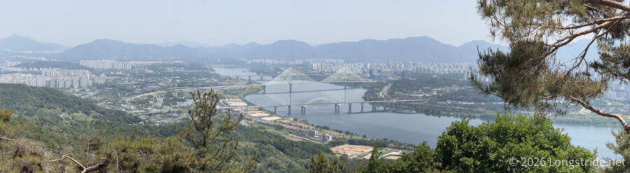
And sure enough, the ridge got quite a bit steeper, as I followed a long series of staircases up. On the way, there were occasional viewing platforms with benches and great views out to the Han River, to the south and east. This kilometer-wide river bisects Seoul, and there are 31 bridges across the river in the Seoul area. The trail will cross the river twice: later today, and further downstream, in a few days.
A sign at the top of the stairs congratulated me for climbing the 570 stairs, which supposedly extended my lifespan by 35 minutes. Beyond there, the trail flattened out a bit, and a ver short while later, reached another saddle, with a sign pointing off in the direction of the Yongmasan Mountain summit, only 600 meters away. Not feeling much time pressure for today, this seemed like a reasonable side-trip, and ten minutes later, I was atop a mountain.
The summit area had a large upright stone with the mountain’s name and elevation, and a short viewing platform with markers for the cardinal directions. If I hadn’t already just taken a break, it would have made for a nice spot for a break, except that there were also a lot of people milling about, and the largely forested mountain top didn’t give much in the way of views that I didn’t get earlier, or later, in the day, and I I quickly backtracked to the trail.
While the exercise stations along the trail so far have largely seemed to be for stretching and mobility, just below the Yongmasan summit was a large covered weights station: barbells, dumbbells, benches, and foam padding on the ground! (And people were actually using it!) Maybe the nearby helipad was used to bring the weights up, but if not, this was a lot of work to set up.
The trail left the Yongmasan ridge, following another ridge to Achasan Mountain, and continued following that ridge south. Achasan is home to the archaeologically valuable remains of a string of four forts along its ridge, dating back to the Three Kingdoms period (late-5th to mid-6th century). There’s not much remaining now — largely just some walls and water pits, but enough that it reminds you that Seoul is not a new city.
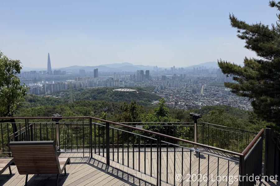
On the way down the ridge after passing the Achasan summit, I stopped briefly at an observation deck at a monument commemorating the new millennium. In the distance, I got a reasonably clear view out to Lotte World Tower, which I’d seen yesterday partially obscured an in more haze. The tower, the tallest building in Korea, and the sixth tallest building in the world, is ridiculously oversized compared to the rest of the skyscrapers in Seoul.
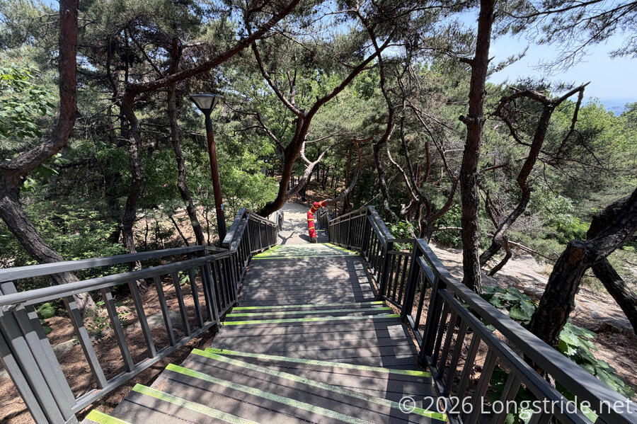
More stairs, including a staircase containing a tree wrapped in highly-visible red fabric, led the rest of the way off the mountain, and back towards the city.
Towards the city, the trail became a bit more like a concrete path following a concrete drainage channel, and branched off in a couple of different directions. I took one of the forks to briefly stop at a cafe to get a strawberry yogurt smoothie to cool down a bit, then continued out of the park, passing a stamp box along the way. I wasn’t the only person collecting stamps — just as I left the stamp box, someone behind me came to get his book stamped.
The park exited onto what felt like a back alley in a neighborhood filled with restaurants and cafes, and that eventually led me to proper city streets. As typical, the section ended at a subway station, though since it was still early afternoon and I had no plans for the day, I kept going.
Stage 6: Gedeoksan Mountain
Another stamp box greeted me just before Gwangjin Bridge, which the trail followed across the Han River. The bridge, easily wide enough to have four lanes of traffic, only had two, flanked with wide walking paths on both sides of the road.
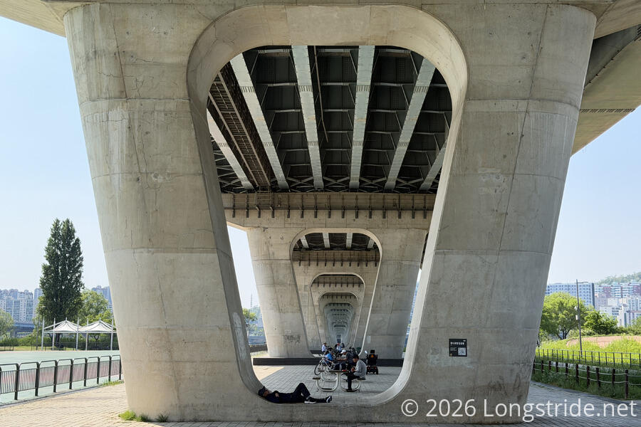
On the south side of the river, a long linear multiuse park followed the river bank. There were several sports fields, a skating rink, a bike park, and plenty of benches, toilets, and exercise stations. The bridge itself offered shade, with picnic tables set up in the spaces between its pillars.
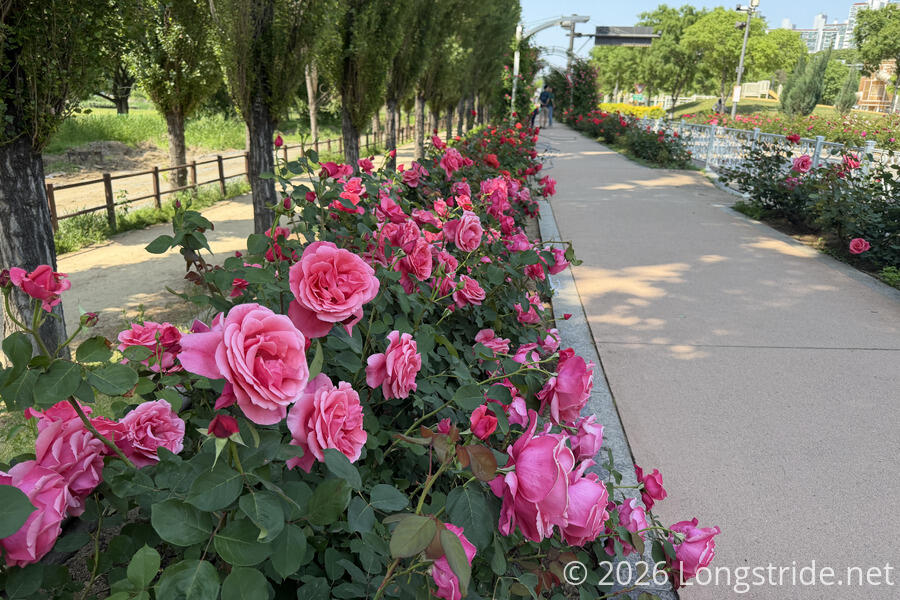
The trail also passed by a rose garden, with roses lining the path for a while.
Leaving the park, the trail wandered along city streets for a while, passing by the Amsa Prehistoric Settlement Site, the site of Neolithic ruins dating from 4000 - 3000 BC. I think I’d have liked to have checked that out, but by this point, it was mid-afternoon, and I was getting a bit tired.
Eventually leaving the road and popping back into forest to climb a small hill, I took a break at a bench overlooking the river. A pair of CCTVs on the trail seemed aimed right at the bench. The cameras seem to be everywhere, and they are not subtle at all.
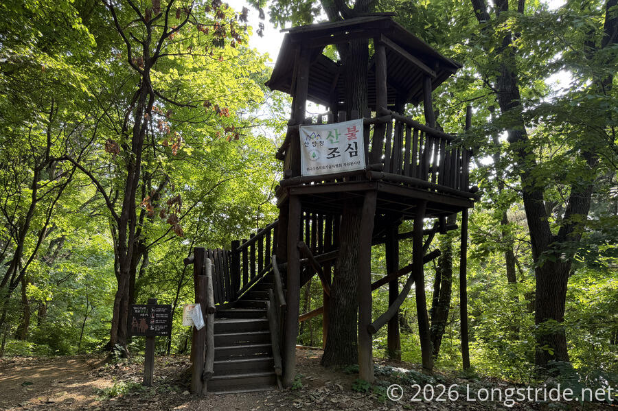
Shortly after, I passed a treehouse, which seemed like an unnecessary, but fun, addition to the trail.
The trail alternated between forest and city streets a couple more times, with the trail markers at one of the street intersections almost well-hidden, and I went the wrong direction twice, before figuring out exactly where I needed to go.
These couple of forest parks had quite a few benches and exercise stations, as well as another treehouse. As before, there were other people out for a leisurely stroll, though by now — 4 pm — there were a lot fewer people than earlier in the day.
The section ended at a street corner and the entrance to Myeongil Neighborhood Park, with the nearest subway station (Godeok Station) about a quarter-kilometer down the road.
By now, I think I have a pretty good feel for the general concept of the Seoul Trail: it’s a network of well-used walking trails through local parks, connected by the street grid when necessary. It’s all pre-existing and well-maintained infrastructure, that just conveniently can be connected to circle the city. So far, there’s not been anything particularly difficult about any of the trail, save for the long staircases today, which makes sense given that, I don’t think, any of the trails have been built for the Seoul Trail.