At 2,228 meters (7,310 ft), Mount Kosicuszko, located in the Snowy Mountains in Kosicuszko National Park in New South Wales, is the shortest of the “seven summits”, the high points of the continents. It is also the one easiest to reach: it can be accomplished with a relatively easy day-hike on well-formed trail from the nearest town. And since I was relatively nearby after completing the Great South West Walk and Great Ocean Walk, it seemed an obvious mountain to summit.
From Wikipedia:
[Mount Kosicuszko] was named by the Polish explorer Paweł (Paul) Edmund Strzelecki in 1840, in honour of Tadeusz Kościuszko, general and hero of the Kościuszko Uprising and American Revolutionary War, because of its perceived resemblance to the Kościuszko Mound in Kraków, Poland.
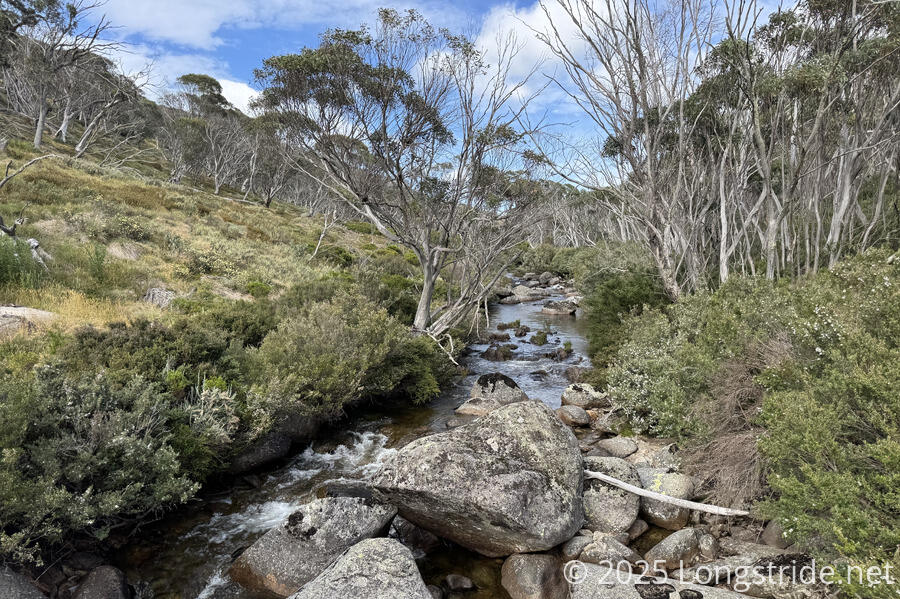
We started our hike from the River Inn, first heading west down the sidewalk along Thredbo’s main road. After a few minutes, we turned off onto the Thredbo River Track. Initially skirting a golf course on its way out of town, the river track had a nice variety of scenery as it followed the river valley upstream.
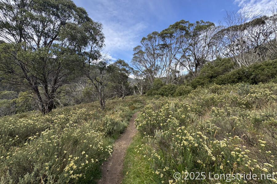
After 5 km from Thredbo, near Dead Horse Gap, the trail turned north, switchbacking its way up the side of the mountain, past the tree line. What had been a nice, gentle climb up the river valley got much steeper, though the trail remained easy to walk, with nice scenery.
There were some clear signs of trail maintenance in-progress. Along the trail, we passed a couple of generators, wheelbarrows, a pneumatic drill, a small backhoe, and large bags of supplies and rocks. At least part of the plan seems to be to reinforce the trail with rocks to make it more sturdy. (Today is Australia Day, a public holiday, so it’s not surprising that no one was out working on the trail.)
On our way up, we passed three separate groups of hikers, including three guys who were on their way back from a campground, and a family with two young kids.
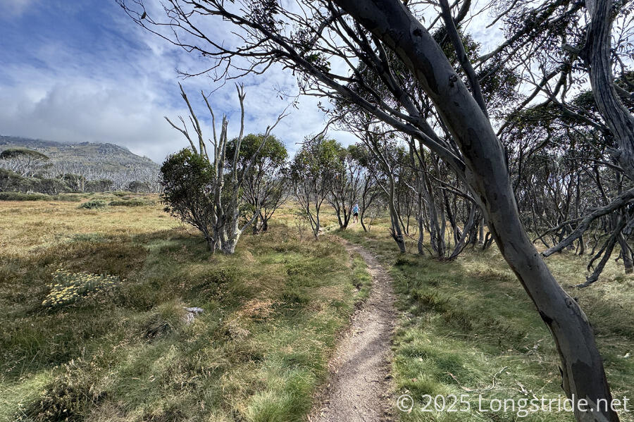
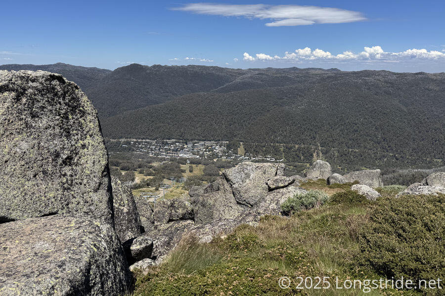
As we got higher up, the trees got shorter and sparser, giving way to ground-hugging shrubs. Large rock slabs stood out as the soil covering them grew thinner. The Thredbo Top Station also came into view, the upper end of the ski lifts from the ski village below. Still operating in summertime, they provide a way for people to skip much of the elevation change on the way to the summit.
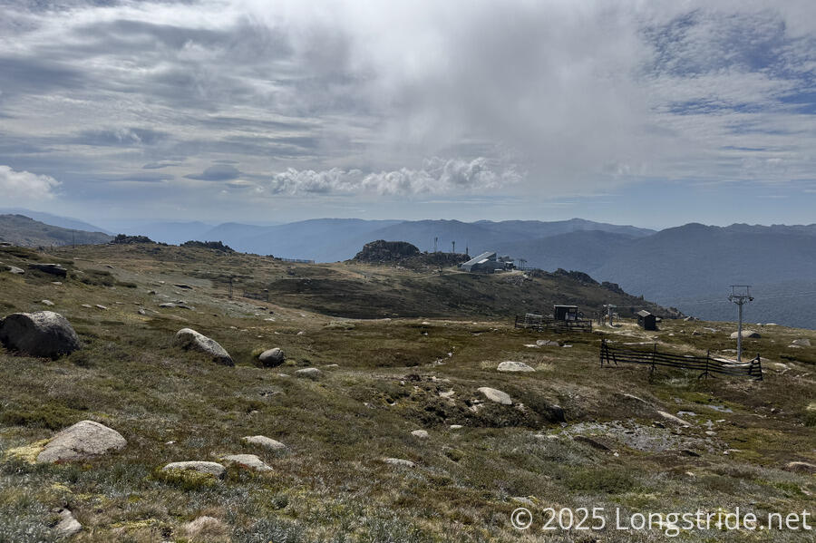
After 4 km on the Dead Horse Gap Track, we had gained a little more than two-thirds of the roughly 1,000 meters of elevation from Thredbo to the Kosciuszko summit, and joined the Kosciuszko Walk, an easy walkway through increasingly boggy terrain. Lower down, the walkway is made of bricks; further up, it’s metal grates. Either way, it’s an almost embarrassingly easy way to walk up to the high point of a continent.
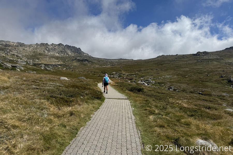
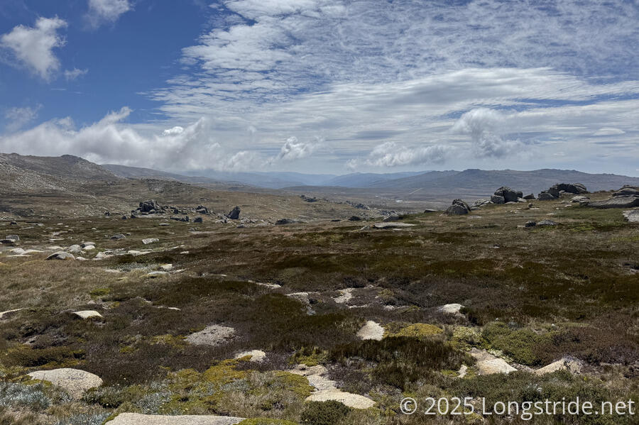
Once we got high enough above the tree line, it didn’t really feel like Australia anymore. With just grasses, wildflowers, rocks, and lichen surrounding us, it felt most like the alpine areas of the Sierra Nevada, but could easily have been many other places far above the tree line.
To the east, we got a look towards Charlotte Pass, where a different route to the summit, the Summit Walk, starts.
At the junction between the Kosciuszko Walk and Summit Walk, a small building with toilets and some benches made an excellent spot for a break.
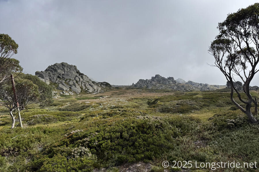
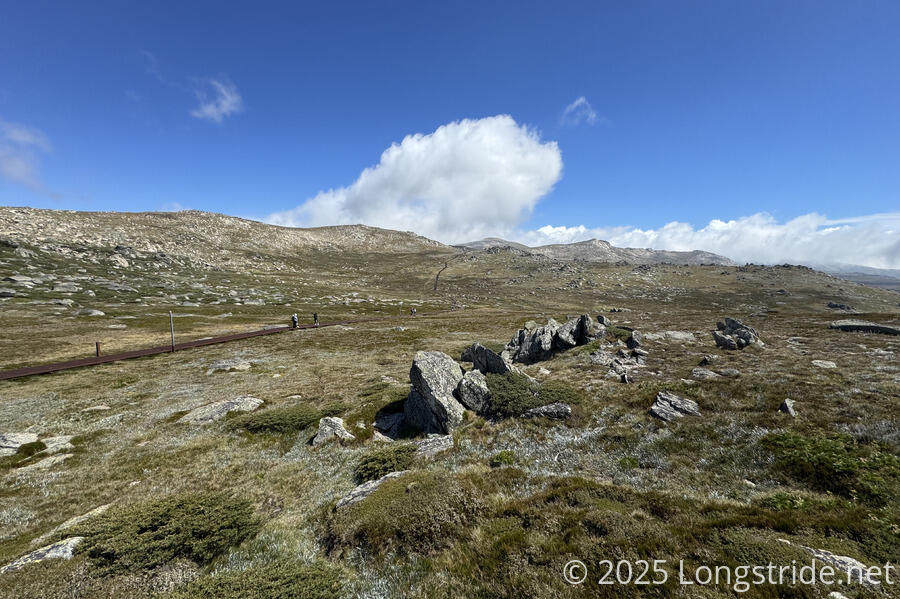
Beyond the junction, the trail became gravel and a little steeper as it climbed up to a saddle and wrapped around the back side of the mountain, circling its way to the summit.
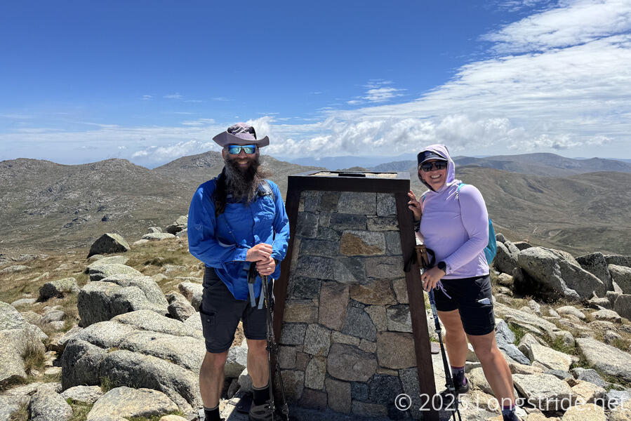
The summit is a combination of stone paving and rocky outcrop, with a small monument obelisk at the top. Naturally, it was somewhat windy, and my hat struggled to stay on my head..
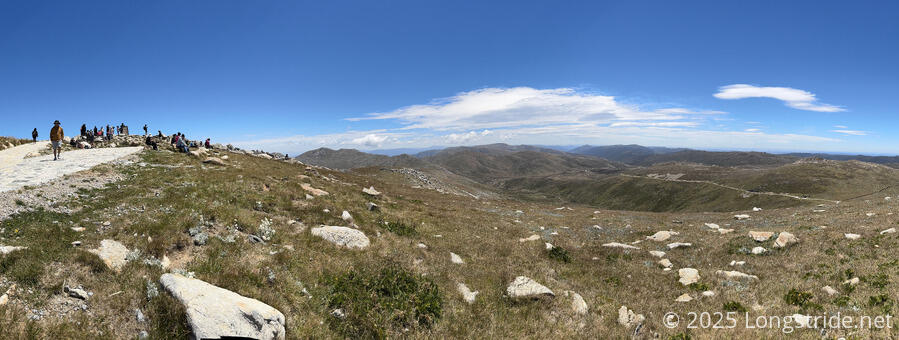
Naturally, being at the top of the continent, there’s spectacular 360-degree views of the surrounding landscape. It’s relatively flat near the top, flat enough at least to be able to sit down on the grass and take a break and admire the scenery.
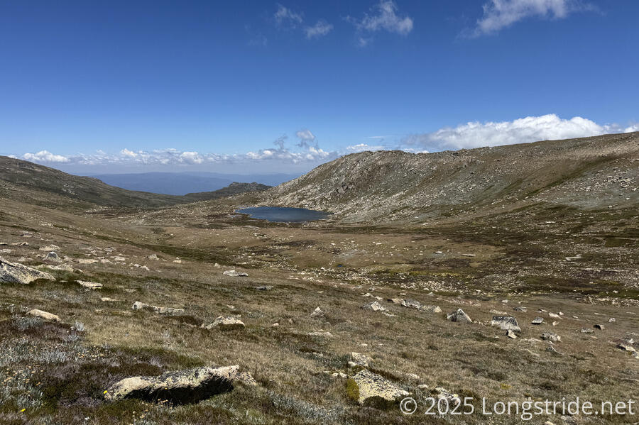
On the way back down, we stopped to admire Lake Cootapatamba, Australia’s highest elevation lake, located in a wide valley only about a kilometer from the summit.
The walk back downhill on the Kosciuszko Walk was nice and easy, and we quickly passed the Dead Hose Gap Track, opting instead to take a different set of trails more directly back down to Thredbo. After passing the top station, we followed the Merritts Nature Track down to town. This is a pair of trails, a downhill cycletrack and (often separate) walking trail through forest, both adjacent to clearings for ski runs. Being a much more direct route than we took going up, this was accordingly steeper, and there were some occasionally awkward sections due to the steepness, but it got us back to town much more quickly.
The entire route we took was about 26.5 km (about 16.5 miles) with 1,070 meters (3,500 ft) of elevation gain and loss, and took just over seven hours, including breaks. From the top station, round-trip to the summit is about 13 km (8 miles), with about 350 m (1,150 ft) of elevation gain and loss, about 3.5 - 4 hours round-trip.
Besides being my first continent summit, Kosciuszko is also my first country high point. And although we deliberately took a harder route to get to the top, this was still one of the easier peaks I’ve summited. If you’re ever in the area with time for a day hike, I highly recommend taking the opportunity to summit Mount Kosciuszko.