Passing the geographical center of Tasmania, we’re now more than halfway along the Tasmanian Trail as we continue our trek south to Dover.
As planned, CareFree and I were up early and off hiking by shortly after 8. It was a nice morning out, with few clouds.
The morning started off along paved roads, taking us south from Bronte Park, with good views of the Nive River valley to the west.
We passed a sign for the Bronte Park Waste Transfer Station, which answered a question I had since passing the somewhat ridiculous number of abandoned tires we saw along the road the first few days on the trail. We’d wondered if it cost “too much” to dispose of tires properly, and that was why there were so many lying in ditches or repurposed as tree planters or fences. At least in Bronte Park, it costs $13 per tire (or $20 with rim) to dispose of a car tire. (4WD or light truck tires are marginally more expensive, and truck or tractor tires significantly more so.)
Several more unusual (from my perspective) road signs piqued our interest this morning as well. First, we passed a sign indicating we were on the “Western Wilds Drive Journey” (which we also saw back in Miena), which felt a little self-aggrandizing to me.
After turning onto a more major route, we passed a “Fatigue can be fatal” sign, and suggesting possible stops in 50 minutes away in Ouse (quite considerably faster than the two days it’ll take us to walk there), or an hour and a half to New Norfolk (the next town for us after Ouse, a further three days). While I wasn’t terribly surprised to see a sign like this (we saw plenty of similar signs on the much more monotonous highways between Melbourne and Sydney when we drove that route after our Great Ocean Walk hike last year), this was the first one of its kind we saw in Tasmania. We wished it’d only take an hour or two to get to either of those towns.
The last unusual road sign was for Bronte Park, Miena, and Highland Lakes, with a photograph of an angler in the water looking a bit too smitten at the trout they’re holding.
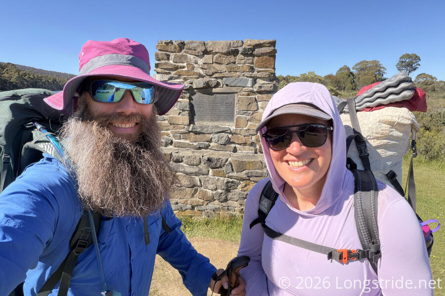
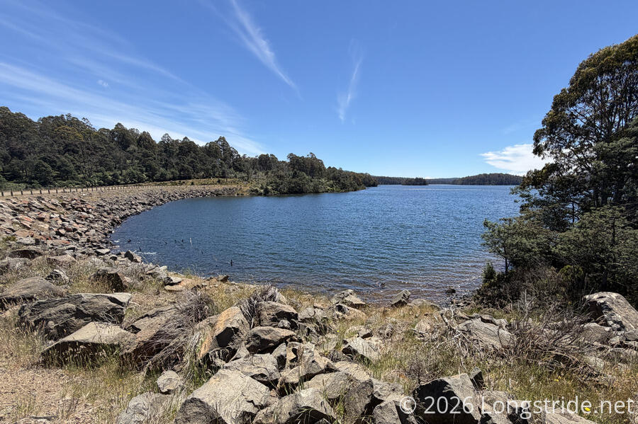
Shortly after, we stopped for a break at a picnic area on Bronte Lagoon, adjacent to a monument located roughly at the geographical center of Tasmania. This is also slightly more than halfway along the trail!
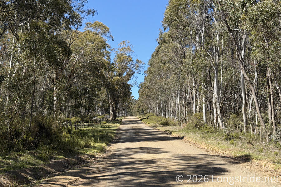
Just past the center of Tasmania, we left the main road for the dirt Victoria Valley Road, climbing up a hill. We’d follow this road for the rest of the day. There generally wasn’t much to see here, aside from occasional road going off to a private residence. At least, the tree-lined road did provide a fair amount of shade.
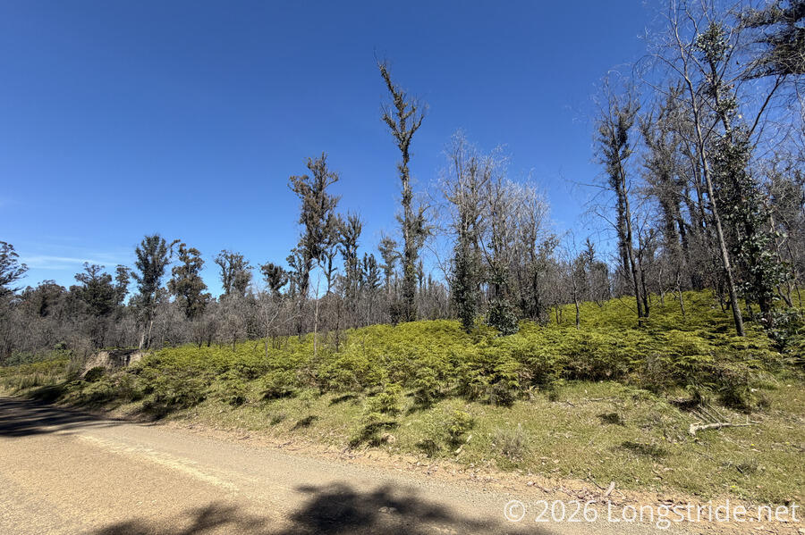
There were signs of a prior fire; for a while, the tall trees were less dense, and the ground cover thick and quite lush.
We stopped for a break at an intersection near a campground on Dee Lagoon. A woman driving by stopped to ask if we needed a lift. A couple hours later, at another break on the side of the road, a guy driving by stopped and backed up to ask us if everything was okay. There’s definitely a fair number of kind people driving on Tasmania’s roads!
After Bronte Lagoon, our other large body of water today was Dee Lagoon, which unsurprisingly, was created to store water for hydropower generation. We passed close enough to see the lagoon a few times: after our break near one of the lagoon’s campsites; at a spillway; and finally at Dee Dam Bay, where the dam that formed the lagoon is located. On our way there, we passed a small community of ten or twelve homes. I guessed they were originally built for workers building the dam.
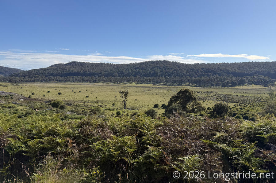
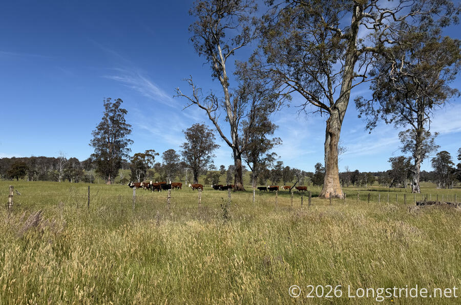
Late in the afternoon, we finally got a major change of scenery. After the tree-lined road and occasional lagoon, the landscape finally opened up to grassy meadows, with a mountain range in the distance. As we continued following the meadows, we passed alongside several cow farms. Unlike the cows we’ve previously seen further north, which often followed us, these cows wanted nothing to do with us and wandered (or ran) away as we walked past.
After passing the farms, we briefly reentered forest, and had to stop for a minute to allow a snake to cross the road.

After passing by a dilapidated building (which we learned later was the former police station from the “convict era”, when Tasmania was used as a penal colony), we turned off the road we were on to another dirt road that led us to our campsite for the evening.
Located on private property, a three-sided and roofed shelter with a water tank had been installed, along with a picnic table and toilet, for Tasmanian Trail users. Behind the shelter, a path led to a clifftop overlooking a field (formerly, a marsh, drained by convicts in the 1840s). A trail register was placed a short distance from the toilet, almost completely hidden by tall grasses. Also near the toilet was a pen for horses.
Already at the shelter was a cyclist who will be, but is not currently, cycling the Tasmanian Trail: starting from Hobart, he’s cycling north by the fastest route possible, so he can cycle the Tasmanian Trail back south to Dover. (And so, by a technicality, we’re still yet to meet someone else who’s actually on the trail.)
A while later, two horseback riders arrived, doing a two-day ride partially on the trail. This is the first time we’ve seen horseback riders here.
We had a nice chat with the cyclist (the two horseback riders mostly kept to themselves).
It was somewhat difficult to find a good spot to pitch our tent; most of the spots large enough were uneven, sloped, had rocks, or were much further away from the shelter and toilet than we wanted. We finally settled on one site, only to realize after we finished getting our tent set up that there were large dead limbs on a tree directly above. We opted to move the tent inside the shelter; not ideal, but it was the flattest ground available.
Tomorrow, we’ll have a shorter day to Ouse. The weather forecast isn’t looking so great, with the possibility of rain, but hopefully we’ll be able to get to town before it rains.