An initially gloomy day took us through some of the best landscapes and largest variety of scenery we’ve had in one day on the Tasmanian Trail.
It was surprisingly cold overnight, and between that and some rain this morning, CareFree and I left the Jones River Camp a bit later than we’d planned.
The campsite was located almost immediately before the private property we had to obtain permission for. (Had we been unable to secure permission, or just wanted to take a shortcut and not come to the campsite, we could have stayed on the last paved road we were on yesterday. We’ll be on that road again later today.)
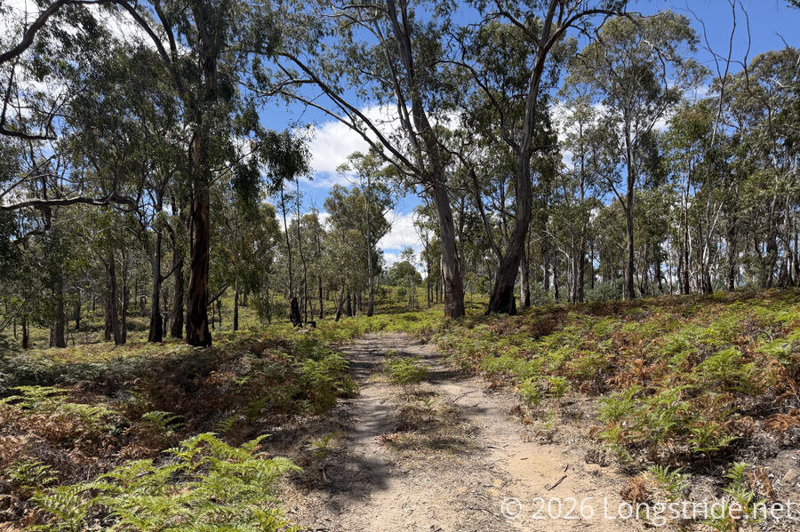
Passing by a house with an aggressively barking dog tied to a doghouse, we began climbing almost straight up Mount Bethune. This was easily one of the steepest climbs we’ve had on the Tasmanian Trail so far, but at least, it wasn’t on road. Though this was clearly not a well-trodden section of trail, the path was reasonably well-defined, and trail markers pointed out the way. (Not that it was all that difficult to follow the ridge line and just go up.)
Light rain made the first part of the climb a bit miserable, but the rain didn’t last too long, and the clouds slowly cleared, giving us a rainbow.
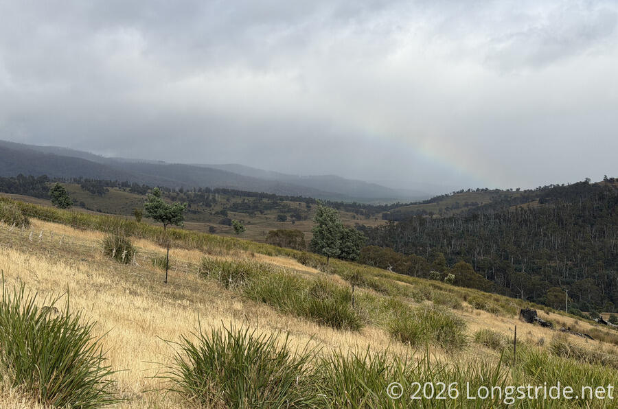
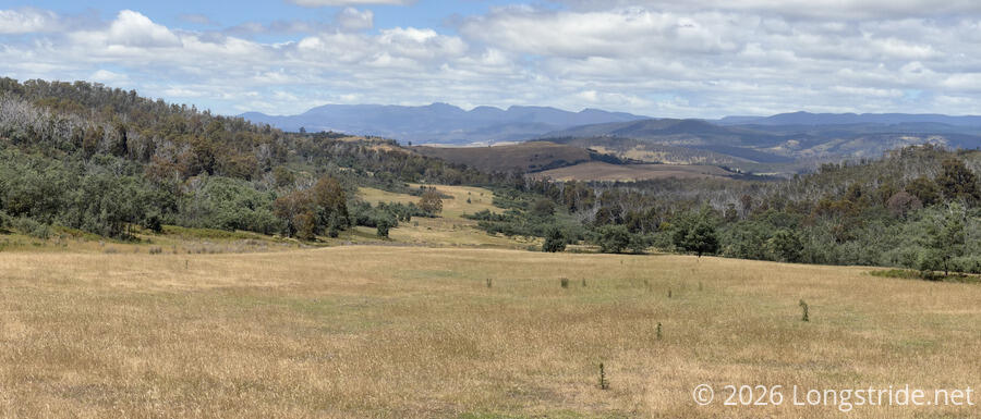
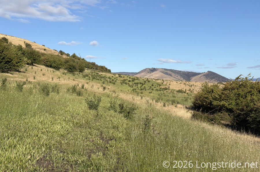
As we climbed, we got increasingly good views of the River Derwent and its valley, further downstream from our crossing yesterday. We also saw the Jones River, though we couldn’t quite see our campsite. We’ll cross the River Derwent twice tomorrow on our way into New Norfolk.

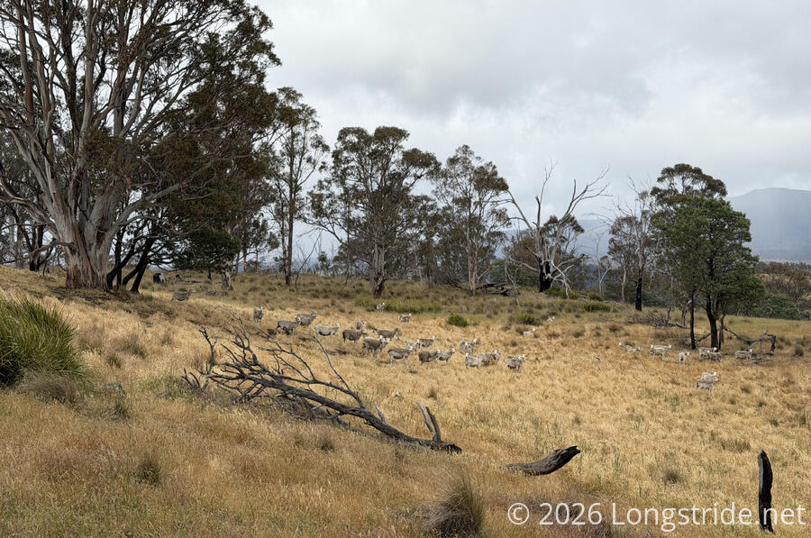
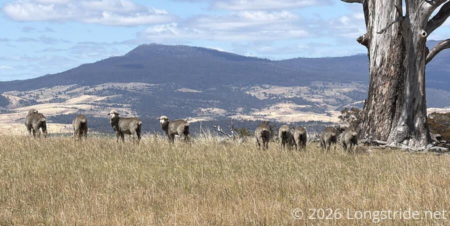
The mountain was also home to a fair number of sheep, which had free range to roam the meadow all the way up to the summit.
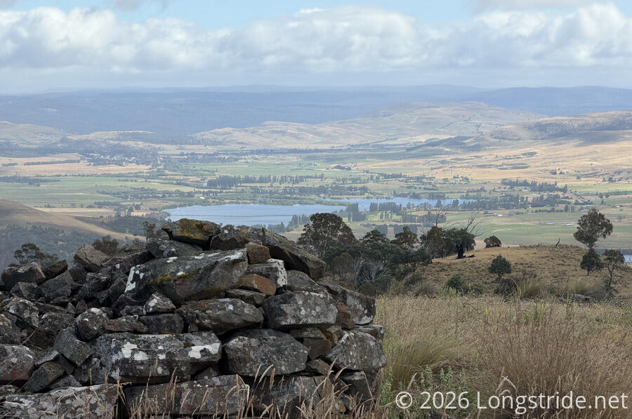
The summit of Mount Bethune has a trig marker on it, making the top quite obvious. Also near the summit was a circular map showing the distance to a number of prominent landmarks. (Usually, these sorts of displays don’t have a map, just directions and distances, so I thought the addition of a map was a nice touch.)
While the trail up to the summit was relatively easy (steepness aside), and a largely clear meadow, the trail down the south side of the mountain was a bit more difficult. The trail was quite rough and rocky, quickly entered forest, and the trail markers were a bit more dispersed and harder to see. We lost the trail a few times, but generally we just followed the ridge line and stayed between the fences that gradually closed in from either side, and we got to where we needed to go.
On our way down, our socks and shoes picked up no small number of pokey seeds that required considerable work to extract them later in the day. (Fortunately for me, I was coincidentally using the same pair of socks as the last time we went through a lot of seeds, so out of the three pairs of socks I’ve had on Walk the Yorke and the Tasmanian Trail, it’s coincidentally only been one pair that’s suffered the brunt of the damage.
After we dropped off the ridge, following a grassy clearing in the forest towards a cow pasture, there were lots of shotgun shells on the ground. One of the reasons this property required permission to cross was because its owner allows hunting. There wasn’t any going on today, but judging from the number of shells we saw in just a short distance on the trail, it wouldn’t surprise me if there were more hunters than hikers there.

Once through the clearing, we turned, following the edge of the forest. With no fence between us and the cows, we tried to stay close to the forest and move as quickly as possible, hoping that we could make our way to the gate at the far end of the pasture before the cows noticed us.
This strategy mostly worked. The cows largely stayed where there were until we got to the gate. The noise from us manipulating the chain on the gate to unlock it with our trail key seemed to draw the cows, and they came to investigate while I was fighting with the lock to get it opened. Fortunately, I got it opened and we made it through and got the gate locked again before the cows reached us. A short trail took us to a dirt road, which led us along the other side of the pasture. By the time we made it to the road, many of the cows had reached the gate, and the rest of the herd was on its way.
Safely out of the pasture, we continued down the road. After a brief climb, we continued descending, eventually with cow pastures on both sides. These cows were quite skittish, and though they weren’t anywhere near the road, took off running as we walked past. We also saw some horses in a lower pasture.

We joined a paved road (that we were on yesterday before we turned off to the road that took us to our campsite), and followed its surprisingly wide shoulders to the entrance to the Meadowbank Private Forest Reserve. A gate at the entrance nominally would have required our trail key, except that the three locks and chain weren’t actually securing the gate shut.
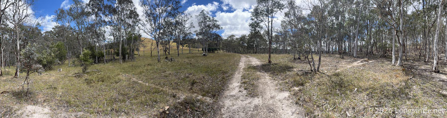
A series of three steep climbs and descents took us through the forest reserve, mostly on a nice dirt road. The road was a bit waterlogged as it crossed two creeks, but aside from the steepness, wasn’t difficult, and it was a nice change of pace from all the road walking we’ve done for most of the trail.
The second ascent, a bit higher in elevation in the first, had a quite different forest, and also seemed to be a bit more lush.
That forest gave way to a large meadow, with long views in all directions to distant mountains.
A gate at the top of the third ascent took us into a sheep station. Naturally skittish, the sheep wasted no time in fleeing from us, often running down the same dirt road we followed for nearly an hour to get out of the paddock. When we weren’t avoiding sheep droppings on the road (or trail, as it eventually became), we very much enjoyed taking in the surroundings.
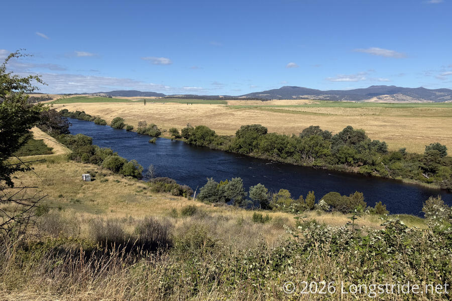
Leaving the sheep station, we returned to a dirt road, following it for an hour and a half, occasionally with views of the River Derwent.
We stopped for a long break on the side of the road. CareFree’s new shoes have turned out to be not the greatest match for the Tasmanian Trail. Although they’re soft and lightweight, and great on trails like we had earlier in the day, they have relatively little cushioning, which is bad for monotonous walking on dirt or paved roads.
Towards the end of our break, we got a call from the coordinator for the Bushy Park Showgrounds. I said we’d be there in about two hours, which was perhaps a little optimistic, especially with CareFree’s feet hurting as they were, but that’d still be 7 pm, which is rather late for reaching camp.
We left the road at Fenton Forest, a private farm. The trail took us on a road past a few houses, one of which had several dogs that all ran up to us barking. A woman, working on the roof of the house they ran from, yelled at the dogs and told them to back off (and they did, mostly), and told us to just keep going (and the dogs wouldn’t chase after us). Given her distance from the dogs, it was pretty impressive how well she had them under control.

Shortly after, a truck (with a dog in the bed) drove by and chatted with us briefly; I suspected they were just checking us out to make sure we were supposed to be there. (Since, it was private property, it was only that we were hiking the Tasmanian Trail, and were members of the Association, that gave us permission to be there.) Later, they drove past us again, and offered that we could take a detour and use one of their swimming holes, but it was already pretty late in the afternoon and we had a deadline to get to the showgrounds.
The road through the farm took us up to a ridge, from where we could see the town of Bushy Park. Leaving the farm dropped us down a trail through a grassy hillside, and then through an overgrown meadow, refilling our socks with seeds.
Leaving the meadow returned us to dirt, and then paved roads for the remainder of the day. We crossed over the Styx River, which we could see from the ridge, and followed what seemed like the main road through Bushy Park. I called our contact to tell him we were about 15-20 minutes out from the showgrounds. We passed a roadhouse, closed for the evening. If we’d realized it was there, we might have tried to get there early enough to get dinner.
We also passed a small herd of sheep, grazing in a field growing hops, which was completely unexpected.

Just before we reached the Bushy Park Showgrounds, a car that drove past us pulled over, and someone got out and started walking towards us. This seemed pretty unusual, but then I realized they were one of the horseback riders we saw at Victoria Valley and on our way to Ouse! It turns out, she lives nearby, and was on her way home from work. She gave us a container of blueberries, which we snacked on after we ate our dinner; they were absolutely fantastic. (Thanks again!)
We reached the showgrounds just before 7, and didn’t have long to wait before our contact showed up with part of his family in tow. We had a brief conversation, and paid a token fee for camping at the showgrounds, which included a restroom with a shower (an unexpected and very nice bonus).
We had plenty of choices for campsites, but we opted to camp next to the office. In a covered space between the office and what seemed to be a storage shed, there were a pair of tables, a spigot from the rainwater tank, and an electrical outlet, all of which we made use of.
As we were eating dinner, a bird landed on one of the overhead electrical cables in the showgrounds, a large rat in its mouth. Clearly, we weren’t the only ones hungry.
After today’s moderately long (32 km) day to Bushy Park, we only have a 22 km day tomorrow to New Norfolk, our final resupply stop. From there, it’ll be four days to Dover, and the end of the Tasmanian Trail!