A dreary, occasionally rainy day brought us over a mountain to Judbury, a small town on the Huon River.
Fog covered the treetops when we got up this morning, which slowed us down a little: almost immediately after our campsite, we’d start a long uphill climb, and leaving quickly would just put us in the clouds before they had any time to lift. While we ate breakfast and got packed up, the clouds did lift, though not as much as we were hoping for.
Before leaving, our hosts generously gifted us with a bag of cherries from their orchard. We tried a couple as we got ready to set out; they were fantastic.
Five minutes down the road brought us to Jefferys Track, a dirt road that crosses the mountains south of New Norfolk and Lachlan, connecting communities in the Derwent and Huon valleys since the early days of colonization.
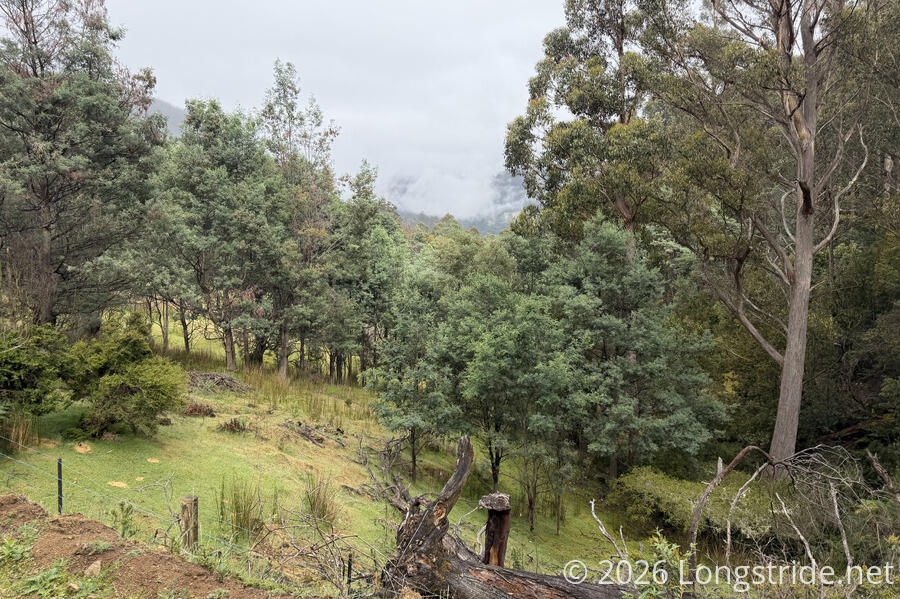
The lower portion of Jefferys Track was just like any other dirt road, passing by scattered houses on the hillside, though the houses got fewer and further between as we climbed up the hill. Few cars and trucks passed, though later in the morning, a guy on a motorbike zoomed past, heading into the hills. We saw a small flock of sulfur-crested cockatoos sitting in an adjacent pair of dead trees. A flaking painted sign at an intersection read “Thank u who picked up the rubbish! I love ya work!”. There was no trash to be seen (at least, not there), so it must have been a mess once upon a time. Occasional clearings and dips in the hill gave us views across the valley, though fog limited what we could actually see.
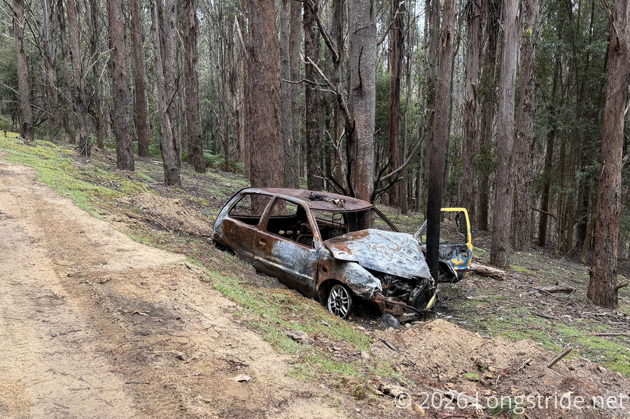
Continuing to climb, we passed two abandoned cars off the road. One was several meters down the hillside, with trees and ferns starting to overtake it. The other was next to the road, smashed head-on into a small but very sturdy tree that carved a gash into the hood, and then set on fire.
Eventually, the road became a rougher 4WD-only road. Shortly after, though, it became significantly wider, and had been clearly worked on recently. Gouges on the uphill side showed where some heavy machinery had cut into the hill to widen the road, and much of the road surface consisted of “fresh” dirt, often with tread marks clearly visible. We stopped for a break shortly after signs of the roadwork began, and ate a shockingly large number of cherries.
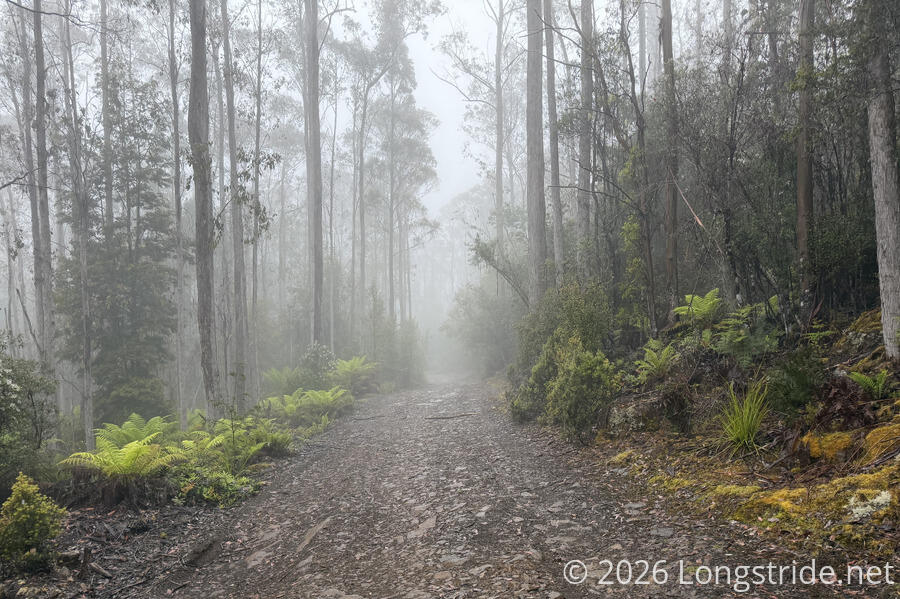
Though this was the steepest part of the day’s climb, it was otherwise a relatively easy hike. The fog had been slowly lifting, though not quite as quickly as we’d been climbing, and at least a couple of times, we caught up with the cloud, walking through mist or a brief drizzle.
About fifteen minutes after our break, we passed a guy operating the construction equipment widening the road. He’d been there at least a week on a lonely job — few other people have passed through, mostly cyclists. He said the road was being prepared for logging trucks, with a portion of the forest to be harvested for paper, and the softer wood shredded into wood chips.
The excavator seemed as though it was at the far extent of the roadwork, because after that, the road became considerably rougher. Possible remnants from earlier work left huge ponds, gullies, and generally impassable-by-vehicle conditions for a while after that.
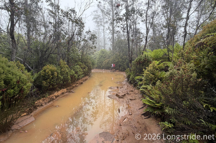
After another half hour, we turned off of Jefferys Trail onto the White Timber Trail. I’d been hoping both White Timber Trail, as well as Jefferys Trail, would be hiking trails, as opposed to dirt roads, based on their names, but alas, I was disappointed both times. The White Timber Trail turned out to be just as much of a dirt road as Jefferys Trail, only smaller, and with more puddles. Several times, due to lack of drainage, the road was nearly completely covered with water, requiring some gymnastics (and using tree branches for leverage) to walk on the narrow, dry edge of the road. My waterproof boots helped when there were slightly-submerged stepping stones, but the water was generally too deep to walk through without getting them flooded. But walking along the edge was no panacea either; thanks to the fog and occasional light rain, the trees were all quite wet, and brushing against them soaked our shirts quite well.
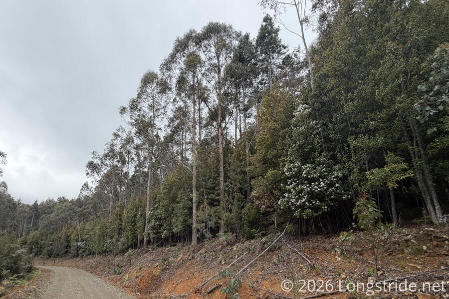
The forest occasionally opened up to widely-spaced tall eucalyptus trees, but there wasn’t much in the way of views. The fog and occasional rain persisted until after noon.
While along the White Timber Trail, we stopped for two more breaks, the second at the intersection with Judds Creek Rd, a gravel road that would take us out of the mountains. While there, we finished the cherries.
We also, finally, for the first time, met the first people who were actually cycling the trail (as opposed to being on the way to start the trail). As we were getting ready to leave, a father and son, and friend of the father, cycled up and stopped to chat for a few minutes. Nearly finished the trail, they’re heading to Geeveston today. (We’ll get there tomorrow evening.)
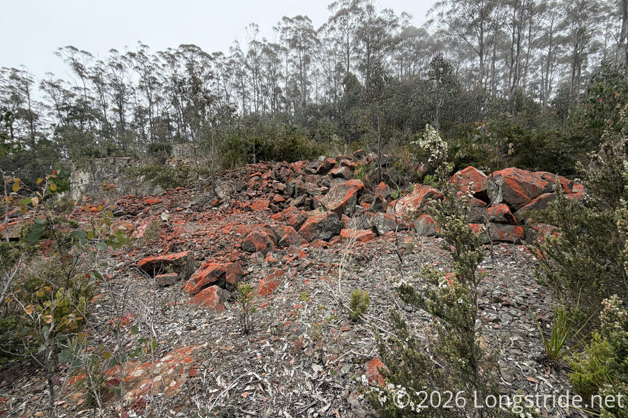
We passed what seemed like the remains of a small quarry, lined with bright red rocks adding some color to the day, then began an occasionally steep descent towards the Huon valley.
For most of the descent, we didn’t have much of a view. Rather, trees on either side of the road were generally very densely packed, with tall trees on the edge of the road interspersed with a densely-packed impenetrable understory of shorter trees.
By the time the fog looked like it was starting to lift, we were already considerably downhill, and we finally started getting some sun and blue sky around 3 pm. The gravel road was mostly fine to walk on, but CareFree’s new shoes were inadequate for the task: insufficient padding made for an uncomfortable walk. (Fortunately, we’re only a couple of days away from finishing the trail, so it won’t be a problem for much longer.)
The long descent eventually took across Judds Creek a couple of times, before the creek settled a bit lower in the valley than the road. Houses started to sparsely appear, and we passed two horseback riders about fifteen minutes apart (startling the second horse, which evidently wasn’t expecting to see people on the road). We also passed one of very few possible campsites alongside any of the roads we’ve walked, with a fire ring situated in the middle of the best area to put a tent. (Not that we’d want to camp right next to a road, but at least it was inside of a conservation area, and no cars had passed us yet, so it seemed pretty low-traffic.) A bit further on, a sign asked drivers to “Respect Rural Recreation”, calling out cycling, horses, and walking, so it would seem that there is a lot of non-car use here.
As we continued to drop out of the mountains, the number of houses increased, and we started started passing by farms.
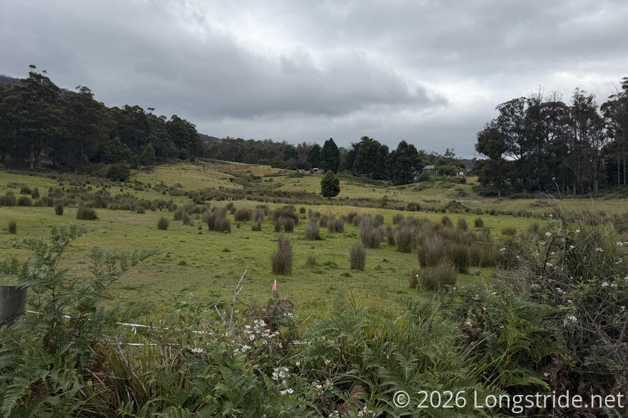
Around 5:30, we reached the “center” of Judbury. Aside from some homes and the community park, there wasn’t much here.
Our campsite for the evening was in the community park, in a somewhat secluded area behind the practice cricket pitch, next to an small overgrown fenced-in horse paddock and a hill down to the Huon River. The park was nice; besides the cricket field and stands, there were a pair of restrooms, a community hall, and a picnic area with barbecue grills. Still, our campsite felt a little exposed — we could still see the road from behind the practice pitch, and overall, we got some weird vibes. (Among others, the women’s restroom’s soap dispenser had a handwritten message on it that soap would no longer be provided because people kept stealing the soap. The mens room, which wasn’t facing the street, had soap. We wondered if things were so hard in Judbury that people would have to resort to stealing soap from the public park to make ends meet.)
We ate dinner at one of the tables, feeling a bit rushed by the wind picking up and dark clouds blowing in. Once we were finished with dinner, we got our tent up quickly, though the clouds turned out to be more for show, and there wasn’t any rain.
Tomorrow, we’ll reach Geeveston, the penultimate town on the trail. We just realized that an update on the Tasmanian Trail’s website from when we started says that the campground we were supposed to camp at is no longer available, so we’re not exactly sure where we’re staying tomorrow. But there seem to be a couple of places to stay, so we’re not especially worried.