This morning, we started our latest long distance trail: the Walk the Yorke.
With a 30 km beach walk planned for the day — and by planned, I mean, we have no choice, because that’s the next possible place to camp — CareFree and I got up at 6:30 am, and were on our way by 7:30.
Conveniently, the start of the trail was just outside the back gate of the holiday park in Moonta Bay, so we could go there directly, without having to walk all the way back out the main entrance and down the road past where the bus dropped us off yesterday.
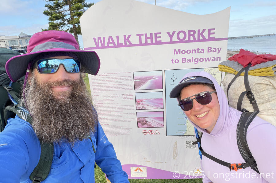
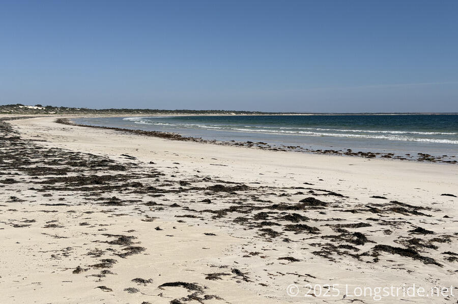
After leaving the parking lot at the Moonta Bay Jetty where the terminus sign was, we started with very nice beach walk. The beach was a nice white sandy beach, reasonably wide and flat, with a relatively firm surface. This all made for a relatively easy stroll.
There were also stretches of seaweed along the beach, though nothing that seemed excessive — yet.
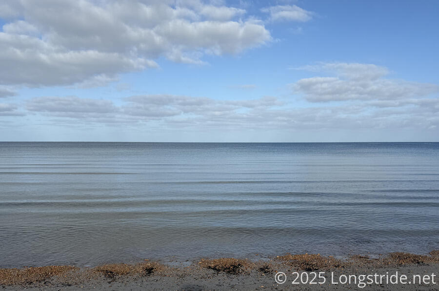
With no wind to speak of, the water was exceptionally calm; the waves were only small ripples. I suspected the calm water is at least partially because we’re pretty far away from the open ocean, and as we get further south, there will likely be more and rougher waves. (Save for a few sheltered bays and harbors on the Great Southwest Walk and Great Ocean Walk further east, the water on the Southern Ocean was consistently very rough.)
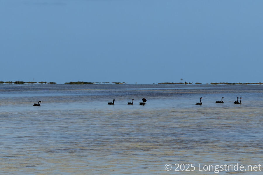
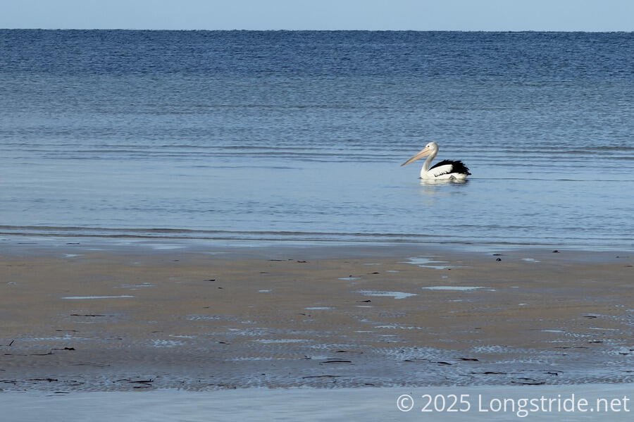
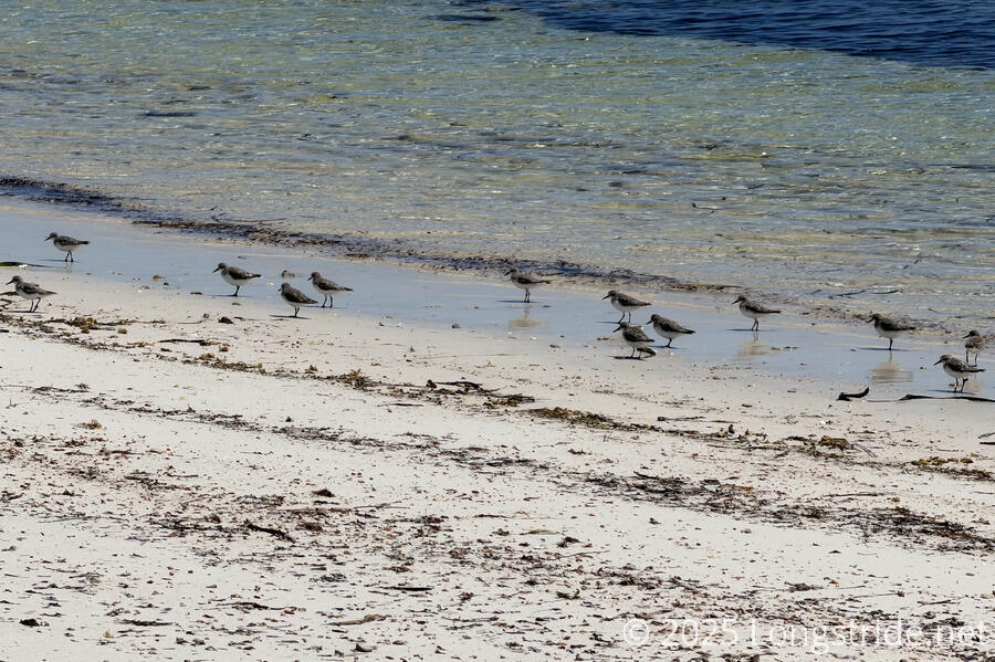
Near the water, sea birds went about their business. A lone pelican floated along parallel on the beach. Seagulls flew around or waded into the ocean looking for food. Later, we saw a small flock of swans.
As we approached Port Hughes, the next town along the trail (and only a few kilometers from Moonta Bay), we passed a string of houses perched above an eroding cliff. They have nice views for now, but I’d be nervous every time a strong storm blew through that just a little more of the cliff would fall off onto the beach until there’s no back yard at all.
We stopped for an hour at the Port Hughes Tavern for breakfast, since we weren’t able to get a good dinner last night. I ordered pancakes, with a side of bacon and eggs, and wound up with more food than I expected when the sides turned into a full dish with toast as well. (This also happened to me in Methven on Te Araroa. I guess in Australia and New Zealand, a “side” means something else?)
Leaving Port Hughes, we followed a brief cliff walk, then returned to the beach. After a little while, we met a guy out for a run on the beach; in talking, we discovered that he’d lived in the US for five years, a good portion of that near where I grew up. Small world!
As we got further south, with the tide out, the beach became wider, with a very deep shallows area that was (mostly) filled with sandbars or just a slick of water. With the beach curving as the land made roughly a 90° turn from south to west, we tried to take a shortcut, cutting the corner a bit. Unfortunately, the shortcut failed; the sandbar we were walking along ran out, and the water quickly became a foot or two deep. Not waiting to wade the rest of the way across, we turned directly inland and sloshed our way through sea grass until we reached the shore.
Fortunately, the water wasn’t too cold (or too deep), but I wasn’t expecting to have soaking wet shoes and socks only four hours into the hike. We stopped on the beach to (slightly) dry out our boots and put dry socks on. With still another 20 km to go, it’d be bad enough to have wet boots; wet socks would just kill our feet, especially on sand.
Looking at the satellite maps later, I decided that if the tide had been a little further out, and we had thought to look at those maps then, it might have been possible to significantly cut the corner like we were hoping. But that might have been risky; there’d really be no telling how the sandbars have shifted and just how deep the water might get if they had. The last thing we’d have wanted is to go swimming when we weren’t expecting it.
Shortly after, the trail cut inland onto a dirt road, to avoid wetlands that consumed the beach.
The seaweed on the shore increased, starting with thin strips at high tide lines, and gradually growing in width and thickness. It was an interesting curiosity until we had to wade through two-foot-deep seaweed, which was annoying, but hardly the worst terrain I’ve hiked through.
The seaweed parted briefly to feature a fantastic, pristine, wide beach, near the tip of the land before turning south around Cape Elizabeth (after which the seaweed returned.)
The reset of the day continued along beach, most of which was nice, but towards the end of the day, the beach became rather rocky and rugged. The wind picked up, and the ocean, which had been calm and dead silent this morning, was now quietly roaring with small waves.
After about 11 hours of hiking (including breaks), we reached The Gap shelter and campground, just off the beach.
The shelter, placed with a great view of the ocean, was an extremely simple angled roof over a picnic table, with a water tank collecting rainwater from the roof. It didn’t provide much protection from the elements, but the roof at least provided a little shade before the sun got too low.
The campsites were a little further back, located along a dirt road, and reasonably sheltered from the wind. Near the campsites was a composting toilet, also with its own small (but empty) water tank for handwashing.
The scene was a bit of an unusual juxtaposition for me: ocean and sand dunes on one side, and a glimpse of the Yorke Peninsula’s vast farmland on the other. Much of the interior of the peninsula is flat, making it ideal for farmland.
I was pretty sore and exhausted by the time we reached our campsite. Starting the hike off with heavy packs and a 30 km beach walk isn’t the greatest for the feet, but we still had a good first day.
Tomorrow will likely be a little longer. While we have a shorter option, 32 km will take us to a caravan park at Port Victoria. And in contrast to beach, we’ll be on gravel or dirt roads the entire day.