A somewhat short day brought us to Ardrossan, our last resupply stop on the Walk the Yorke.
In talking with a local, we decided that since it was Saturday, the weekend before Christmas, whatever road construction might be occurring that would impact the trail ahead would be paused for the weekend and holidays. So we opted to just go ahead and push through, and be extra cautious in the closure area.
A brief walk along the road brought us to a trailhead that zig-zagged its way around and up a deep gully and onto the clifftop, beginning another day that was all clifftop and no beach.
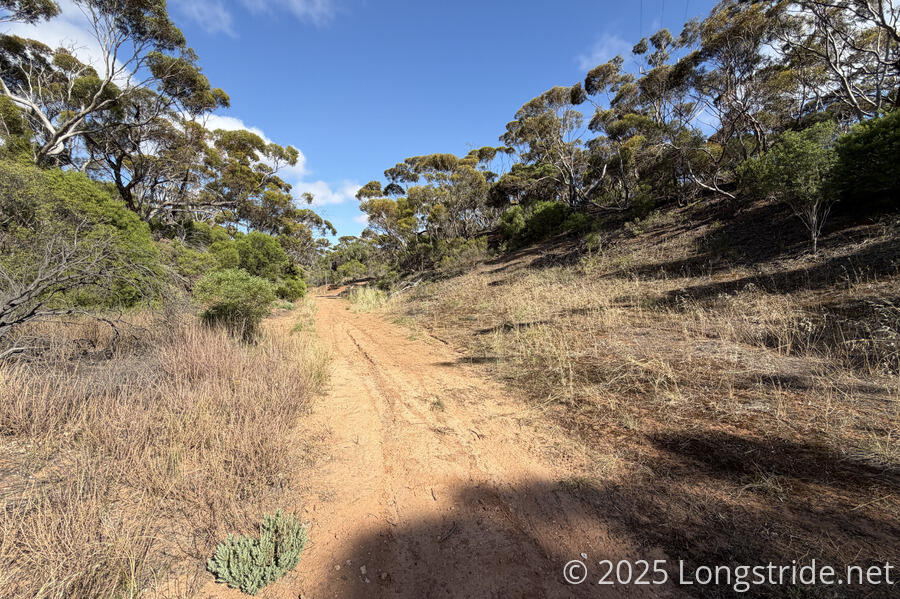
The trail was initially quite nice, as it was definitely used to get up to nice views on Billy Goat Flat, especially back to Pine Point.
Beyond that, while the trail was nominally a reasonably wide gravel-bed cycle track similar to many of the others we’d walked on, the further we went, the more overgrown it got. We got plenty of seeds stuck in our socks, but nowhere near as many as the farmland just past Port Moorowie.
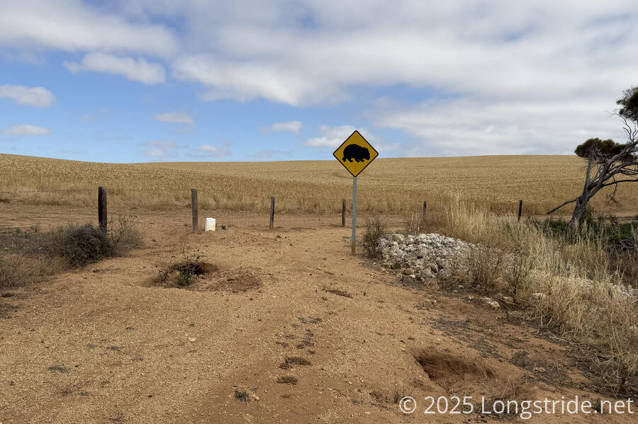
In one area with less overgrowth, a large sign with a wombat on it alerted to the presence of the animals and the large holes that served as entrances to their burrows. We didn’t see wombats, but we did see plenty of entrances to their tunnels.
It became clear why the trail was closed. While the primary reason for the road construction was to improve access to a copper mine in the area, new bed for the cycle track had been created to go around, rather than through, some deep gullies. While the work had not yet been finished, there were even some trail signs already placed. And while it appeared safe to us now, it seemed likely that when work was actually being conducted, at least one of the new paths we took would be busy with heavy machinery using as an access route for the construction. Certainly, there’d be a time when it would be blocked while gravel was being laid down.
But we made our way through safely, and counted ourselves lucky.
Separately from the road construction, a 1.5 km stretch of trail had yet to be defined, and the trail notes said to just follow the fence line. This must have been resolved already as part of the construction; we couldn’t actually identify any particular place where the trail seemed incomplete.
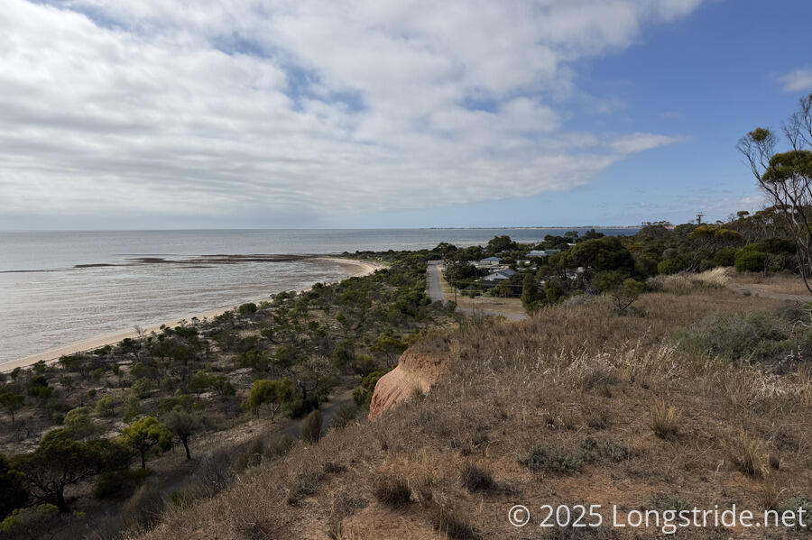
Both before and after the construction area, it should be unsurprising to learn that the trail generally followed the boundary of a farm. This eventually ended as we entered Rogues Point, and we joined a paved road through it and the neighboring town of James Well.
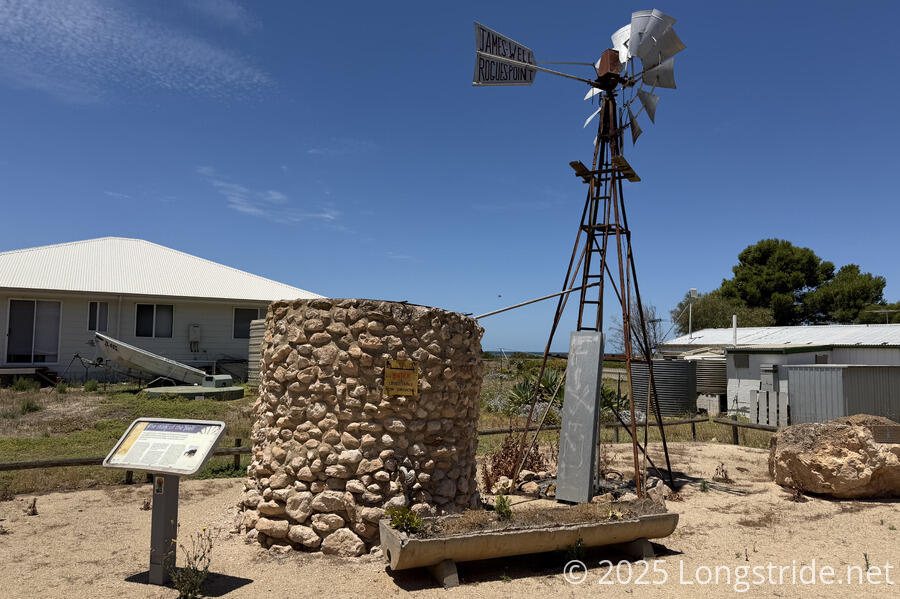
Rogues Point’s claim to fame is that it’s the site where convicts who escaped from Tasmania (then called Van Diemen’s Land) in 1848 were captured. The neighboring James Well is named after one of several wells set up by a colonist for their farming needs, and water was made available to others (at a price). Some farmers would come with with thousand-gallon water tanks to manually fill with four-gallon buckets.
Leaving James Well, the trail crossed a fence with a sign exclaiming, “Keep Out, No Entry. Emergency Access Only”. Presumably the warning was for for cars or ATVs; a bike stile was adjacent to the locked gate, and a trail marker planted just ten meters ahead.
This took us into a deep, sandy gully, which was annoyingly slow-going because of the soft sand and tire ruts. Fortunately, it wasn’t very long; fifteen minutes of slog brought us to a steep climb back up to the top of the cliffs, and we stopped briefly to shake out all the sand that had collected in our boots.
A short walk took us through the Parara Bush Campground, and then to a monument for seven sperm whales that had beached and died on Parara Beach on December 8, 2014. Sperm whales are a deep-water species, so it was unusual to find them in the Gulf St Vincent; one of the plaques at the monument suggested that they may have become disoriented, which is how they wound up in the gulf, and then this subsequently led to them getting stuck on the beach at low tide.
The monument itself consisted of seven dolomite boulders placed in the same pattern as the whales stranded. (Dolomite was chosen for its significance to the local mining industry and nearby Ardrossan’s history.)
The trail again jogged inland to avoid the jetty and grain yard just south of Ardrossan. At the grain terminal, we saw workers placing tarps over (presumably) freshly-received grain. One worker was standing atop a mountain of grain; hopefully it wasn’t too windy for them there!
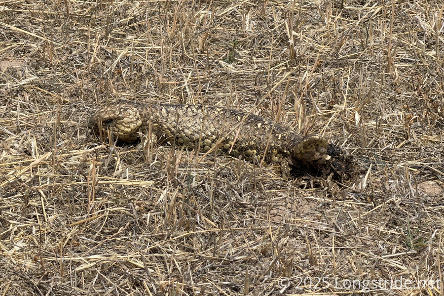
We also saw a sleepy lizard, well-camouflaged in dry grass.
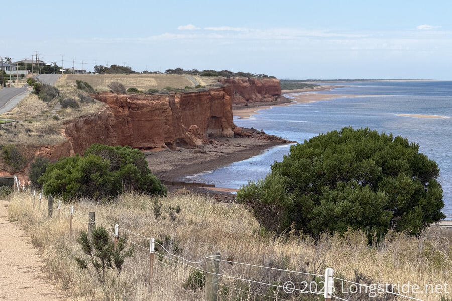
Entering Ardrossan proper on road, the trail then split off to follow the cliff top. Here, the cliffs were bright red.
According to a sign, a local aboriginal story is that:
“The dhugudja (curlew bird) leit their children at the beach to look for food. Winda (owl) heard the children making noise, and sent the gadlis (wild dogs) to deal with them. Nhandhu (kangaroo) fought the gadlis for the dhugudja and killed them. You can see the blood stained colouring in the cliffs today.”
Red Cliffs Over Ardrossan Harbour×Red Cliffs Over Ardrossan Harbour
Most days, there have been signs with stories such as that. It’s a nice touch of the aboriginal culture, though I’d also like to see more history. Either way, Walk the Yorke has done a significantly better job of presenting the local aboriginal culture than either the Great South West Walk or Great Ocean Walk did.
Diverting a short distance from the trail, we arrived at the Ardrossan Caravan Park, one of the larger caravan parks we’ve stayed at.
Our campsite was on the other side of a “creek”, with no bridge over, so we had to exit the park and walk around the outside to get there. Our campsite was a nice and grassy (but unpowered) site located above the creek’s gully, amidst a large sea of semipermanent caravans, which gave us a somewhat weird vibe. While we were setting up our tent, a couple of kids playing came over and asked us if we needed any help. (This also added to the weird vibe; I’m not really sure what they were expecting us to ask for.)
A fence with large “No entry to creek” signs blocked entry to the completely dry creek, which had a maintenance road built to connect the two sides of the caravan park. It seemed rather absurd, but I suspect the creek can probably be an unsafe raging torrent when it rains.
After getting our tent up, we walked to Drakes, the local grocery store, picking up a small resupply for just two more days to Port Wakefield to finish the trail.
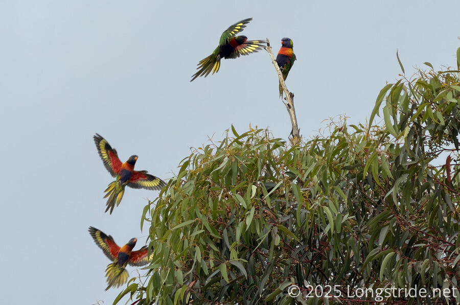
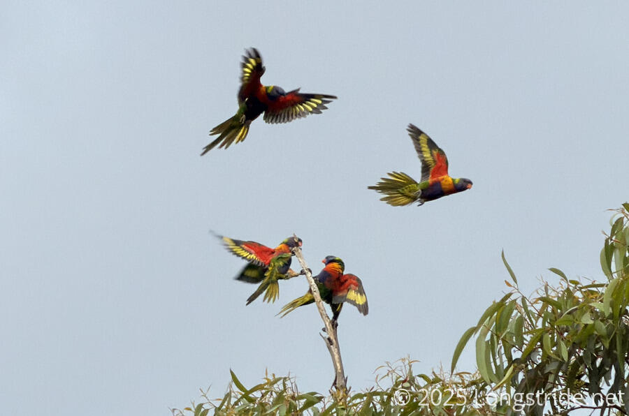
As we cooked dinner in the very meager camp kitchen (with an electric water kettle, but no stove — probably not much use for it if all the semipermanent caravans have kitchens), I noticed a brightly rainbow-colored bird, a rainbow lorikeet, sitting on a stripped branch atop a tree. As I was taking its picture, three other lorikeets flew in to harass it, leading to much squawking. Later, several of them would roost in leafy portion of the tree, usually well-hidden from the ground.
Tomorrow, our penultimate day on the trail will take us to a caravan park in Port Clinton, as we near completion of the Walk the Yorke.