A long, but surprisingly easy day took us from Port Vincent to Pine Point.
As expected, this morning it was much cooler out than it was yesterday, with clouds blocking the sun. With relatively light packs since we only have food for two days, we got off to a quick start.
On our way out of town, we passed a woman who once hiked a section of the trail. So far, we’ve met a few people who have hiked sections, but never the whole trail, let alone anyone else currently hiking the trail.
Leaving Port Vincent, the trail followed a brick sidewalk along the waterfront. As the sidewalk reached the outskirts of town, the trail climbed up to the top of the cliffs on a trail that was created by Port Vincent’s Tidy Town initiative.
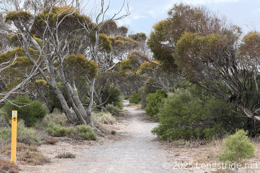
A short stretch of trail went through forest again, but with the trees not being very tall, there wasn’t much in the way of shade. Still, it was nice to have some green around.
Then we went through another golf course. As with yesterday’s course, it appeared closed, and I wondered just what the golf season here is.
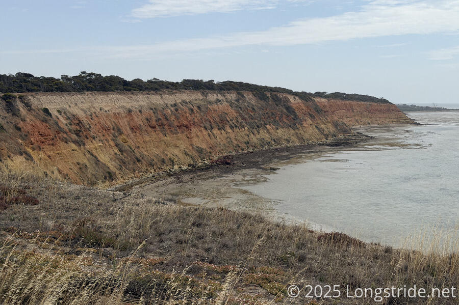
The cliffs here had pretty distinct layers, suggesting interesting geologic activity in the past.
The flies continued to be a nuisance, but even through there were a huge number of them today, they weren’t in our faces as much, so at least that was also a bit of a relief. The other day, I was kind of hoping that yesterday’s heat wave might thin their numbers. This didn’t seem to actually have happened.
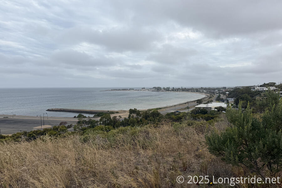
We passed through Port Julia, a small residential community that used to be have a prominent shipping industry for the grain produced on the peninsula. We saw a few parrots, though we still haven’t seen another flock as big as the one in Corny Point.
Leaving Port Julia, we returned to the beach.
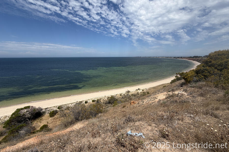
South Australia has had an algae bloom the past several years, due to three issues in combination: flood waters in 2022-23 that flushed a large amount of nutrients into the sea; an upwelling of additional nutrients from deeper waters to the surface in the summer of 2023-24; and a marine heatwave that began in September 2024 that significantly elevated water temperatures above normal.
As a result, nearly every beach access along the trail has had a large blue warning sign about the issue, which we were told by locals is more prominent along the east coast. We’d started to see signs of that on other beaches the last several days, but it was especially evident on today’s beach, where significant amounts of sea foam lined the waterline. Occasionally, pieces would break off in the wind and tumble up the beach.
A good portion of the beach was wide and flat. If the tide had been going out, we might have been able to cut a little corner while following the beach. But remembering our failed “shortcut” from the first day on trail, and also being able to visibly see the tide come in, we stuck to the beach.
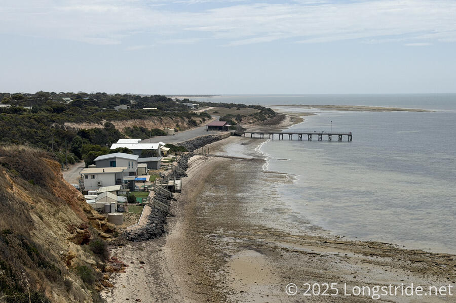
As we neared Black Point, the beach got a bit more soft and seaweedy, but fortunately, it wasn’t very long until we reached our turnoff.
Coming off the beach near Black Point, we entered the Maxine Hawke Park, a conservation area started in 1995, with planted trees watered via reclaimed water from a nearby waste treatment plant. It was nice to get some shade, but definitely don’t drink the water there.
Out of the park, on the side of a road we followed for a while, a sign said of the community, “For those who visit, Black Point remains an idyllic family holiday destination with its calm, safe swimming beach and relaxed, non-commercialised atmosphere.” I took a bit of an issue with this; it may sound idyllic, but with no commerce, how can a community truly thrive? If it’s primarily a vacation destination, how long before it’s like Port VIctoria or Port Rickaby where there’s only a handful of permanent residents, and maintaining a functioning community becomes nigh impossible?
The road, partially with a cycle path nearby, led us to Pine Point, and we checked in to the caravan park there, with its very bubbly and cheery owner. (I think I’ve never been called “darling” so much before!) The park’s kiosk had plenty of soda and ice cream for us, and we also ordered burgers and chips. After getting meh burgers and chips at the Port Vincent Kiosk, we weren’t really expecting much, but, the food here was surprisingly good.
Pine Point, like many of the other small settlements on this side of the peninsula, once had a busy port filled with ketches to transport grain across the Gulf Saint Vincent to Adelaide. Pine Point seemed a little more resilient than some of the other communities we passed, and while the major industries of the peninsula (farming and shipping of the farmed goods, as well as mining) still persists, the nature and number of the jobs required has changed, thanks to the bulk grain handling facilities in Port Giles (which we passed three days ago; between Edithburgh and Stansbury and Ardrossan, which we’ll reach tomorrow. Perhaps this means that it is inevitable for more of the peninsula’s seaside towns transforming into vacation communities such as Black Point. (Edithburgh certainly seemed well on its way.)
We also discovered that a stretch of trail ahead is closed for road construction. It was disappointing there wasn’t any indication of this in the trail notes on the Yorke Peninsula’s website, and the closure notification posted on the message board at the kiosk didn’t include any particular suggested detour. We could walk the highway and cut back over to the trail at the next town, but it’s a 100 km/hr road, so, obviously, we’d prefer not to. A phone number to call for more information was unstaffed when we called.
But, this is a problem for tomorrow.