A long day didn’t go as planned, with rougher beaches and more roadwalk than expected.
Before we got started this morning, CareFree got some news regarding the theft of her wallet: the motel, using the information she provided on transaction locations, decided that a new receptionist they hired was the culprit and fired them. Which is unfortunate in many ways. Of course, it’s unlikely we’ll ever really know for sure what actually happened. Or get her wallet back with the rest of the items in it. But at least the police should have more information to go on, I guess.
We stopped by the general store again on our way out of town for more soda; with a long and very warm day forecast for today, we needed something to stay cool with. (We also needed more sunblock; we’d nearly run out, and Australia is no place to be outside without sunblock on.)
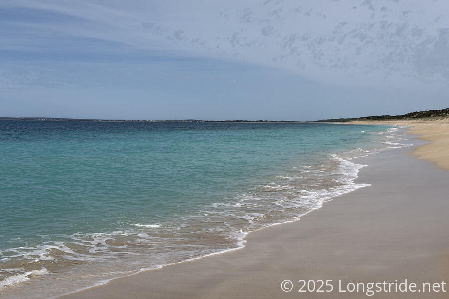
Leaving Marion Bay, we were very quickly back on a beach. We actually passed a few people on the beach, a rarity: an older couple out walking their dog, and another person out for a jog on their way back to town.
The weather this morning started off slightly warmer than yesterday, though some cloud cover helped keep it cooler. That didn’t last long, though, and much sooner than we’d have liked, the sun was out at full brightness.
The beach was okay to walk on, but the seaweed made it difficult to stay on the hard part of the sand. Still, we made good time for a while, and the seaweed eventually disappeared.
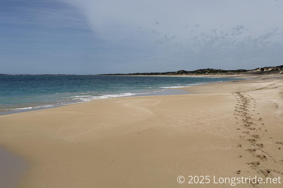
Later, as the beach got more slopy, the waves got quite a bit more vigorous — which, to be honest, I expected now that we were on the south coast — and it became a difficult challenge of walking low enough on the beach to walk on firmer sand, but not so low as to be overrun by the waves. In addition to being more sloping, the beach was also less even, with small hills and valleys made of soft, shifting sand. This added to the challenge of keeping our feet dry. Which, ultimately, we did not succeed with. I’d had the thinking that since the tide was going out, it wouldn’t be so difficult to avoid the water. But the waves were so inconsistent and rose so high on the beach that the tides going out just didn’t help.
Especially after the difficulty of the sand, and getting our feet wet, I think we both kind of regretted not taking a zero in Marion Bay. But it’d only been four days since Point Turton, and I’m not entirely sure we have time for it, given our plans for after we finish the trail. So I think we’ll revisit that idea when we do make it to Edithburgh, in four days.
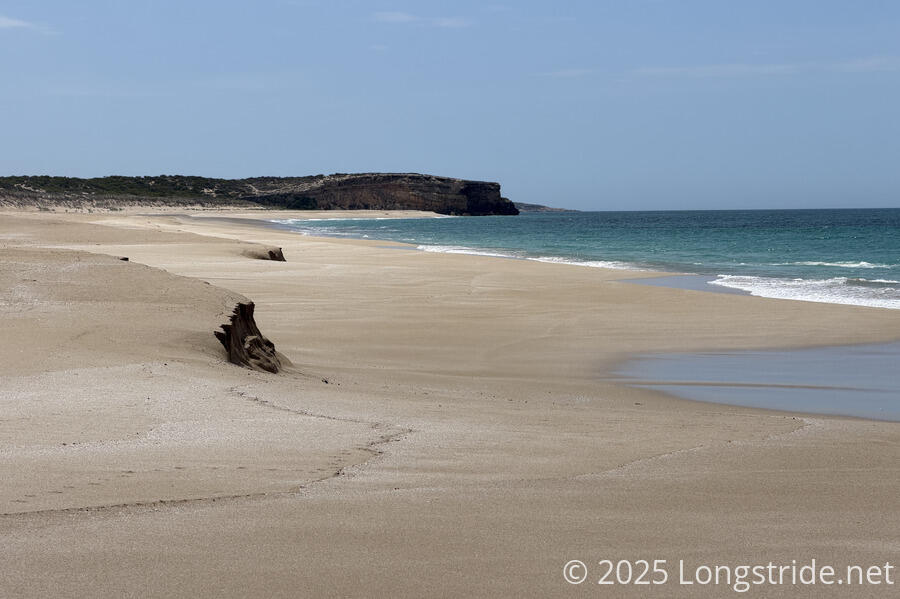
Ahead, Meehan Hill, sticking out into the water, provided an obvious end to the beach. As we got closer to it, we knew our struggle on the beach (or, at least, this beach) would soon be over.
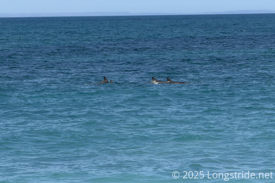
We got lucky, though, to see a pod of dolphins swimming, this time a little closer than before.
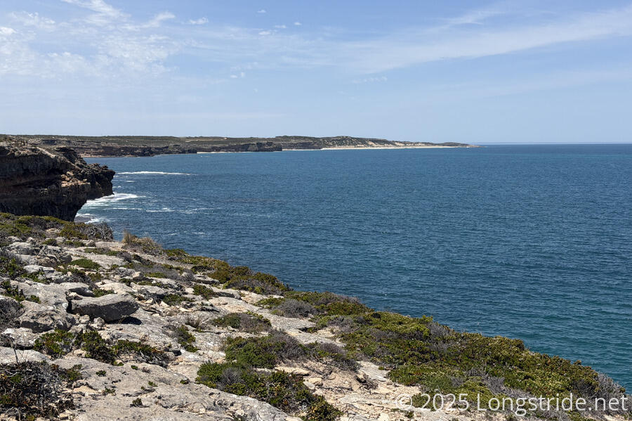
Once we made it off the beach to the top of Meehan Hill, very frustrated, we stopped on some rocks for a break. Today is supposed to be one of the most scenic on the trail, at least according to some people we spoke with. We hadn’t really been finding that to be the case. The views, apparently, are supposed to come from Kangaroo Island to the south, which was still low on the horizon and somewhat shrouded in haze. The view from the beach was okay, but nothing spectacular, at least, not compared to what we’ve seen in the past week.
But, making it to Meehan Hill had put us past halfway on the trail, so as tough as the morning had been, at least we had that accomplishment.
While we were there, a day hiker coming from ahead on the trail, gave us a rough idea of what to expect: we’d be on the clifftop for a long while, and then more beach. Not really appreciating either the view we had at the moment, or more beach, and weighing in that it was already 1 pm with 20 km still to go (in 3.5 hours, we’d hiked barely more than 10 km), we decided to bail on the clifftop and head to the road. We’d be on the road for a while anyway later today, so, may as well get a head start on it. At least we’d go fast. And, there’d be a small store along the way we could stop and get ice cream and soda from.
A little over an hour later, we reached the store, and took a somewhat long break in the shade, eventually feeling very much recharged with ice cream and cold drinks.
Another few hours down the road, we reached where the trail was supposed to leave the road, but found it to be a bit more overgrown than we were willing to deal with, and returned to the road to walk the last twenty minutes to our campsite, at Foul Bay.
One of the perks of being an explorer is getting to name things. According to the sign at the Foul Bay Campsite, Matthew Flinders, who circumnavigated and mapped Australia in 1801-1803, named the bay as such because he couldn’t find solid ground in the bay to lay his anchor. He also named quite a lot of other things, including Kangaroo Island (supposedly because of a great feast of kangaroos his crew had there); the Investigator Strait between the Yorke Peninsula and Kangaroo Island (after his ship, the Investigator), and even the Yorke Peninsula and Australia itself.
While we were eating dinner in the shelter at the campground, someone arrived by car to clean the toilet. In all the hiking I’ve done, I’ve never seen this before. Unfortunately, but not surprisingly, they did not leave any toilet paper.
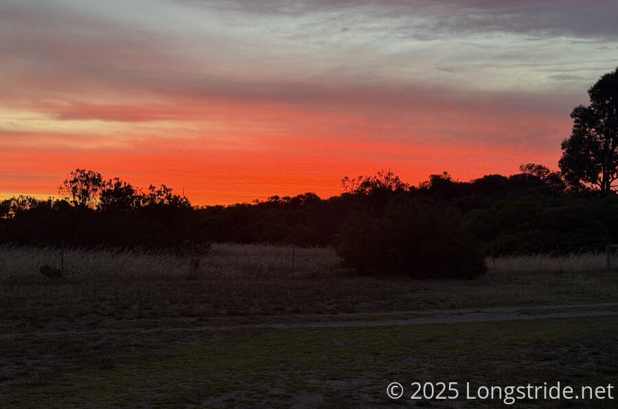
Some clouds provided a fantastic sunset, and after dinner, we retreated to our tent to watch an episode of tv we’d downloaded while in town.
Tomorrow, we’ll have another long day, over 32 km to Mozzie Flat, though with a bailout option at Sturt Bay 10 km before that, if the trails turns out to be too rough.