Our longest day on trail so far brought us to Edithburgh a day ahead of schedule, giving us time to take a day off for rest.
It was a bit breezy overnight, and this continued into the morning as we began a long day, continuing east along the Yorke Peninsula’s south coast. Leaving Mozzie Flat, the trail quickly became a footpath adjacent to farmland.
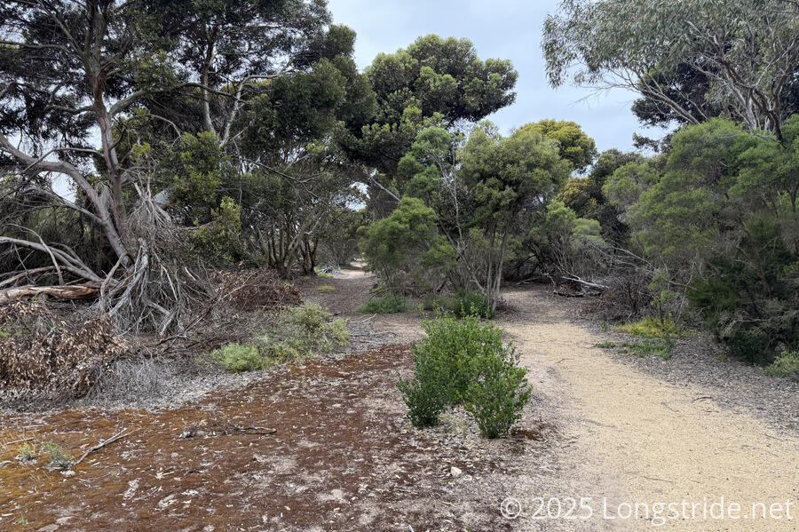
Before reaching the small town of Port Moorowie, we went through a nice, airy forest, only about a 15 minute walk from the campground, with plenty of camping opportunities (though obviously lacking in water and toilet facilities).
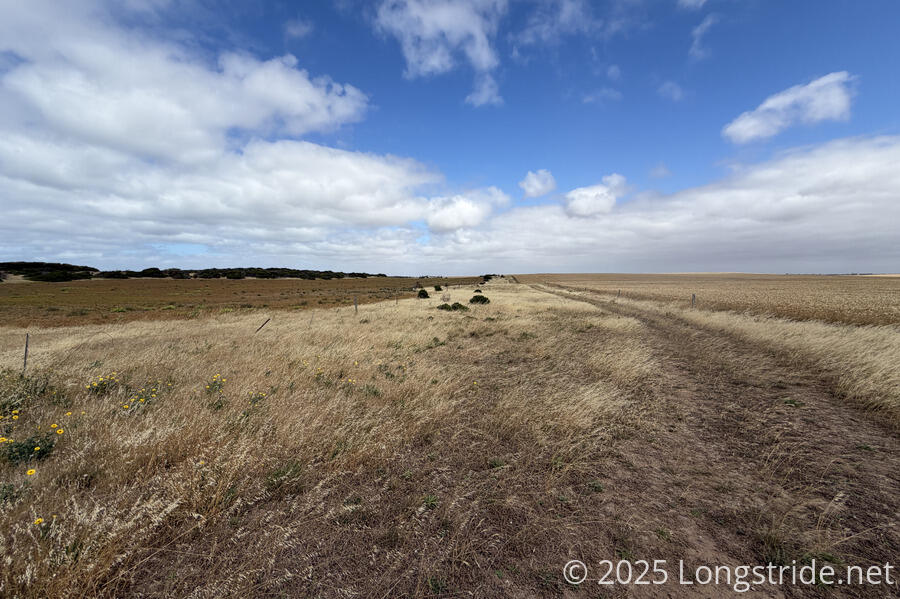
After making its way through town and snaking through a park on the town’s eastern outskirts, the trail again traveled along the thin boundary between two farms. While this was much less overgrown than yesterday’s property boundary trail, there were still plenty of grasses happy to shed their seeds into our socks, in what seemed like record numbers.
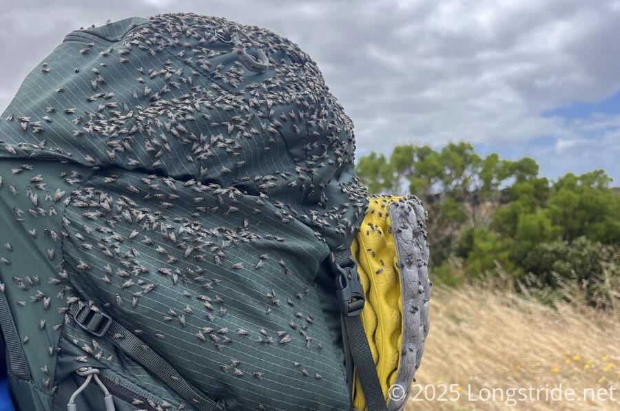
Also with record numbers were the flies, which were impressively relentless.
An hour along the path between farms brought us to a dirt road, and another ten minutes brought us to the Kemp Bay Shelter, where we stopped for a break.
Despite the annoyance of the flies and grasses on the trail — I don’t think I’ve ever had so many seeds stuck in my socks before — we made excellent time, about 10 km in two and a half hours.
Leaving the shelter, we continued on the clifftop, walking through scrub with a loosely defined trail. A sign asked us not to step on the plants, since they help to hold the land together. This was easier said than done. Especially with the strong breeze making it hard to not lurch around, staying off the plants would be easier if there were a single regular-width path rather than multiple very narrow paths.
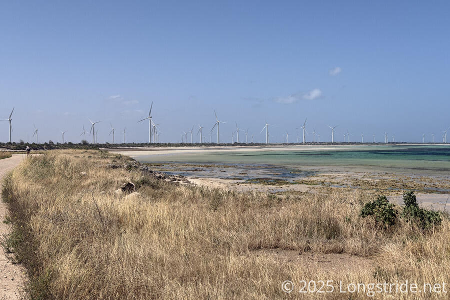
Off in the distance, we could also see a sizable wind farm. If it’s usually as windy as it was today, those turbines probably generate a lot of power.
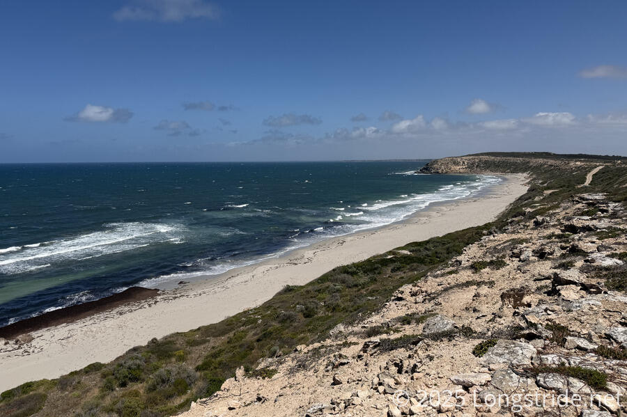
The wind was evident far out into the Inspiration Strait, with whitecaps as far as the eye could see. In the distance, the Troubridge Hill Lighthouse became visible, its unusual shape standing tall above the surrounding land.
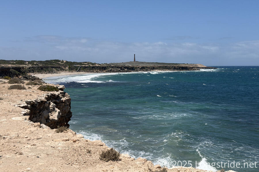
The path eventually joined a dirt road, and we again picked up speed. We saw a handful of people driving and stopping at various overlooks, and some of the signs called out shipwrecks in the area, due to the nearby shoals and reefs. (One sign said that by 1911, there had already been 19 shipwrecks in the area.)
The Troubridge Hill Lighthouse is the first brick-construction lighthouse in Australia. Built in 1980 from wedge-shaped clay bricks fired specially for this lighthouse, it replaced an older lighthouse and is a quite distinctive marker during the day.
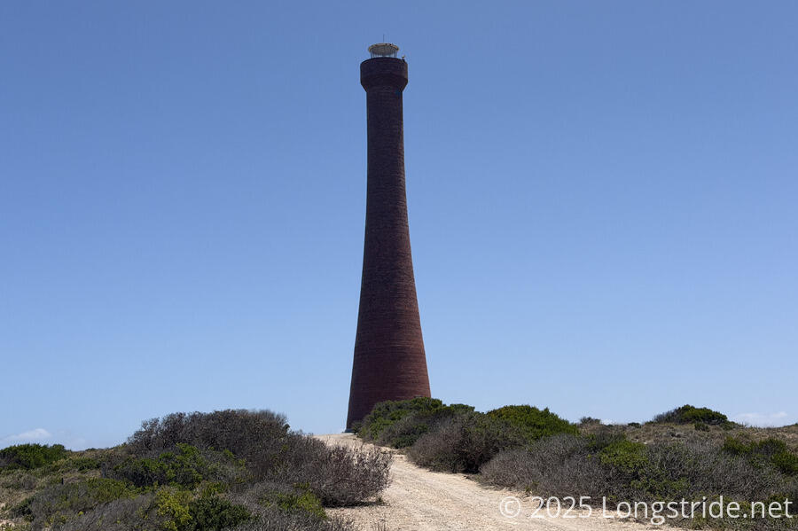
We took a long break in the lighthouse’s shade, though unfortunately, there was nowhere around the lighthouse that wasn’t windy.
As we continued on the road, we soon curved north, now on the Yorke Peninsula’s east coast. We passed the windfarm we saw earlier, though none of the turbines were spinning.
Another hour and a half later, we reached the Goldsmiths Beach Bush Campground, and took a break in the shade of its shelter, our feet tired and hurting from the repetitiveness of the roadwalk from the majority of the day.
When we resumed, CareFree continued on the road; I followed the trail onto the beach, my feet needing a break from the road.
The beach was surprisingly nice, if a bit narrow. There were plenty of sea birds, including a few oystercatchers and three black swans. Also, a dead dolphin that had washed up on the beach and was partially buried.
I arrived near the end of the windfarm, where the trail left the beach and connected to the road, just before CareFree also arrived. I was surprised it took us the same amount of time to get there; she had been hoping I would take longer so she could have an extra break.
We took a very short break, but it was now after 5 pm, and we still had a fair distance to go to get to town. We continued on a trail that shifted inland a bit. It was a little overgrown, much to CareFree’s dismay, but it was largely fine, and we made fast progress. We saw some kangaroos, which haven’t really been as common as we’d expected them to be given our experience on the Great Ocean Walk and Great South West Walk earlier this year.
Then, the trail veered a little closer to the beach. Without trees to block the seaweed, the seaweed that covered this part of the beach had blown back to cover the trail quite thickly, making it a slow-going slog. We eventually decided to leave the “trail”, descending the beach to walk along the ocean, which, with firm sand, was much faster.
Once we reached Sultana Point, we left the beach and joined a gravel road, taking us into Edithburgh. Shortly after, we reached another beach access point on the Sultana Bay, and stopped at a picnic table to rest our feet.
The rest of the walk to town was as fast as we could manage on paved road while not angering our feet further. We stopped for dinner at the only place that seemed open, the Location Cafe, which really only had pizzas left because they’d shut down the rest of their kitchen for the evening. (The pizza was great.)
A block away, we reached the Edithburgh Seaside Motel, where we’ll be staying the next two nights. Our feet are exhausted, and we need a break.