A long day of difficult beaches and vague clifftop paths brought us to a great change of scenery: the Dhilba Guuranda - Innes National Park.
A light rain fell briefly in the early morning, which seemed to set the stage for the rest of the morning. When CareFree and I left camp around 8 am, it was cloudy with a nice breeze. We hoped it wouldn’t rain, but with 30 km to hike today, the longer it was cloudy, the easier the day would be.
It took a little while longer to finish walking through the sprawling Gleesons Landing Campground, and eventually, we were deposited on a short beach which only took about 25 minutes to cross.
Leaving the beach brought us to another campground, the Daly Head Bush Campground, also populated with several caravans. On our way out, we ran into an older guy out for a walk on the trail. He was actually the first person we talked to who asked us where we were from — that is the surprising thing is that it took this long for someone to ask. (He also guessed I was Canadian; close, but not quite.)
A little further, we stopped at a bench at a small monument for the Daly Head National Surfing Reserve. It was a bit early for a break, but the sky had darkened and it was definitely raining to the south, so it seemed prudent to get a break and snack in while we could be somewhat comfortable.
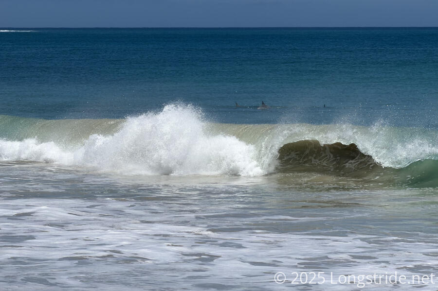
Before the trail dropped us back onto beach (via a long staircase), we saw something swimming in the surf. At first we thought it was a dolphin, then maybe a seal once we got out the binoculars. Either way, the surf was pretty vigorous.
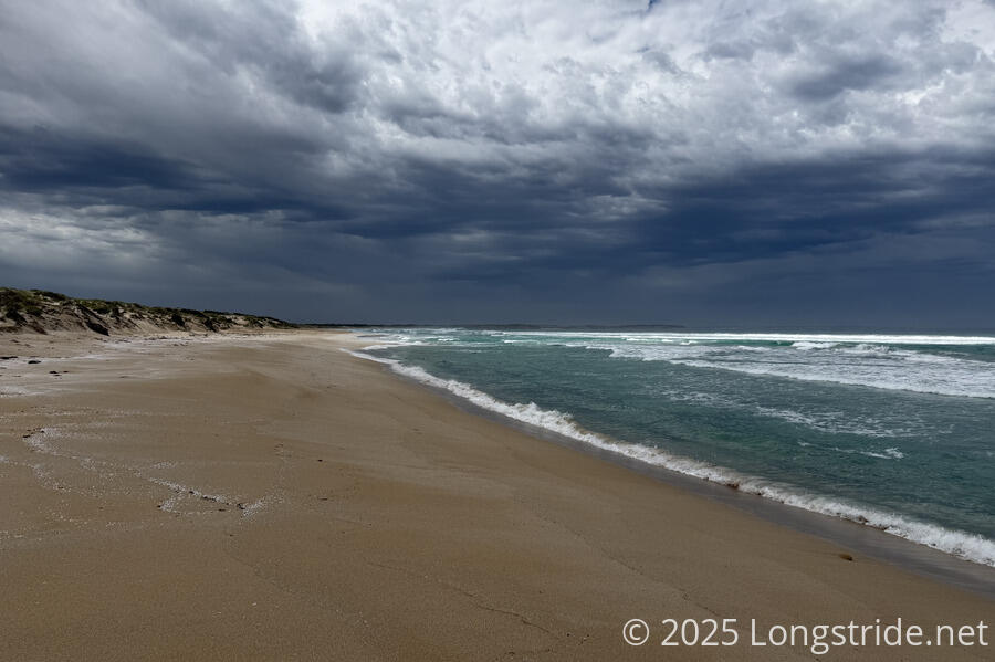
This beach wasn’t the easiest to hike on. Close to high tide, there wasn’t much of a flat part of the beach; it was rather sloped, we were often in looser sand, and the waves often crashed high up the slope. I got my shoes wet when one of the waves got me by surprise.
At the break, we’d put on our rain jackets, but this was making it warm, and the threat of rain seemed to have blown out to sea, so we stopped to take our rain jackets off. Then, one of the waves snuck up on us; I was able to get my pack moved out of the way before it got wet (and my shoes more wet), but CareFree didn’t see it coming in time and her shoes got soaked.
So we wound up also changing into dry socks. At least it wasn’t as bad as our ill-advised “shortcut” on the first day, when we wound up walking through water for several minutes.
We were on the beach for a little over two hours. Because there was so little firm sand to walk on, I had to stop twice more along the way to clean loose sand out of my boots.
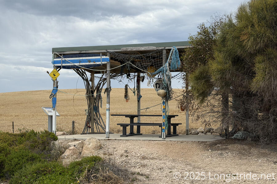
We eventually stopped for a break at the Formby Bay Shelter, at a small parking area on the cliffs above the beach. The shelter was much like the other shelters we’ve seen on the trail, except it had been decorated with a surfboard, fishing nets, sandals, and other water-related artwork and accoutrements.
Unfortunately, its water tank was either empty, or the valve was fiddly and we couldn’t figure out how to get it open. Thankfully, we still had plenty of water, but we were hoping to hedge a little in case our campsite was unexpectedly dry.
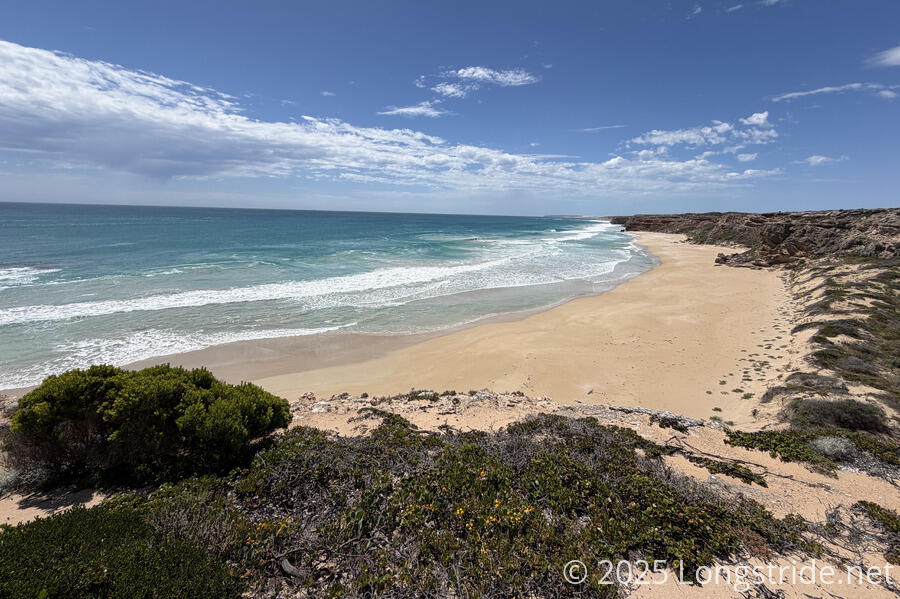
From the shelter, the trail quickly dipped down to a beach, which gave us the opportunity to see some more dolphins from a little closer. Then, it was back up to the cliff.
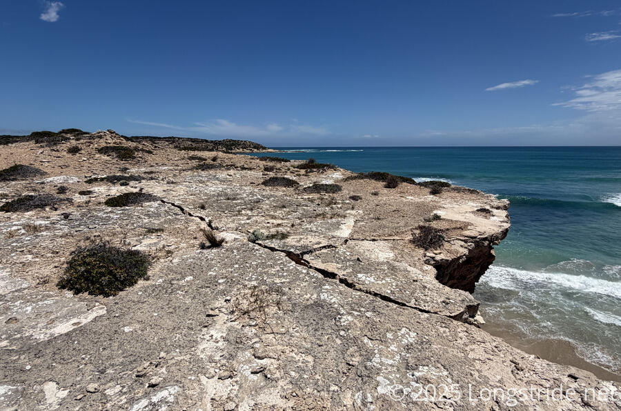
Many of the cliffs that we walked along have been unstable, but that was especially evident with the cliff face shortly after we got back on top. A large crack ran from the edge, threatening to eventually plunge a large chunk of cliff onto the beach below.
As we proceeded further along the cliff top, the trail markers disappeared, leaving us to follow a shifting maze of sandy paths. It was a little disconcerting that there was no clear path, leading us to stomp through bushes more than we’d have preferred. However, there really was only one direction to go: follow the coast and the cliff face.
The trail seemed to cross a couple of property lines, as evidenced by the fences we either walked around, over, or crawled through. Our maps showed areas delineated as “Unnamed Heritage Agreement”, and twice we passed by some old wooden structures that evoked a feeling of a ceremonial place and that we should not intrude.
There’s nothing quite like that nagging feeling where you’re not sure if you’re supposed to be where you are or not, but there’s really no choice but to move forward anyway. At one point, the scrub got thick enough that we considered bailing to the access track along a farm, but we couldn’t tell if that would actually get us where we needed to go, or even how long there would still be a path there.
Ultimately, a couple of hours of bush bashing and pressing on got us to where we needed to go: a steep path down to Gym Beach.
The beach was nice, if a bit sandy at points, but after the slow going on the cliff, coupled with some soft beach, we were pretty tired and needed a short break to collect ourselves.
Another twenty minutes of more firm beach brought us to the first trail sign we’d seen in two hours, indicating where we needed to go to get off the beach.
After a brief walk along a dirt road, we arrived at the entrance to the Dhilba Guuranda - Innes National Park, the largest area of natural vegetation left on the Yorke Peninsula. (Almost the entirety of the center of the peninsula has been cleared for farming.) so it was a treat to walk through natural forest for once.
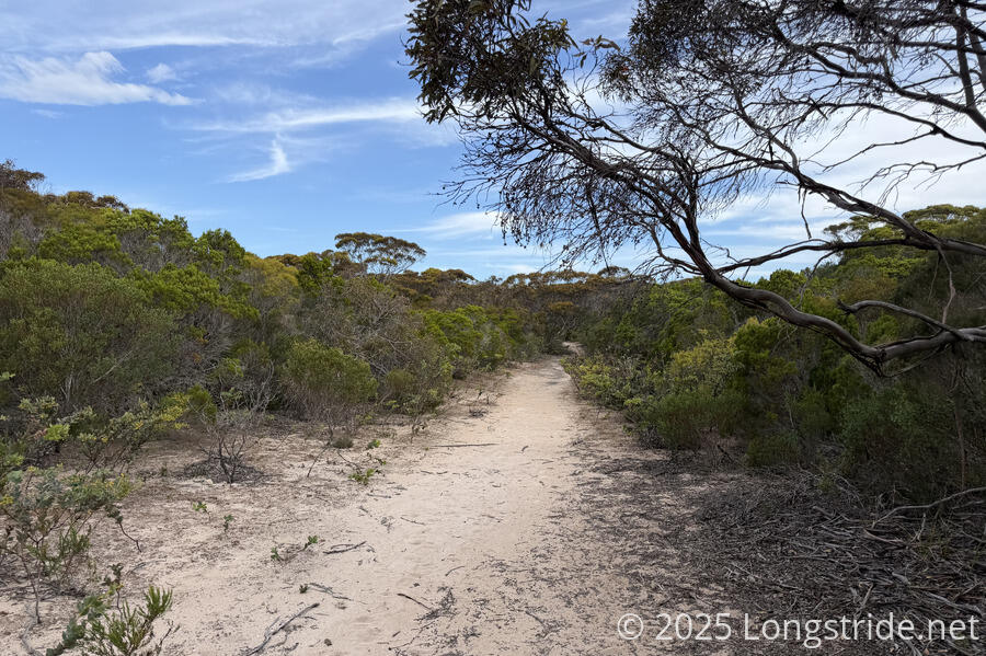
We saw a wallaby (or kangaroo, maybe, it was hard to tell) flee the trail into the forest, but overall, aside from the ants, and the flies that hounded us whenever we didn’t have a good ocean breeze, there wasn’t that much we saw.
We reached our campsite, Shell Beach Campground, a bit after 7. Being in the national park, this is the only trail campsite we had to book in advance (and pay for; all the rest have been free). Besides the wind, which continued to be a challenge in setting up our tent and cooking our food, there was also a new foe: mosquitoes! The wind helped some, but not completely, and we let more bugs into the tent than we’d have liked.
But, at least we had nice, soft sandy ground, and the water tank at the campground’s toilet had plenty of water for us.
We were set to have a relaxing evening, but the barely functional cell service we had brought more bad news for CareFree: she was receiving notifications that her spare credit card, which was stored with our luggage at the Glenelg Motel in Adelaide, was being used in Adelaide. We spent the next two hours trying to deal with that. Because we couldn’t contact the motel itself since it was after hours, we also had to go on the assumption that her laptop might also have been taken, which meant trying to change important passwords just in case. It’s definitely not what we wanted to be doing after an already very tiring day on the trail!