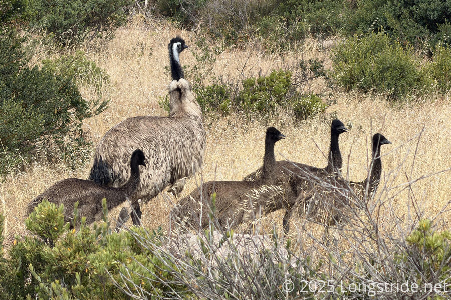
Finishing our trek through the Dhilba Guuranda - Innes National Park, we hiked to Marion Bay, and saw a lot of emus along the way.
It seemed like a nice clear day, and we had a mission: make it the nearly 30 km to the town of Marion Bay before the general store closed at 5:30, so we could pick up our second food box (and also get sodas and ice cream). So, we’d have liked to have left camp by 8 am.
However, CareFree had business to attend to. With the meager cell service at our campsite (and no guarantee we’d have any as we traveled through the national park), we waited until a little after 8 to call Glenelg Motel, to confirm what had been taken from the luggage we’d left in storage. The owner was aghast — they’d never had anything stolen from a customer’s stored luggage before — and were all too happy to help find out who did this. At CareFree’s request, they checked her suitcase, and confirmed that the pouch containing her wallet was not there, but importantly, her laptop and calendar planner were. They requested she file a police report (which she did once she was done with that call), and provide them with information so they could do their own investigation.
Needless to say, this was quite a drag on the day, especially when it came to thinking through what all might have been in her wallet, and in the pouch the wallet was in, and maybe even in the pouch that pouch was in; if all of it was taken, it would be quite the hassle to arrange replacements for.
We finally left our campsite at nine, making our way back out to the dirt road we’d been following yesterday evening.
That brought us to a trail that, on its way to Pondalowie Beach, traveled through Nhibu anggi, a sacred womens’ site of the Narungga people, the traditional owners of the Yorke Peninsula. While we were walking through the dunes, a sign requested we stay on the boardwalk and not take photographs. This is the first such request posted on the trail. (Later in the day, there would be another, near our exit from the national park.) It reminded me of the areas we came across yesterday that also seemed ceremonial in nature, but at least today, we had the benefit that we knew we were exactly where we were supposed to be.
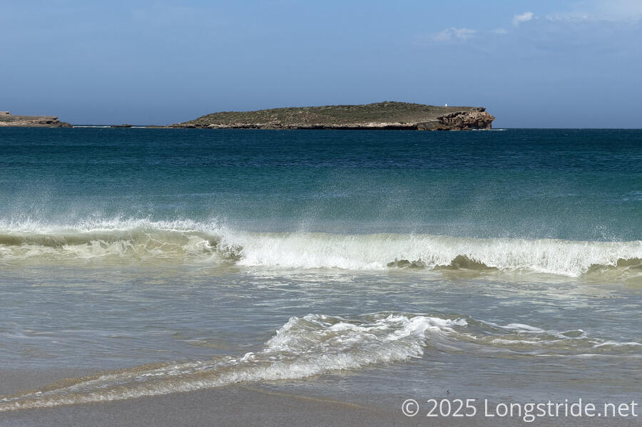
Pondalowie Beach was a nice, crescent-shaped beach. Often, waves here seemed to be highly synchronized, and tended to break along a kilometers-long curved line in the water all at the same time. (I tried to take video; the waves immediately calmed down and stopped cooperating.)
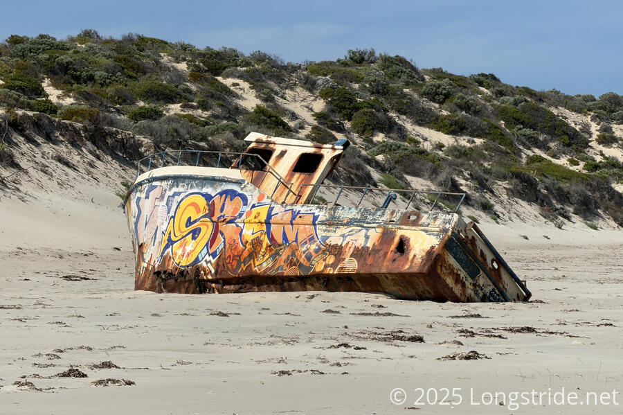
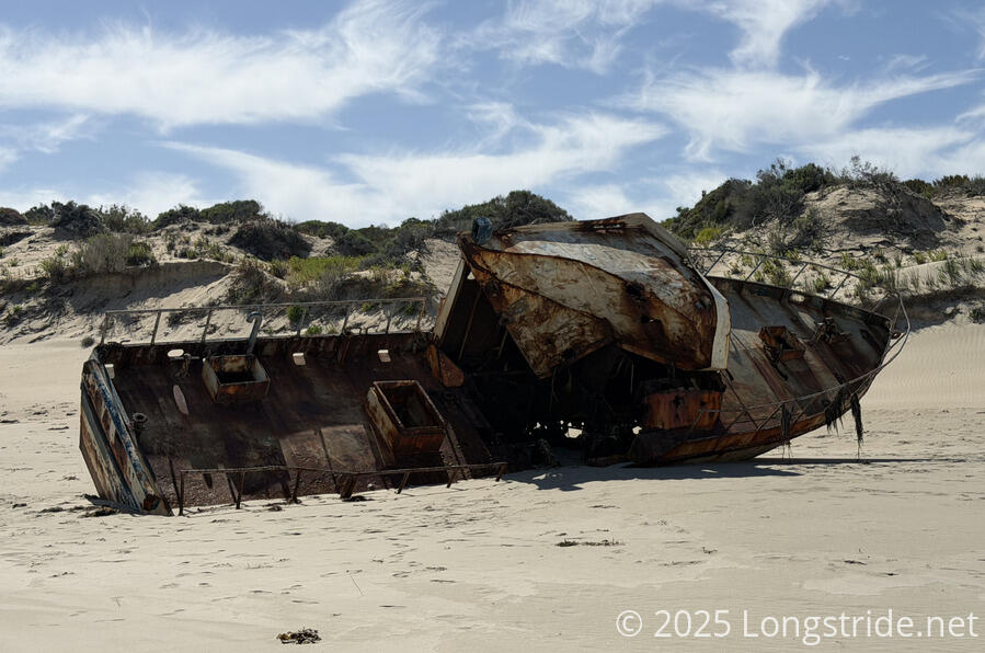
A lone, rusted shipwreck on the beach was the main point of interest. Graffiti on one side made it look more lively and intact than it was; the holes and extent of its deterioration was more clear on the other side.
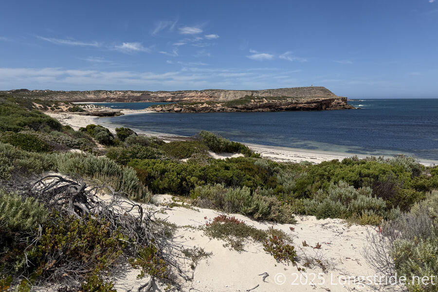
Rounding around the beach took us past some houses and people getting ready to go fishing, and we stopped for a break at a lookout at the top of the beach. Coincidentally, this was the westernmost extent of the trail! An island just off the beach funneled water flowing in from the Spencer Gulf, leading to some impressive and long-lasting wave splashing on the rocks. It seemed that at extreme low tide, the island might even be connected to the mainland.
When we continued, we had a nice view to West Cape, and its small lighthouse. If we had more time, we could have detoured over to see the view from there, the westernmost point of the Yorke Peninsula.
Back on a dirt road, we began heading southeast through the park, barely catching a glimpse of two emus running into the brush.
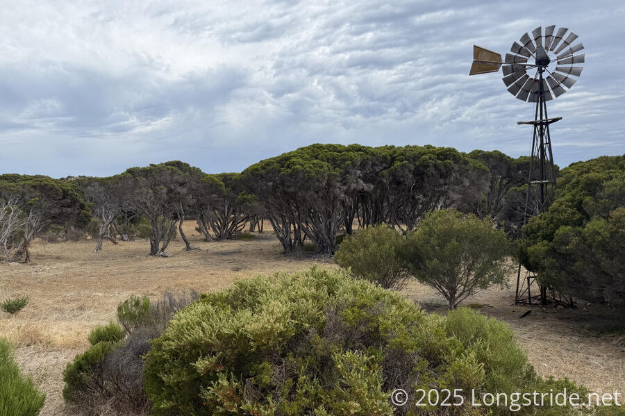
The road continued through the Pondalowie Campground. We turned off onto a trail, perhaps less clear and well marked than we would have liked, and followed that for a while. Passing by a clearing, a windmill stood, probably once used to pump groundwater.
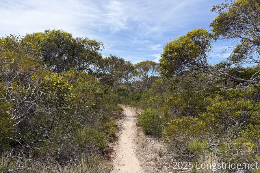
Wandering around the park for a little more (and diverging from the line on our map), the trail crossed a road and looked momentarily bushy and overgrown. CareFree wanted to bail out to the road; I wanted to continue on the trail. My feet were pretty tired yesterday, and more roadwalk wasn’t going to help, especially with more roadwalk towards the end of the day anyway. My gut feeling (which turned out to be correct) was that just the trailhead was a bit messy, and once we got a hundred meters past the trailhead, the trail was a perfectly fine mix of dirt and sand, and we sped our way along.
The speed wasn’t just from the niceness of the trail; it also came from biting flies, which chased us essentially the whole time we were in the park. They constantly bounced off our legs in a way that was even more annoying than the regular-sized flies constantly swarming around our heads.
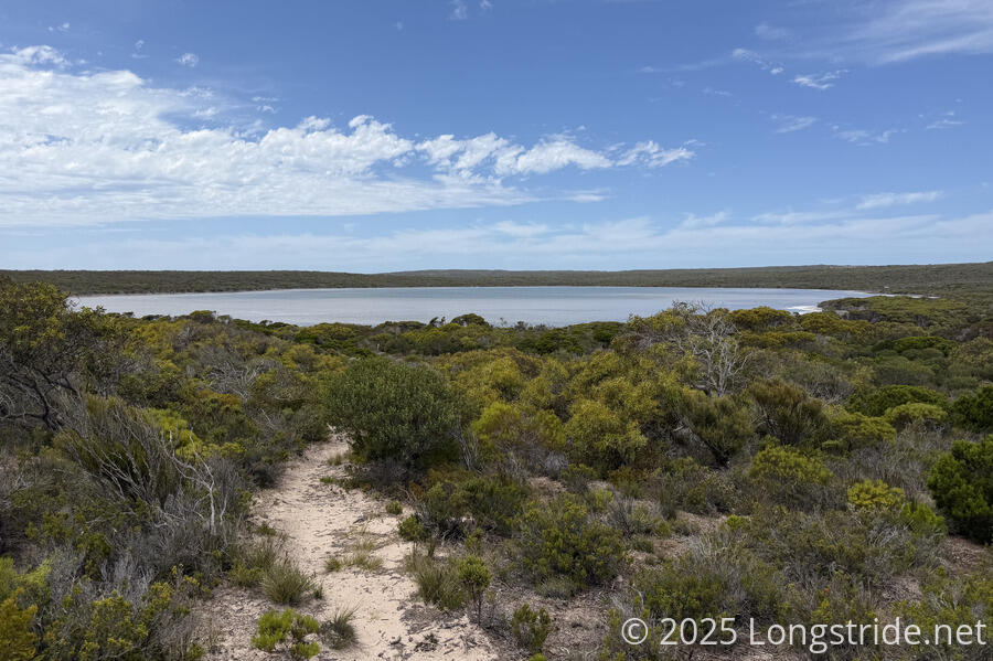
We got a nice view of Deep Lake, and the trail dropped down to travel alongside half the lake. If we weren’t a little pressed for time, we might have stopped at the lake for a break.
I suppose that technically, we were in some kind of forest — at least occasionally, the trees were taller than we were — but really, the Yorke Peninsula feels closer to a desert than anything else. Still, the plants are different than I’m used to seeing (either in North America or New Zealand) and it definitely has a different sort of “wild” feeling to it.
The trail eventually joined a road, which took us past a few buildings, and then brought us to a rail trail, the legacy of gypsum mining and plaster production in the area. Here, the forest was a bit denser than it had been for most of the rest of the day.
We kept seeing emus throughout the day, occasionally single birds, but more often, the dads with multiple chicks — if you can even call a meter-tall bird a “chick”. If we were disappointed with only getting a good view of a pair of emus running away once on the Great South West Walk, we were elated to be almost overrun in emu sightings today.
A park ranger we ran into shortly after we finished the rail trail and rejoined dirt road is who informed us that the male birds, not the females, raise emu chicks. The most chicks we saw at once was four, but the ranger mentioned that there was one who frequented Marion Bay that paraded around with sixteen!
The rest of the day was almost entirely roadwalks — first dirt, then along gravel and paved roads — that brought us into Marion Bay. We were a little later than we’d planned, but the general store was still open (the owner was waiting for a delivery that was running late.) So we were able to pick up our food boxes (with four days of food to get us to Edithburgh), and, of course, get ice cream and soda.
We had reserved a room at the Marion Bay Tavern & Motel, so we got our key, dropped our packs off, and got dinner at the tavern.
Tomorrow, we’ll return to the beach and continue along the south coast of the Yorke Peninsula. We’ve also got our eye on the weather: while it’s generally been okay, there’s a day next week that is going to be brutally hot, and we’re not looking forward to that.