Capping off a year of coastal hikes, Walk the Yorke in South Australia’s Yorke Peninsula became my fourth coastal hike in a row.
If you like beaches, I highly recommend this trail. Read on to see why.
The Trail
Walk the Yorke is a 490 kilometer (304 mile) walking trail along the coast of the Yorke Peninsula, connecting Port Wakefield in the east and Moonta Bay in the west. It is an initiative of the Yorke Peninsula Council, which manages the trail and provides trail notes and maps for the trail’s 16 sections. The trail is both a hiking and cycling trail, with the cycling trail generally following roads inland where the coastal path is not favorable to bikes.
The trail is generally described going clockwise, starting in Port Wakefield, but we chose to hike it counter-clockwise, starting in Moonta Bay, because of bus timetables. (We wanted to catch the bus in Port Wakefield to go back to Adelaide, so counter-clockwise worked better for that.)
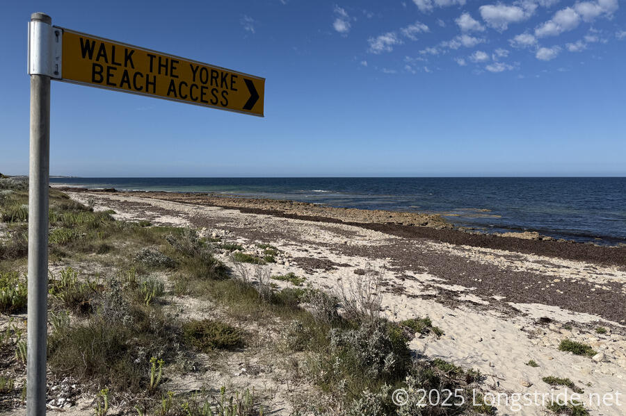
Most of the trail is on the beaches, or the cliffs above the beaches. A smaller portion is on roads, usually just on the inland side of the coastal dunes.
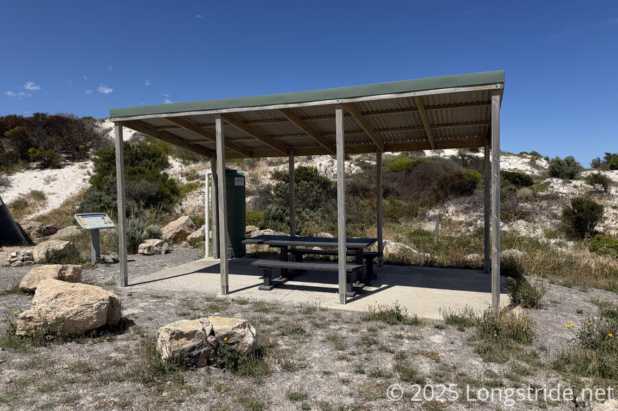
Hikers (and cyclists) along the trail are supported with a series of day-use shelters and campgrounds. Most of the shelters have composting toilets, and water tanks, which, outside of towns, are the only source of drinking water on the trail. Along many of the longer (dirt) roadwalks, there are benches every couple of kilometers, so one can take a break without having to sit down on the road.
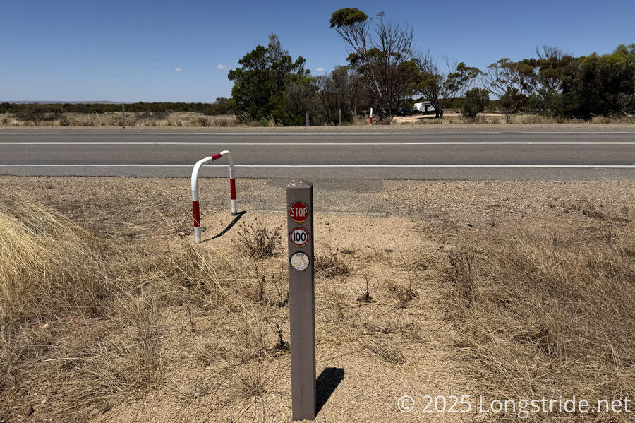
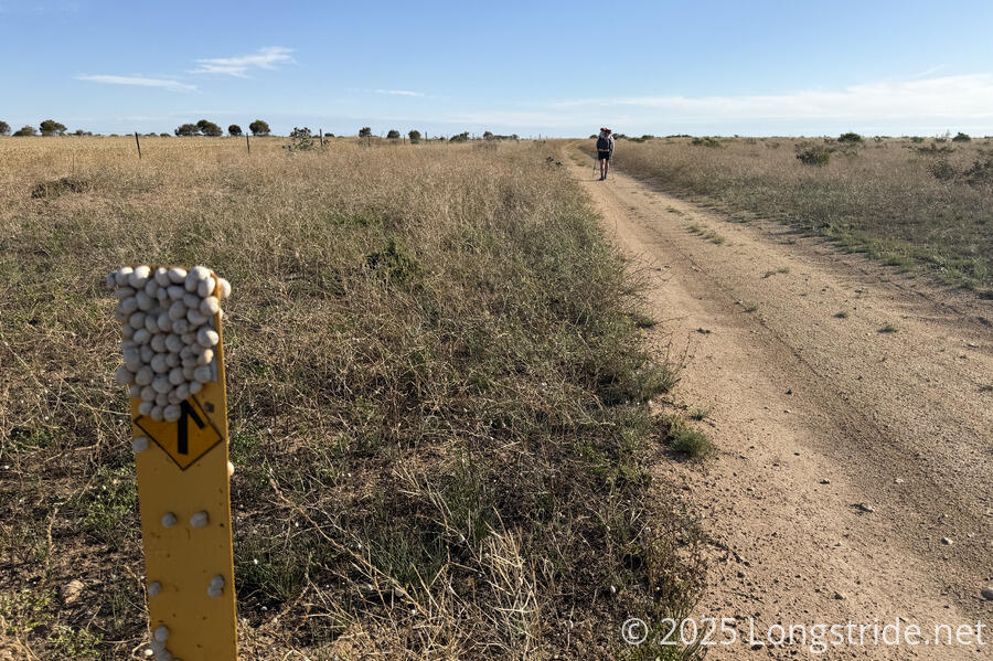
Most of the roads the trail explicitly follows are low- or zero-traffic roads adjacent to farms, or the short walks through the towns that dotted the coast. One thing I really appreciated is that every time the trail joined a road, road signs explicitly called out the start (and end) of a Walk the Yorke Shared Zone, so drivers were aware to be on the lookout for cyclists and walkers. Most of the time, drivers were fairly courteous, though there was always the occasional driver who insisted on driving far too fast down a dirt road, kicking up a huge cloud of dust. At crossings of high-speed roads, markers on the trail called out the speed limit of the road, and used bike stands on both sides to indicate where to cross (and potentially alerting drivers to the location of the crossing as well).
Towns along the trail also have a variety of lodging opportunities, including caravan parks with both tenting and small cabin opportunities. Wild camping away from the designated campgrounds is not really an option, at least, not one that can be relied on. Camping on the beach is inadvisable, and there are very few places on the dunes or cliffs where one could pitch a tent. (Regardless, such a place wouldn’t have any water.)
Getting To and From the Trail
Walk the Yorke is rather accessible, as long-distance trails go. A bus line stops in Port Wakefield, just over a kilometer away from the eastern terminus, and continues on to Moonta Bay, stopping at a parking lot next to the trail’s western terminus. In both towns, a caravan park adjacent to the trail provides camping or lodging opportunities before starting or after completion.
From Adelaide, Port Wakefield is about an hour and a half bus ride. Moonta Bay is roughly another hour and a half further.
When the trail isn’t on road, there’s generally one nearby. Many beaches along the trail have road access at least once along their length, so if one needed to bail off the trail for some reason, it would not be too difficult. As noted above, we skipped off the official trail to one of the roads paralleling the coast multiple times for a variety of reasons.
It took us three weeks to walk the trail, including three rest days in Point Turton, Edithburg, and Port Vincent. (Two of those were planned; the third was to sit out bad weather.) We hiked the whole trail in one trip, but the trail’s proximity to towns and roads makes it easy to section hike. For cyclists, especially those with a support car, there’d only be a few days where staying indoors in a town would be a challenge.
We had cell service almost every time we needed it, though service was a bit more sporadic in and near the national park.
A Series of Amazing Beaches
If you like wide, white-sand beaches, Walk the Yorke is your trail.
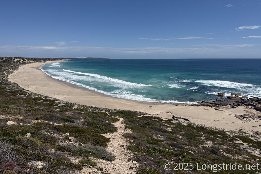
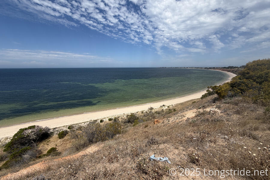
While the other three coastal trails I hiked this year (the Great South West Walk, Great Ocean Walk, and East Coast Trail) had some amount of beach walking, all three of those trails spent much of their coastal time on cliffs above the ocean. And while Walk the Yorke did spend time on cliffs as well, a significant portion of its length, especially on the western coast, is on beach.
Relative to its length, Walk the Yorke has the most beach walking of any trail I’ve hiked (though New Zealand’s Te Araroa likely has more beach in total). And, most of these beaches were fantastic to walk on, with plenty of relatively flat hard sand above the waterline. There was certainly an element of luck there: we got lucky with the tides. Many of the beaches we had easy walks on would have had miserable soft-sand hiking at high tide.
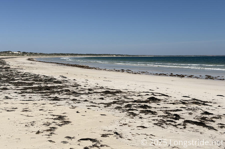
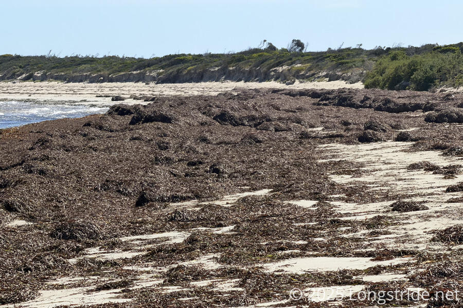
Although the tide was often, but not always, on our side, the main thing that marred our beach-walking experience on the Yorke were huge mounds of seaweed swept onto the beaches. Some of these were over two meters tall! In some places, they got in the way of having an easy walking experience, though frequently, there was enough beach (thanks to the beach being very wide and/or the tide being out) that it wasn’t a terrible problem. Several residents along the trail told us that the seaweed comes and goes with the storms, so it’s not always as bad as we had it. Aside from the seaweed, the beaches were fairly clean, with very little other debris washed up.
Even when the tides (and seaweed) were on our side, walking along beaches can often be tiring and monotonous, so we we enjoyed the change of pace we got when the trail did climb on the cliffs overlooking the ocean. This was usually much more rugged than walking on beach, but our feet appreciated not having consistent repetitive motions. And while you can get some nice views from beaches, there’s also a lot of sameness in beach views, so the change in perspective from the clifftop is also great.
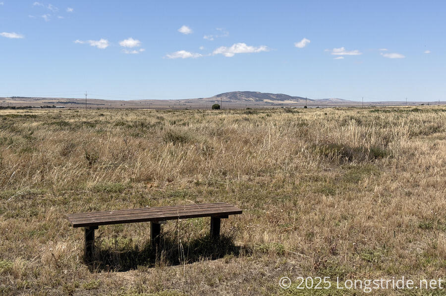
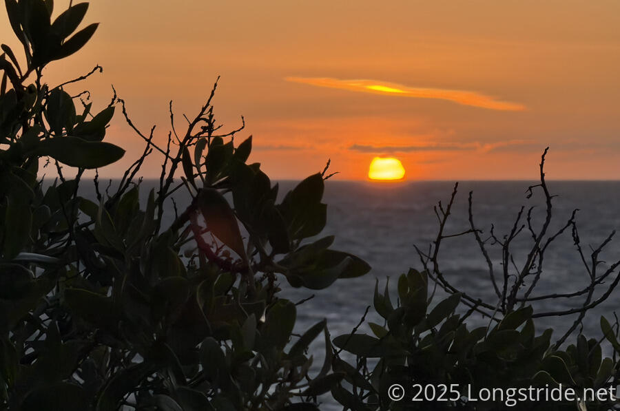
One could argue that the trail has three views: ocean from the beach; ocean from the clifftops; and of the flat interior farmland, though, that’s being a bit reductionist. While the views do have a fair bit of sameness, there is still a bit of variety. And we had a fair number of great sunrises and sunsets.
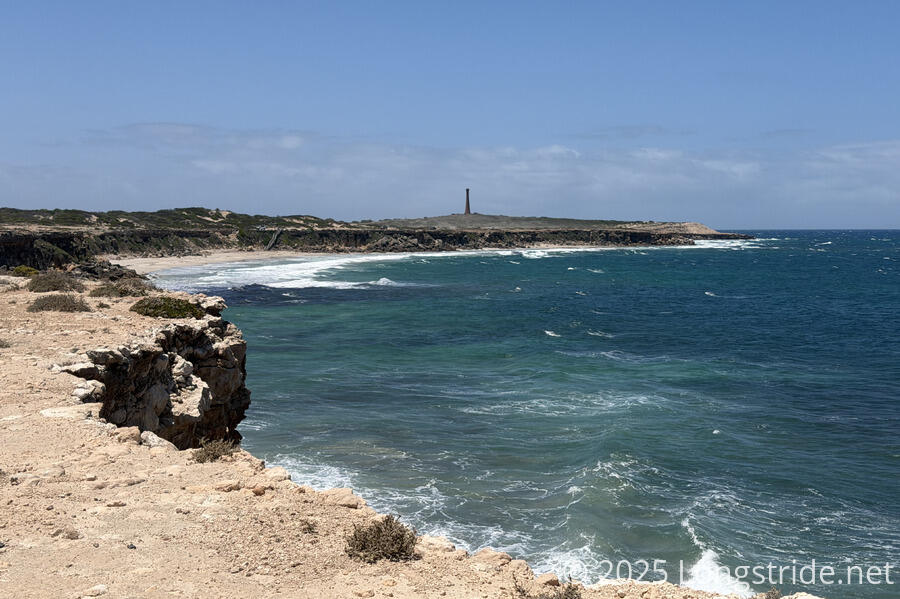
What the Yorke does lack is rugged coastline. Most of the coast is beach; only a few places had either rugged, rocky shore, or the kind of rough and vigorous waves that were hallmarks of the Great Ocean Walk and East Coast Trail. At least part of this is because much of the Yorke is very protected coastline, being deep in the Spenser and St Vincent Gulfs. With the large Kangaroo Island to the south, almost none of the coastline is exposed to the open ocean, except in the area around the Dhilba Guuranda - Innes National Park, and much of that coastline is closed to public access. Not to say this is a bad thing. The gentle coast allows the trail to follow the beach as much as it does. But it does mean the trail lacks the epic crashing waves of the Great Ocean Walk and East Coast Trail.
Flat Doesn’t Mean Easy
Walk the Yorke might be the flattest trail I’ve ever hiked, but that doesn’t mean it easy. The repetitive monotony of beach walking (not to mention, the sand that inevitably gets in your boots) is a good way to get blisters. Especially if your feet get wet from the surf reaching unexpectedly far up the shore. And sometimes, the beach is just too narrow, steep, or soft to make for comfortable walking regardless of the tide.
When the trail isn’t on the beach, it’s usually either on the cliffs above the coast, or on (mostly low-traffic) dirt or paved roads a short distance inland (usually just inside the dunes).
The trail has a few steep climbs from the beach to the cliffs, or down from the cliffs to the beach, but these are all very short. Where they’re difficult, it’s generally because the trail’s on loose shifting sand. And then the difficulty is quickly over.
Roads are a fast way for getting from one place to another, but they’re just as repetitively monotonous as the beach (though with less chance of getting wet!). But on Walk the Yorke, most of the roads are adjacent to the farms on the very flat interior of the Yorke Peninsula. Often dusty, there was a repetitive sameness along all of these roads that made us long for a return to the shore.
The worst of the trail was a several-kilometer stretch of unmarked trail through rough scrub above the beach between Gleesons Landing and the Dhilba Guuranda - Innes National Park, where we frequently lost the trail due to shifting sands, and were mostly just following the coast because there was really only one way to go. The day before, we bailed off the top of a dune to briefly follow a road because the trail was even more indistinct. A few days later, we likewise skipped a clifftop walk, taking a road instead, after becoming tired and frustrated by the beach walk that day.
Resupply
We found the resupply situation on Walk the York to be generally pretty good. On the east coast, every day the trail passes through a town with a grocery store or some other kind of food option.
By comparison, the south and west coasts were supply deserts, with sparse resupply options limited to small kiosks and caravan parks in a few towns. In particular, between Corny Point and Marion Bay, there were no options for food or indoor lodging. We made that part of the trail work with resupply boxes mailed via Australia Post to Point Turton and Marion Bay.
Especially on the west coast, but also especially notably in Edithburgh at the south of the east coast, the towns often felt like ghost towns, barely hanging on. In Balgowan, the kisok was closed, and in Port Victoria, the general store was closed and the kiosk also up for sale. Edithburgh was strangely lifeless, though apparently that was because we were about two weeks before all the vacationers arrive following Christmas and Boxing Day.
Wildlife
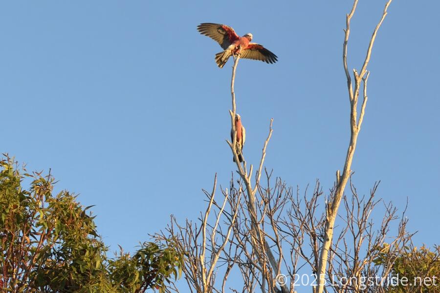
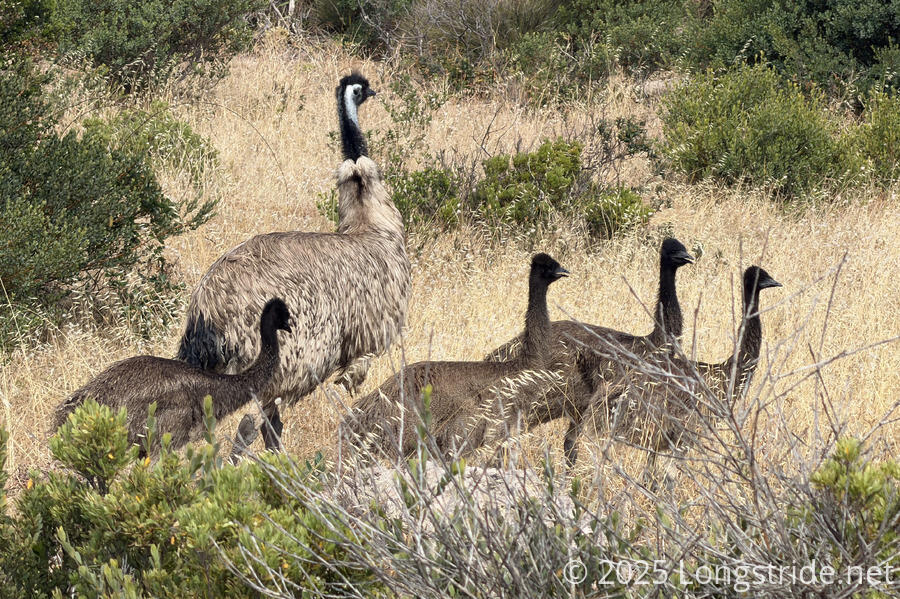
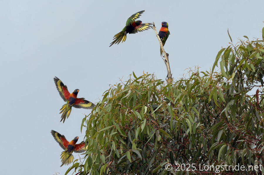
Overall, I was a little disappointed with wildlife on the Yorke. On the plus side, we saw a fantastic number of emus in Dhilba Guuranda - Innes National Park; a large and noisy flock of cockatoos in Corny Point; and dolphins on several days. Perhaps the star bird was the brightly-colored rainbow lorikeet. But there were fewer seabirds than we expected to see, and hardly any of the rest of Australia’s iconic wildlife, which we saw on the Great South West Walk in spades.
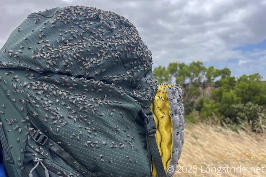
The one animal we saw in great quantities were flies, which on many days covered our packs while we were hiking, generally being a nuisance. Surprisingly, we did not see any live snakes, though we saw one shedded snake skin, and a dead juvenile snake in the middle of the trail. Hiking at the very beginning of summer, perhaps it was not yet warm enough for the snakes to become active.
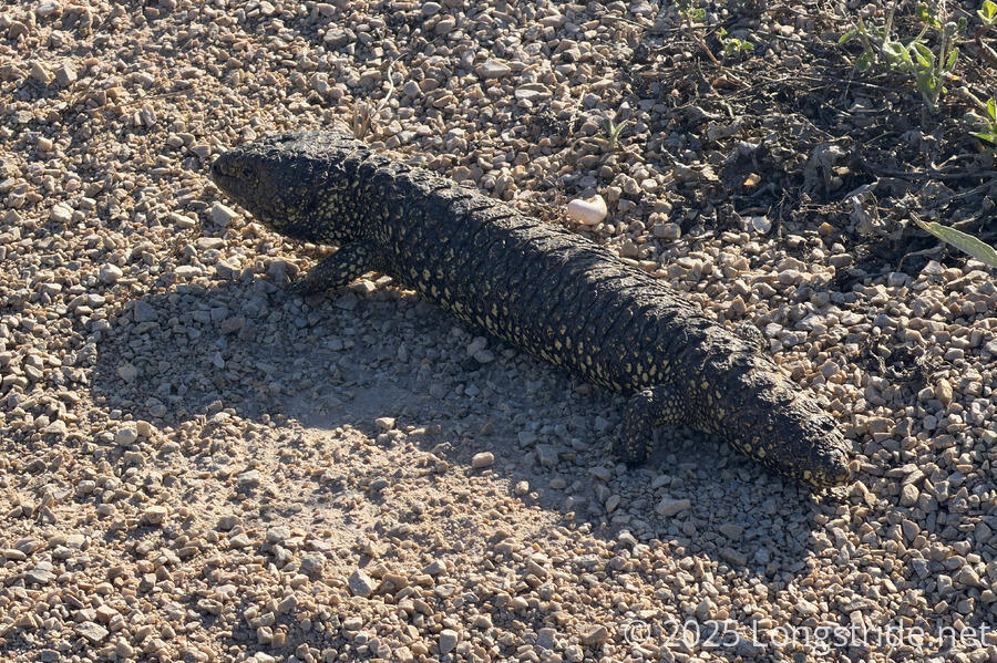
The one reptile we saw in spades were “sleepy lizards”, slow-moving lizards that almost look like a small log and blend in quite well with the underbrush. From the signage along the trail, I got the feeling they’re almost seen as mascots of the region.
Weather
We generally had good weather. Only a couple of times did it actually rain on us, and even then, it wasn’t for very long. Aside from the shelters, there was rarely ever any shade, so we were exposed to the sun almost the entire time we were hiking. Starting near the beginning of the Australian summer, we were a bit concerned about temperature, which is why we picked a southern coastal trail, rather than something further north.
The breeze coming in from the ocean usually helped to take an edge off the heat, which usually wasn’t too bad. We did have a bit of a heat wave towards the end of our hike, including one day where the weather reached 35 °C (95 °F), which was absolutely brutal even just walking around town that day. We were fortunate to have timed it so that we could take that day off in Port Vincent, where we stayed in a cabin with air conditioning. (While we were on the trail, Melbourne and Sydney both had multiple days over 40 °C (104 °F), so we got really lucky.)
I had some concern there might be issues with water at the shelters, given we were going into summer. But with the exception of two shelters that seemed to have busted valves, all of the shelters with tanks seemed to have plenty of water, and we had plenty of water when we needed it.
In Summary
Walk the Yorke wasn’t my favorite trail of 2025, but I still had a good time, and I’m glad I hiked it. It’s easy to get to, and easy to get away from, quite scenic along most of its length.