Over nearly 1,750 kilometers, from Cape Reinga to Wellington, Te Araroa travels across towns, cities, and the diverse landscape of New Zealand’s North Island. Continue reading for a glimpse at what New Zealand — and Te Araroa — have to offer.
North Island (Te Ika-a-Māui)
The North Island was an incredible (though mixed) experience. Starting off at Cape Reinga at the northern tip of New Zealand’s North Island, my partner, CareFree, and I made our way along roads, highways, beaches, rivers, and thick and muddy forests to Wellington, at the south end of the North Island, 80 days later.

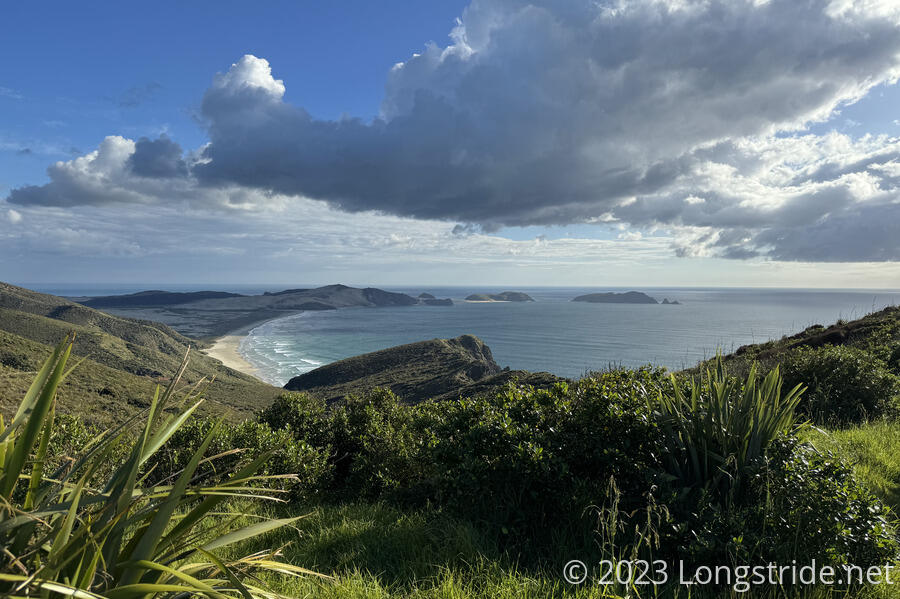
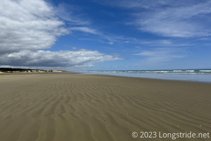
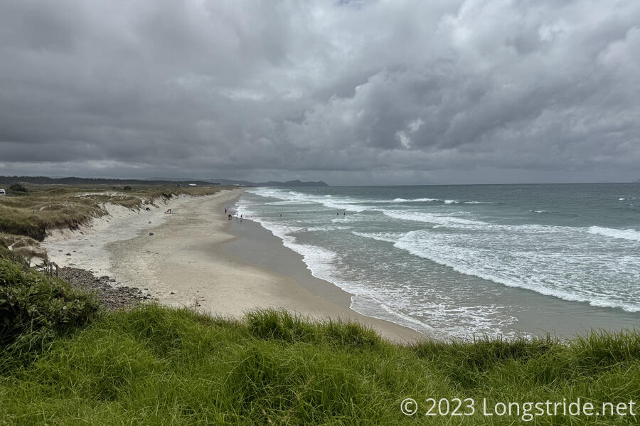
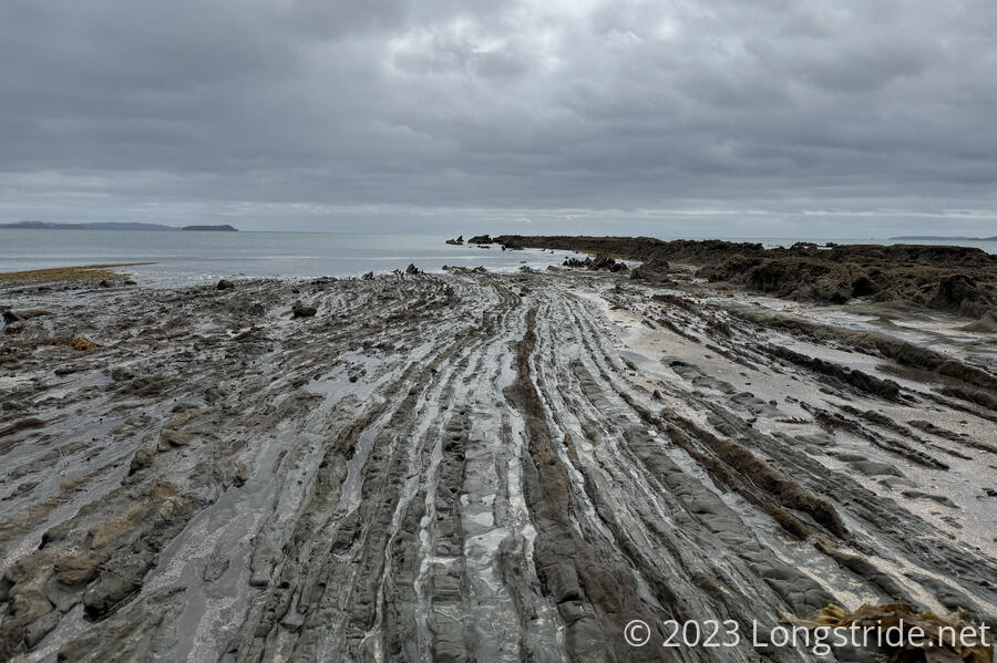
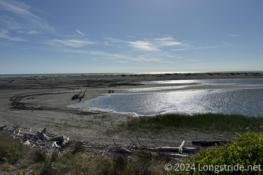
After reaching Ninety Mile Beach, Te Araroa’s first and longest beach walk, we spent three full days walking along the beach. It was the longest time I’ve ever spent on a beach, and the first while on a long hike. That by itself was pretty epic. We got quite lucky with the tides, being able to walk the whole distance each day with the tide sufficiently far out that we could walk along the firm parts of the beach almost the whole way. And it was quite lively, with lots of sea birds and plenty of washed up jellyfish (and the occasional shark, stingray, or pufferfish). The constant drone of the ocean, mixed with the bright New Zealand sun with no shade made for a tiring hike, but at least the ocean breeze kept it from being too hot.
Leaving the beach took us through the towns of Ahipara and Kaitaia (along a highway, which wasn’t the greatest to walk along), to a very welcoming Krishna Sanctuary, and then into the Raetea Forest, the first of New Zealand’s infamous muddy forests.
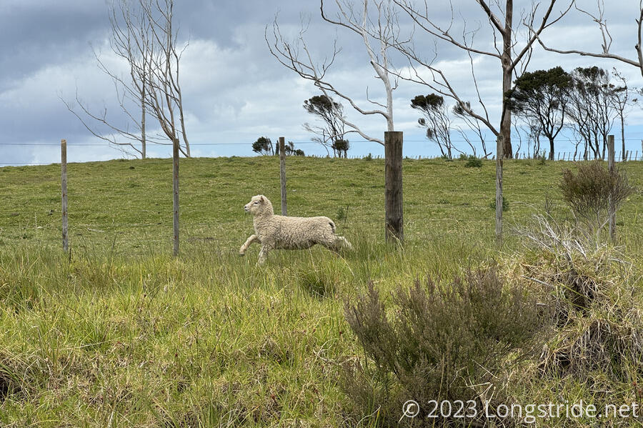
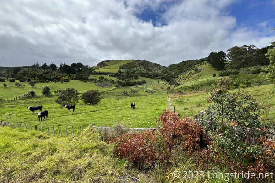
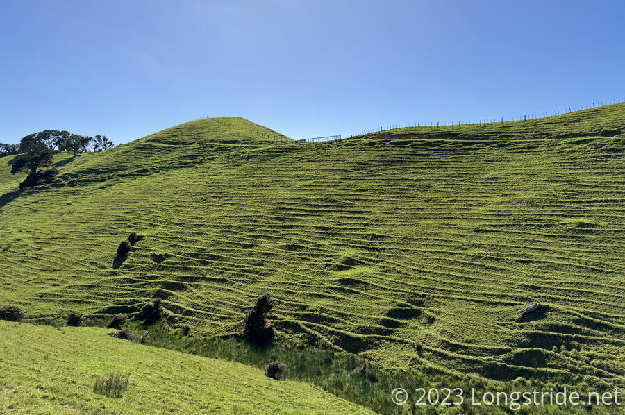
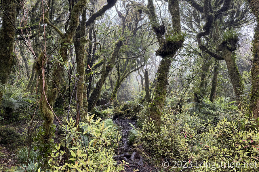
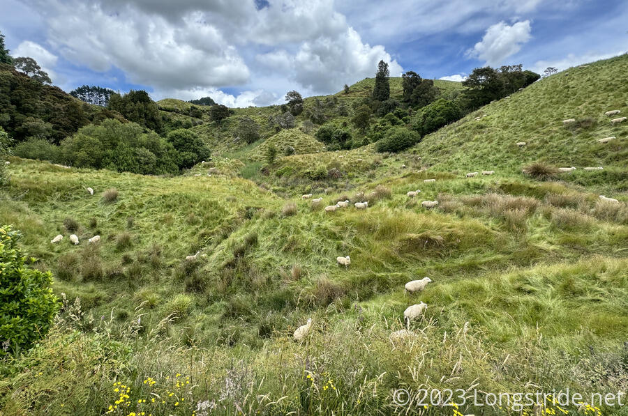
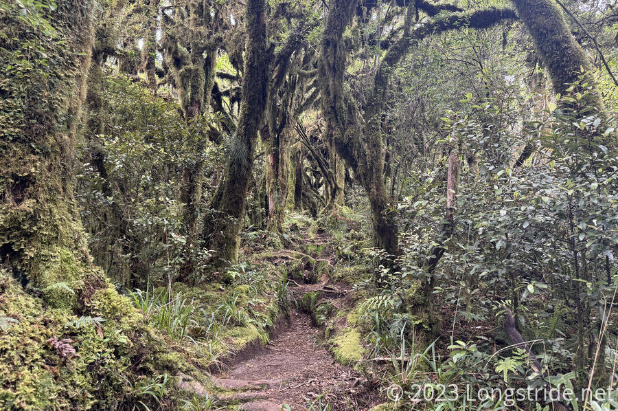
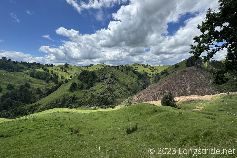
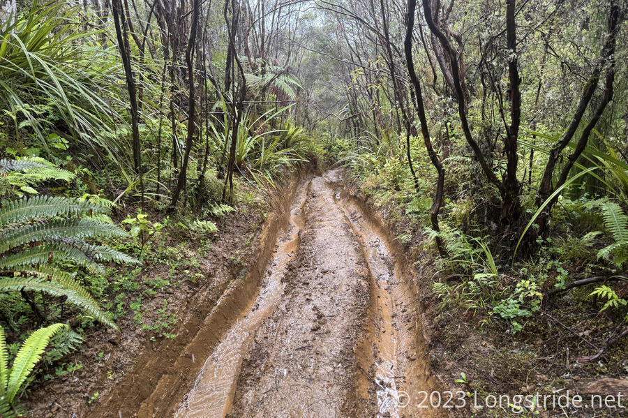
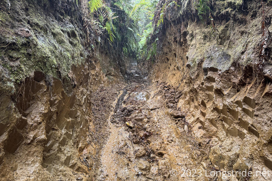
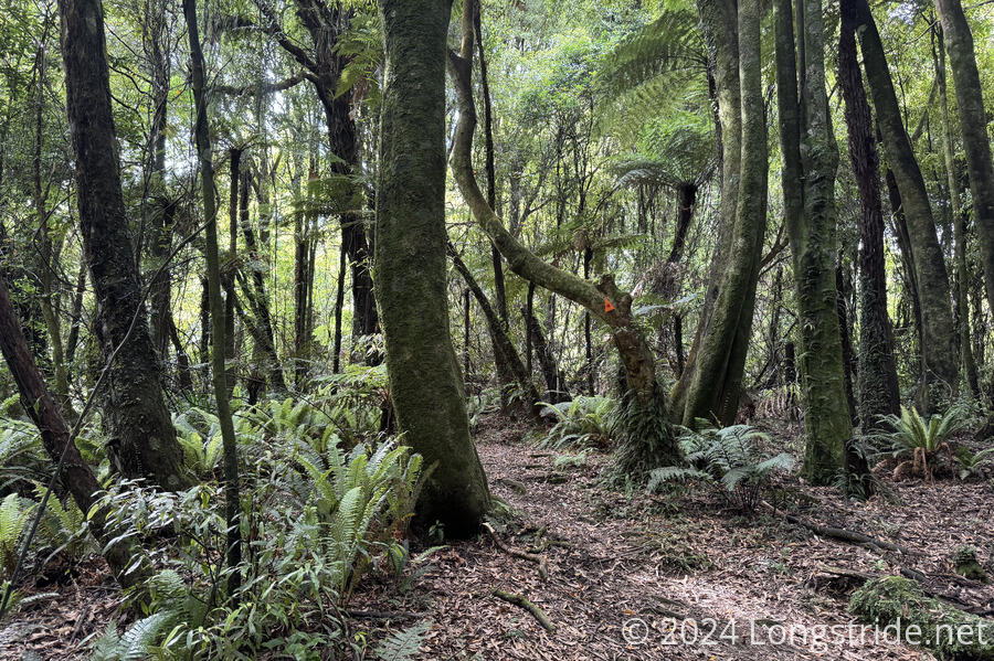
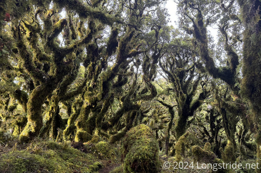
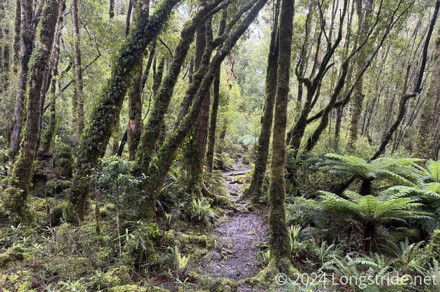
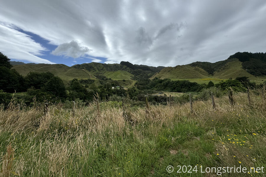
Raetea was an incredibly dense, lush forest. It was quite beautiful to walk through, and we saw our first Kauri trees, which once dominated New Zealand’s northern forests. (The vast majority of them were logged in the 1900s, and the relatively few remaining are in danger of succumbing to Kauri Dieback, a soil-borne fungus that kills the trees.) We had a long, slow day through the forest, at one point traveling less than a kilometer per hour as we navigated steep knee-deep mud. Exiting forest into farmland gave us our first (and unfortunately, not last) encounter with a horse that did not seem to like our presence at all.
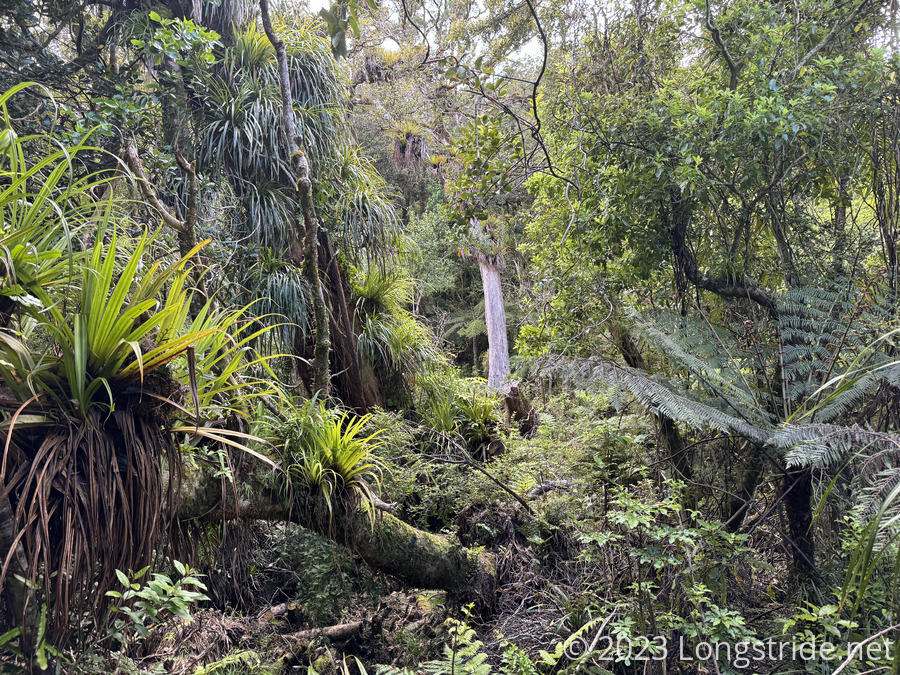
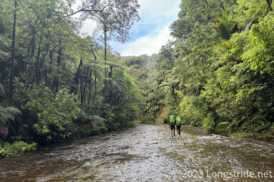
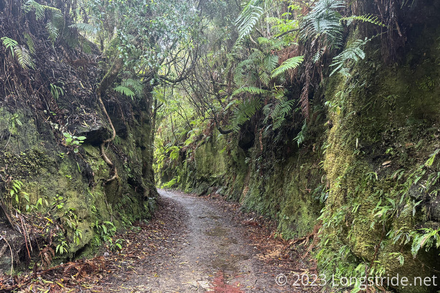
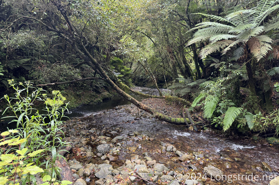
A dirt and gavel roadwalk brought us to the Puketī Forest. Going through the forest, the trail traveled for over 3 km through a stream, then through steep and eroded mountainside, and then along several unexpected (but very welcome) stretches boardwalk, culminating in a absurd (but typically New Zealand) stretch of wooden staircase and gravel path several kilometers long.
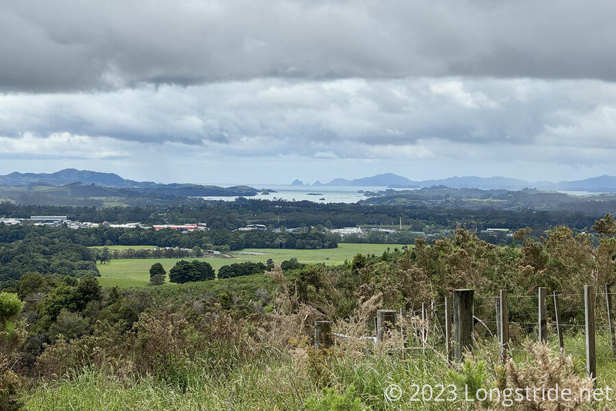
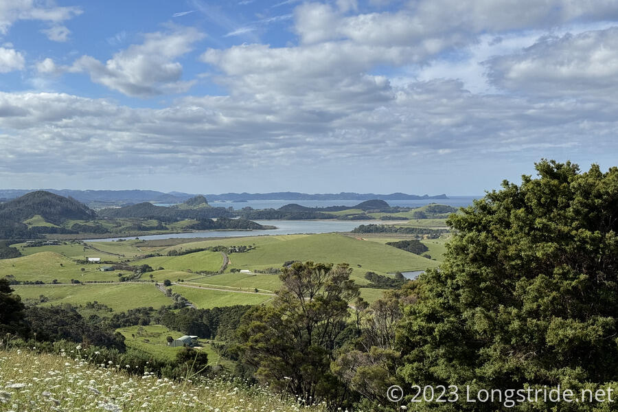
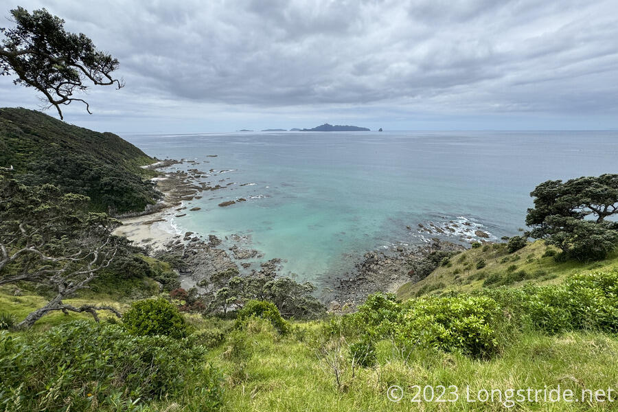
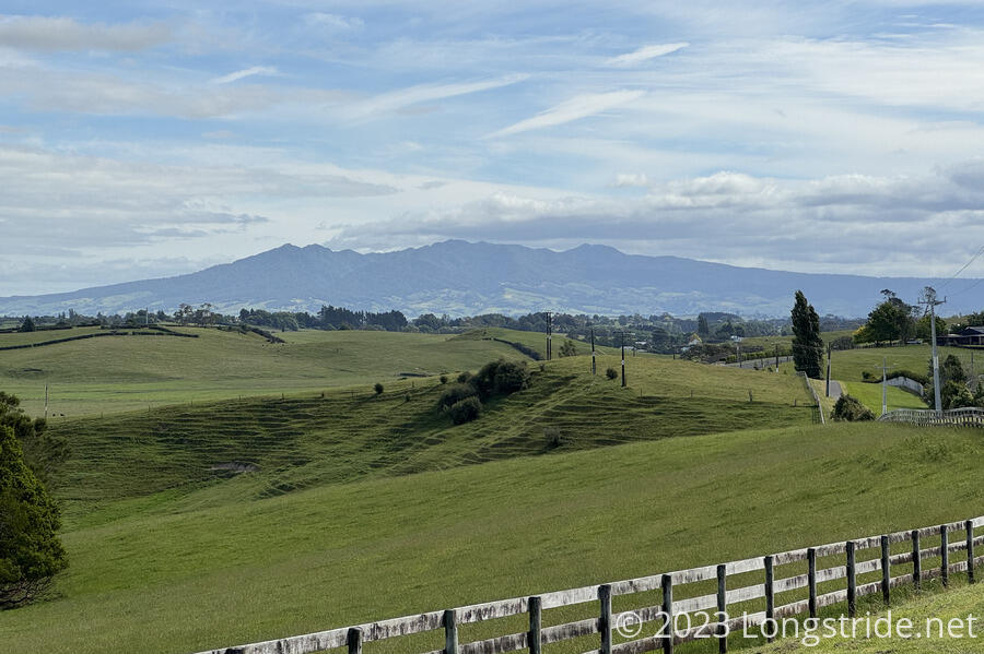
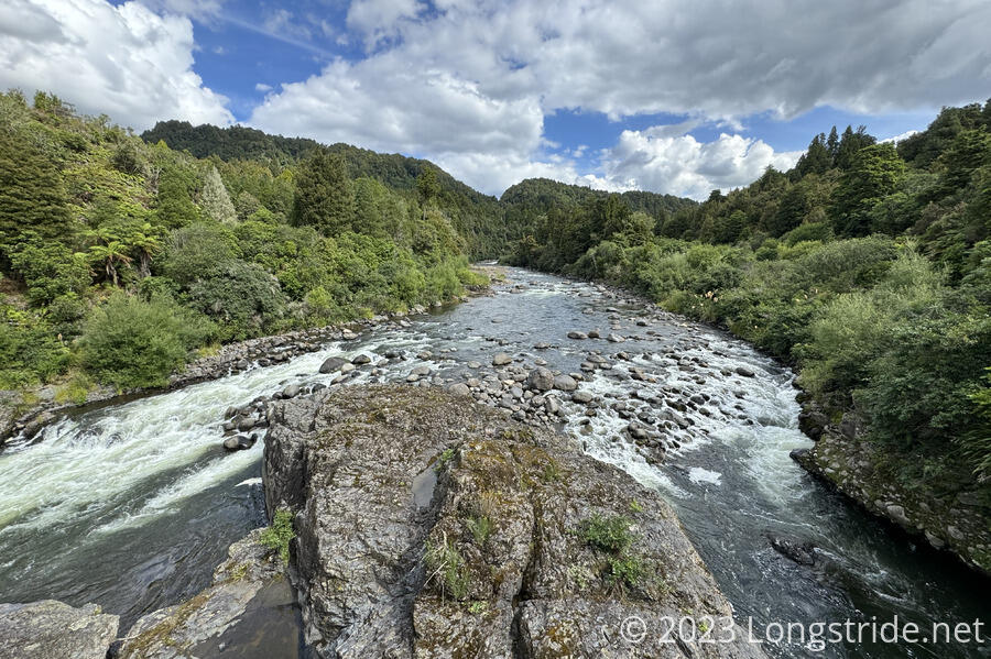
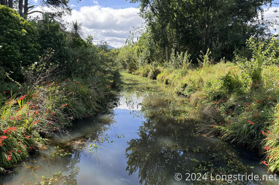
More farmland and an incredible waterfall on the Kerikeri River brought us to Kerikeri, where we took our first rest day. Along the way, the Bay of Islands peeked out behind the hills.
Another day past Kerikeri, on roads, brought us to Waitangi, where the English and Māori signed the Treaty of Waitangi in 1840. The treaty established New Zealand as a country.
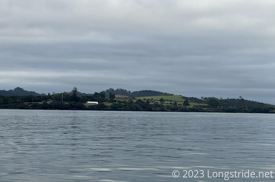
The next day brought us our first discontinuity on the trail. With the tide was against us (and the kayak rental company closed), we couldn’t paddle up the Waikare Inlet, and instead took a ferry across the inlet from Paihia to Russel. With a couple of exceptions, most of the several day walk to Ngunguru was on roads.
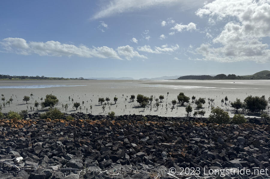
Another ferry, this time across the Ngunguru River, gave us one of our more challenging days in the Northlands: crossing the Horahora and Taiharuru Rivers, which had to be timed with the tides. Both rivers featured muddy mangrove swamps which did a number on my feet.


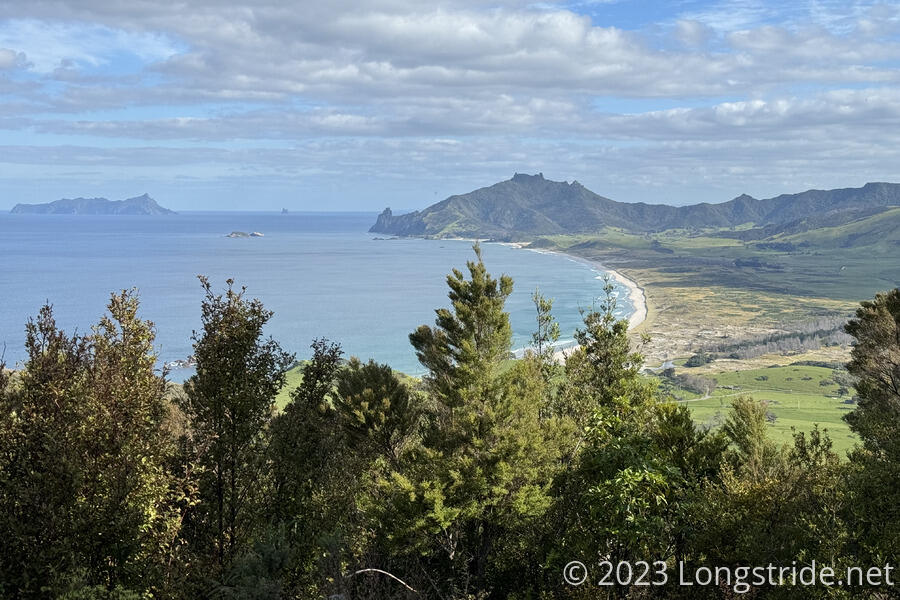
A jaunt down Ocean Beach and up and along Bream Head made for an arduous, but beautiful day, and brought us to another ferry crossing, this time across Reotahi Bay.
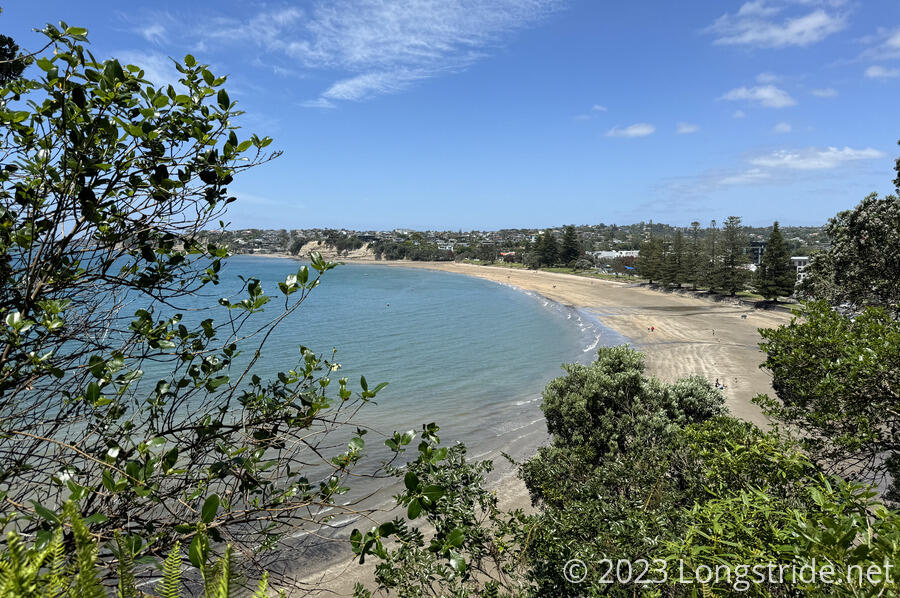
A walk through Ruakaka brought me to Uretiti Beach, along more roads to Waipu, and along a recently constructed cyclepath to Waipu Cove.
The next day took me into the Brynderwyn Hills on gravel road, through yet another farm, and then along the stunning Mangawhai Cliffs, just outside of Mangawhai Heads.
After a day of rest, the trail followed more roads to Mangawhai, and then on to Te Arai and Pakiri Beaches, and through two small but annoying estuaries.
The next day, one of our few with rain, took us through more farmland, and then a muddy, slippery, very eroded forest track. With the rain making the day somewhat miserable, today was one of the lowlights of the North Island. The day after that was a better, though still dreary and foggy largely roadwalk to Puhoi, where we stayed in a nice, though eccentric pub.
With the tide again against us, we skipped kayaking from Puhoi to Wenderholm Regional Park. What would have been a dangerous walk along Highway 1 was significantly moderated by the road having been recently relocated, and we were able to walk on the now-nearly-empty older road. With miserable weather, and the tide still not cooperating, once we reached Waiwera, a small community at the very northern extents of Auckland City, we took a bus back to the city and took a day off to rest.
Returning back to where we left off, we walked along Waiwera and Ōrewa Beaches, two small towns, and no shortage of sketchy roadwalking to the Dacre Cottage, a historic cottage on the banks of the Okura River estuary.
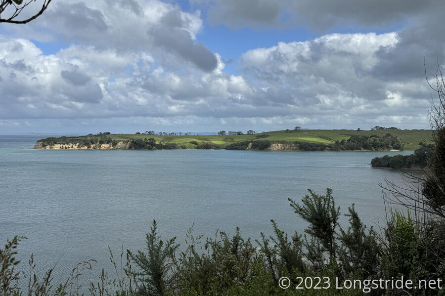
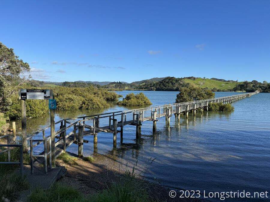
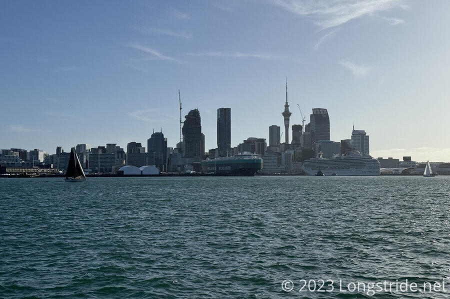
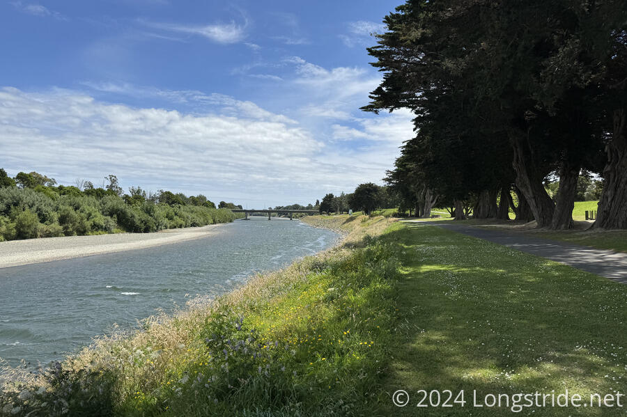
After a hip-deep crossing of the gentle and clear Okura River, we walked under sheer (and eroding) cliffs around Piripiri Point and entered the sprawling suburbs of northern Auckland. As we made ur way south, Rangitoto and Motutapu Islands, volcanic islands just off the coast in the Hauraki Gulf, stood majestically. Long road walks, several beaches, no shortage of opportunities to stop at cafes and corner stores, and a jaunt around North Head brought us to the Devonport Ferry Terminal, the last of our North Island discontinuities. With perfect timing, we arrived just as a ferry was ready to depart for Auckland’s CBD. Ten minutes later, our ferry across the Gulf dropped us at the edge of the city center, making our way to the Auckland Domain, a large park in the heart of the city. In just under a month, we’d completed the first significant segment of our hike, from Cape Reinga back to CareFree’s apartment in Auckland.
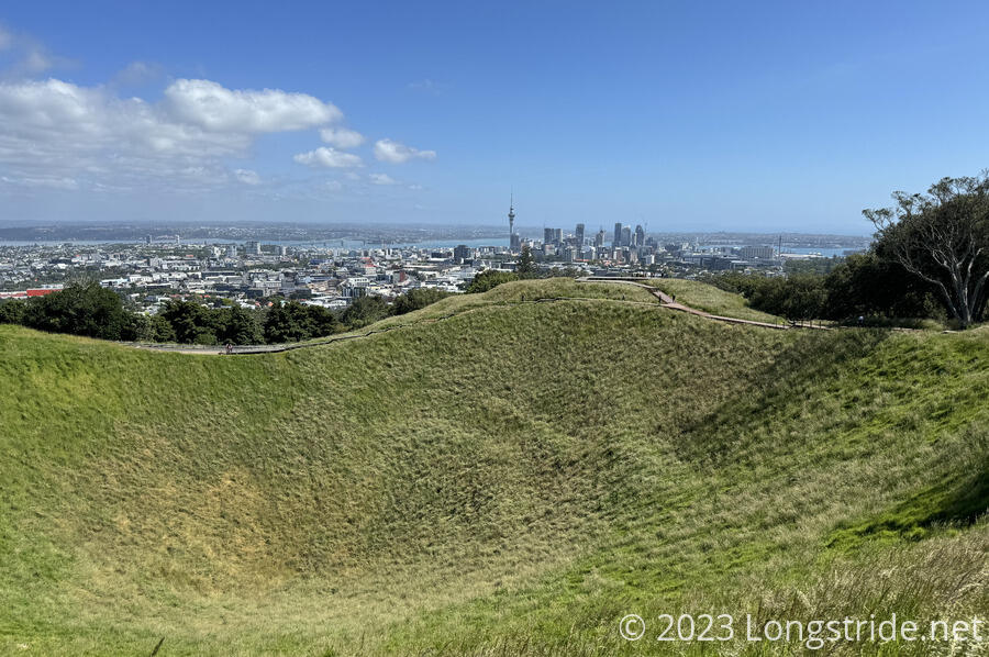
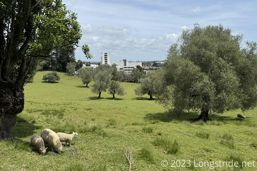
Taking advantage of Auckland’s bus system, we donned day packs and walked through the central part of Auckland. From the Domain, we headed up and over Mount Eden, the tallest of the mountains in the Auckland Volcanic Field; made our way to Cornwall Park and alongside One Tree Hill; across a bridge over Manukau Harbour; followed an costal esplanade through Ambury Regional Park; and stopped for the day at a bus stop near Auckland Airport.
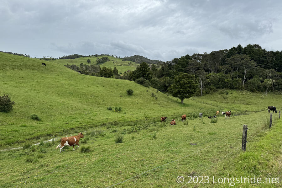
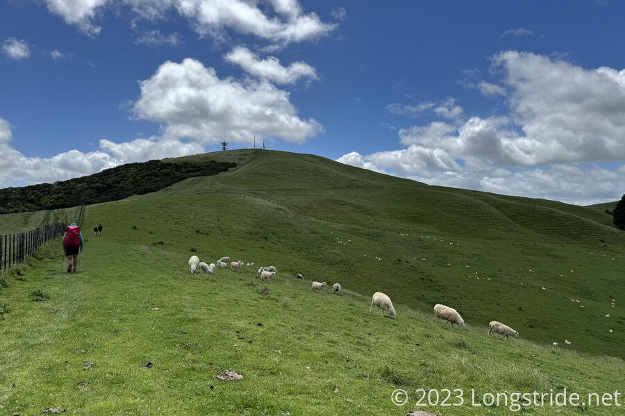
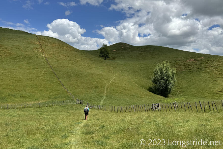
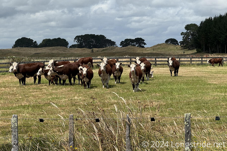
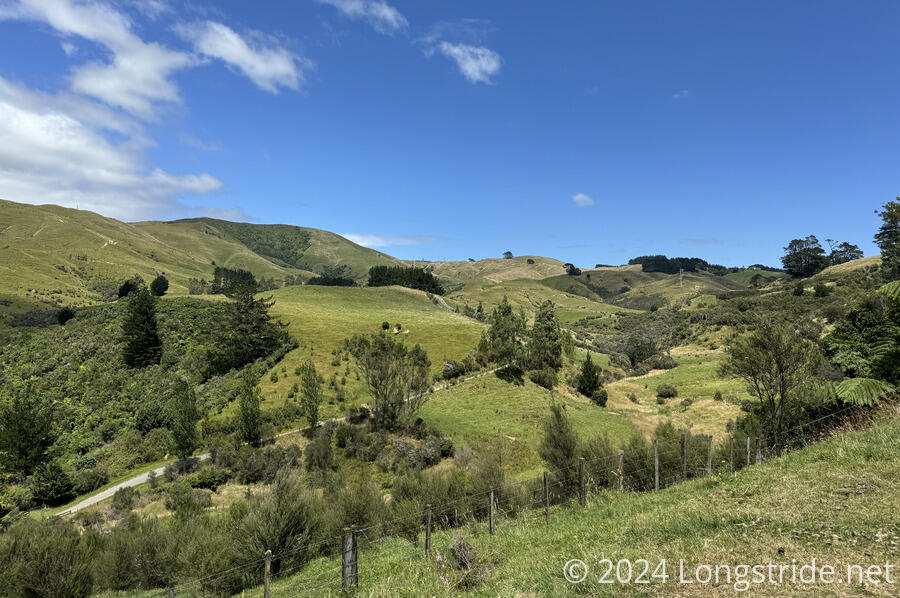
After another rest and chores day in Auckland, we returned to the bus stop and continued walking south along some trails and mostly roads, heading out of Auckland along a stream valley and through botanical gardens to Drury. More road walk brought us out of the Auckland region and into Waikato, named after the Waikato River, the longest in New Zealand. After crossing a very windy sheep farm, we had our most dangerous road walk of the trail along a very busy stretch of SH 2, and then were blocked for several minutes by a herd of cows standing around literally waiting for directions. Eventually, we reached Mercer, a tiny village. Another frustrating day along the Waikato River, through overgrown farms and free-roaming cows brought us to Rangiriri, and then finally to Huntly, where we stopped after a short day for resupply.

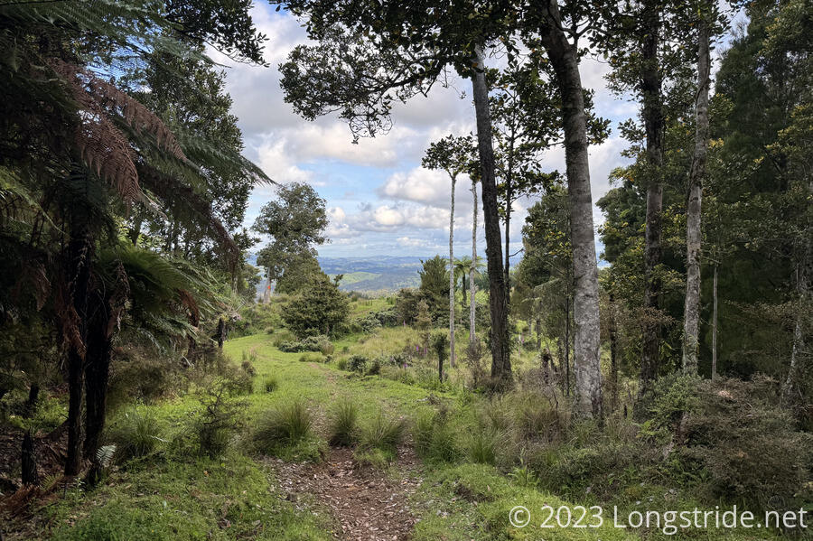
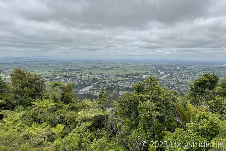
A relatively short day from Huntly took us through the mountainous Hakarimata Scenic Reserve, past a very large Kauri tree, and into Ngāruawāhia, the home of the Kīngitanga (Māori King) movement. The next day was a very long walk along the Te Awa River Ride from Ngāruawāhia to Hamilton along the Waikato River, then through and out of town along (mostly) roads, with some occasional farmland to Whatawhata. After tenting at a friendly cafe, another long road walk turned into a farm road walk, eventually bringing us to Pirongia Forest. A steep climb straight up the ridge brought us to Pāhautea Hut, atop the mountain. The next day, a light drizzle fell most of the day, giving us a very muddy descent from the mountain, bringing us to a “trail angel”’s garage/bunkhouse in the middle of nowhere. Another long road- and farm-walk brought us to an amazingly nice stretch of trail, so nice that we questioned if we were even still on the TA! After overnighting in Waitomo (home of famous glowworm caves that we didn’t have time to visit), we continued through farmland. An intransigent horse gave us a bit of a scare, and we opted to take a longer roadwalk detour than walk through a bull farm (with a large warning sign, no less). Eventually, a rather hot day out, we arrived in Te Kuiti, where we resupplied.
After a brief walk through the Mangaokewa Reserve, we took the advice of other hikers and took a road detour around a terrible stretch of trail. This upset the plan we had for staying at a shelter on farmland adjacent to the trail, because we didn’t want to backtrack a few kilometers, and we pushed on, gambling (successfully) that we’d find someone who’d let us camp on their lawn — the first and only time we did this on the TA.
Another day of roadwalk brought us to Pureora Cabins, at the foot of the Timber Trail, an 84 km cycling path through Pureora Forest. We charged through the cyclepath in two days. On the first day, we took a detour off the Timber Trail to summit Pureora Mountain, returned to the trail via an old and disused trail, and camped at a shelter at the Piropiro Campsite as light rain blew in. The second day was quite rainy, which kept us moving at a quite brisk pace, and made it to a TA hiker campground established towards the end of the trail. A somewhat rainy roadwalk brought us to Taumarunui, on Christmas Day.
We spent three days in town, relaxing, resupplying, and attending an orientation and safety lecture at Taumarunui Canoe Hire for our upcoming canoe trip down the Whanganui River.
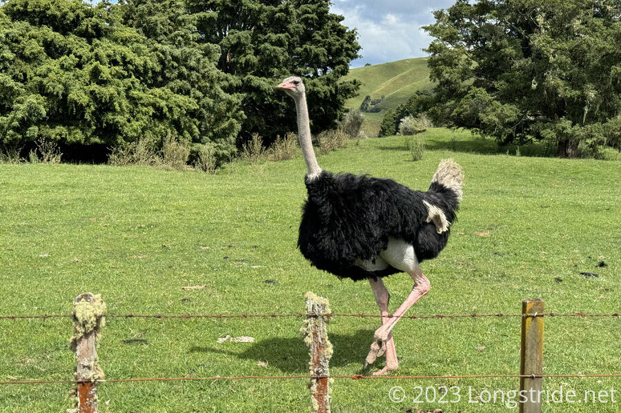
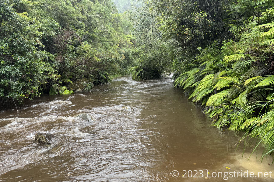
A long road walk took us through Ōwhango and to the start of the 42 Traverse, an ATV track through a former national forest, passing an ostrich along the way! With rain forecast, we kept going further than we’d planned, bypassing the campsite near the entrance for one a couple of hours in. We were glad we did: downpours caused flooded, overflowing streams that were a challenge to cross, incredibly slick steep muddy track, and plenty of standing water that was no fun to hike through.
That brought us to Tongariro Holiday Park, where we stayed for three evenings to wait out the rain.
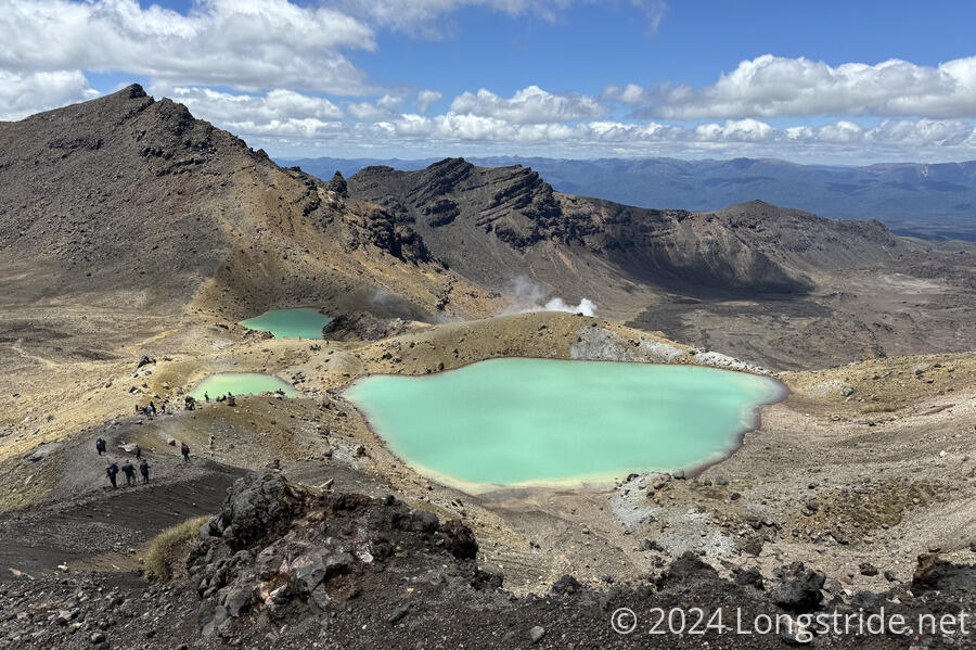
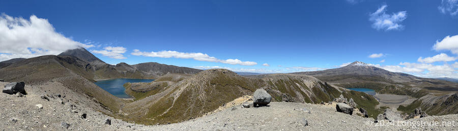
Leaving the holiday park the morning of January 1, 2024, we were treated to the epic Tongariro Alpine Crossing. Epic views (and fantastic trail) gave way to some of the worst maintained trail on the TA, bringing us to Whakapapa.
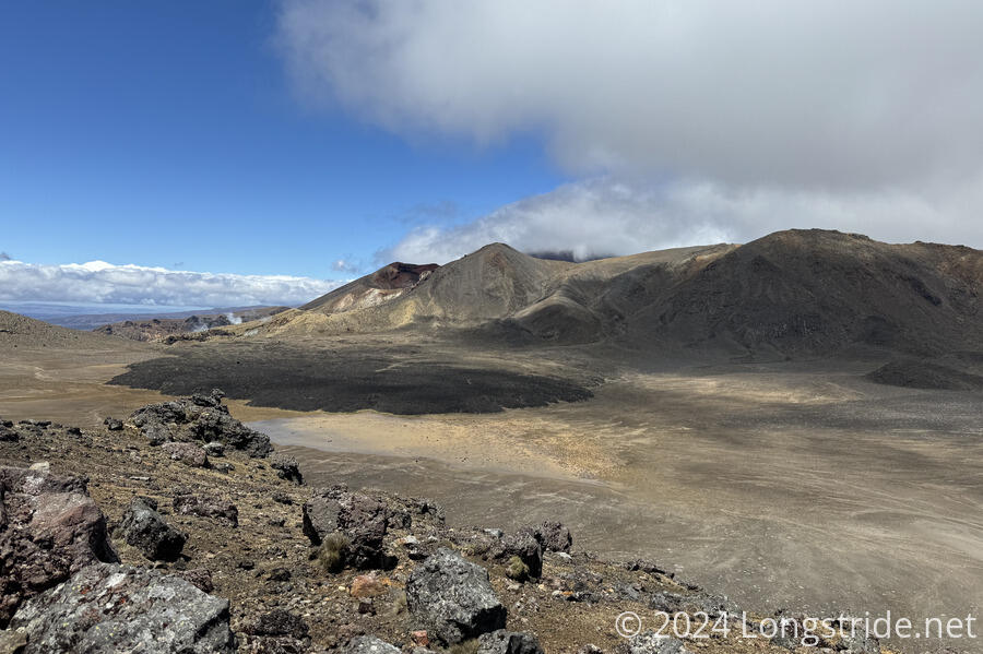
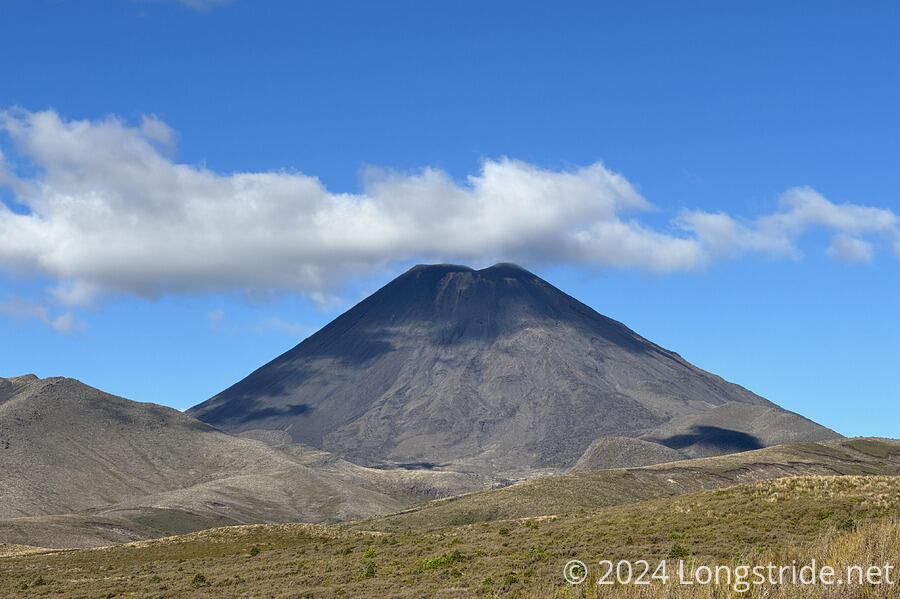
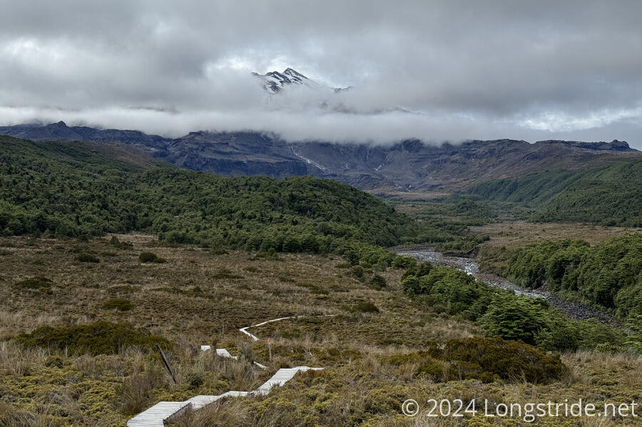
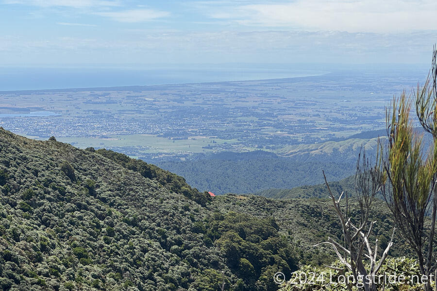
With a day to kill before the next stretch to the Whanganui River, we took a day off to hike to the Tama Lakes, on the saddle between Mount Ngauruhoe and Mount Ruapehu, the tallest mountain on the North Island.
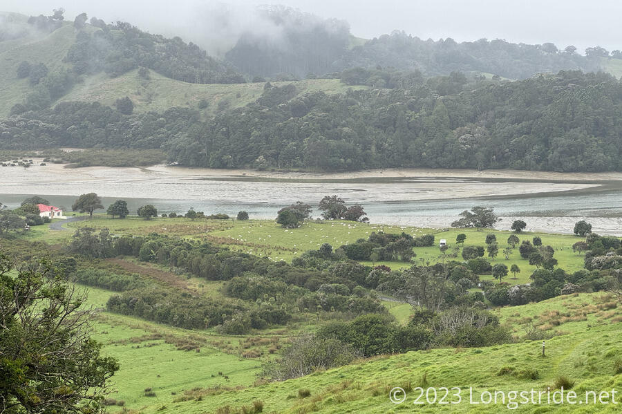
From Whakapapa, we walked on alternatingly fantastic and frustrating track (and roads) to National Park Village. A better-than-expected cycle track led us to Kaitieke, a former logging town. Another long roadwalk, generally along the Retaruke River, brought us to Whakahoro Landing, where we’d begin our five-day canoe trip down the Whanganui River.
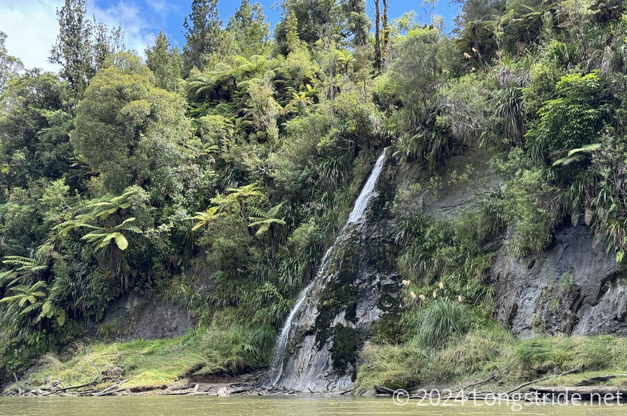
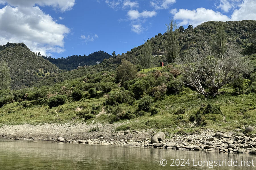
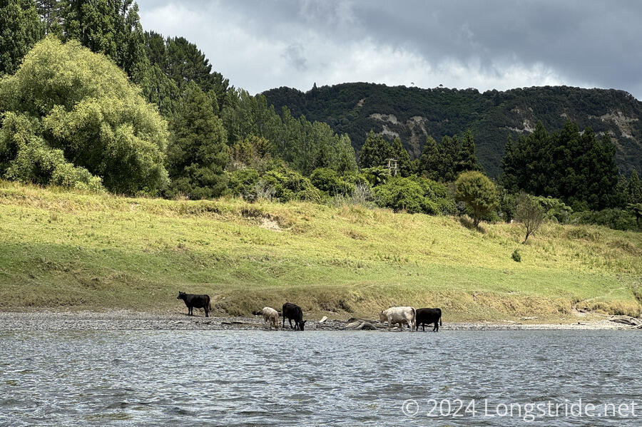
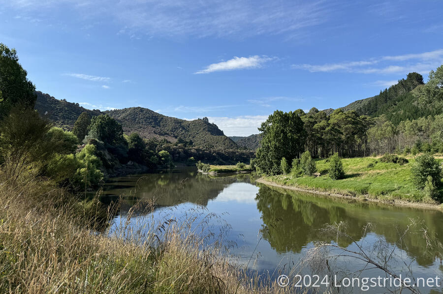
The first day on the Whanganui was a learning experience in how to effectively work as a team in a canoe, but we were able to successfully make it through the rapids on the river without capsizing. The scenery was a little bit out of Jurassic Park, with lush occasional waterfalls and green ferns lining the Whanganui’s steep valley walls. The second day on the river gave us more interesting rapids, and for brief stretches, we rocketed along at over 10 km/hour! The third day took us through the infamous 50-50 rapid, so-named because of its high tendency to capsize boaters. (We made it through a little wet, but still afloat.) The fourth day was much calmer, as the river continued to approach sea level and meander through shorter hills and farmland. The last day, we were close enough to the ocean to deal with tidal effects, leaving camp a bit earlier than advised and fighting the last while of the incoming tide. Five days on the river brought us to the town of Whanganui, and after leaving our boats at a landing, we continued on along the road to the main part of town.

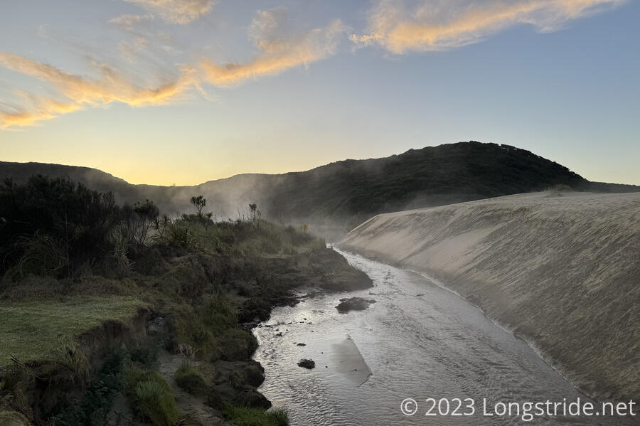
After a resupply the next morning, and a ride up an historic elevator, we continued a very long roadwalk, some along busy highway, until we eventually reached Whangaehu Beach, our first black-sand beach on the TA, and the very impressive Koitiata Campground. The next morning, we finished walking down the beach, and then followed a long road walk to Bulls. (The town, not the animal, though there were plenty of those too.)

The next couple of days were strenuous roadwalks, first to Feilding, which has won New Zealand’s Most Beautiful Town award 16 times, and then to Palmerston North, where we resupplied and stopped for a day to rest, our first in two weeks since we left Tongariro Holiday Park.
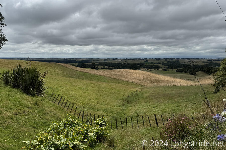
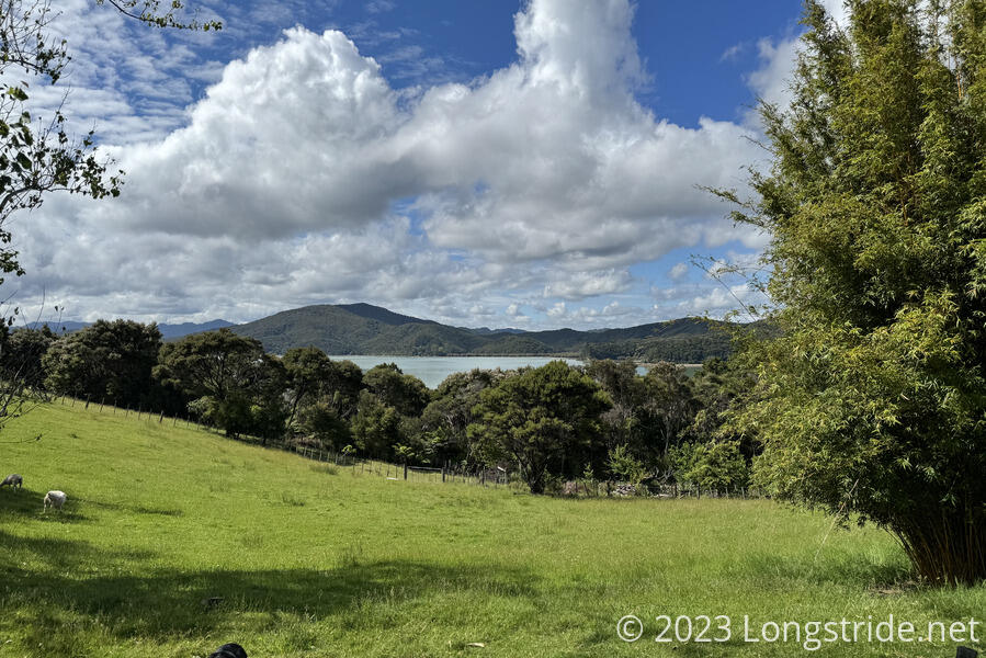
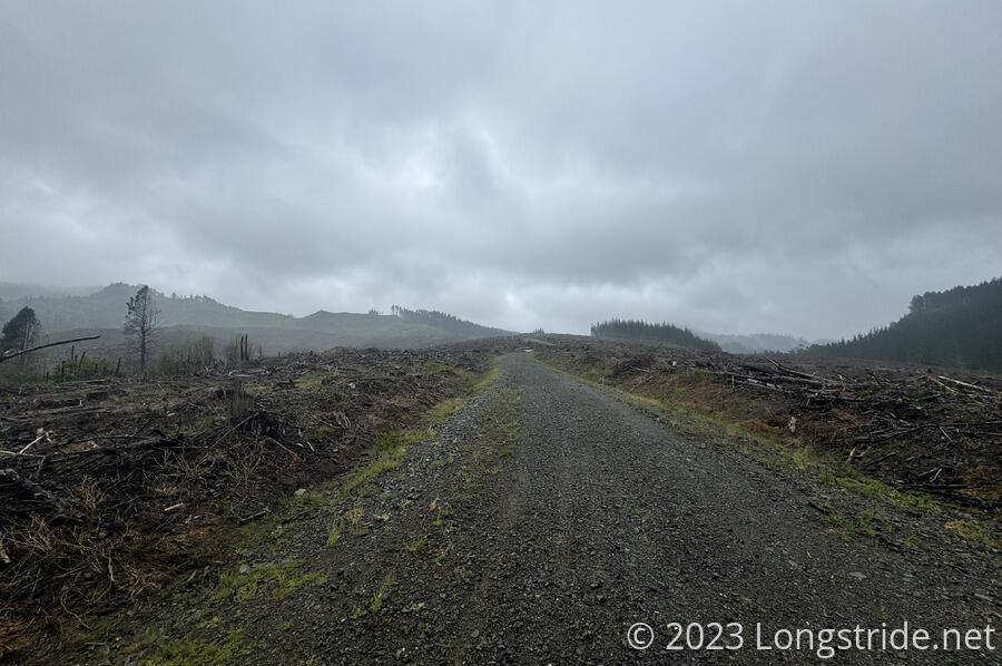
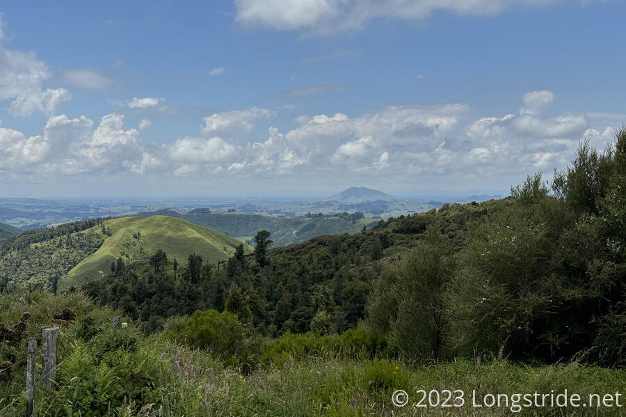
A series of trails, cycle paths, and roads took us away from Palmerston North and back into mountains. Dirt logging roads, and dense forest track, plus a little rain, took us deeper into the mountains, and then into farmland near the entrance to the Tararua Forest Park.
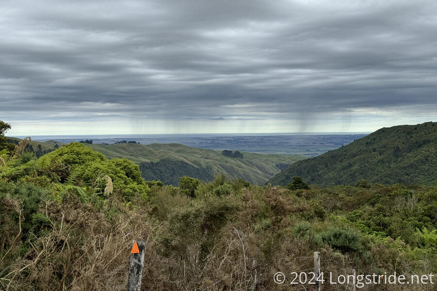
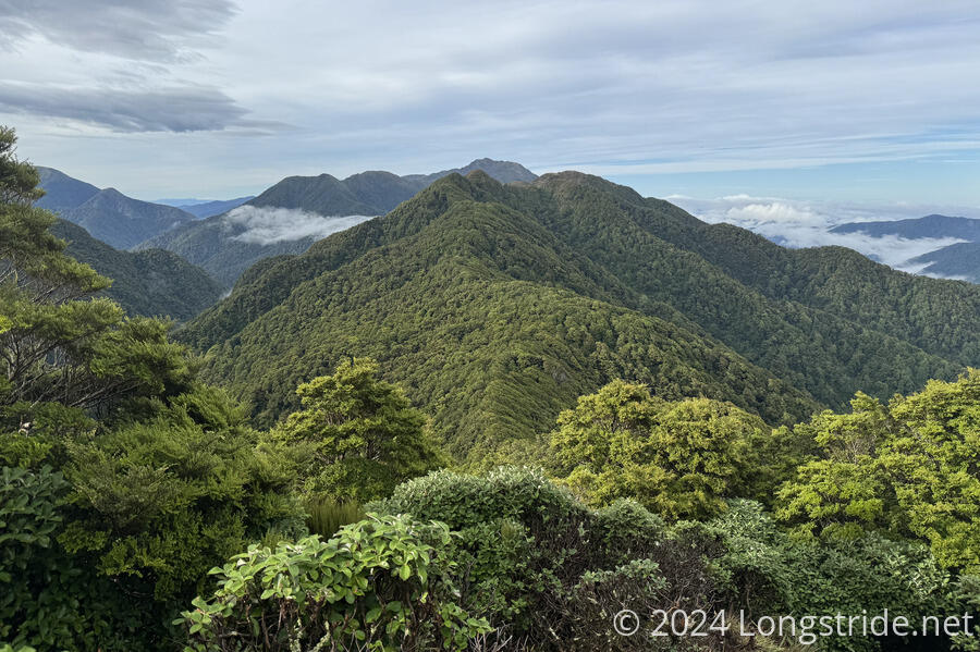
The Tararua Range was easily the most challenging stretch of trail on the North Island. A lush and dense forest greeted me with a steep climb up a ridge, which I then followed past one hut to a second atop the ridge.
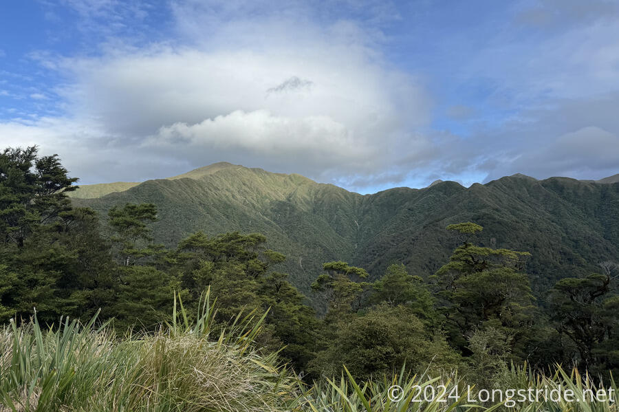
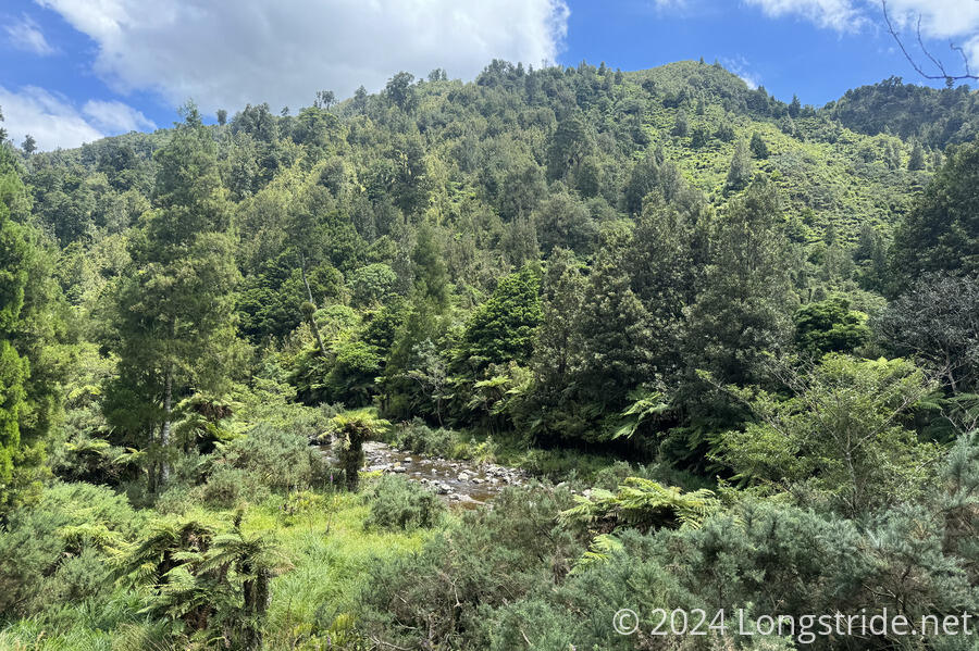
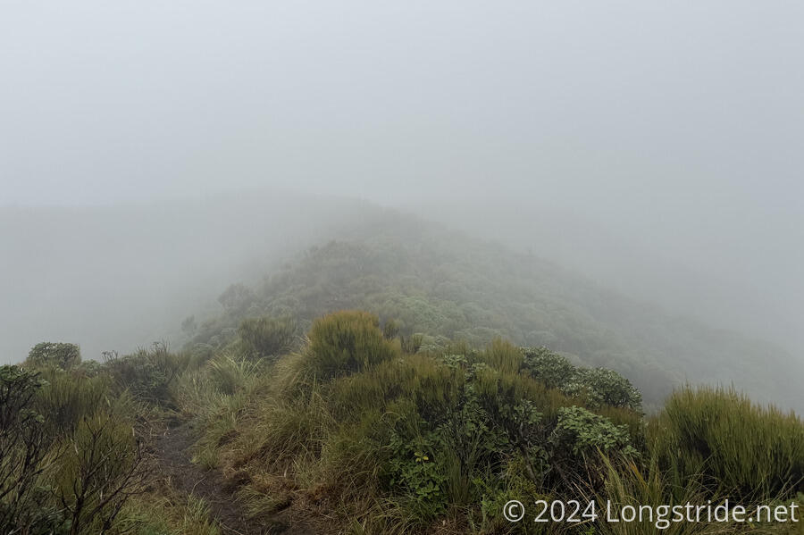
A foggy, windy, rainy day took me to the Dracophyllum Hut, really more of a two-person emergency shelter. One of my shortest days on trail, I’d hiked 7.5 km in almost five hours. The next day, with much better weather, took me along a very sketchy ridge walk that made me quite glad I had stopped at Dracophyllum. After negotiating further steep descents and ascents, the trail made its way along a fantastic ridge above the treeline, and then back down through steep, and incredibly dense forest to the Waitewaewae Hut deep in a valley.
Another arduous day took me to Parawai Lodge. The fifth day finally saw me [out of the Tararua Range], and a long road walk took me into Waikanae.
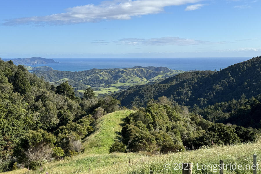
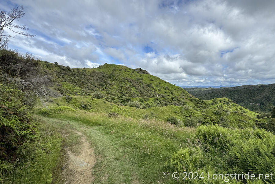
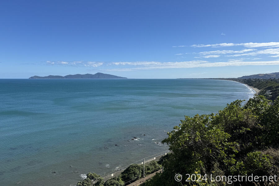
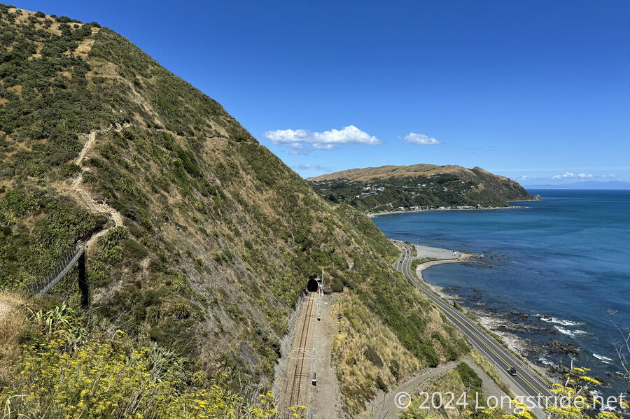
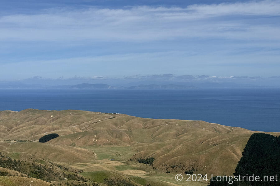
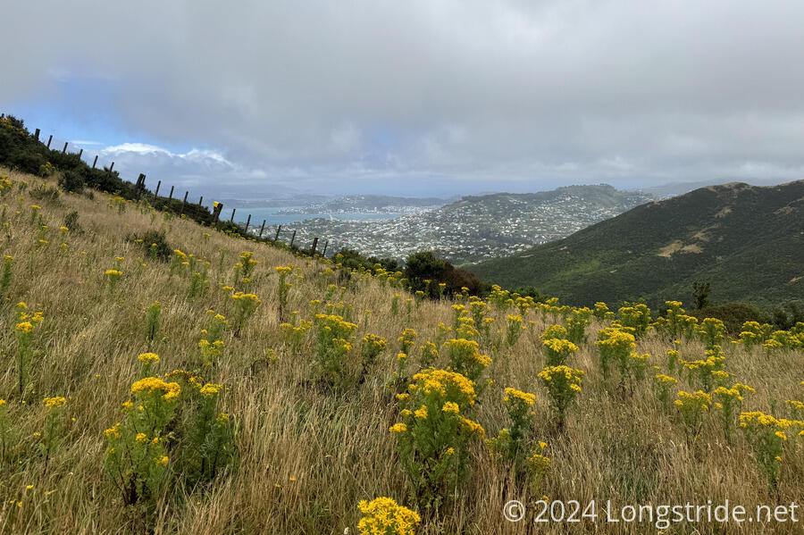
After a minor resupply, we set off to the Kapiti Coast, following a nice walkway along a river and through wetlands. A beach walk brought us to the outskirts of Paekākāriki. An impressive walk along the Escarpment Track, along a steep hillside above the ocean brought us to Pukerua Bay. From there, roads lead to Porirua. Just past the town, the trail climbed through lush forest, logged areas, and pine plantations with our first views of Wellington — and the South Island. One more day took us through the mountains north of Wellington to the CBD, and then finally, to, Island Bay, the TA’s North Island Southern Terminus.
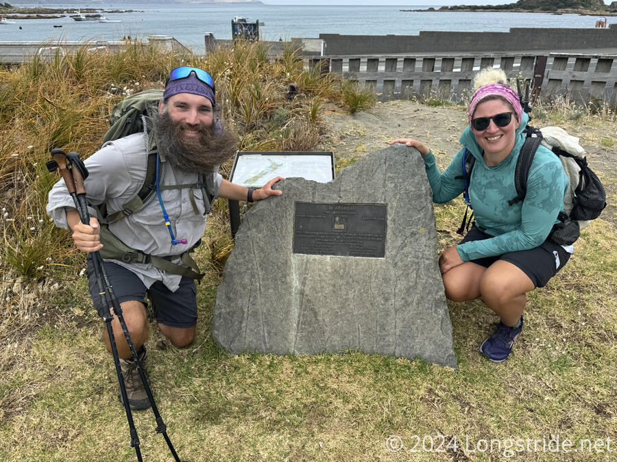
After some rest and extensive resupply, including a fair bit of gear, I was ready to tackle the South Island.